Retkitiedot
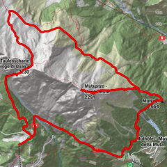
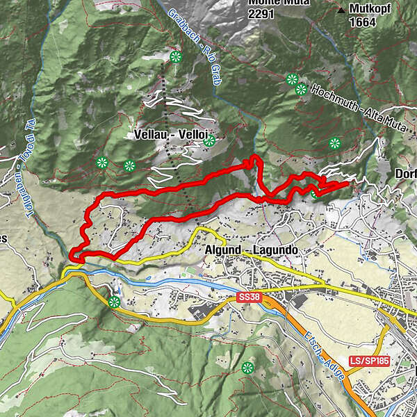
9,87km
460
- 751m
489hm
497hm
05:00h
- Lyhyt kuvaus
-
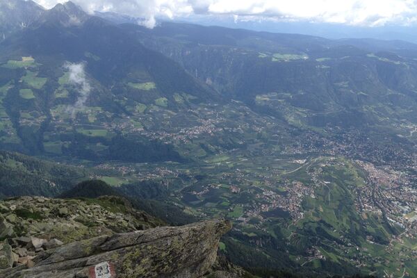
Schöne Aussichten auf Meran, beim wandern durch die Weinberge entlang des Wasserwegs
- Vaikeus
-
helppo
- Arviointi
-
- Lähtöpiste
-
Parkplatz
- Reitti
-
Dorf3,1 kmMeran4,1 kmLochermühle6,1 km
- Paras kausi
-
tammihelmimaalishuhtitoukokesäheinäelosyyslokamarrasjoulu
- Korkein kohta
- Ebeneich (751 m)
- Kohde
-
Parkplatz
- Lepo/Retriitti
-
Diverse:
- Leiter Am Waal, Mitterplars, 26
- Cafe Konrad
- Schloß/Castel Thurnstein, St. Peter, 8, 39019 Tirolo BZ, Italienthurnstein.it
- Ferienwohnung Ebeneich
- Hotel (Restaurant) Edelweiss, Via Venosta, 105, 39020 Tell, Parcines BZ
- Kirjallisuus
-
Es lohnt ein Abstecher nach Meran zu machen.
Im örtlichen Touristenbüro gibt es viele Informationen und Kartenmaterial für die Waalwanderung und generelle Info für diese Gegend:
Corso della Libertà, 39
39012 Merano BZ
Italy - Karttamateriaali
-
Kompasskarte, Wanderkarte "Meraner Waalwege"
- Lähde
- stegemac
GPS Downloads


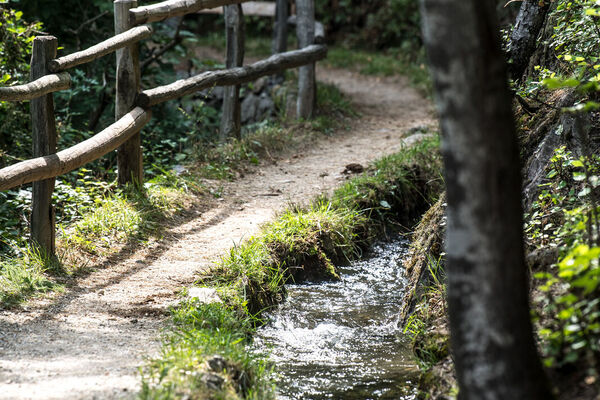
Polun olosuhteet
Asfaltti
(30%)
Sora
(50%)
Niitty
Metsä
(20%)
Kallio
Altistettu
Lisää retkiä alueilla
-
Meraner Land
1736
-
Meran und Umgebung
756
-
Algund
300