© Saale-Unstrut-Tourismus e.V. - Jens Hauspurg
- Lyhyt kuvaus
-
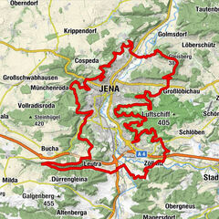
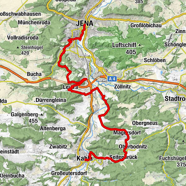
Along the Luther Trail over the western peaks of the Jenaer Saale Valley to the porcelain makers in Kahla.
- Vaikeus
-
vaikea
- Arviointi
-
- Reitti
-
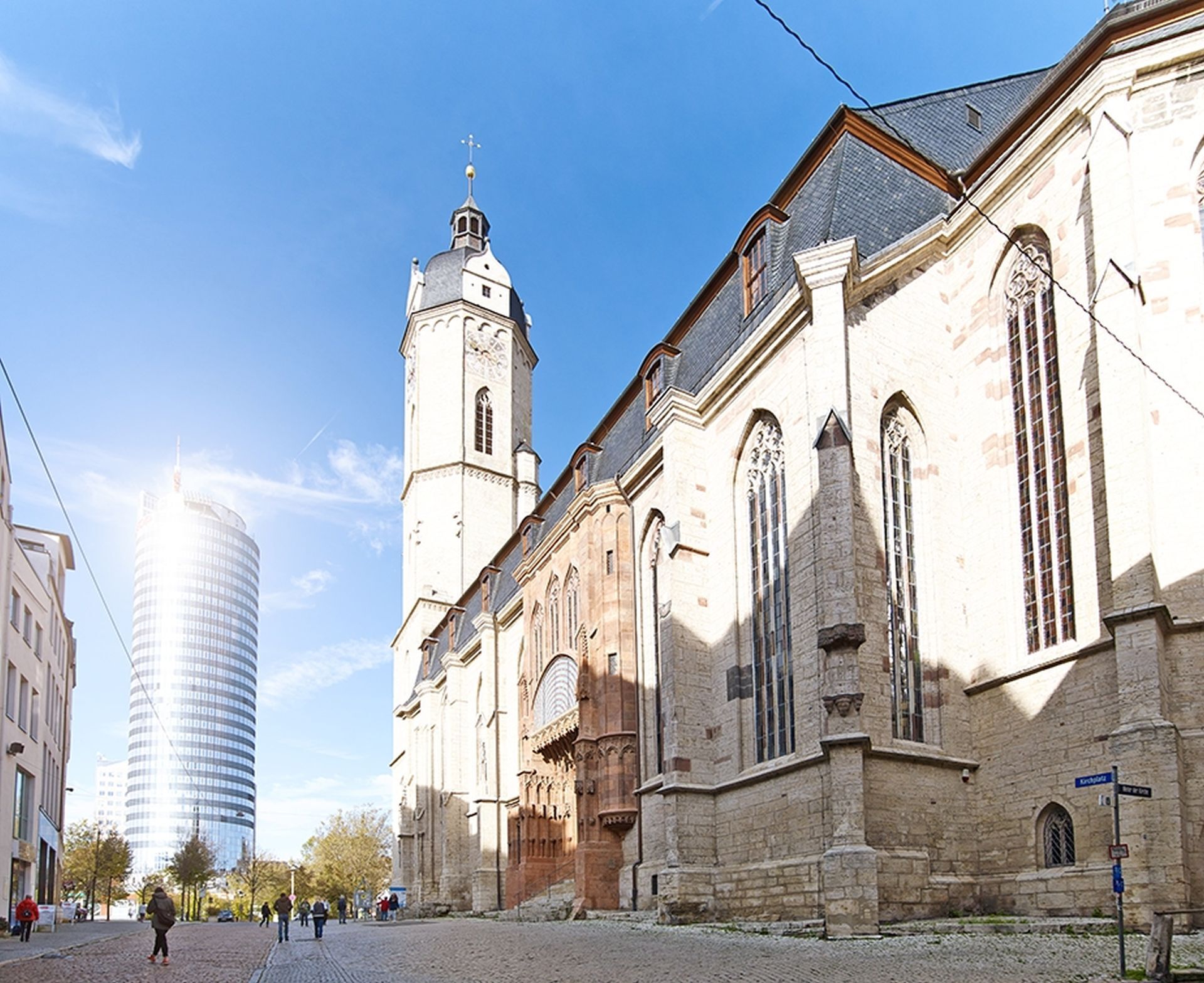
St. MichaelJena (143 m)0,1 kmZentrum0,2 kmSaalebalkon0,6 kmLichtenhain3,2 kmNikolaikirche3,5 kmAmmerbach5,1 kmEvangelische Kirche5,1 kmAmmerbacher Hof5,1 kmGöschwitz12,1 kmLeutra14,4 kmGoldenes Schiff17,6 kmSt. Laurentius17,7 kmMaua17,8 kmRabenschüssel18,7 kmHaus Helenenstein21,1 kmOelknitz22,7 kmLandgasthof Magersdorf26,7 kmMagersdorf26,7 kmUnterbodnitz27,5 kmSeitenbrück30,0 kmSeitenroda32,2 kmLandgasthof Seitenroda32,3 kmLichtenberg (400 m)32,6 kmDohlenstein (366 m)33,3 kmKahla35,8 kmEl Greco35,8 km
- Paras kausi
-
tammihelmimaalishuhtitoukokesäheinäelosyyslokamarrasjoulu
- Korkein kohta
- 391 m
- Kohde
-
Kahla market square
- Korkeusprofiili
-
 © outdooractive.com
-

-
KirjoittajaKiertue Luther Trail: Section 27 – From Jena to Kahla käyttää outdooractive.com toimitettu.
GPS Downloads


Yleistä tietoa
Virvokepysäkki
Kulttuuri/Historiallinen
Lupaava