Retkitiedot
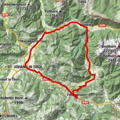
23,94km
692
- 1.262m
765hm
770hm
02:30h

- Lyhyt kuvaus
-
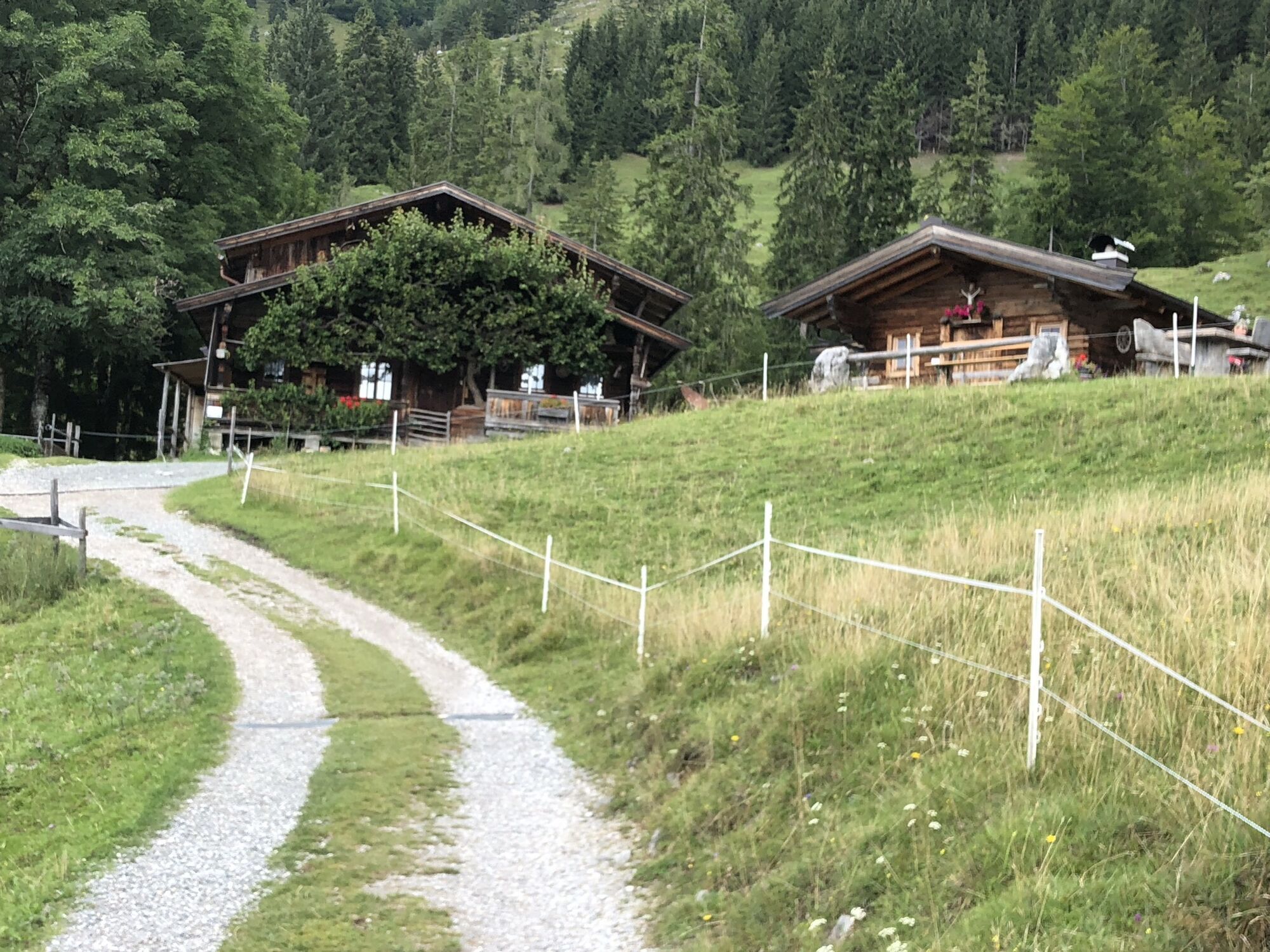
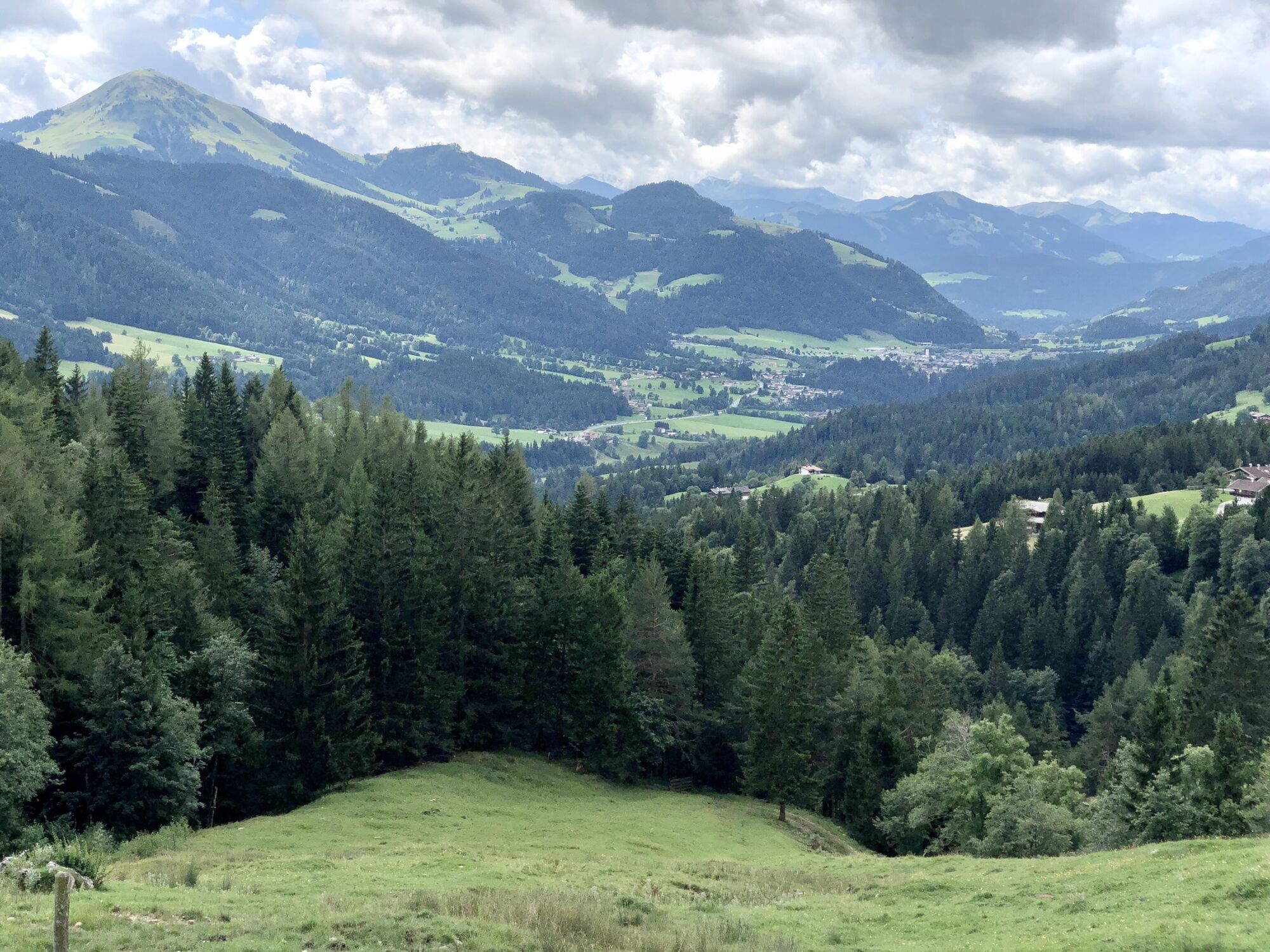
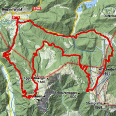
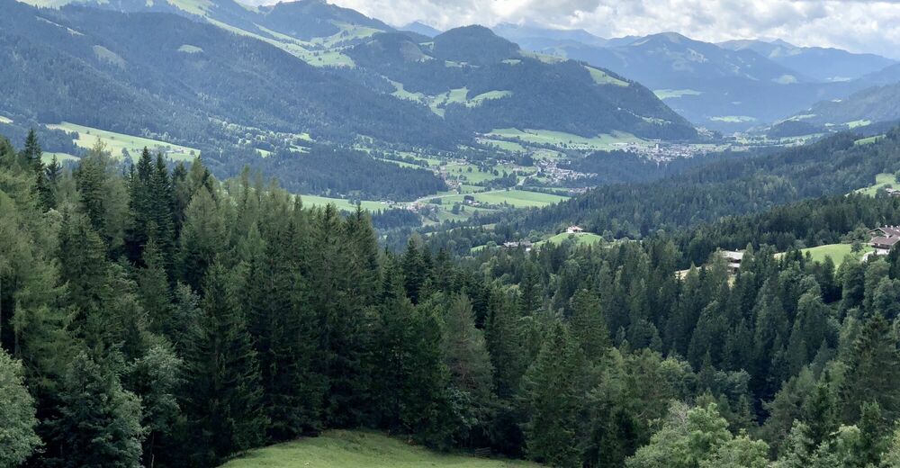
Eine MTB Rundfahrt von Going am Wilden Kaiser über Scheffau zur Steiner Hochalm und zurück über Auwald nach Going.
- Vaikeus
-
tapa
- Arviointi
-
- Reitti
-
Steiner Hochalm0,1 kmSchießling3,6 kmWegscheid4,3 kmGasthof Jägerwirt4,5 kmSteinacker5,2 kmMittersbach5,5 kmLandhotel Föhrenhof6,9 kmFöhrenhof7,0 kmAuwald (749 m)7,1 kmEllmauer Hof8,0 kmSteinerner Tisch (772 m)8,3 kmPfarrkirche9,3 kmEllmau9,5 kmGoing11,4 kmAlexandra12,0 kmEllmau13,7 kmSteinerner Tisch (772 m)14,8 kmEllmauer Hof15,2 kmS'Kleine Wirtshaus Ellmau16,0 kmAuwinkel (742 m)16,1 kmOberau17,4 kmAm Trattenbach18,0 kmScheffau am Wilden Kaiser18,9 kmPfarrkirche Scheffau18,9 kmLeiten (794 m)19,1 kmBruggenmoos19,5 kmGaisberg (761 m)19,7 kmSteiner Hochalm23,8 km
- Paras kausi
-
tammihelmimaalishuhtitoukokesäheinäelosyyslokamarrasjoulu
- Korkein kohta
- 1.262 m