© Alpbachtal - Gabriele Grießenböck

- Lyhyt kuvaus
-
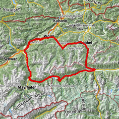
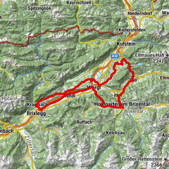
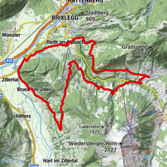
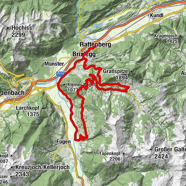
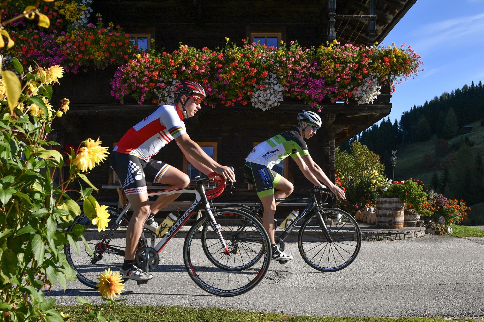
Gorgeous tour into the Alpbach Valley, further on asportive note into the beginning of the Ziller Valleyand back to the start.
- Vaikeus
-
vaikea
- Arviointi
-
- Reitti
-
Rattenberg0,0 kmBrixlegg1,9 kmMehrn (560 m)2,7 kmSonnbichl3,6 kmDekanatspfarrkirche St. Petrus3,9 kmReith im Alpbachtal (638 m)4,2 kmBischofsbrunn4,7 kmAlpsteg (619 m)5,3 kmKöckn Kapelle7,0 kmAchleitn Kapelle8,3 kmSterzn Kapel9,0 kmAlpbach (975 m)12,0 kmKapelle Maria vom Guten Rat19,1 kmHygna (817 m)19,3 kmGschwendt Almstüberl21,1 kmKerschbaumer Sattel (1.113 m)24,9 kmGasthof Steinerhof25,7 kmMariä Reinigung28,4 kmSpielplatz/Wöxlkreuz31,1 kmHart im Zillertal (666 m)31,7 kmGasthof Hamberg32,6 kmPizzeria La Strada32,8 kmImming37,2 kmGasthof Dorfwirt38,5 kmPfarrkirche Bruck38,5 kmBruck am Ziller (579 m)38,6 kmLandhauskapelle40,2 kmSankt Gertraudi (527 m)41,5 kmFilialkirche St. Gertraudi41,6 kmLichtwerth (529 m)42,7 kmRestaurant Gut Matzen43,3 kmWeng (526 m)44,1 kmBrixlegg44,7 kmRattenberg46,7 km
- Paras kausi
-
tammihelmimaalishuhtitoukokesäheinäelosyyslokamarrasjoulu
- Korkein kohta
- 1.218 m
- Kohde
-
Rattenberg, town main square fountain
- Korkeusprofiili
-

-

-
KirjoittajaKiertue Road bike 09 Alpbach-Reither Kogel käyttää outdooractive.com toimitettu.
GPS Downloads


Yleistä tietoa
Virvokepysäkki
Lupaava
Lisää retkiä alueilla