Retkitiedot
10,77km
1.599
- 1.716m
385hm
375hm
02:30h

- Lyhyt kuvaus
-
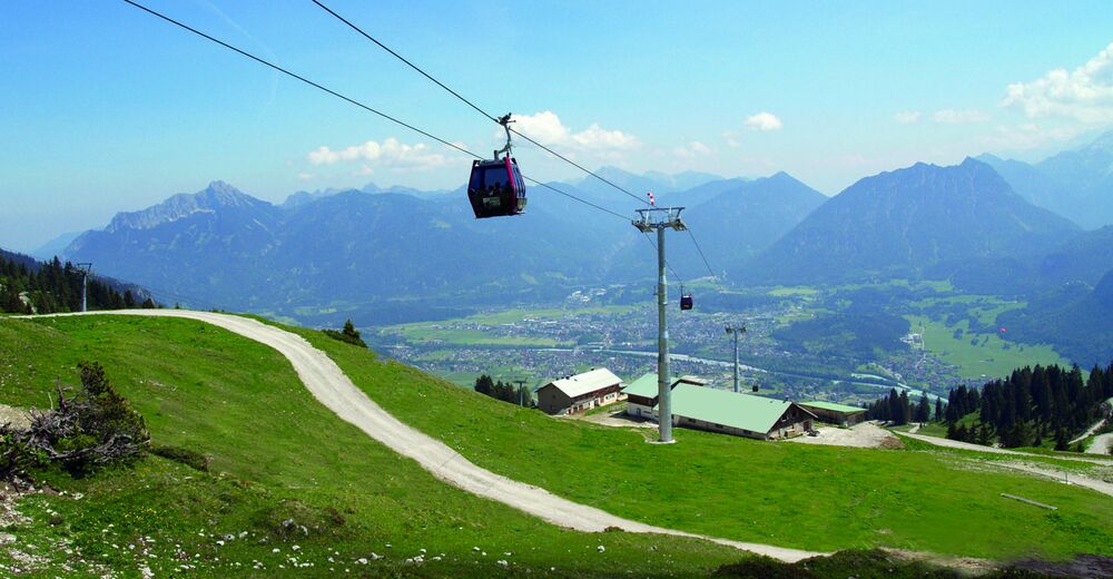
Bergbahn, Wanderwege, Almen und Restaurant
- Vaikeus
-
tapa
- Arviointi
-
- Lähtöpiste
-
Talstation Bergwelt Hahnenkamm
- Reitti
-
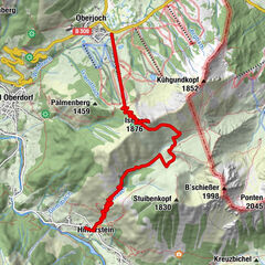
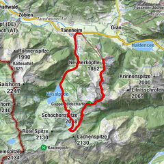
Hahnenkammbahn Höfen0,0 kmPanoramarestaurant0,1 kmHöfener Alm0,5 kmSchneetal Alm3,2 kmLechaschauer Alpe4,3 kmGehrenalpe6,2 kmLechaschauer Alpe8,1 kmHöfener Alm10,1 kmPanoramarestaurant10,6 kmHahnenkammbahn Höfen10,7 km
- Korkein kohta
- 1.716 m
- Lepo/Retriitti
-
Höfener Alm, Lechaschauer Alm Schneetalalm, Gehrenalpe, Panoramarestaurant
GPS Downloads


Polun olosuhteet
Asfaltti
Sora
Niitty
Metsä
Kallio
Altistettu
Lisää retkiä alueilla
-
Allgäu
2367
-
Naturparkregion Reutte
1434
-
Höfen
583