
© ÖAV-Hüttenfinder - Alpenverein Innsbruck

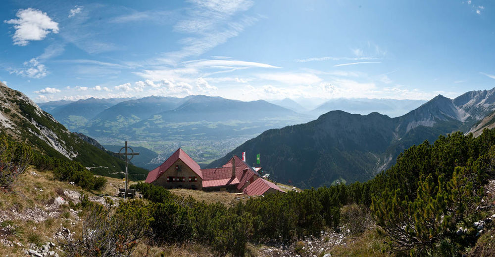
© Alpenverein Hall in Tirol - Michael Larcher
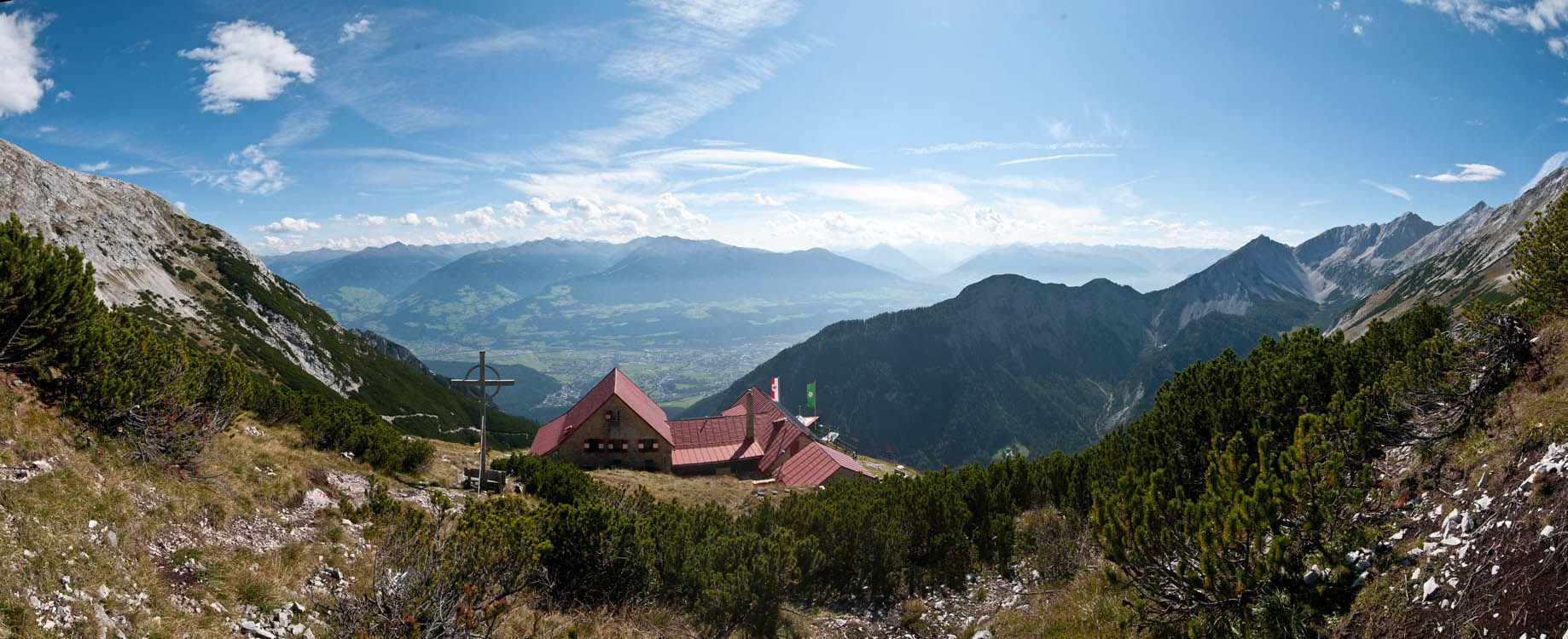
© Alpenverein Hall in Tirol - Michael Larcher

© ÖAV-Hüttenfinder - Alpenverein Innsbruck

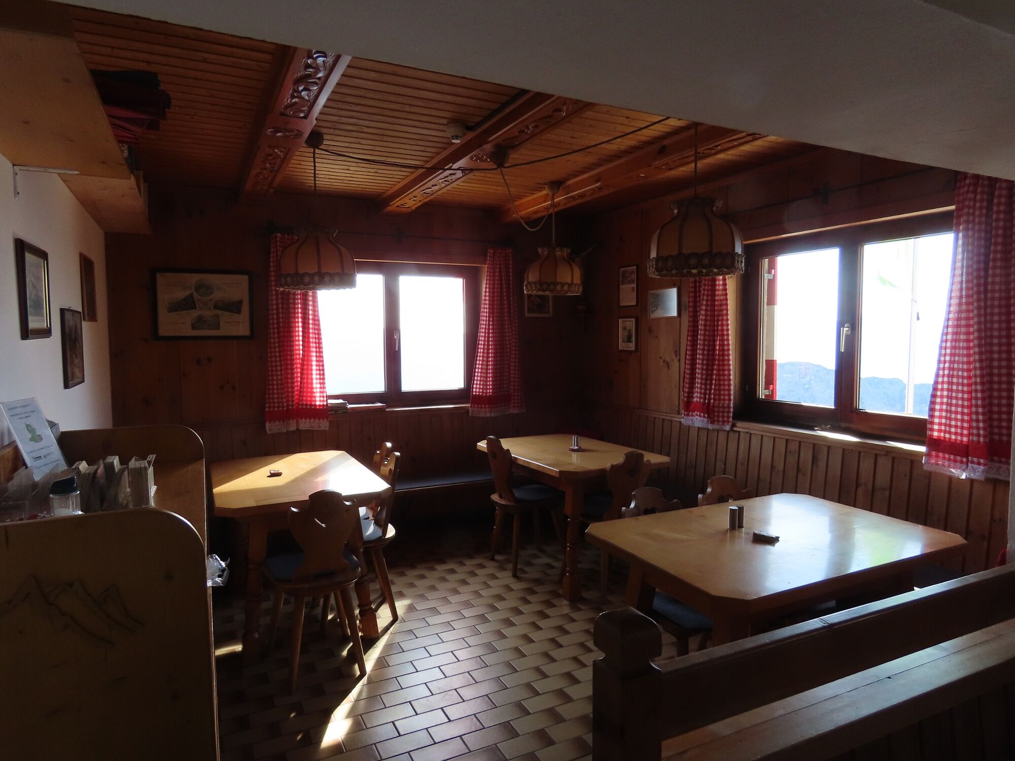
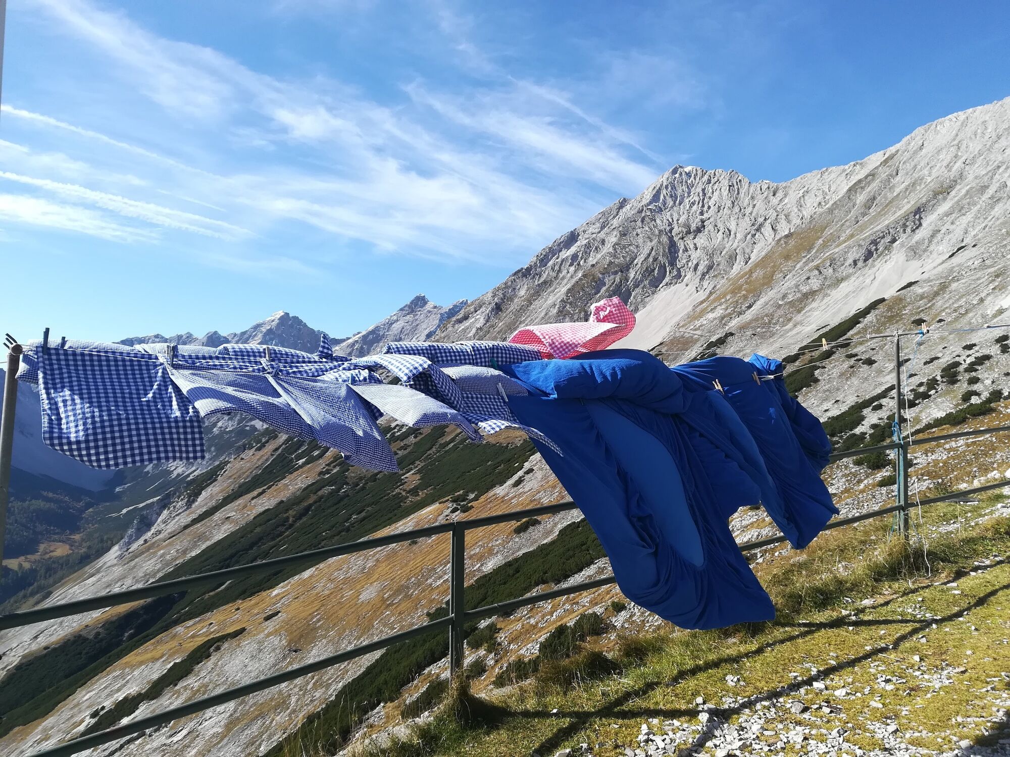
© Tourismusverband Region Hall-Wattens - Anne W.

© Tourismusverband Region Hall-Wattens - Anne W.

© Tourismusverband Region Hall-Wattens - Anne W.

© Tourismusverband Region Hall-Wattens - Anne W.

© Tourismusverband Region Hall-Wattens - Anne W.
- Lyhyt kuvaus
-
Throught the Halltal we take the trail up to the Bettwurf Hut
- Vaikeus
-
vaikea
- Arviointi
-
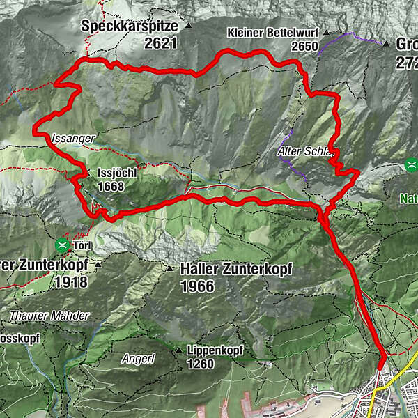
- Reitti
-
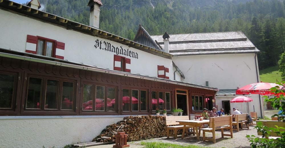
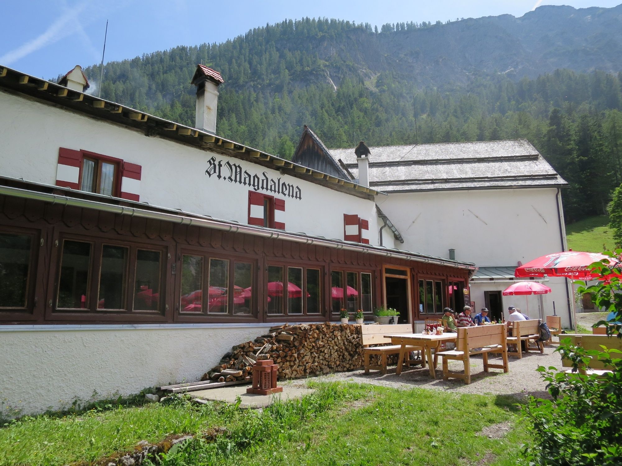
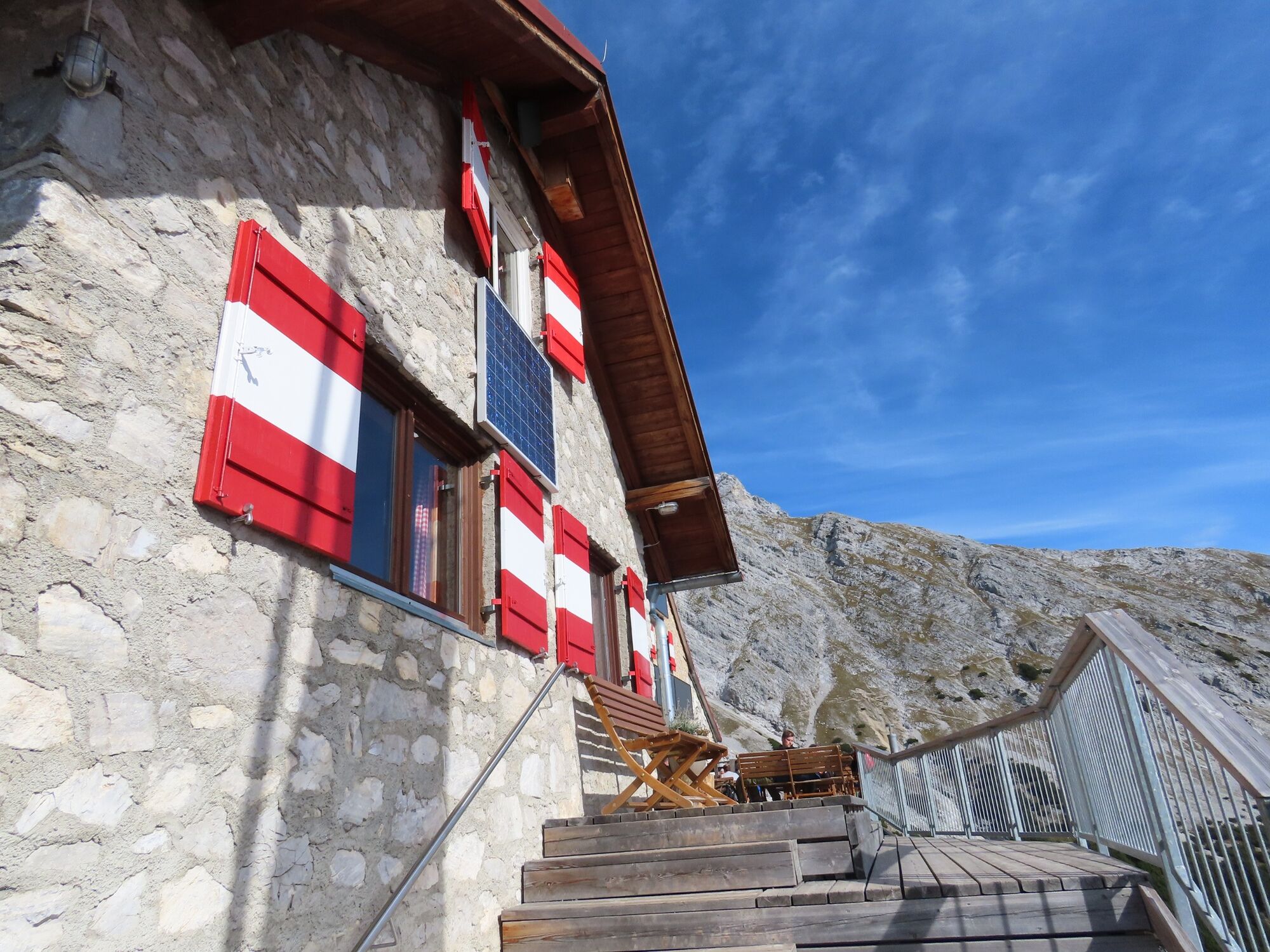
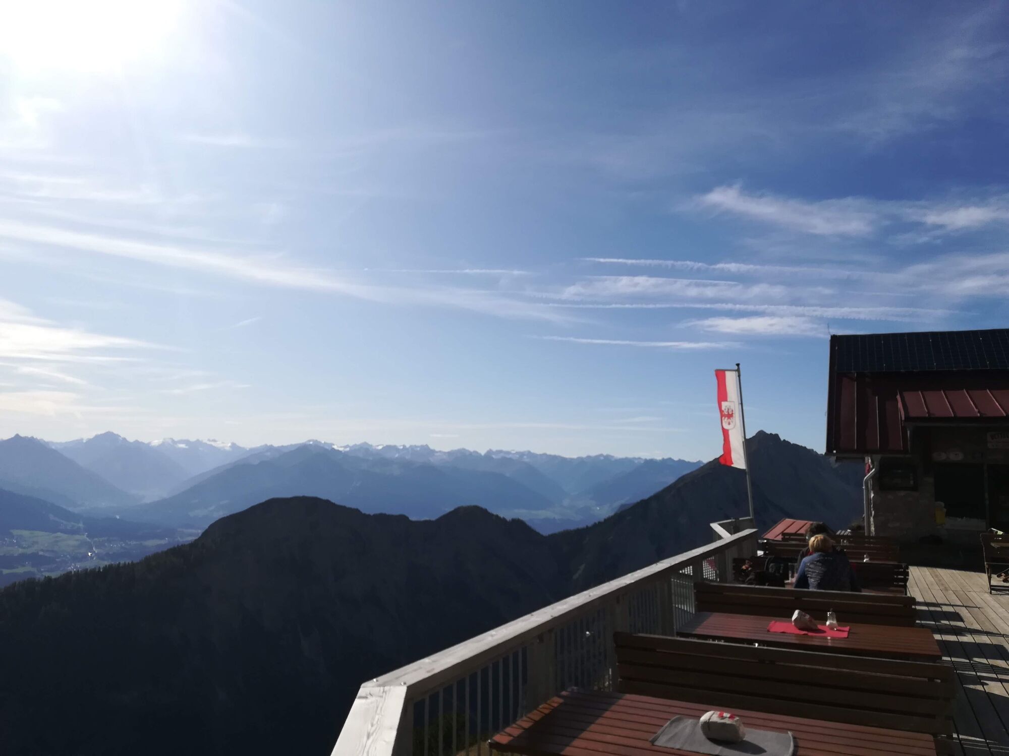
Bergerkapelle1,0 kmBettelwurfeck2,2 kmJakobibründlquelle2,2 kmKohlanger3,2 kmJausenstation St. Magdalena (1.287 m)3,4 kmErzherzogberg (1.424 m)4,8 kmHerrenhäuser (1.490 m)5,3 kmRuppertikapelle5,3 kmIssjöchl (1.668 m)6,4 kmKohlstatt (1.978 m)8,6 kmBettelwurfhütte (2.077 m)12,8 kmBeim Juchezer14,1 kmGamsgufel15,5 kmUntere Bettelwurfreise15,6 kmBergerkapelle17,2 km
- Paras kausi
-
tammihelmimaalishuhtitoukokesäheinäelosyyslokamarrasjoulu
- Korkein kohta
- 2.181 m
- Kohde
-
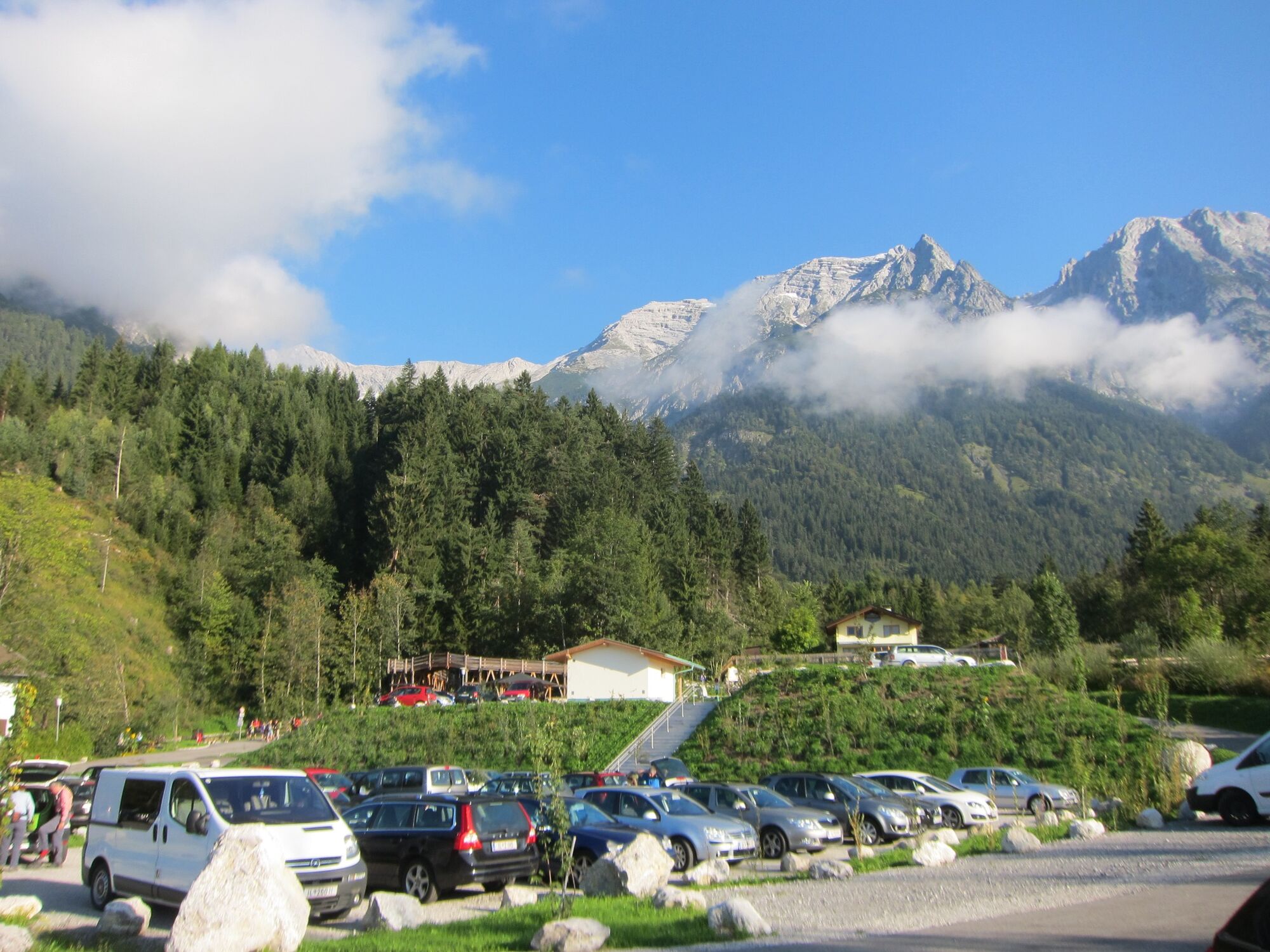
Halltal Parkplatz
- Korkeusprofiili
-


- Kirjoittaja
-
Kiertue From the Halltal to the Bettelwurf Mountain Hut käyttää outdooractive.com toimitettu.
GPS Downloads
Yleistä tietoa
Virvokepysäkki
Sisäpiirin vinkki
Lupaava
Lisää retkiä alueilla
-
Ferienregion Hall - Wattens
1479
-
Absam
344


