

© Outdooractive Redaktion - Hartmut Wimmer

© Outdooractive Redaktion - Hartmut Wimmer

© Outdooractive Redaktion - Hartmut Wimmer

© Outdooractive Redaktion - Hartmut Wimmer

© Outdooractive Redaktion - Hartmut Wimmer
© Tannheimer Tal - Michael Keller
© Tannheimer Tal - Michael Keller

© Outdooractive Redaktion - Hartmut Wimmer

© Outdooractive Redaktion - Hartmut Wimmer

© Outdooractive Redaktion - Hartmut Wimmer

- Lyhyt kuvaus
-
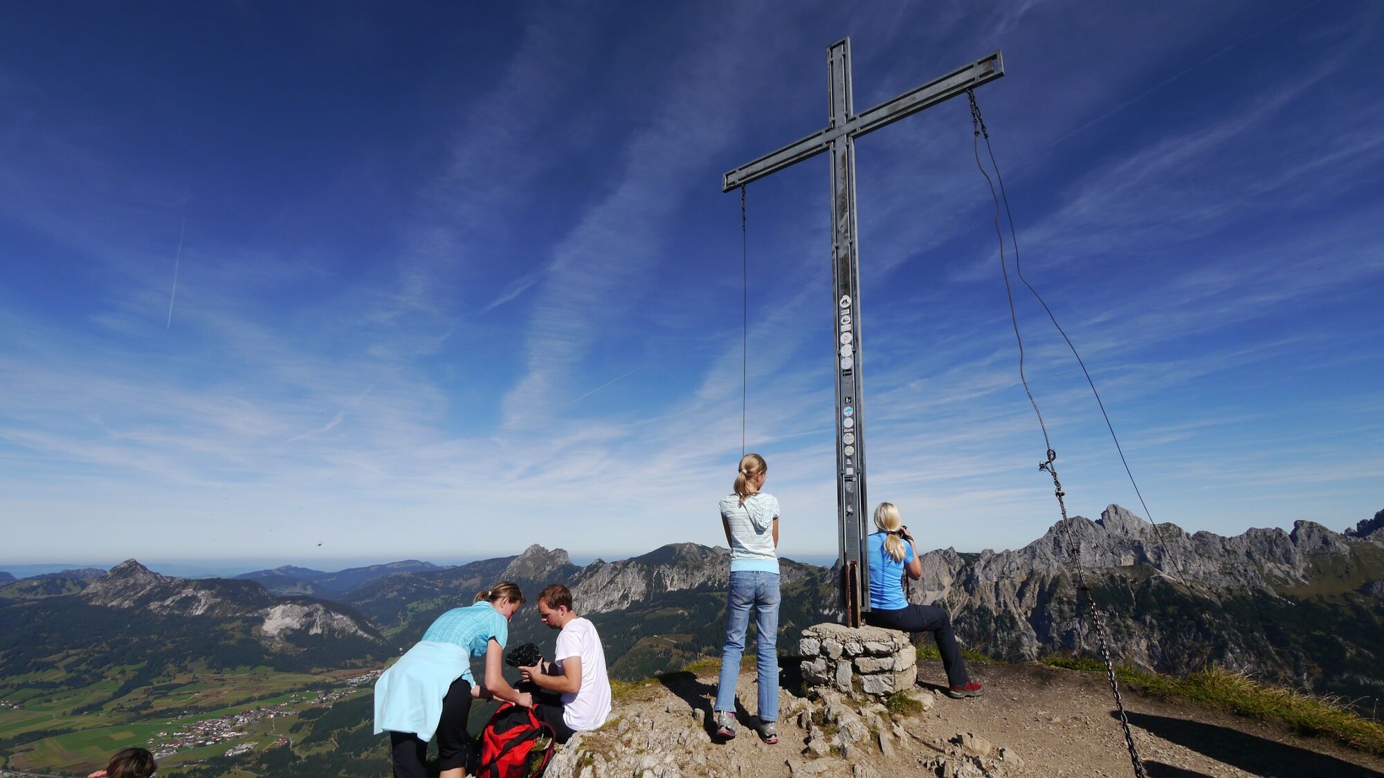
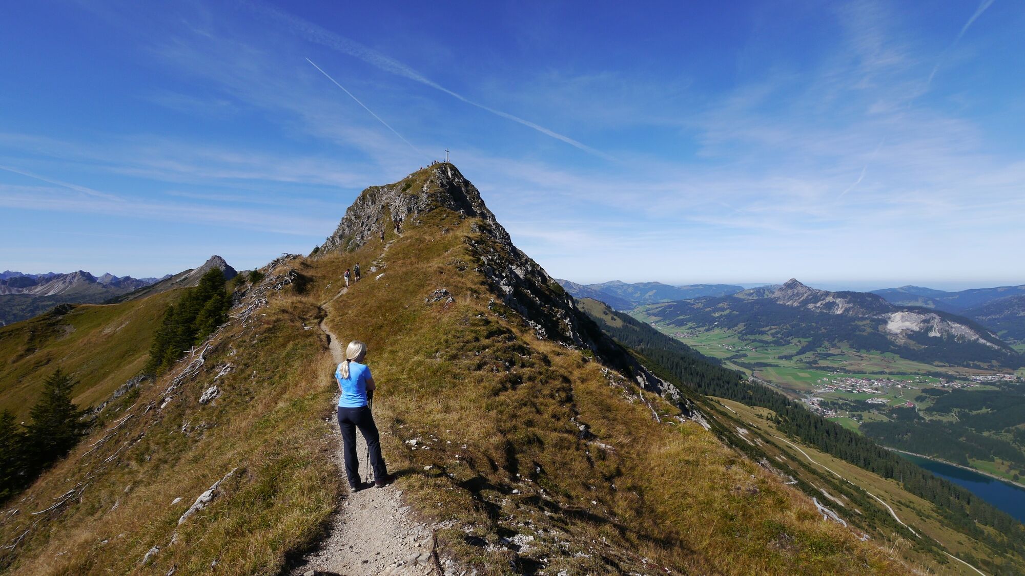
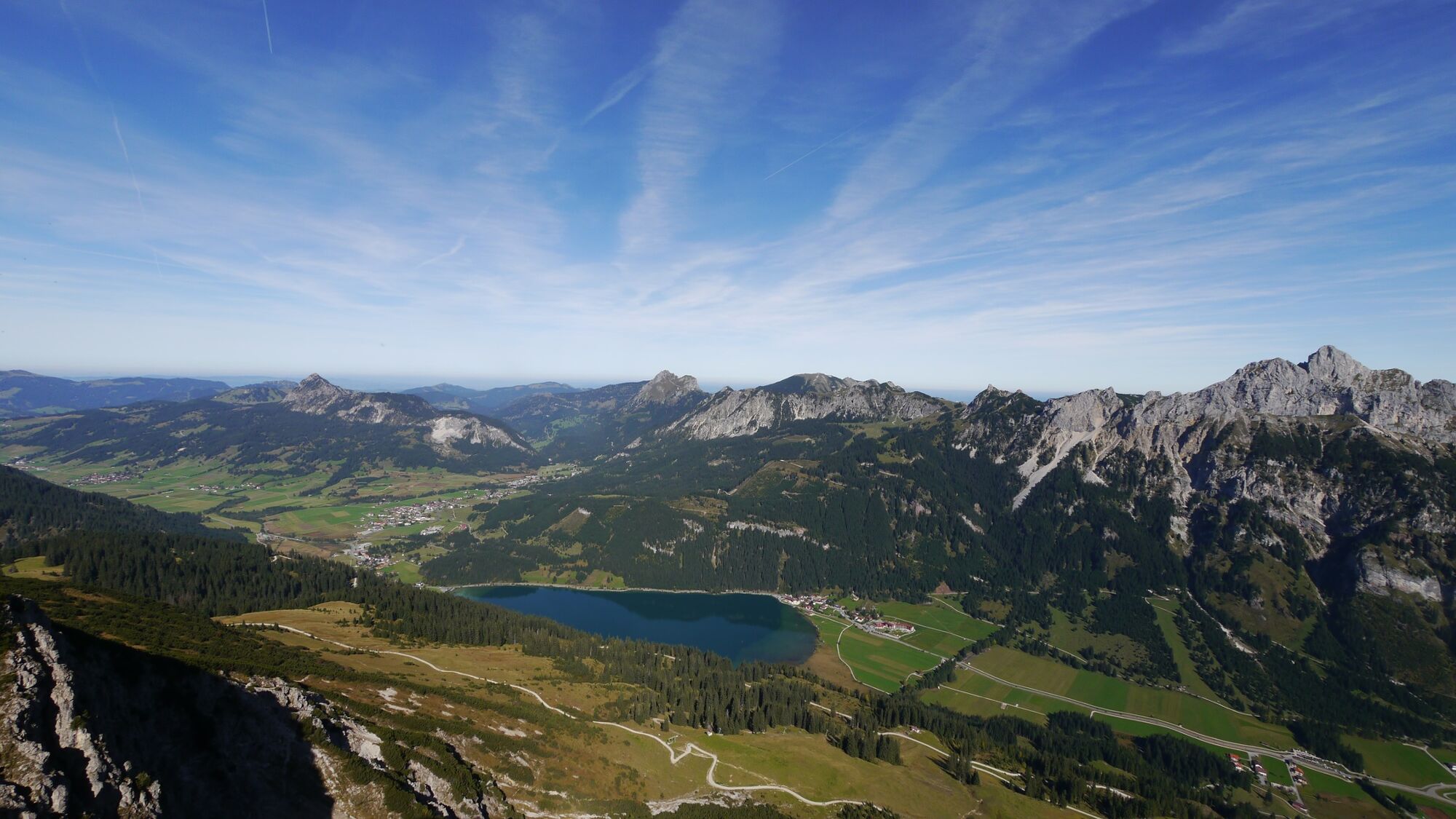
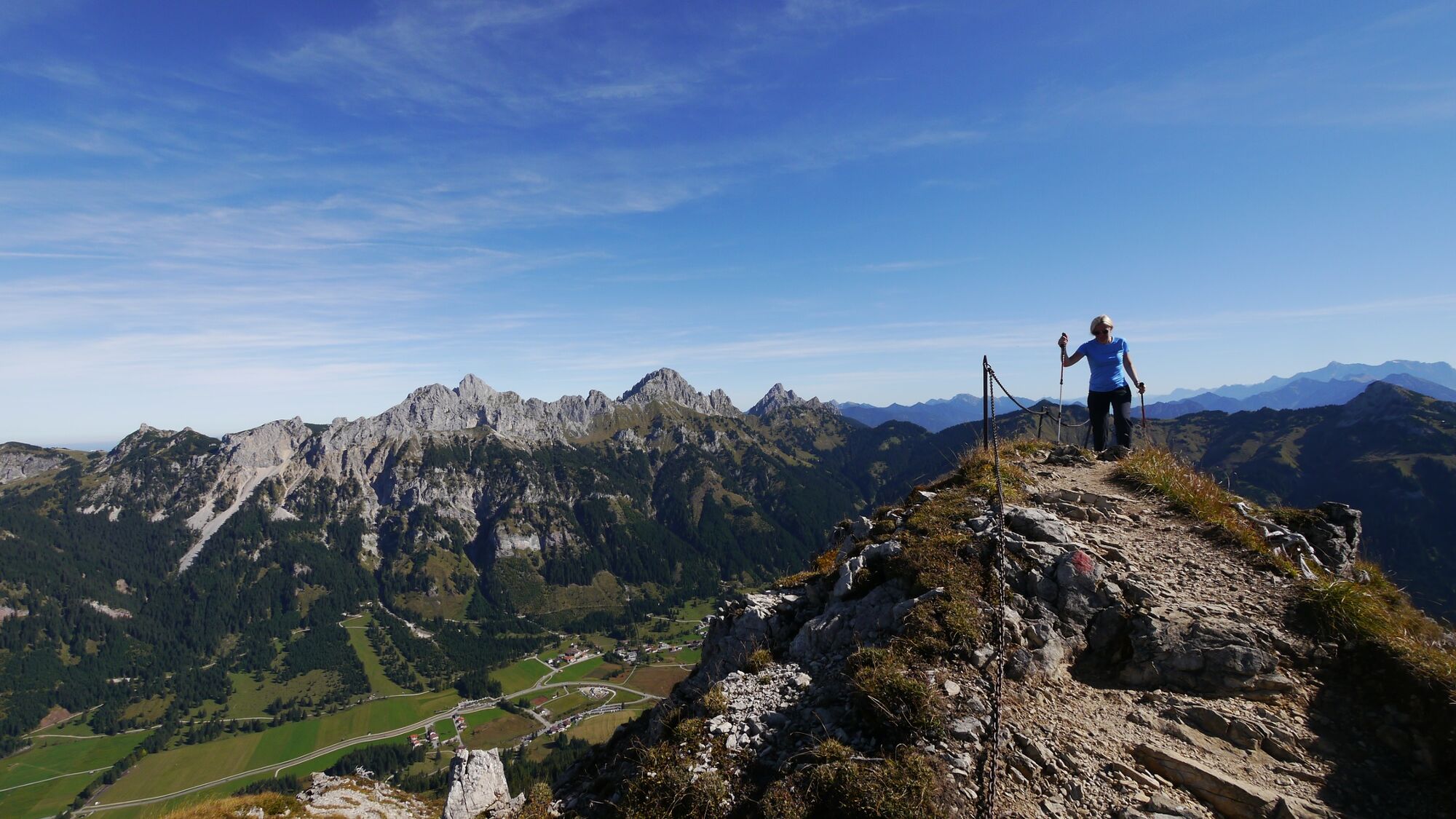
Beautiful summit tour to the Krinnenspitze
- Vaikeus
-
tapa
- Arviointi
-
- Reitti
-
Krinnenalpe (1.505 m)1,0 kmKrinnenalpe1,2 kmEdenalpe Nesselwängle2,8 kmKrinnenspitze (2.000 m)4,0 kmEdenalpe Nesselwängle6,5 kmKrinnenalpe8,1 kmKrinnenalpe (1.505 m)8,3 kmKrinnenalpe9,4 km
- Paras kausi
-
tammihelmimaalishuhtitoukokesäheinäelosyyslokamarrasjoulu
- Korkein kohta
- 1.992 m
- Kohde
-
Nesselwängle lift parking
- Korkeusprofiili
-


-

-
KirjoittajaKiertue Krinnenspitze in Nesselwängle käyttää outdooractive.com toimitettu.
GPS Downloads


Yleistä tietoa
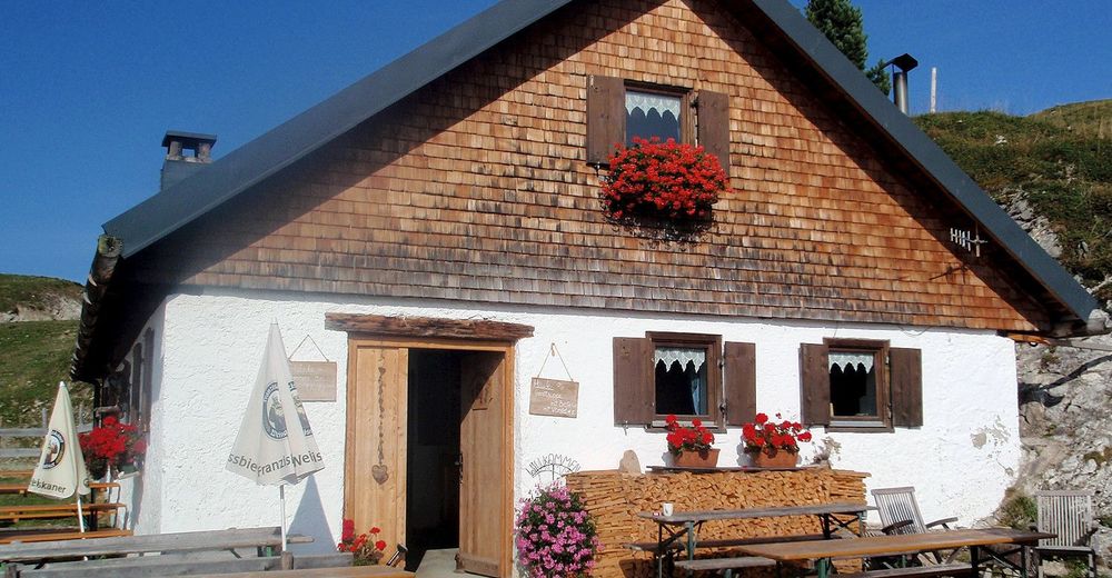
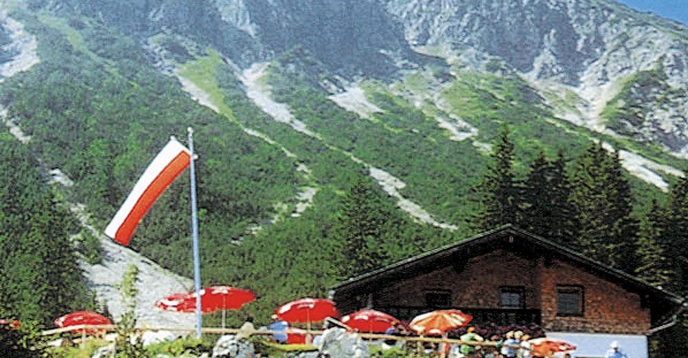
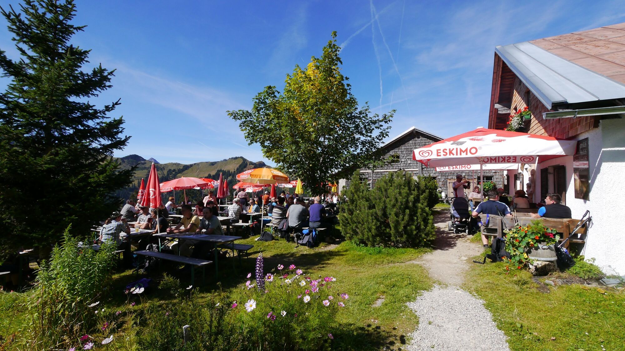
Virvokepysäkki
Flora
Fauna
Lupaava
Lisää retkiä alueilla
-
Allgäu
2357
-
Tannheimer Tal
1454
-
Nesselwängle
584


