

© Tourismusverband Region Hall-Wattens - Hall Wattens

© Tourismusverband Region Hall-Wattens - Hall Wattens
- Lyhyt kuvaus
-
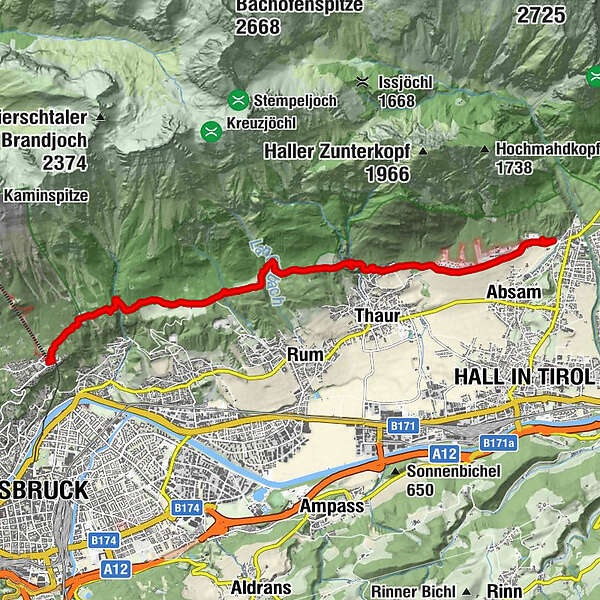
Varied hike across meadows and forests from Absam to the Hungerburg.
- Vaikeus
-
helppo
- Arviointi
-
- Reitti
-
Stollenquelle3,7 km103,8 kmSchlosskirche St. Romedius4,2 kmRomediwirt4,2 kmRumer Mure6,9 kmLoam9,7 kmCafe Pension Alpina11,1 kmHungerburg11,2 kmInnsbruck (574 m)11,2 km
- Paras kausi
-
tammihelmimaalishuhtitoukokesäheinäelosyyslokamarrasjoulu
- Korkein kohta
- 950 m
- Kohde
-
Innsbruck, Hungerburg
- Korkeusprofiili
-


- Kirjoittaja
-
Kiertue Varied hike along the Adolf Pichler Trail käyttää outdooractive.com toimitettu.
GPS Downloads


Yleistä tietoa
Virvokepysäkki
Lisää retkiä alueilla


