© APT - Valsugana e Lagorai - APT Valsugana

- Lyhyt kuvaus
-
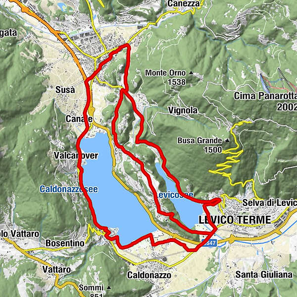
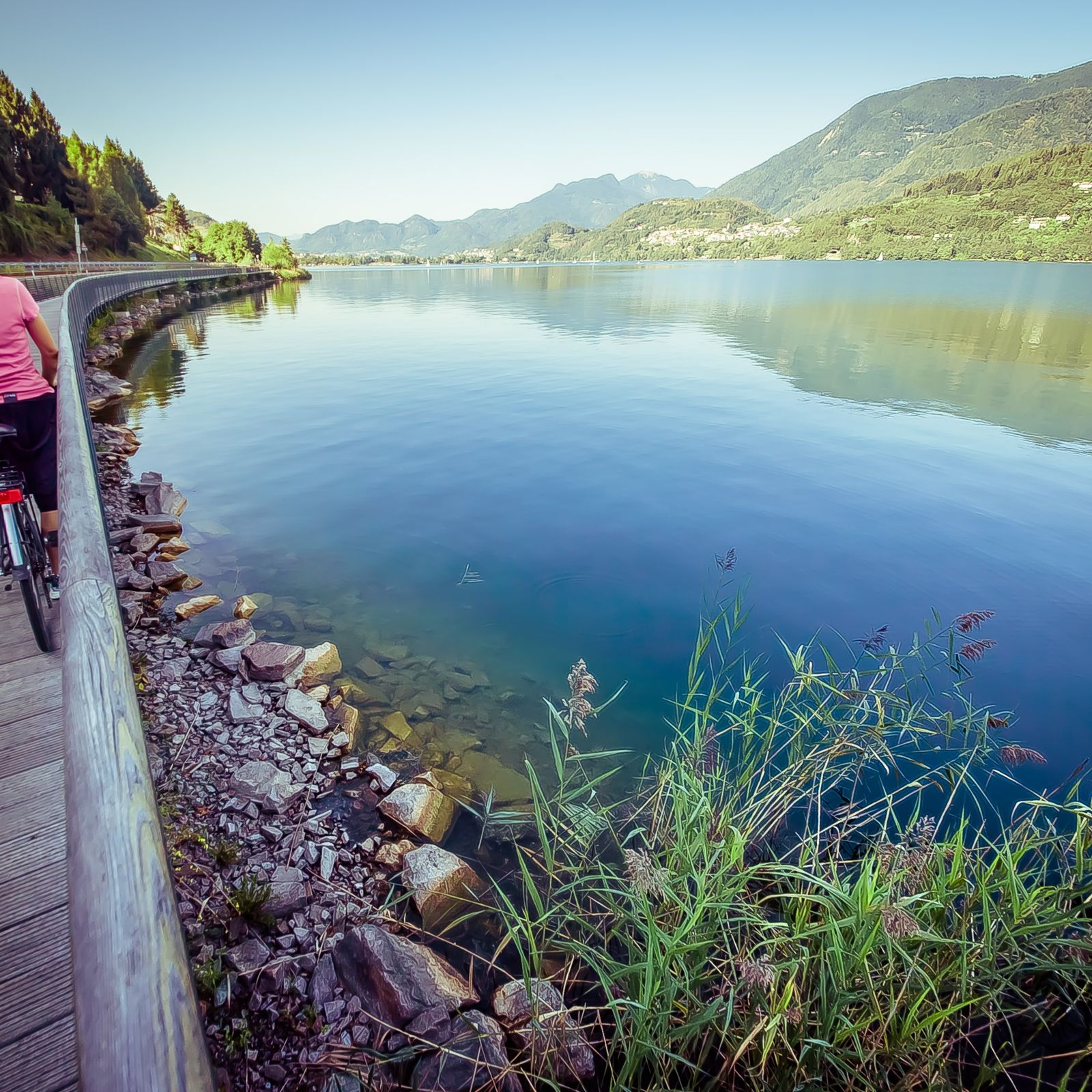
Easy route, which allows you to admire the landscapes of the lakes of Levico and Caldonazzo, passing through the history of Castel Pergine and the apple orchards of Colle di Tenna
- Vaikeus
-
helppo
- Arviointi
-
- Reitti
-
Levico Terme0,4 kmPaluda del Baruchèl5,0 kmVisintainer5,6 kmMasetti8,2 kmZivignago10,1 kmPergine Valsugana11,4 kmAngi13,3 kmSan Cristoforo al Lago - Ischia13,8 kmCanale13,8 kmSan Cristoforo al Lago14,3 kmGiropizza VIP15,3 kmValcanover15,5 kmRistorante Valcanover15,7 kmMaso Osler15,8 kmBinario 79 - Da Ciolda16,1 kmRistorante-Pizzeria HAPPY DAYS17,2 kmCalceranica18,3 kmAltalena18,6 kmArea giochi18,6 kmCalceranica al Lago19,0 kmEnergy Hotel19,1 kmCosta23,4 kmLevico Terme23,9 kmVeg. Point26,4 kmTenna26,7 kmIschia29,2 kmPozza30,5 kmMasetti31,4 kmPergine Valsugana31,4 km
- Paras kausi
-
tammihelmimaalishuhtitoukokesäheinäelosyyslokamarrasjoulu
- Korkein kohta
- 631 m
- Kohde
-
Levico Terme
- Korkeusprofiili
-
 © outdooractive.com
- Kirjoittaja
-
Kiertue Roadbike - Lakes Levico and Caldonazzo - and Tenna Hill käyttää outdooractive.com toimitettu.
GPS Downloads


Yleistä tietoa
Virvokepysäkki
Kulttuuri/Historiallinen
Flora
Lupaava
Lisää retkiä alueilla