Retkitiedot
16,01km
395
- 407m
24hm
24hm
04:30h
- Lyhyt kuvaus
-
Nice Cycle-tour along the Bodensee
- Vaikeus
-
helppo
- Arviointi
-
- Reitti
-
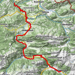
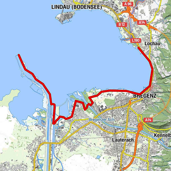
Lochau-Hörbranz0,0 kmLochau0,5 kmTannenbach1,9 kmBregenz (427 m)3,3 kmSt. Sebastian8,6 kmHard9,4 kmKiesgewinnung Rhein12,8 km
- Paras kausi
-
tammihelmimaalishuhtitoukokesäheinäelosyyslokamarrasjoulu
- Korkein kohta
- 407 m
- Link
- www.patruckel.com
- Lähde
- Patrick Schmidt
GPS Downloads


Ajoreitit
Asfaltti
Sora
Metsä
Vuoripolut
Singletrails
Trial
Liikenne
Lisää retkiä alueilla
-
St. Gallen - Bodensee
288
-
Bodensee - Vorarlberg
168
-
Hard
41