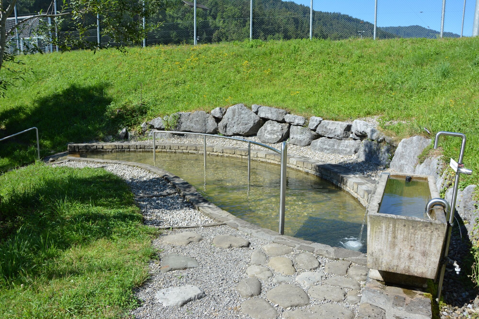
© Andelsbuch Tourismus - Renja Metzler

- Lyhyt kuvaus
-
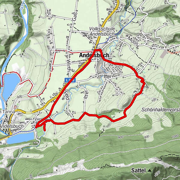
Ortszentrum - Parzelle Grunholz - Krähenberg - Unterbezegg - Mühle - Kneipp-Wassertretanlage - Dorfmitte
- Vaikeus
-
helppo
- Arviointi
-
- Reitti
-
Unterbezegg1,3 kmPfarrkirche Andelsbuch4,4 kmAndelsbuch4,6 km
- Paras kausi
-
tammihelmimaalishuhtitoukokesäheinäelosyyslokamarrasjoulu
- Korkein kohta
- 678 m
- Kohde
-
Ortszentrum
- Korkeusprofiili
-

- Kirjoittaja
-
Kiertue Andelsbuch | Wege zum Wasser - Kneipp-Wassertretanlage käyttää outdooractive.com toimitettu.
GPS Downloads


Yleistä tietoa
Virvokepysäkki
Kulttuuri/Historiallinen
Lupaava
Lisää retkiä alueilla
-
St. Gallen - Bodensee
2065
-
Bregenzerwald
2295
-
Andelsbuch
669