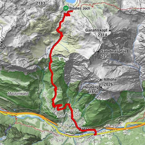
"Stebok Wäg" from Dalaas to Formarinsee/Freiburger Hut | Dalaas


© Alpenregion Bludenz Tourismus GmbH - Andrea Fritz

© Alpenregion Bludenz Tourismus GmbH - Alex Kaiser

© Alpenregion Bludenz Tourismus GmbH - Alex Kaiser

© Alpenregion Bludenz Tourismus GmbH - Andrea Fritz

© Alpenregion Bludenz Tourismus GmbH - Alex Kaiser

© Vorarlberg Tourismus GmbH
- Lyhyt kuvaus
-
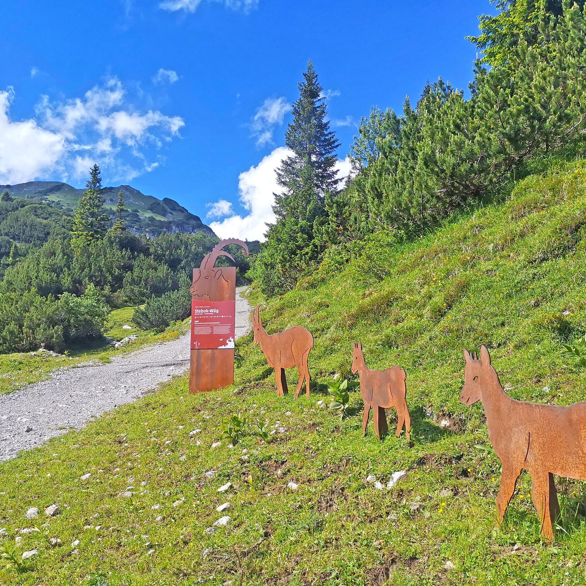
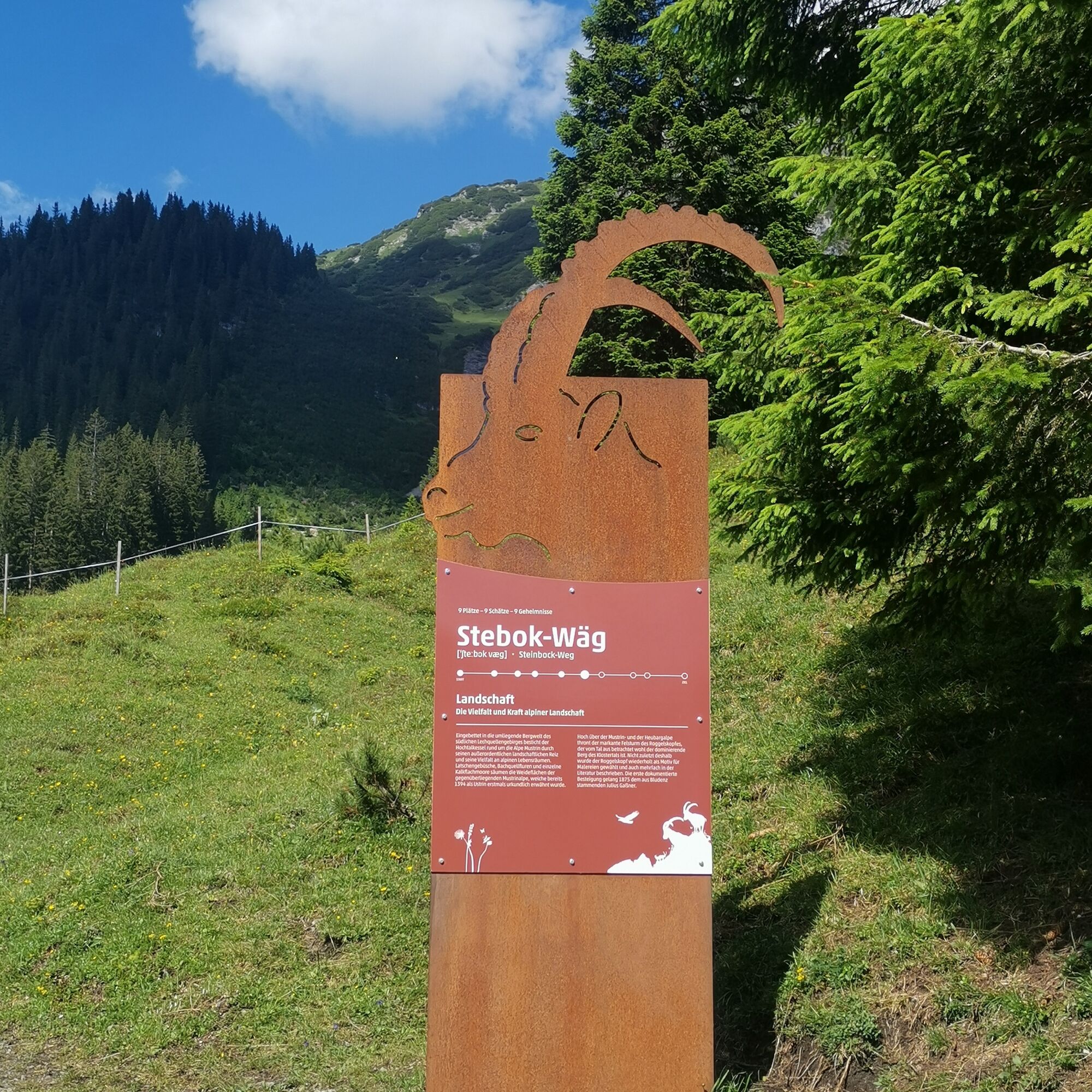
Scenic mountain hike to the Formarinsee, which was voted the most beautiful place in Austria in the fall of 2015! Nine stations with information worth knowing about the Klostertal and numerous ibexes accompany you on the way from Mason via the Mustrinalpe to the Formarinsee.
- Vaikeus
-
tapa
- Arviointi
-
- Reitti
-
Dalaas (835 m)0,6 kmSt. Oswald0,7 kmUntermarias1,1 kmObermarias1,3 kmKapelle2,2 kmMason2,3 kmFreiburger Hütte8,0 kmMason13,6 kmKapelle13,7 kmObermarias14,6 kmUntermarias14,7 kmSt. Oswald15,2 kmDalaas (835 m)15,4 km
- Paras kausi
-
tammihelmimaalishuhtitoukokesäheinäelosyyslokamarrasjoulu
- Korkein kohta
- 1.915 m
- Kohde
-
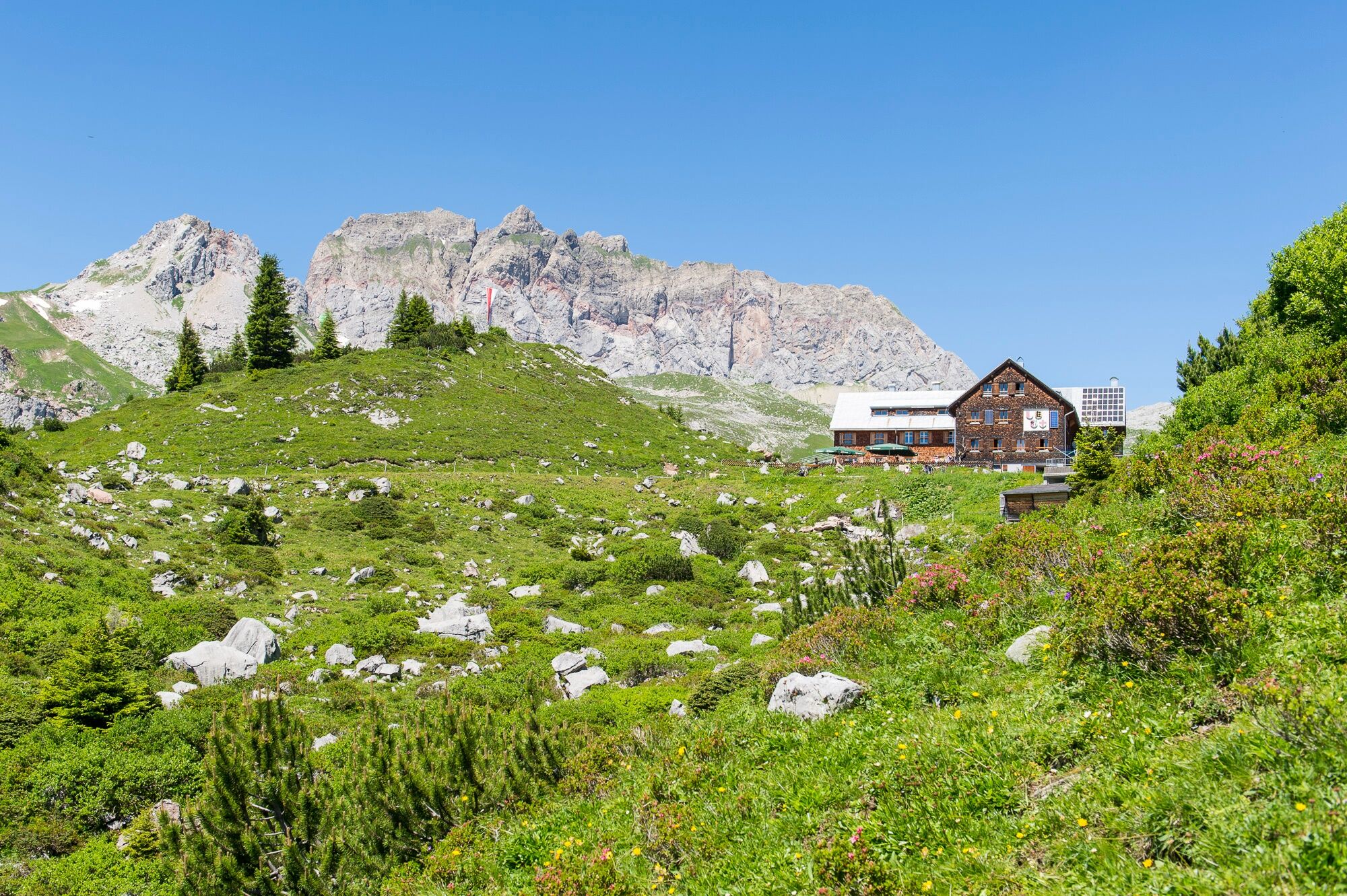
Freiburger Hut, Dalaas
- Korkeusprofiili
-

- Kirjoittaja
-
Kiertue "Stebok Wäg" from Dalaas to Formarinsee/Freiburger Hut | Dalaas käyttää outdooractive.com toimitettu.
GPS Downloads


Yleistä tietoa
Virvokepysäkki
Lisää retkiä alueilla
-
Klostertal
1790
-
Dalaas / Wald am Arlberg
467


