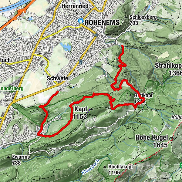
Alpwanderung: Fallenkobel - Götznerberg - Millrütte - Alpe Gsohl - Ledi


- Lyhyt kuvaus
-
Der Fallenkobelweg ist Ihnen noch unbekannt? Dann nichts wie los, erkundigen Sie den wunderschönen Wanderweg. Sie werden es nicht bereuen.
- Vaikeus
-
tapa
- Arviointi
-
- Reitti
-
HopfrebenGötznerberg1,6 kmRappenloch4,1 kmKrümmana4,5 kmMillrütte6,1 kmBöserstein6,5 kmGsohlalpe7,3 kmAlpe Gsohl7,4 kmHohenems (432 m)9,9 km
- Paras kausi
-
tammihelmimaalishuhtitoukokesäheinäelosyyslokamarrasjoulu
- Korkein kohta
- 1.143 m
- Kohde
-
Ledi / Schießstand Hohenems
- Korkeusprofiili
-

-

-
KirjoittajaKiertue Alpwanderung: Fallenkobel - Götznerberg - Millrütte - Alpe Gsohl - Ledi käyttää outdooractive.com toimitettu.
GPS Downloads


Yleistä tietoa
Lupaava
Lisää retkiä alueilla
-
St. Gallen - Bodensee
2066
-
St. Galler Rheintal
1333
-
Hohenems
345


