Damüls Fontanella I Türtschalpe und Alpe Unterdamüls

Logo Damüls Fontanella I Türtschalpe und Alpe Unterdamüls
Retkitiedot
12,13km
1.163 - 1.780m
Distanz
686hm
449hm
Nousu
03:00h
 
Kesto
Lyhyt kuvaus

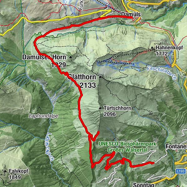
Fontanella - Türtschalpe - Alpe Unterdamüls - Kirchdorf Damüls

Vaikeus
tapa
Arviointi
Tekniikka
Kunto
Maisema
Elämys
Reitti
Gadastatt
2,0 km
Türtschalpe (1.641 m)
4,2 km
Türtschalpe
4,4 km
Alpe Unterdamüls
9,1 km
Damüls (1.423 m)
12,0 km

Korkein kohta
1.780 m
Kohde

Damüls Kirchdorf

Korkeusprofiili

Kirjoittaja

Yleinen luokitus

5

0

%

4

0

%

3

0

%

2

0

%

1

0

%

Virhe
On tapahtunut virhe. Yritä uudelleen.
Kiitos arvostelusta

Luokitus poistettiin

GPS Downloads
  • GPX GPS Exchange Format (XML)
  • KML Google Earth, Google Maps
QR-latauskoodit matkapuhelimiin

Yleistä tietoa

Virvokepysäkki

Suosittuja retkiä alueella

Glatthorn

tapa
6,49km | 507hm | 02:30h

Panorama hike Dornbirn Karren

tapa
3,43km | 472hm | 01:20h

Üble Schlucht / Laterns

tapa
6,3km | 322hm | 02:30h

Hiking around the lake Spullersee

helppo
5,58km | 183hm | 01:56h