

Retkitiedot
15,8km
834
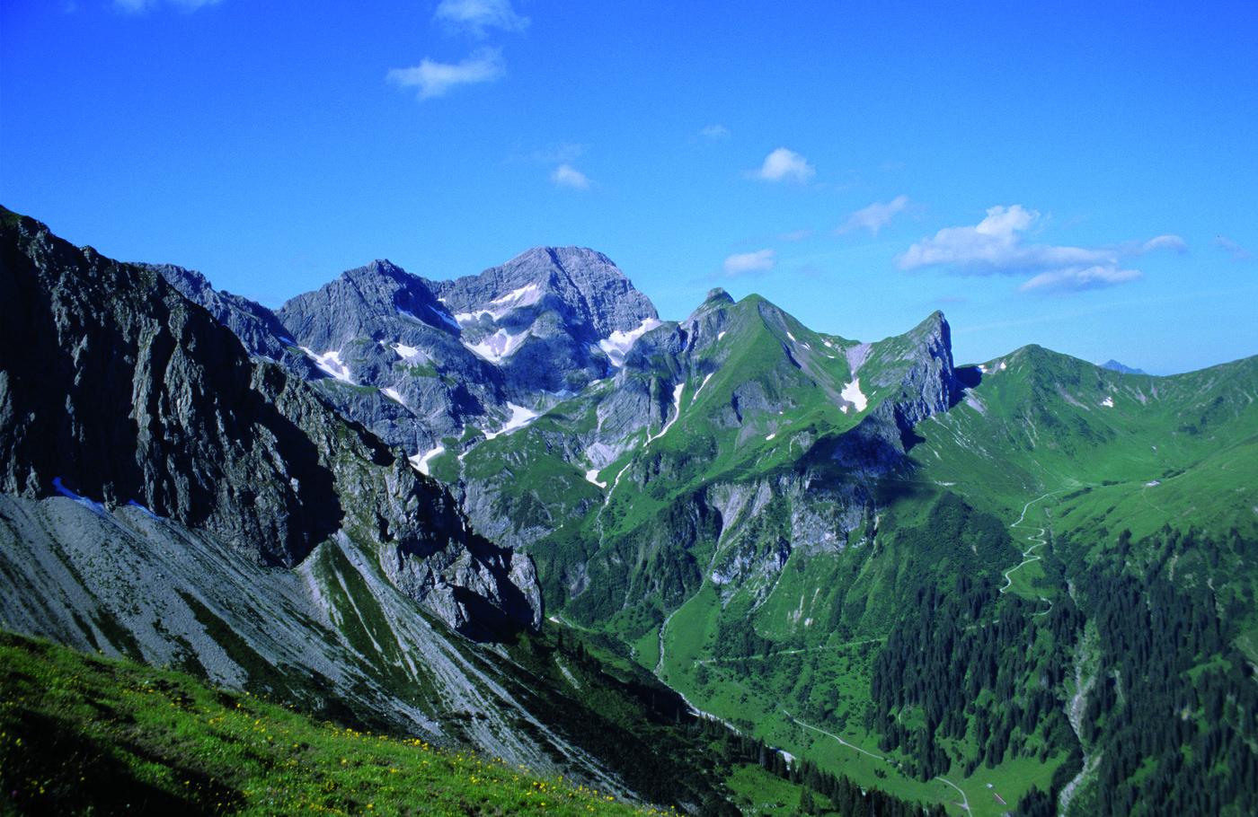
- 2.017m
318hm
06:00h
- Arviointi
-
- Lähtöpiste
-
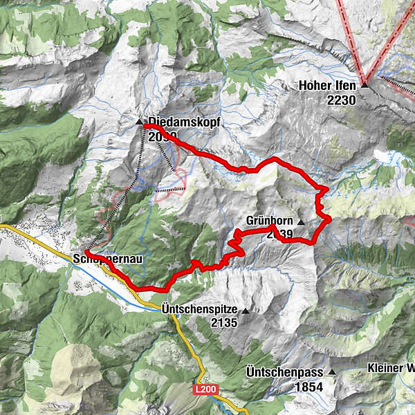
Bergstation Diedamskopf
- Reitti
-
PanoramarestaurantSchwarzwasserhütte5,2 kmNeuhornbach Alpe9,3 kmÜntschele13,3 kmSt. Philippus & Jakobus14,8 kmSchoppernau (852 m)14,9 kmZum Fraaanz Restaurant15,0 kmSchrannen-Hof15,5 km
- Korkein kohta
- 2.017 m
- Lepo/Retriitti
-
Panoramarestaurant am Berg, Schwarzwassehütte, Neuhornbachhaus, Breitenalpe, Kiosk Mittelstation.
- Karttamateriaali
-
Au-Schoppernau Tourismus
GPS Downloads

Polun olosuhteet
Asfaltti
Sora
Niitty
Metsä
Kallio
Altistettu
Lisää retkiä alueilla
-
Bregenzerwald
2297
-
Diedamskopf
755


