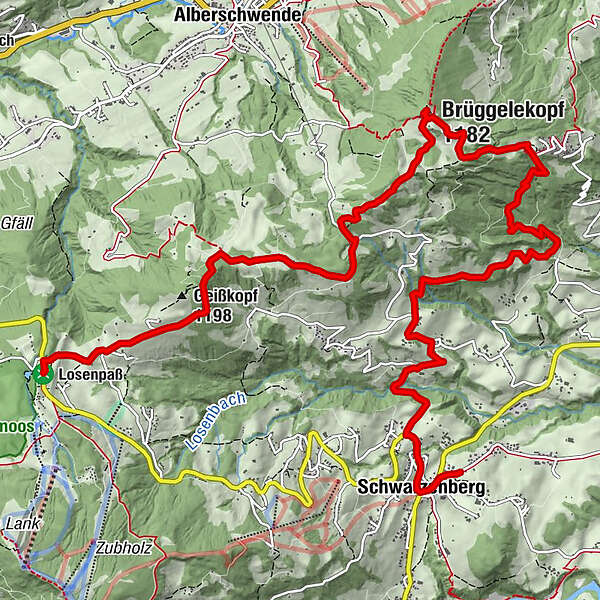
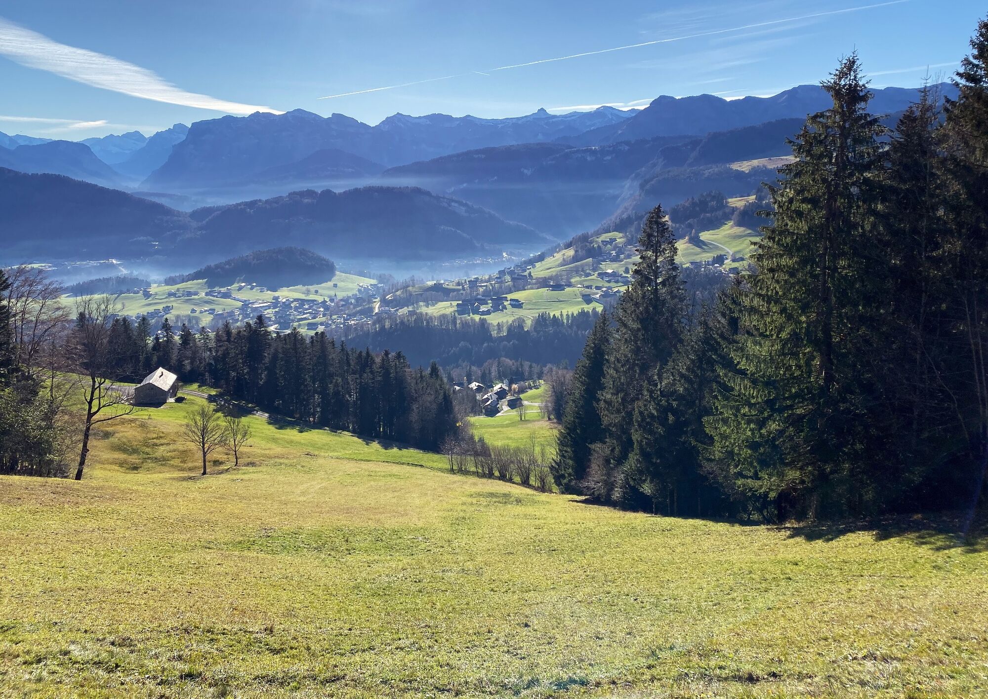
Schwarzenberg | From Bödele accross the Brüggelekopf to Schwarzenberg


© Gemeinde Alberschwende - Karin Hillebrand

© friendship.is - Jana Sabo

© Bregenzerwald Tourismus - Teresa Meusburger

© Bregenzerwald Tourismus - Cornelia Kriegner

© Bregenzerwald Tourismus - Teresa Meusburger

© Bregenzerwald Tourismus - Teresa Meusburger

© Bregenzerwald Tourismus - Nadine Lerho

© Bregenzerwald Tourismus - Teresa Meusburger

© Bregenzerwald Tourismus - Teresa Meusburger

- Lyhyt kuvaus
-
From the picturesque village of Schwarzenberg accross the Bödele and Brüggelekopf with views of Lake Constance.
- Vaikeus
-
tapa
- Arviointi
-
- Reitti
-
Berghof Fetz0,1 kmGasthof Berchtoldshöhe5,0 kmAlpengasthof Brüggele5,6 kmBrüggelekopf (1.182 m)5,7 kmJakob Bader Maurer Kapelle (1657)10,8 kmKapelle Hl. Theresia11,2 kmHotel Gasthof Hirschen Schwarzenberg13,3 kmSchwarzenberg (696 m)13,3 kmAdler13,3 kmPfarrkirche Schwarzenberg - Heiligste Dreifaltigkeit13,3 km
- Paras kausi
-
tammihelmimaalishuhtitoukokesäheinäelosyyslokamarrasjoulu
- Korkein kohta
- 1.172 m
- Kohde
-
Schwarzenberg
- Korkeusprofiili
-


-

-
KirjoittajaKiertue Schwarzenberg | From Bödele accross the Brüggelekopf to Schwarzenberg käyttää outdooractive.com toimitettu.
GPS Downloads

Yleistä tietoa
Virvokepysäkki
Lisää retkiä alueilla
-
St. Gallen - Bodensee
2067
-
Bregenzerwald
2297
-
Schwarzenberg
610


