
© Valais/Wallis Promotion - David Carlier - David Carlier

© Valais/Wallis Promotion - David Carlier - David Carlier


© Valais/Wallis Promotion - David Carlier - David Carlier

© Valais/Wallis Promotion - David Carlier - David Carlier

© Valais/Wallis Promotion - David Carlier - David Carlier

© Valais/Wallis Promotion - David Carlier - David Carlier
© Unbekannt - Anzère Tourisme

© Valais/Wallis Promotion - Anzère Tourisme

- Lyhyt kuvaus
-
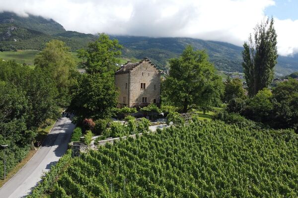
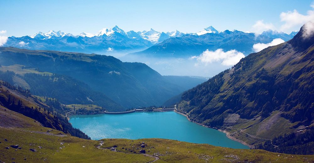
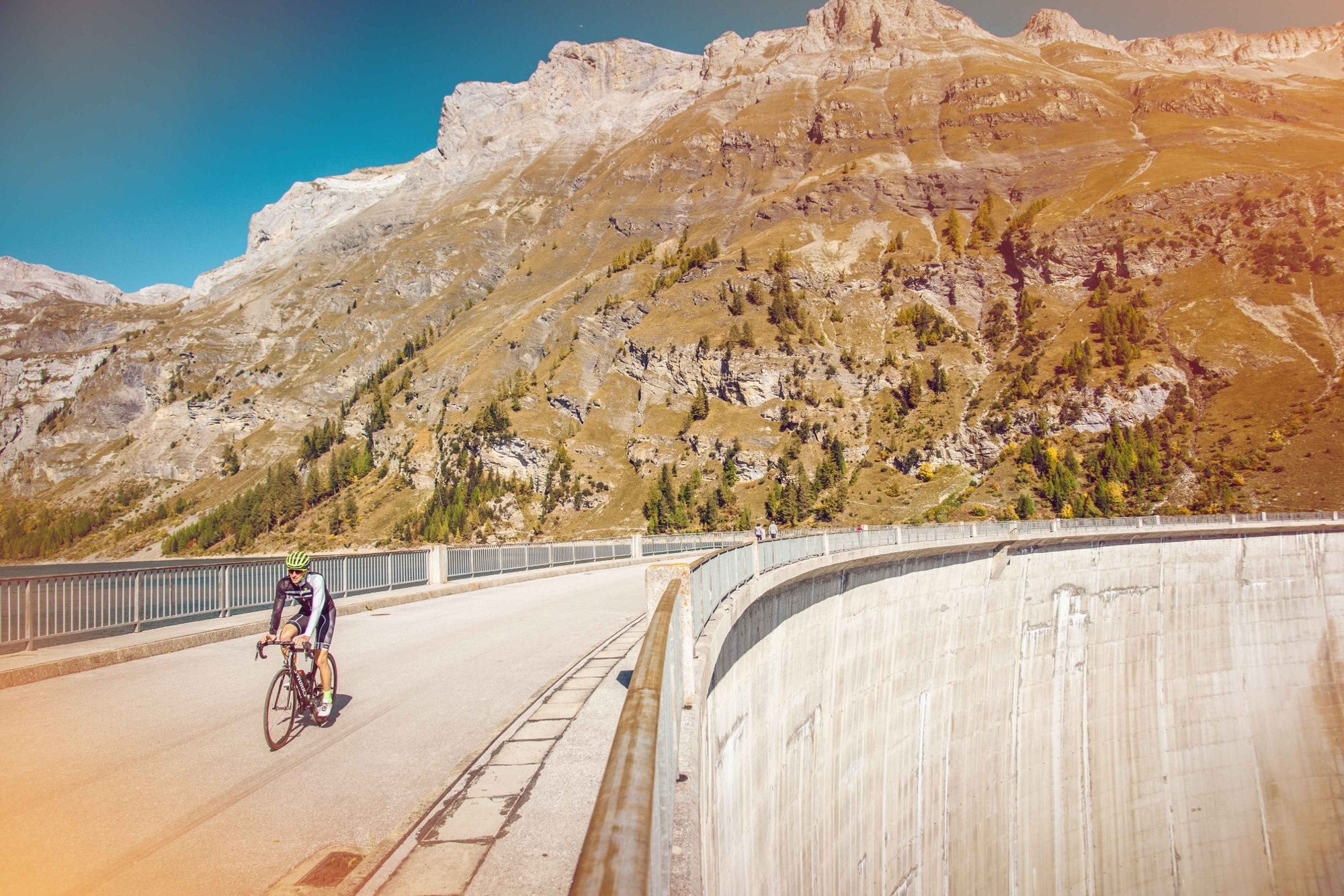
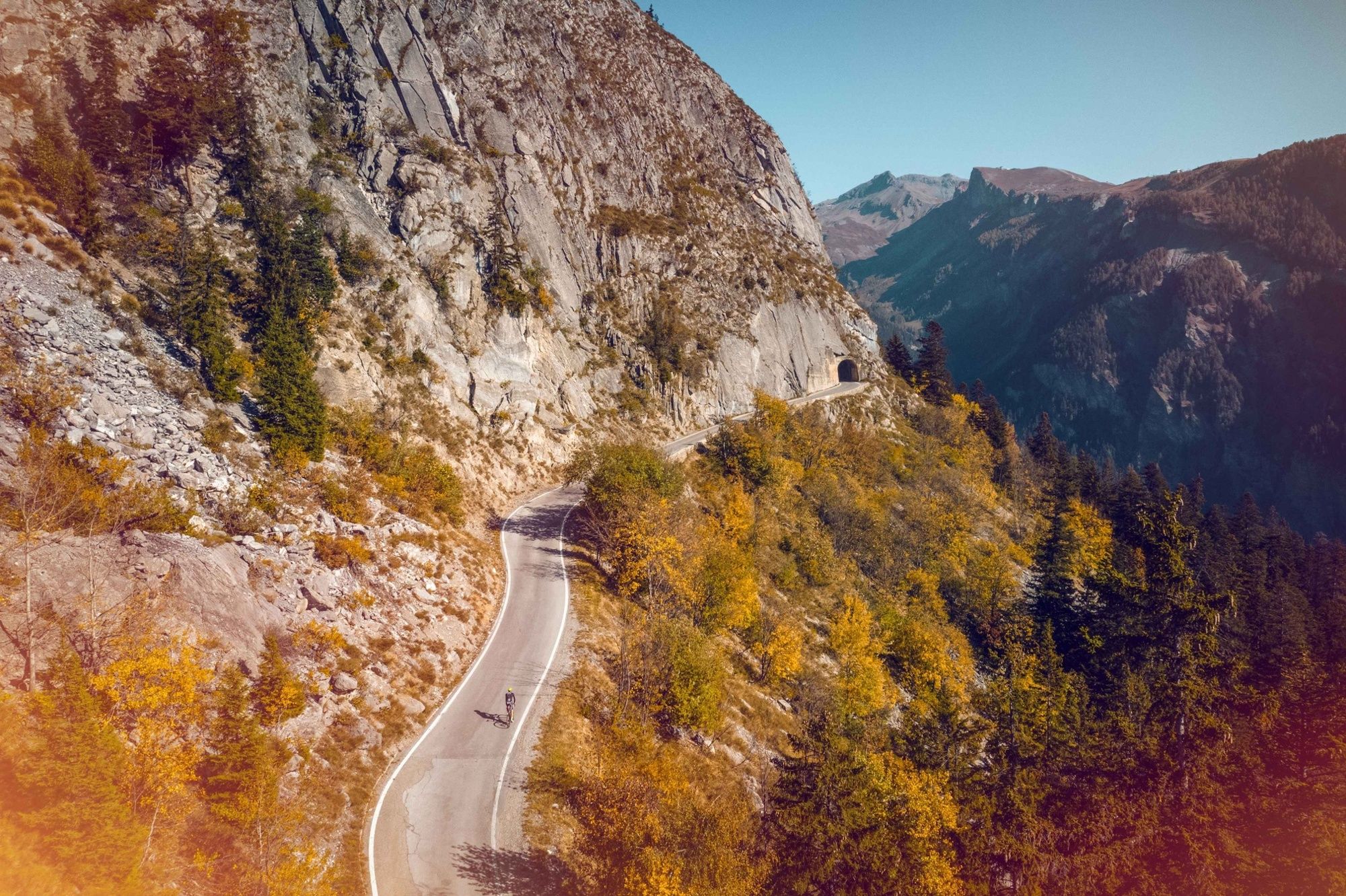
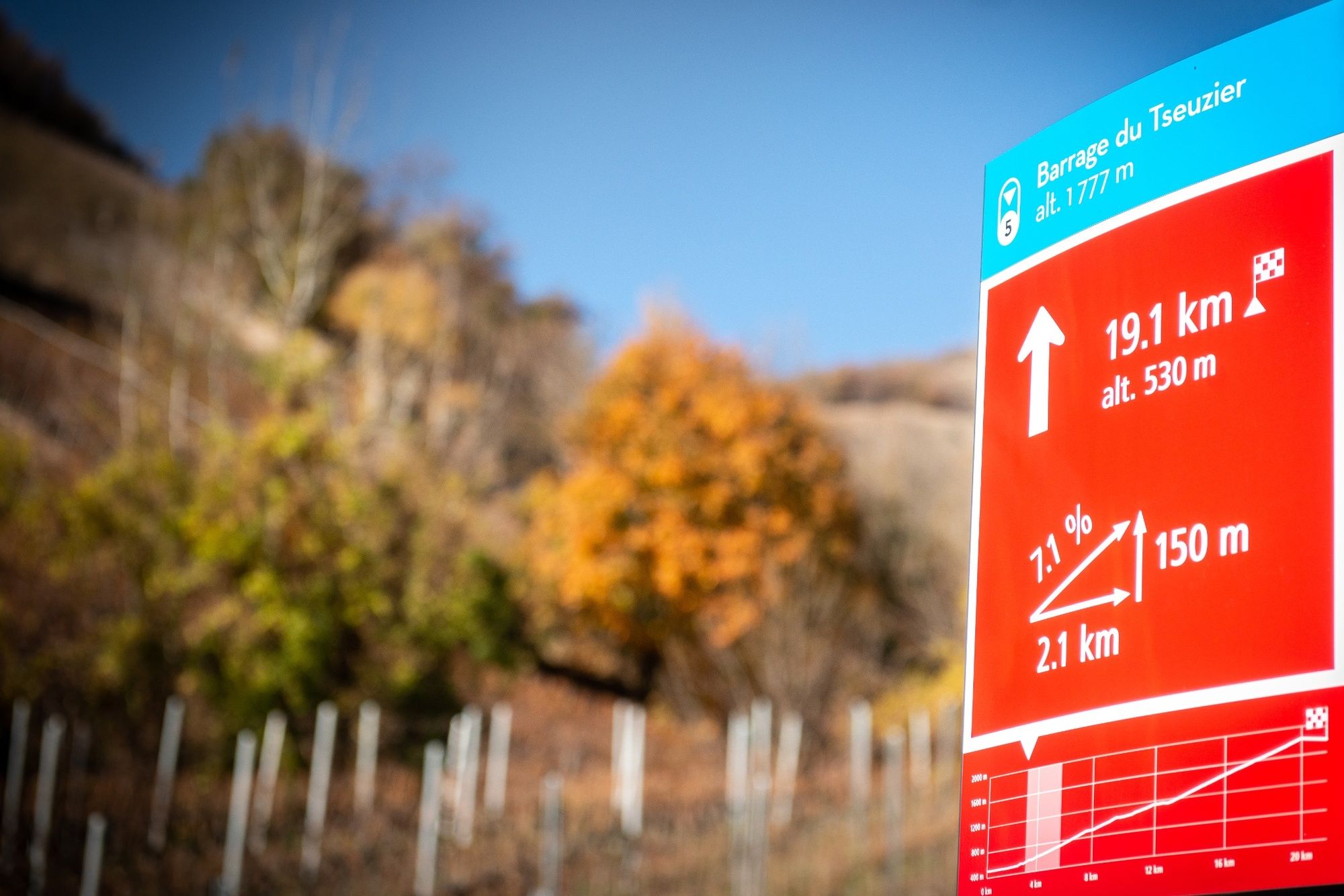
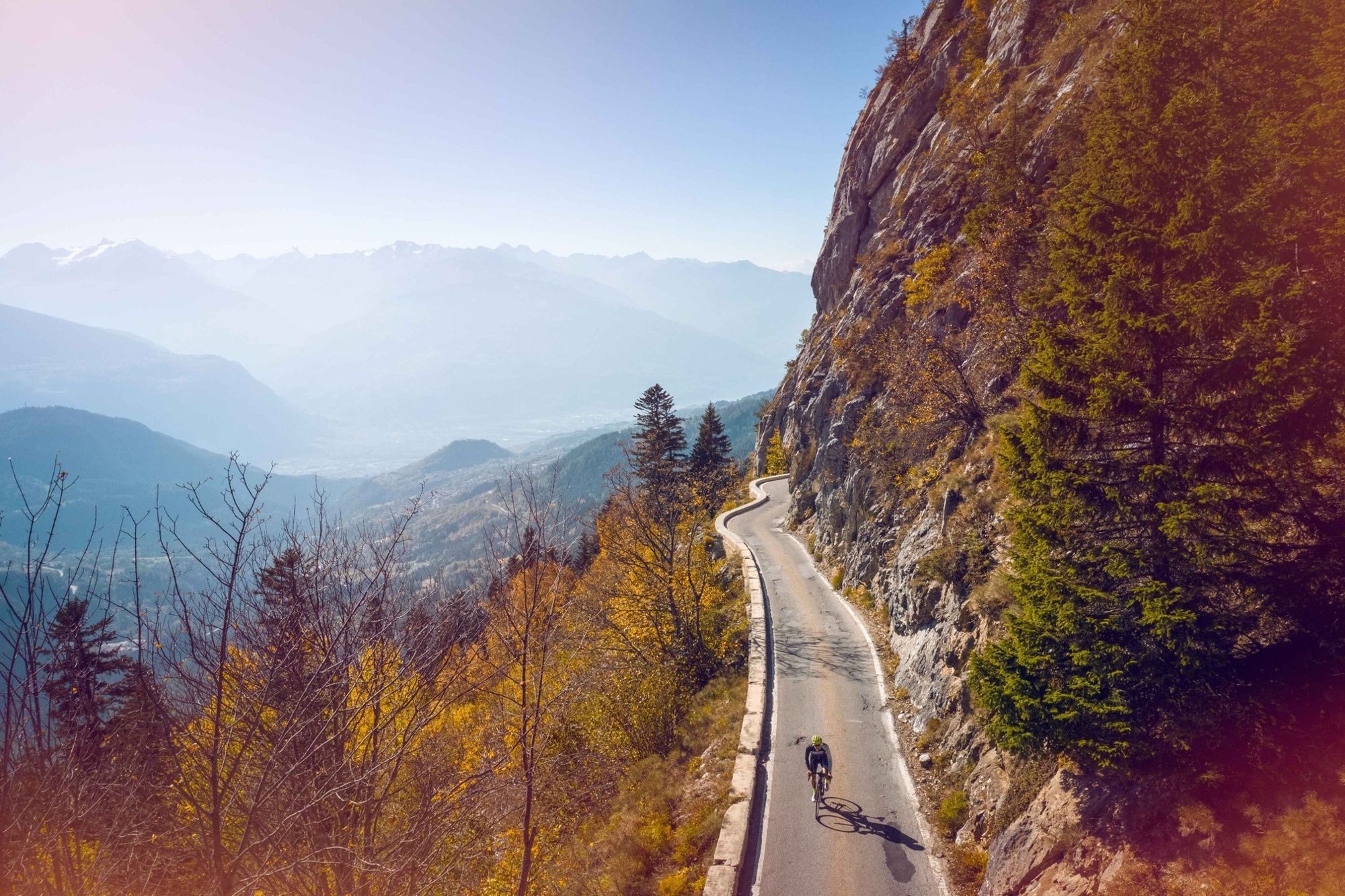
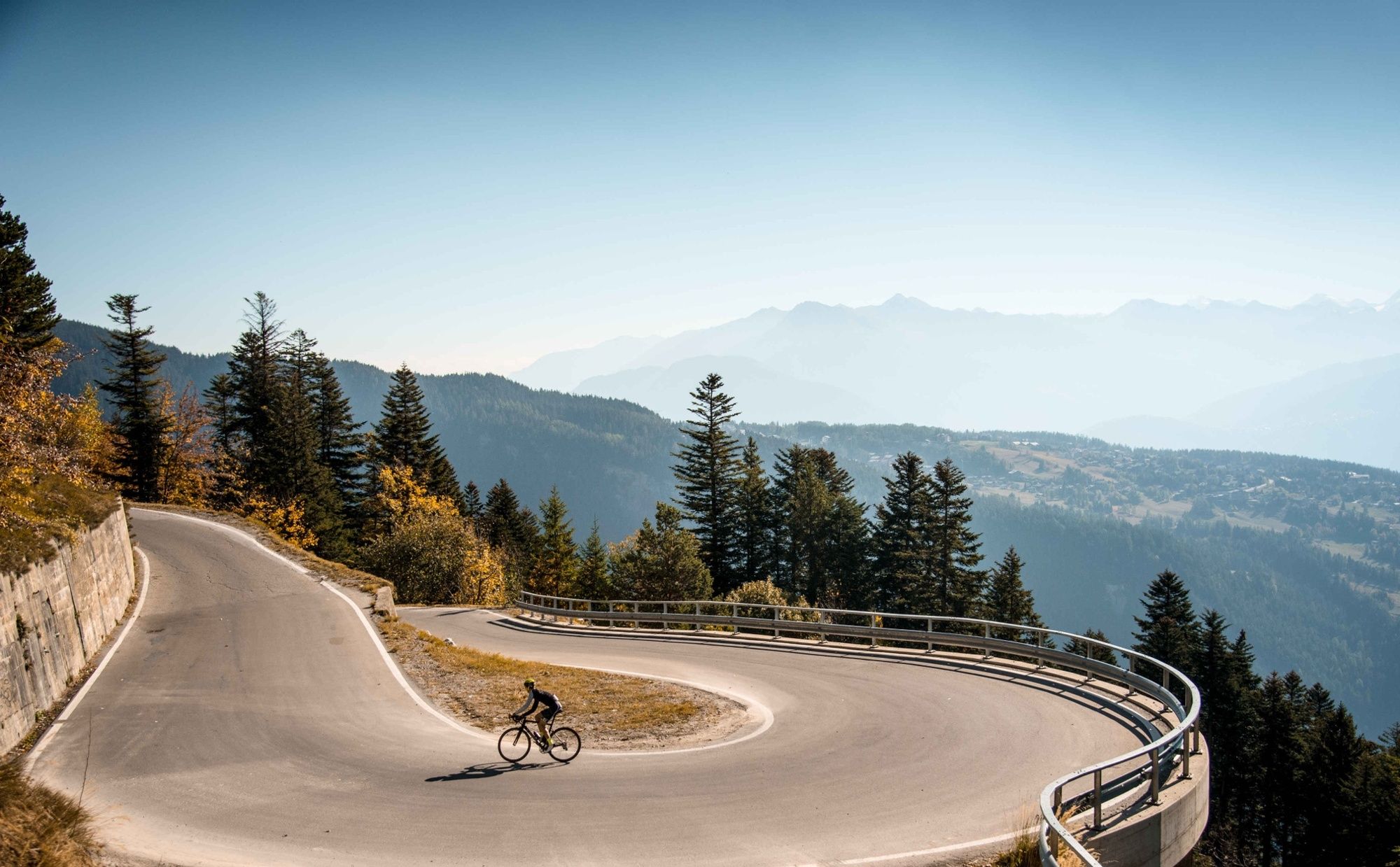
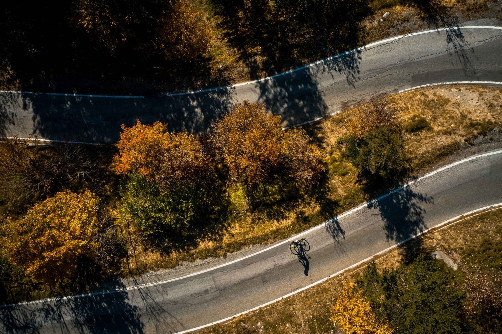
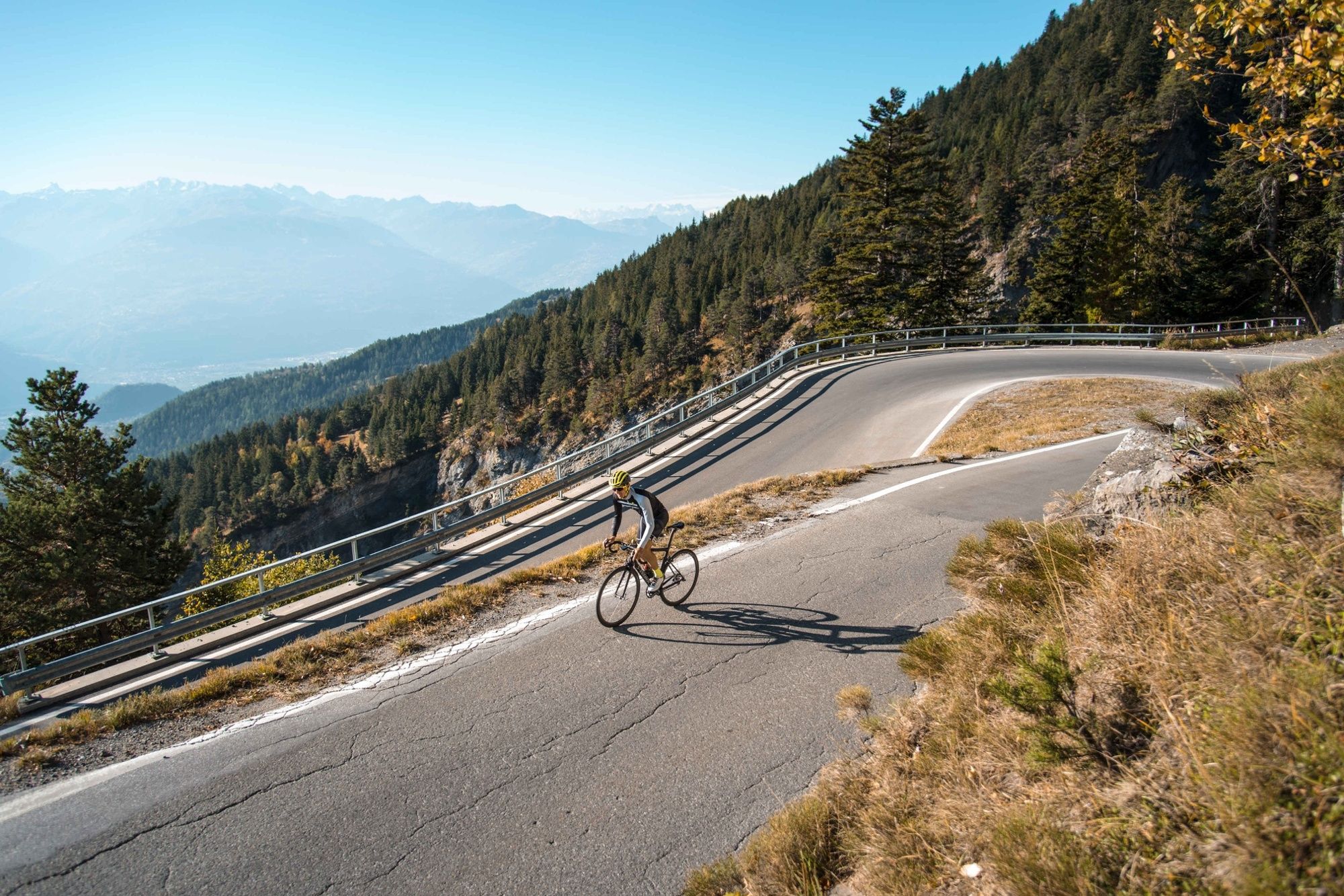
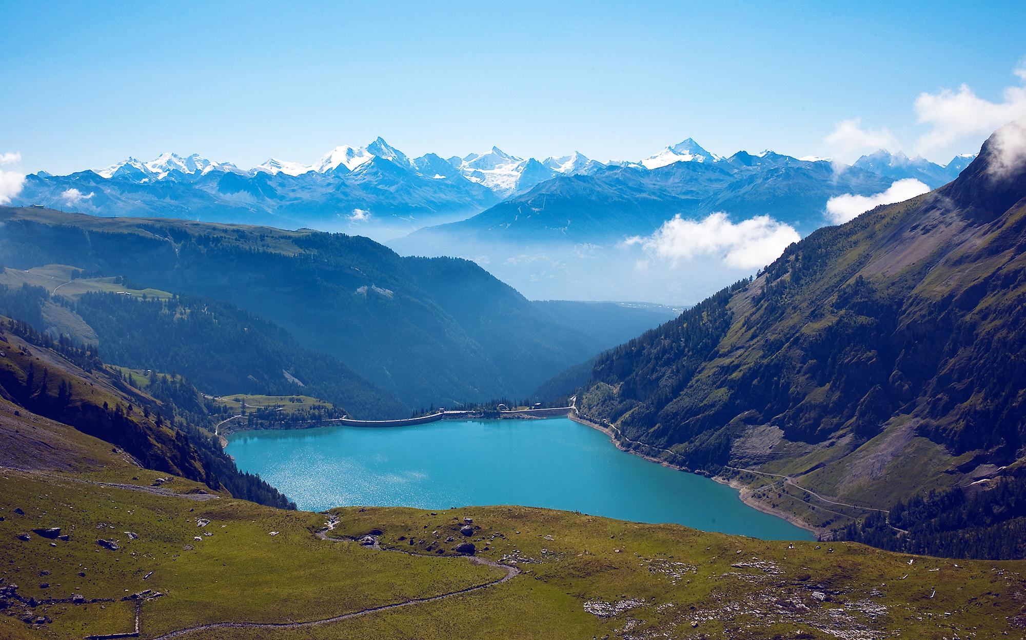
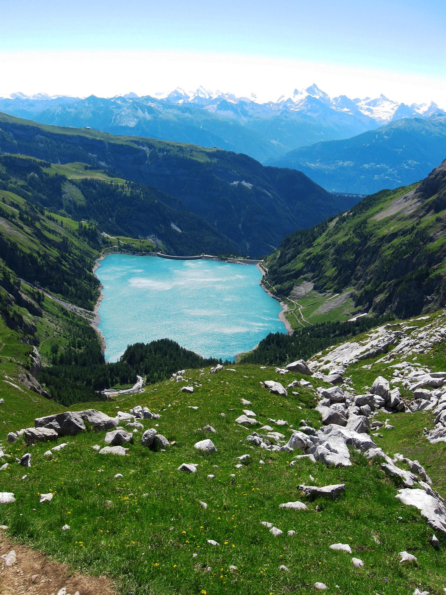
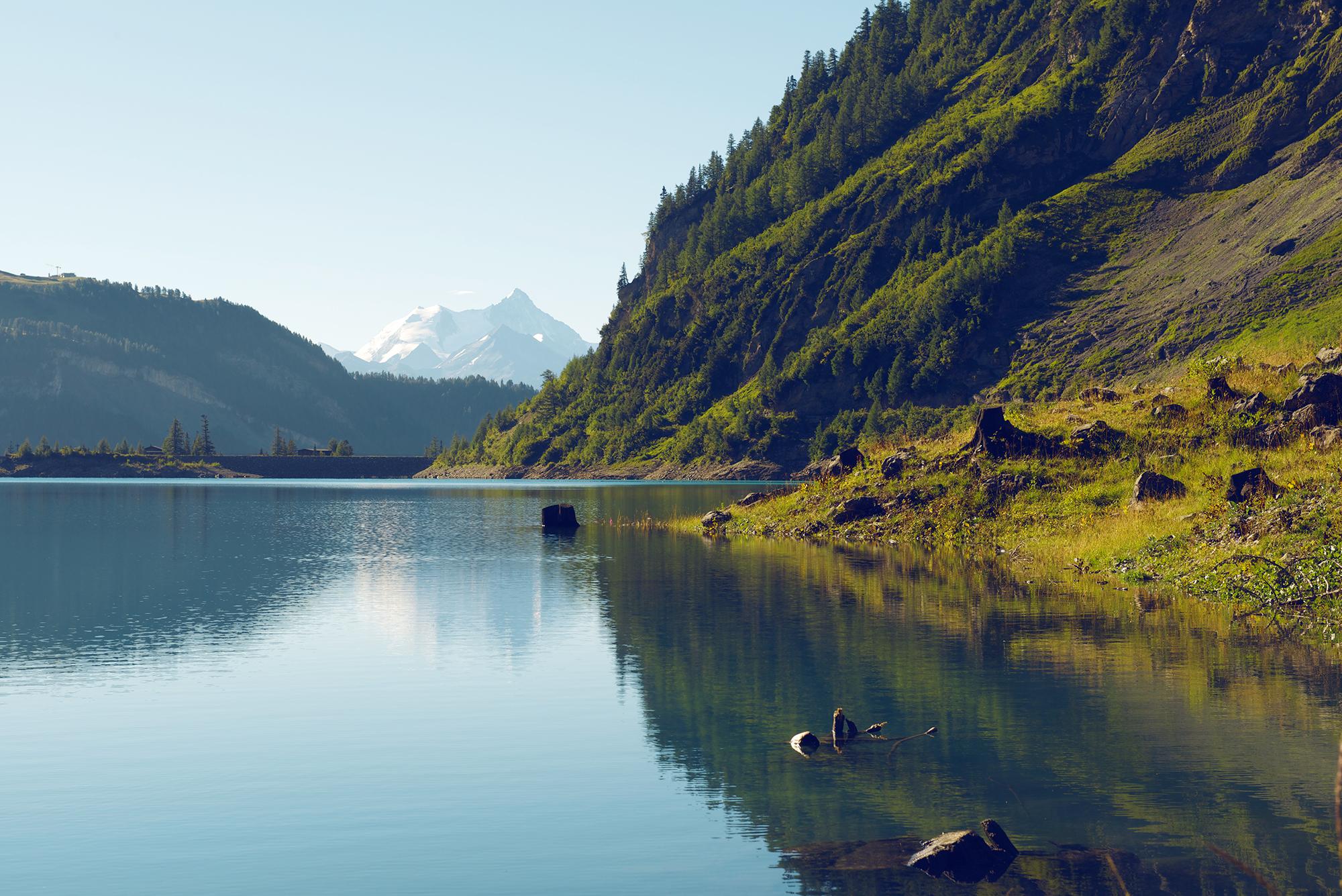
The climb to Tseuzier Dam, which rises to 1777 metres of altitude, starts in Sion and is about 22 kilometres long. From the Valais vineyards to the lake of Tseuzier, this itinerary offers a panoramic view that is breathtaking at every moment .Along the whole climb, special signs have been erected to mark the route.
- Vaikeus
-
vaikea
- Arviointi
-
- Reitti
-
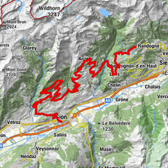
Uvrier1,6 kmSaint-Léonard (498 m)2,0 kmLormey4,2 kmLe château (997 m)8,0 kmLa Place (Ayent)8,2 kmSaxonne (Ayent)9,3 kmBotyre (Ayent)9,3 kmSt-Romain (Ayent)9,9 kmLuc (Ayent)10,1 kmFortunau (Ayent)10,4 kmLes Routesses10,6 kmLes Fugesses12,0 kmLes Rousses20,3 kmLac de Tseuzier21,9 km
- Paras kausi
-
tammihelmimaalishuhtitoukokesäheinäelosyyslokamarrasjoulu
- Korkein kohta
- 1.779 m
- Kohde
-
Tseuzier Dam
- Korkeusprofiili
-
 © outdooractive.com
- Kirjoittaja
-
Kiertue Tseuzier – Trophy of the Dams käyttää outdooractive.com toimitettu.
GPS Downloads


Yleistä tietoa
Virvokepysäkki
Kulttuuri/Historiallinen
Sisäpiirin vinkki
Flora
Fauna
Lupaava
Lisää retkiä alueilla
-
Thyon les Collons
118
-
Anzère/ Valais
83
-
Anzère
29