Retkitiedot
10,21km
1.771
- 2.369m
1.184hm
1.184hm
03:30h
- Lyhyt kuvaus
-
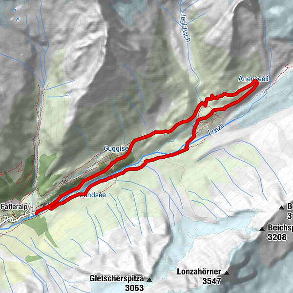
Wildromantische Wanderung im hintersten Teil des Lötschentals (auch als 2-Tagestour möglich).
- Vaikeus
-
tapa
- Arviointi
-
- Lähtöpiste
-
Parkplatz Fafleralp
- Reitti
-
Gletscherstafel0,2 kmPeter Tscherrig Anenhütte4,8 kmGletscherstafel9,9 km
- Paras kausi
-
tammihelmimaalishuhtitoukokesäheinäelosyyslokamarrasjoulu
- Korkein kohta
- 2.369 m
GPS Downloads


Polun olosuhteet
Asfaltti
Sora
Niitty
Metsä
Kallio
Altistettu
Lisää retkiä alueilla
-
Oberwallis
1872
-
Lötschental
1075
-
Blatten
132