
- Lyhyt kuvaus
- Vaikeus
-
tapa
- Arviointi
-
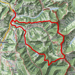
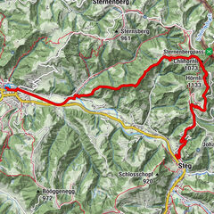
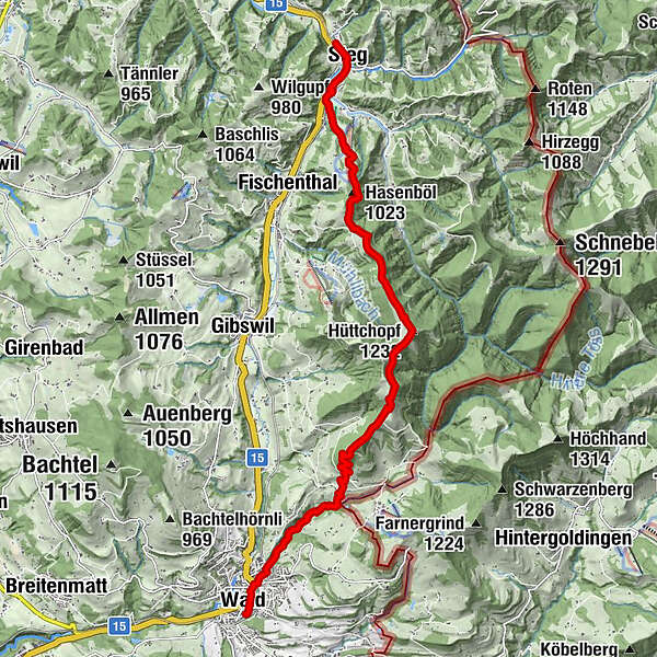
- Reitti
-
Bahnhof0,0 kmSteg0,3 kmLandgasthof zum Steg0,4 kmBoden0,8 kmSchmittenbach1,1 kmHasenböl (1.023 m)2,8 kmTannen3,6 kmHüttchopf (1.232 m)5,7 kmAlp Scheidegg6,9 kmScheidegg (1.197 m)6,9 kmSchmittenbach-Wasserfall I10,5 kmSchmittenbach-Wasserfall II11,0 kmReformierte Kirche Wald ZH11,8 kmWald ZH (616 m)12,2 kmWald (615 m)12,2 km
- Paras kausi
-
tammihelmimaalishuhtitoukokesäheinäelosyyslokamarrasjoulu
- Korkein kohta
- 1.231 m
- Kohde
-
Wald, Bahnhof
- Korkeusprofiili
-
 © outdooractive.com
-

-
KirjoittajaKiertue Steg – Hüttchopf – Wald: «Kopf lüften» käyttää outdooractive.com toimitettu.
GPS Downloads

Yleistä tietoa
Virvokepysäkki
Lupaava
Lisää retkiä alueilla
-
Toggenburg
1770
-
Goldingen - Atzmännig
770
-
Fischenthal
221