


Elsenfeld OT Rück: Along the Rück vineyards to Elsenfeld, over the Elsava and via the forest path back to Schippach to the parking lot.


From the P Übergang Weinberg to the Schulzentrum parking lot:
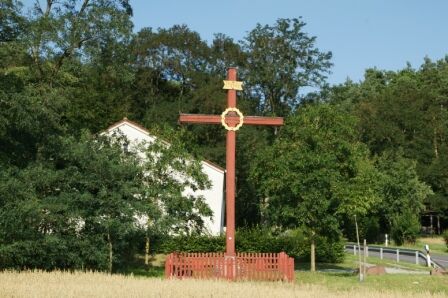
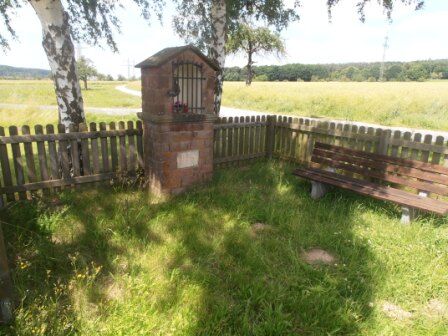
On the Franconian Red Wine hiking route, walk past the garages. Slightly ascending, turn left at the "Beim Pavillon" signpost to the pavilion in the vineyard. Turning right - always following the Franconian Red Wine hiking route - pass the Fuchsbau inn until you reach the "Rotes Kreuz" signpost. Now leave the Franconian Red Wine hiking route and follow the blue M Main hiking trail to the left across open terrain. After reaching a Marian shrine, cross the country road, then the Elsava river, and reach the natural park hiking parking lot "Schulzentrum" via a meadow path.
From Schulzentrum to Antoniusstraße parking lot:
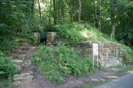
Follow the "Rotes X" marker towards the "Waldstraße" signpost. Always along the forest edge on the forest path, you are accompanied by the "Rotes X". Passing a World War II bunker, the Kreuzmühle mill, and the Engelbrunnen fountain, turn left at the "Waldstraße" signpost and follow the "Rotes X" to the Antoniusstraße parking lot.
From Antoniusstraße to Übergang Weinberg:
From here, continue following the "Rotes X" on the bike path, turn left at the bridge. At the main road (Neidkopf on the gable of the half-timbered house), turn left and pass the late Baroque St. John's Church in Rück. Always following the "Rotes X", the path leads steeply uphill for about 200m to the vineyards. Turn left at the "Weinberg" signpost and follow the "Rotes X" to the natural park hiking parking lot "Übergang Weinberg".
A3 to Stockstadt exit, continue on B469 towards Miltenberg to Elsenfeld exit, then follow the signs to Rück.
By train from the direction of Aschaffenburg or Miltenberg to Obernurg-Elsenfeld stop. Then take bus line 64 towards Elsenfeld-Rück. Get off at Rück-Alte Schule stop.
Parking available at the Übergang Weinberg parking lot.
Suosittuja retkiä naapurustossa
-
5,0
Kulturweg Niedernberg: Blechkatzen im Honischland
Vaellus 10,2 km -
3,0
Elsenfeld district Rück: Across the vineyards past the Red Cross to Hofstetten, return over the Hochberg to the parking lot
raskasVaellus 10,6 km -
Südspessartsteig
raskasPitkän matkan vaellusreitti 60,8 km -
Tour zw. Heubach u Sandbach
valoVaellus 5,49 km -
Elsenfeld: To Hofstetten via Hochberg and the Rücker vineyards back to the car park
raskasVaellus 11,1 km -
Elsenfeld OT Schippach: From Schippach through the Rück vineyards to Elsenfeld, over the Elsava and back to the parking on the forest path.
mediumVaellus 8,41 km -
Buntsandsteinweg Etappe 4 - Kirschfurt-Collenberg
mediumVaellus 8,61 km -
Elsenfeld: From Eichelsbacher Straße along the Elsava at the edge of the forest to Schippach, through the Rücker vineyards back to the parking lot
mediumVaellus 9,26 km -
Buntsandstein-Erlebnisweg Gesamtstrecke
Teemareitti 39,9 km -
Freudenberg: Durch den Freudenberger Stadtwald, schwarz, WF3
Nordic Walking 10 km
Vaellus & jäljitys


Älä jää paitsi tarjouksista ja inspiraatiosta seuraavaa lomaasi varten.
Sähköpostiosoitteesi on lisätty postituslistalle.