


SOČA VALLEY I5: Tolmin - Ljubinj - Petrovo Brdo


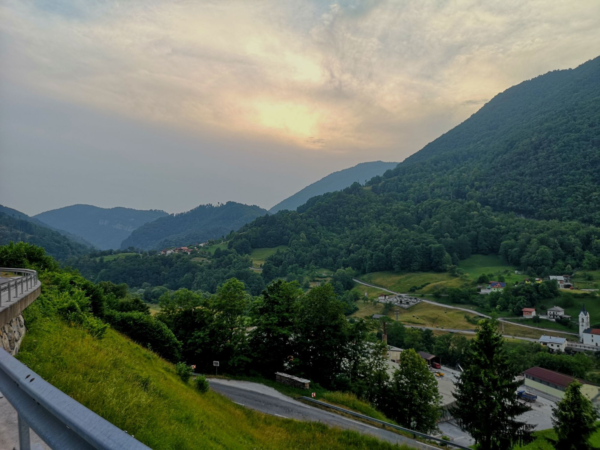
From the Tolmin Valley, you will first ride along the Soča River and then continue to the villages above the valley and soon descend to the narrow Baška grapa, which is a peaceful valley, continue past...
From the Tolmin Valley, you will first ride along the Soča River and then continue to the villages above the valley and soon descend to the narrow Baška grapa, which is a peaceful valley, continue past Grahovo, where the first Slovenian animated film entitled “Na svoji zemlji” (On One’s Own Land) was produced. In Podbrdo, you access the Juliana Bike trail. In Grapa, where the trail mostly climbs, but is mostly on the shady side as well as not as busy as other roads, the road is quite suitable for cycling.


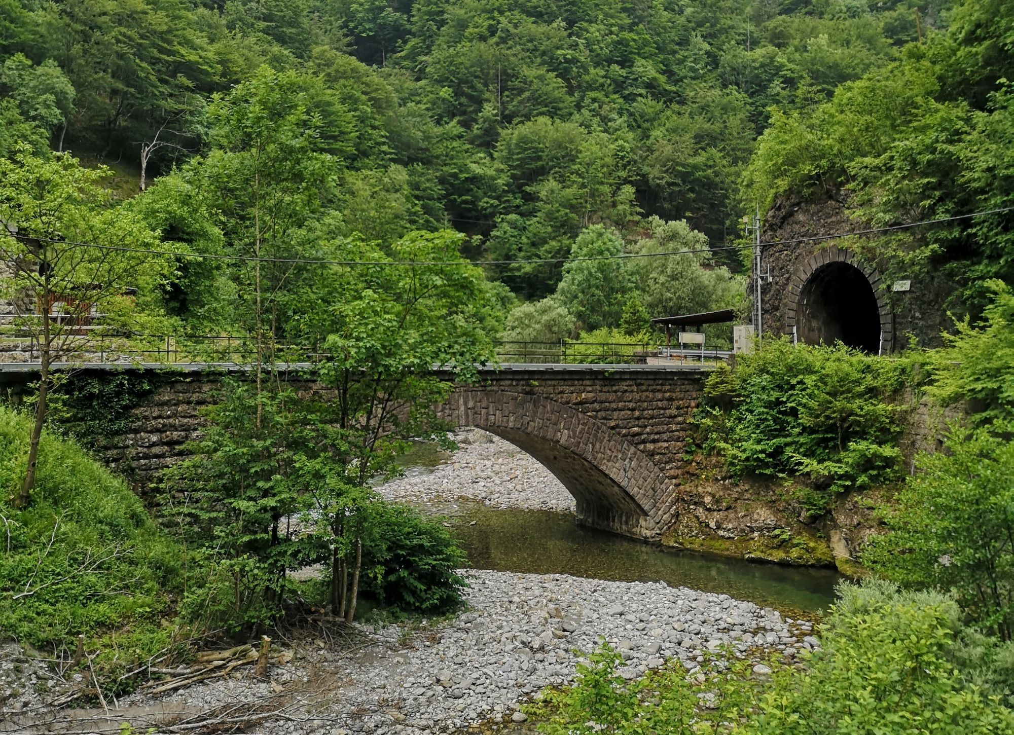
Turn from the centre of Tolmin towards south, to Šolska ulica street and continue for a kilometre to the confluence of the Soča and Tolminka Rivers. Before turning right towards the closed hotel, drive down to the left along a narrow cart road and on the bank of the Tolminka River turn left to cross the bridge over the river. Follow the signs for the Alpe-Adria Trail on the other side of the bridge. A minor rockfall area will soon stop you, so you have to cross it by walking, and then continue cycling along an unpaved path along the right bank of the Soča River. After 1.5 km you will reach an asphalt road, where you turn left back towards Tolmin and after 100 metres turn right up a slope to the asphalt road towards Prapetno. Start a 3.2 km moderate climb. Access the main road from Tolmin and turn sharp right then continue to Kneža River that runs below us in Baška grapa, follow the main road. At church in Kneža, access the main road through Grapa. Turn left. From there to Podbrda you can no longer get off course, since you have to cycle along the only main road through Grahovo and Hudajužna. Access the Juliana Bike Trail in Podbrdo.
Technically flawless bike (road, gravel, XC, all-mountain)
Helmet, gloves, sunglasses
Food and beverages in a backpack
Spare tire, pump, multi tool, first aid kit
Personal identity document, health insurance card, mobile phone and/or navigation device, map of the area
Suosittuja retkiä naapurustossa
-
3,6
Tolminka Klamm
valoVaellus 1,90 km -
4,8
Roundthelake
valoVaellus 11,4 km -
5,0
Tolminka Klamm
mediumVaellus 2,12 km -
4,7
Slowenien Triglav Nationalpark
mediumVaellus 19,5 km -
4,4
Savica Wasserfall
mediumVaellus 1,89 km -
4,8
Mostnica Gorge
mediumVaellus 4,93 km -
4,7
Bohinj
mediumVaellus 22,1 km -
5,0
Mostnica Gorge, Bohinj, Slovenië
mediumVaellus 9,48 km -
4,2
Slap Slavica
mediumVaellus 9,62 km -
4,5
Wanderung durch die Tolminska Klamm
mediumVaellus 2,89 km

Vaellus & jäljitys


Älä jää paitsi tarjouksista ja inspiraatiosta seuraavaa lomaasi varten.
Sähköpostiosoitteesi on lisätty postituslistalle.