


Feel good hiking trail at the Jauerling route 1


Kuvia käyttäjistämme
-
 © Werner Spitzer 1Luotu 19.09.2025
 -
 © Werner Spitzer 1Luotu 19.09.2025
 -

 © Christian KakuskaLuotu 20.07.2024
 -
 © Christian KakuskaLuotu 20.07.2024
 -
 © Christian KakuskaLuotu 20.07.2024
 -

 © Michael Hell 1Luotu 06.01.2022
 -
 © Michael Hell 1Luotu 06.01.2022
 -
 © Michael Hell 1Luotu 06.01.2022
 -
 © Michael Hell 1Luotu 06.01.2022
 -
 © Michael Hell 1Luotu 06.01.2022
 -
 © Michael Hell 1Luotu 06.01.2022
 -
 © Ognjen ScekicLuotu 17.12.2022
 -

 © Evelin RingseisLuotu 17.08.2025


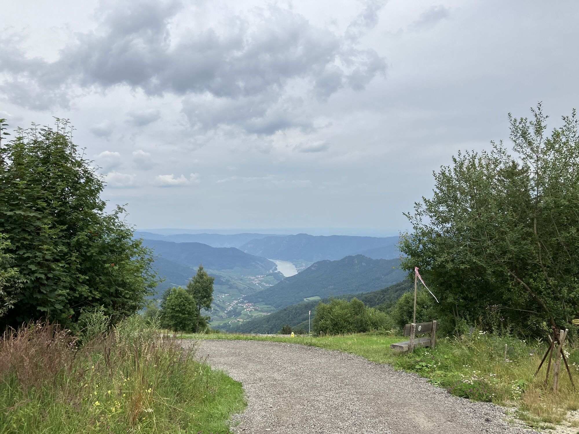
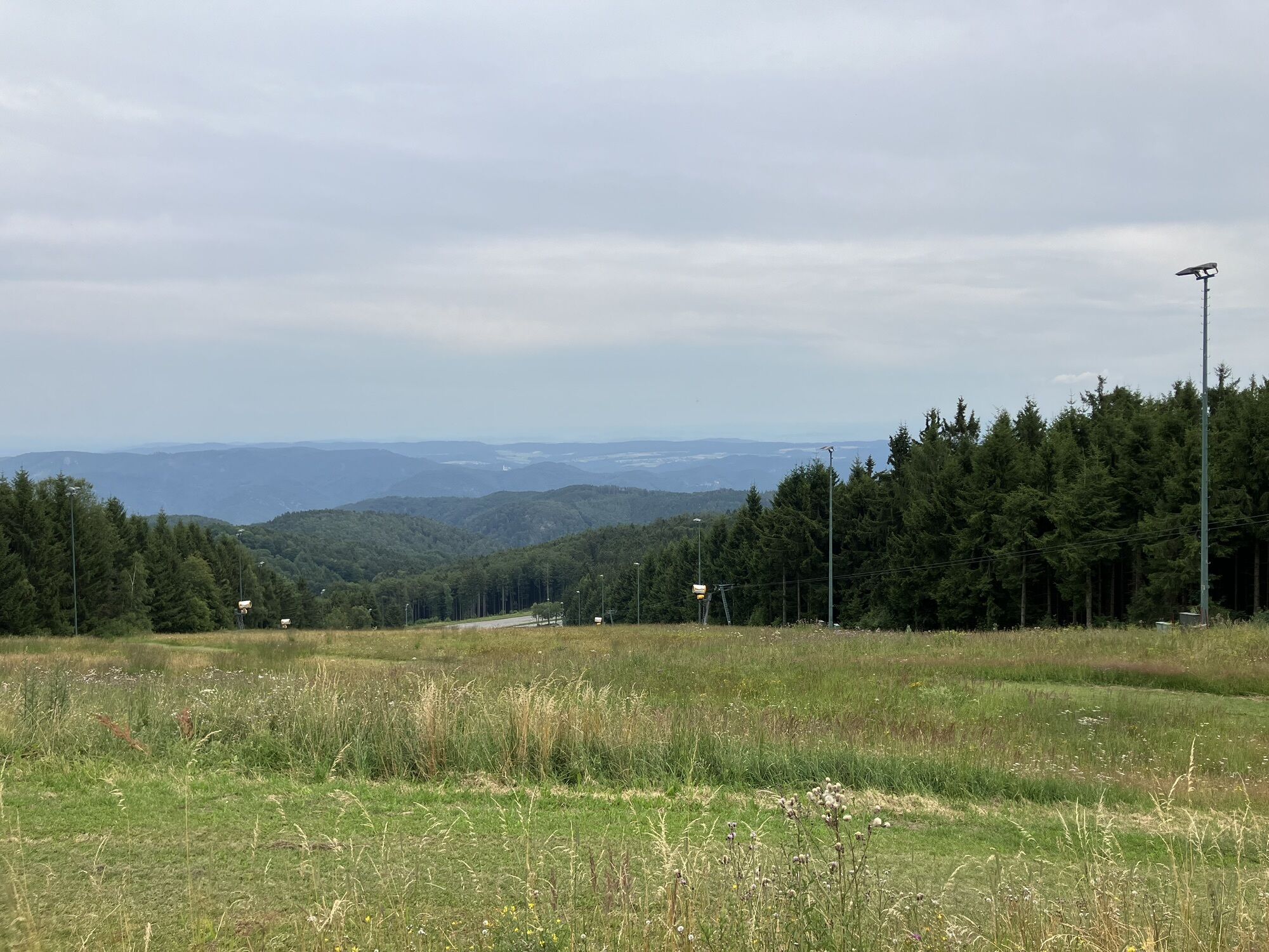


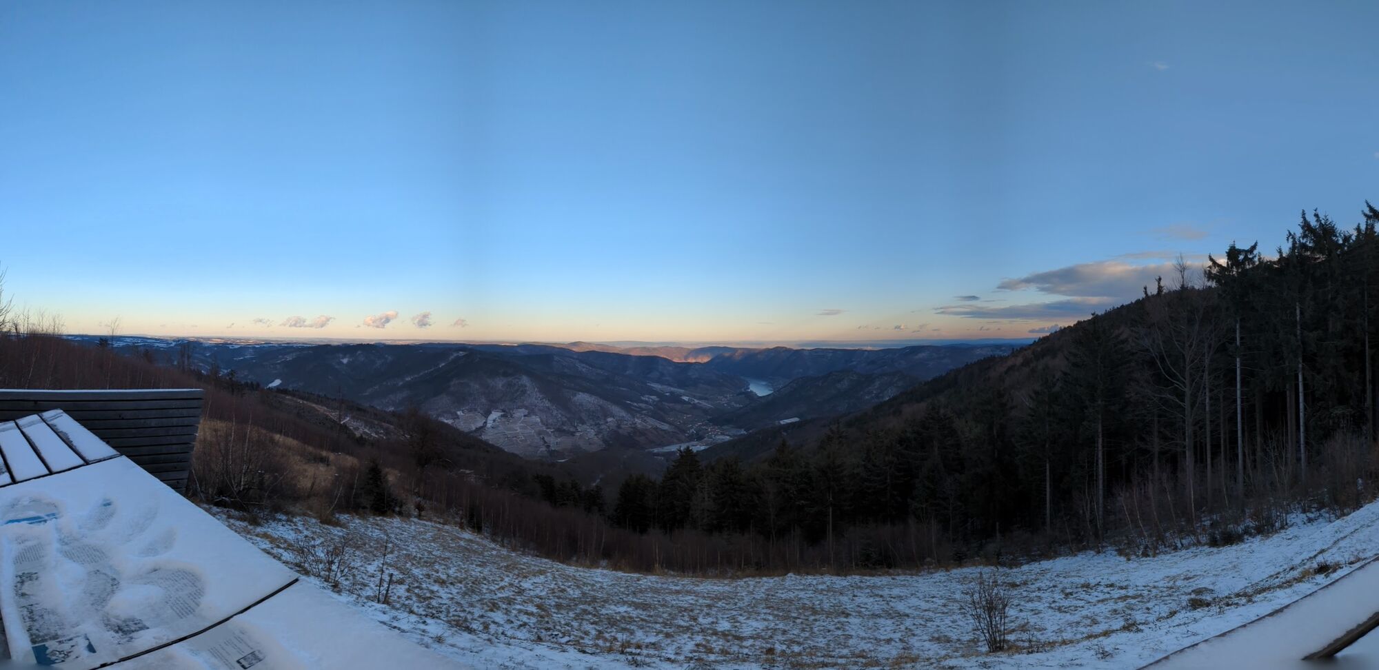
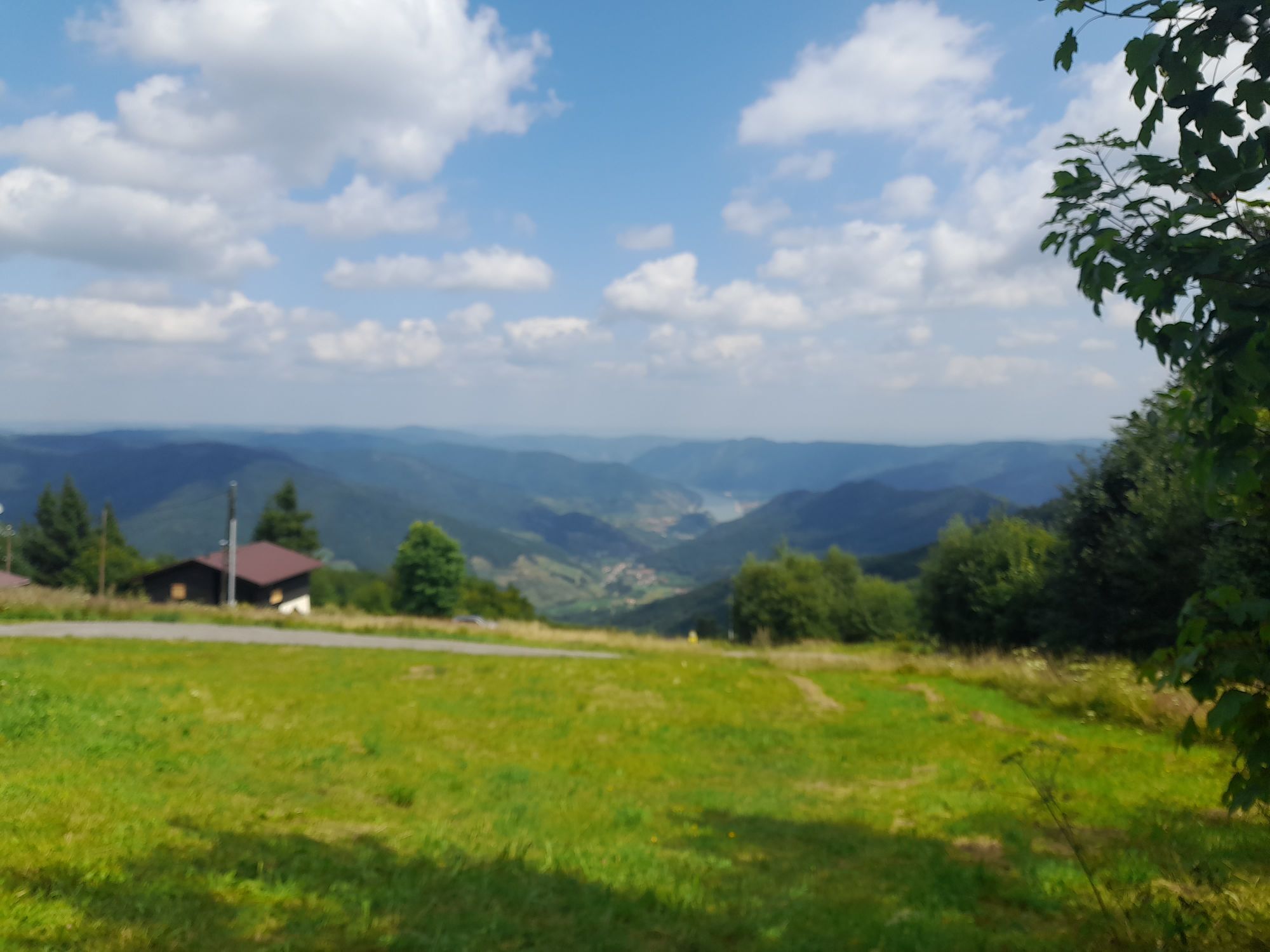
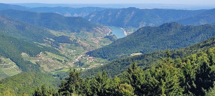
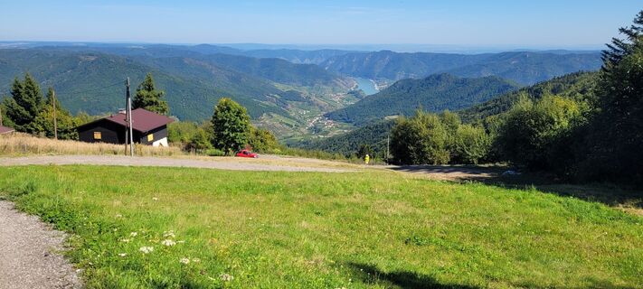
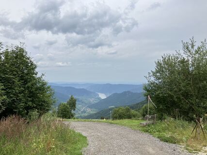
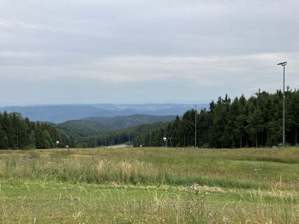
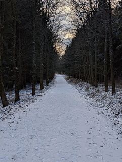
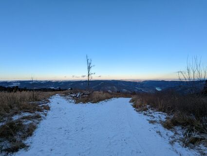
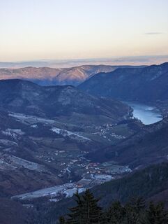
The pleasant hike leads on forest roads and some hiking trails through forest and meadow on the high plateau of the Jauerling. At some points, in good weather, there is a wonderful view. Rest and refreshment...
The pleasant hike leads on forest roads and some hiking trails through forest and meadow on the high plateau of the Jauerling. At some points, in good weather, there is a wonderful view. Rest and refreshment options are available.

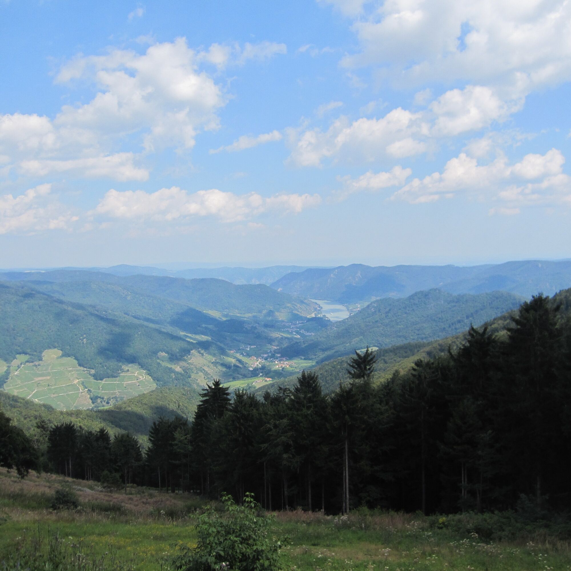

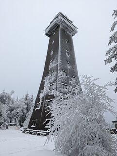
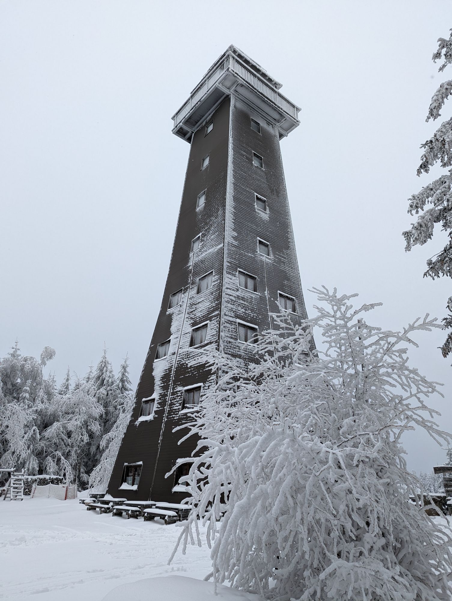
The starting point of the route is the parking lot at the mountain station of the ski lift at the Jauerling. The path first leads to the viewing tower. This is open daily from 9:30 am to 6:00 pm from April to around All Saints' Day, in winter only on weekends and holidays from 11:00 am to 6:00 pm, and by appointment. After the viewing tower, we cross the Turnerwiese and then turn right onto the forest road which leads us along the Ahornallee (without maples!) to the parking lot of the Naturparkhaus. After this walk through the forest, it first goes right over a clearing and then through the forest on a quiet hiking trail until after about 10 minutes we reach the Naturparkhaus Gasthaus at the Jauerling. The inn is open during the summer season - May 1 to October 31 - Thursday to Tuesday & holidays: from 9:00 am to 6:00 pm, excluding evening reservations. Wednesday is a day off. During the winter season - November 1 to April 30 - the inn is open Thursday to Sunday & holidays from 10:00 am to 6:00 pm, excluding evening reservations. Monday, Tuesday, and Wednesday are days off. We enjoy the beautiful view from the Wachau terrace of the Naturparkhaus. Afterwards, it continues on the path which leads back to the parking lot, and then along the Ahornallee back to the viewing tower and the mountain station parking lot. There are always rest opportunities along the path.
Kyllä
Hiking boots, waterproof clothing, and drinking water. The Wachau hiking map is available from Donau Niederösterreich Tourism, www.wachau.at.
Emergency call Mountain Rescue Wachau: 140
By car from the West Autobahn in Melk on the B3a towards Emmersdorf, then take the third exit in the roundabout (direction Dürnstein, Krems) on the B3 to Schallemmersdorf, turn left to Maria Laach on the L7145, from Maria Laach to Oberndorf on the L7133, then towards the viewing tower to the mountain station. Destination is Oberndorf am Jauerling (mountain hut).
Oberndorf is best reached by public transport on weekends. There is one bus per day from Melk (train to Melk station), but only during the school year. On weekends, the Naturparkbus or Jauerling bus goes to the parking lot at the Naturparkhaus. The Naturparkbus circulates on weekends from Spitz via Jauerling to Emmersdorf and via Mühldorf and the Weitental to Emmersdorf and back. The bus is a demand bus that must be reserved by phone – up to one hour before departure: Tel. 0810/810 278. Details on the bus schedules can also be found at www.vor.at.
Nextbike rental bike stations (EUR 1/hour) are located in Melk, Emmersdorf, Spitz, Aggsbach, and Mühldorf.
https://www.nextbike.at/niederoesterreich.html
Parking (free) is available at the Naturparkhaus and at the mountain station.
Recommended is the Jauerling farmers' market of the Maria Laacher farmers in the Kerblerhaus in the center of Maria Laach (every Saturday 9 am to 3 pm).
At the Hohen Jauerling, the nature park offers a themed trail. The path "over us the wide, wide sky" is ideal for a walk and provides information about the Jauerling, the nature park communities, and the flora and fauna in the region. Younger hikers are motivated to stroll through the forest along the 10 stations, which can be explored using an app. More information (including map and audio sample) can be found at http://www.naturpark-jauerling.at/gipfel-jauerling/.
Just below the Jauerling summit at 915 m above sea level lies the Naturparkhaus – Gasthaus at the Jauerling. From the Wachau terrace you can enjoy the highest and most beautiful view of the Danube ever.
The Naturparkhaus is car-free and traffic-calmed. The last ten minutes to the Naturparkhaus must be covered on foot. The tenants, the Gratz family, continuously spoil you with warm cuisine. Groups and/or bus tours are requested to register. Regional quality and products, as well as intensive cooperation with producers from the nature park, characterize the kitchen and the work of the tenants, the Gratz family.
www.naturpark-gasthaus.at
Suosittuja retkiä naapurustossa
-
4,6
Wachau: Seekopf - Hirschwand
mediumVaellus 10,4 km -
4,7
Wachau World Heritage Trail 04: Spitz - Mühldorf
mediumPitkän matkan vaellusreitti 10,9 km -
4,6
World Heritage Trail Wachau 03: Weißenkirchen-Spitz
mediumPitkän matkan vaellusreitti 10,5 km -
4,5
St. Michael-Rundweg
mediumVaellus 7,05 km -
4,4
Panoramaweg Weissenkirchen
valoVaellus 5,04 km -
4,1
Spitz a. d. Donau Jauerling Schwallenbach retour 16.04.2016
mediumVaellus 20 km -
4,2
Welterbesteig Wachau 03: Weißenkirchen-Spitz
valoPitkän matkan vaellusreitti 10,4 km -
3,9
Red Gate Circular Route
valoVaellus 5,44 km -
4,6
Rundhöhenwanderweg Weißenkirchen in der Wachau - Schildhütten - Cholerakreuz - Weißenkirchen
valoVaellus 8,75 km -
4,1
Spitz - Buchberg - Runde
mediumVaellus 9,60 km
Vaellus & jäljitys


Älä jää paitsi tarjouksista ja inspiraatiosta seuraavaa lomaasi varten.
Sähköpostiosoitteesi on lisätty postituslistalle.