


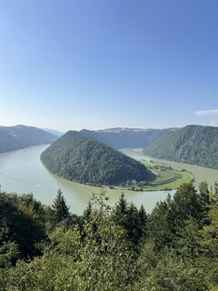
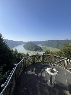
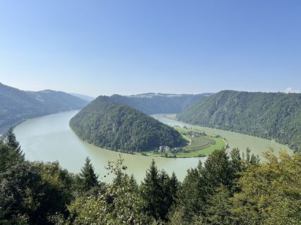
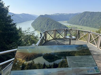
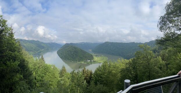
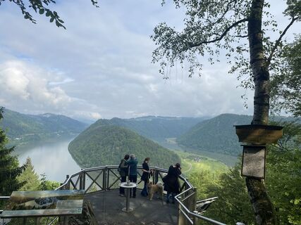
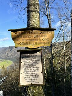
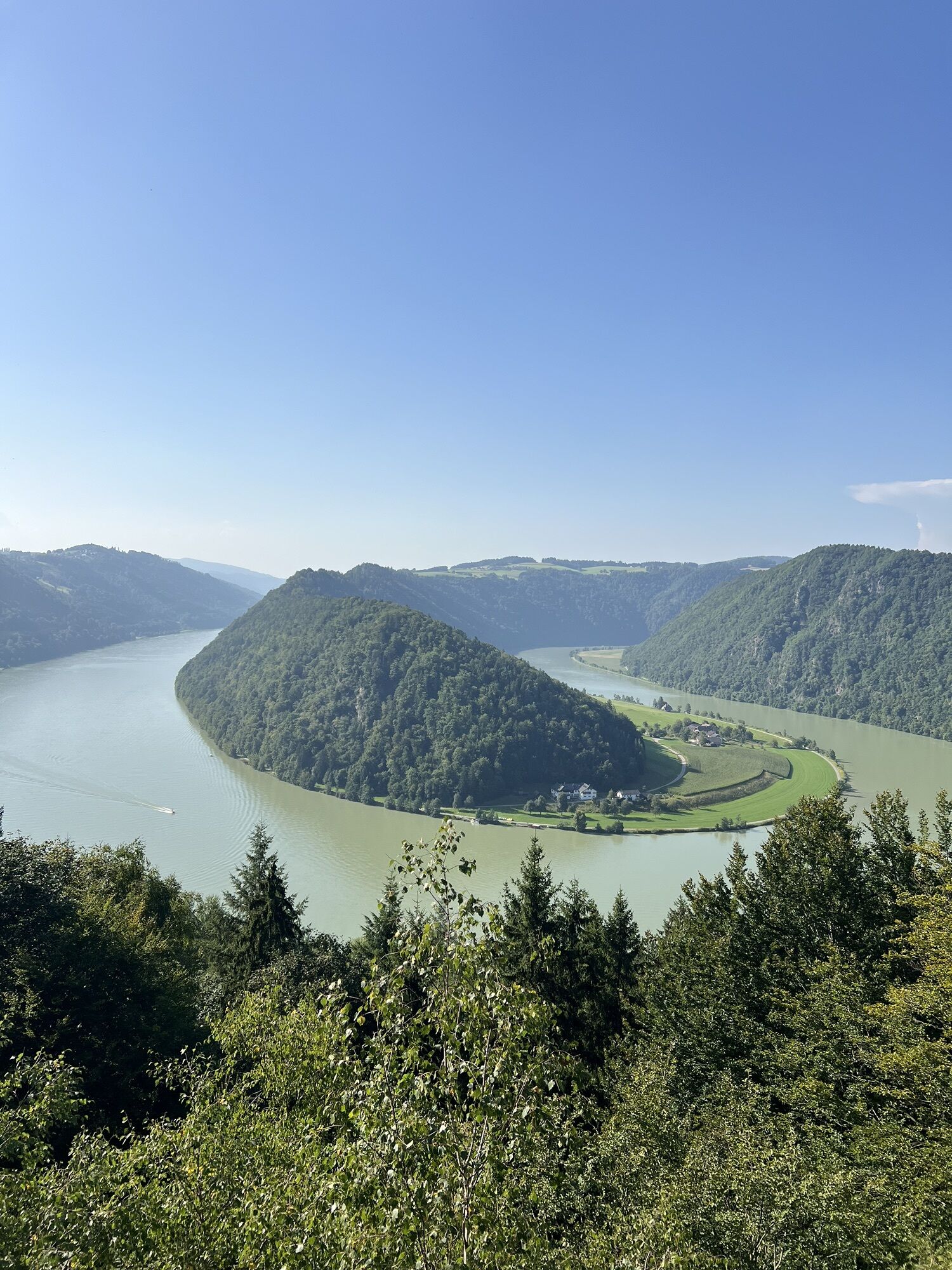
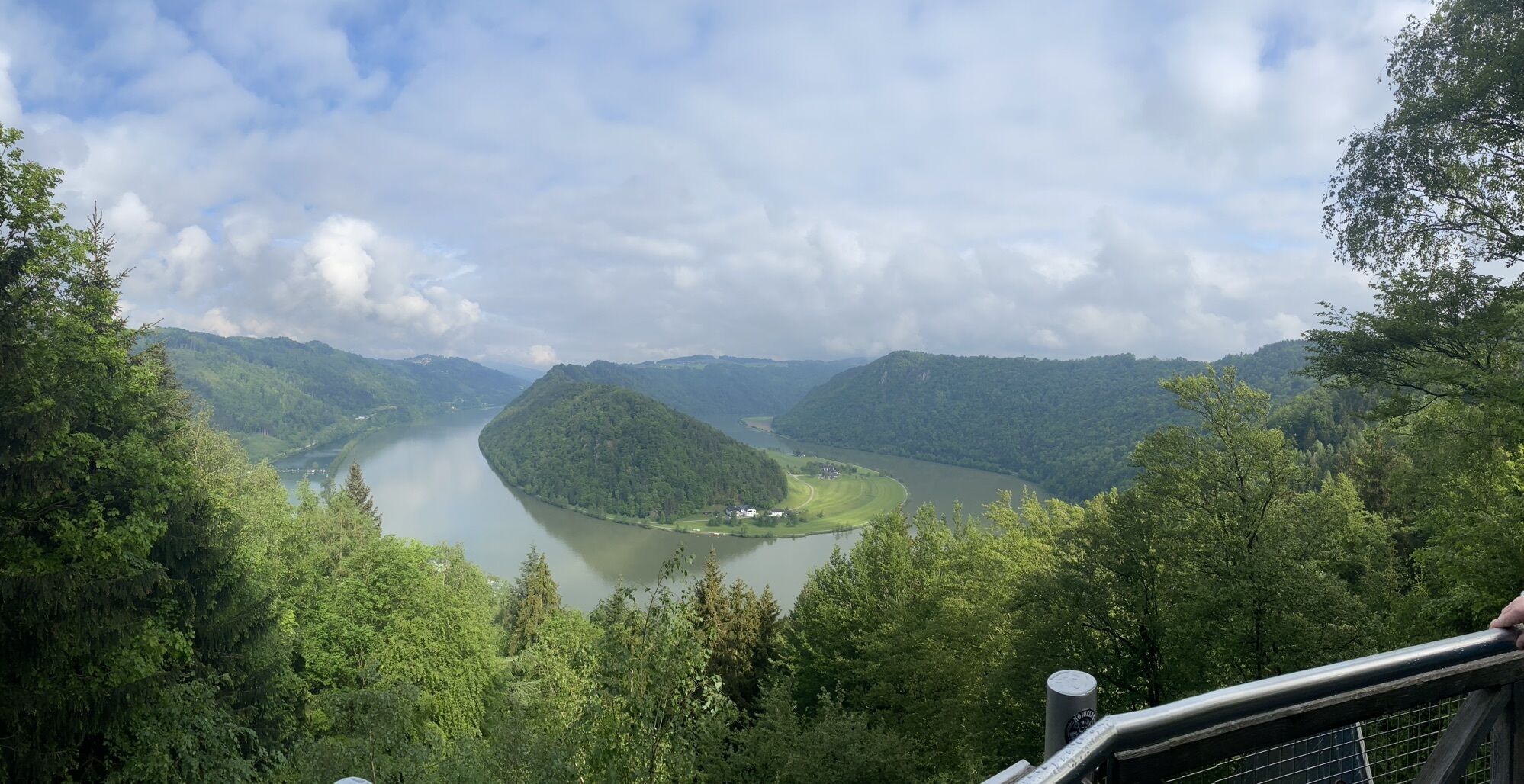
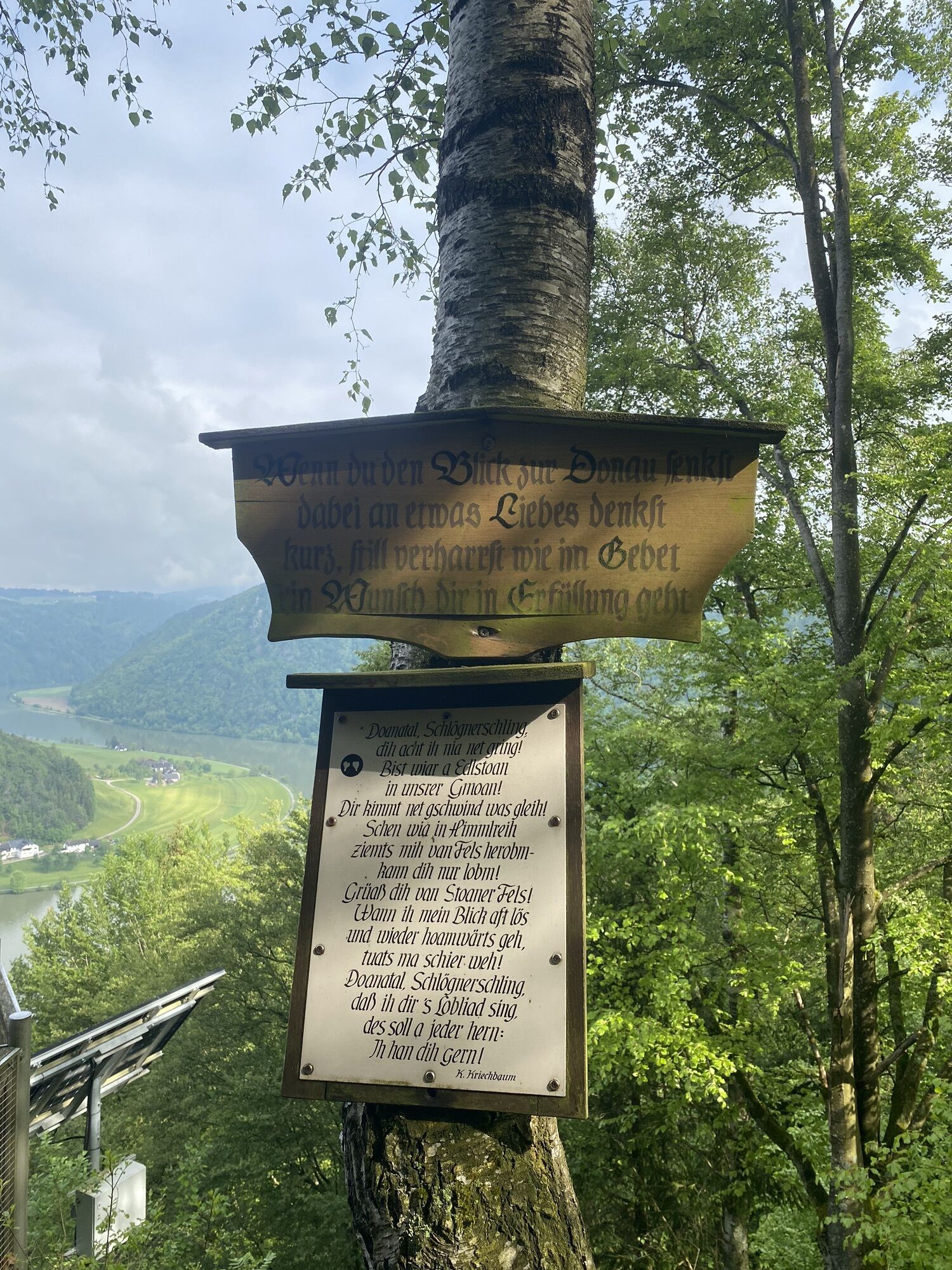
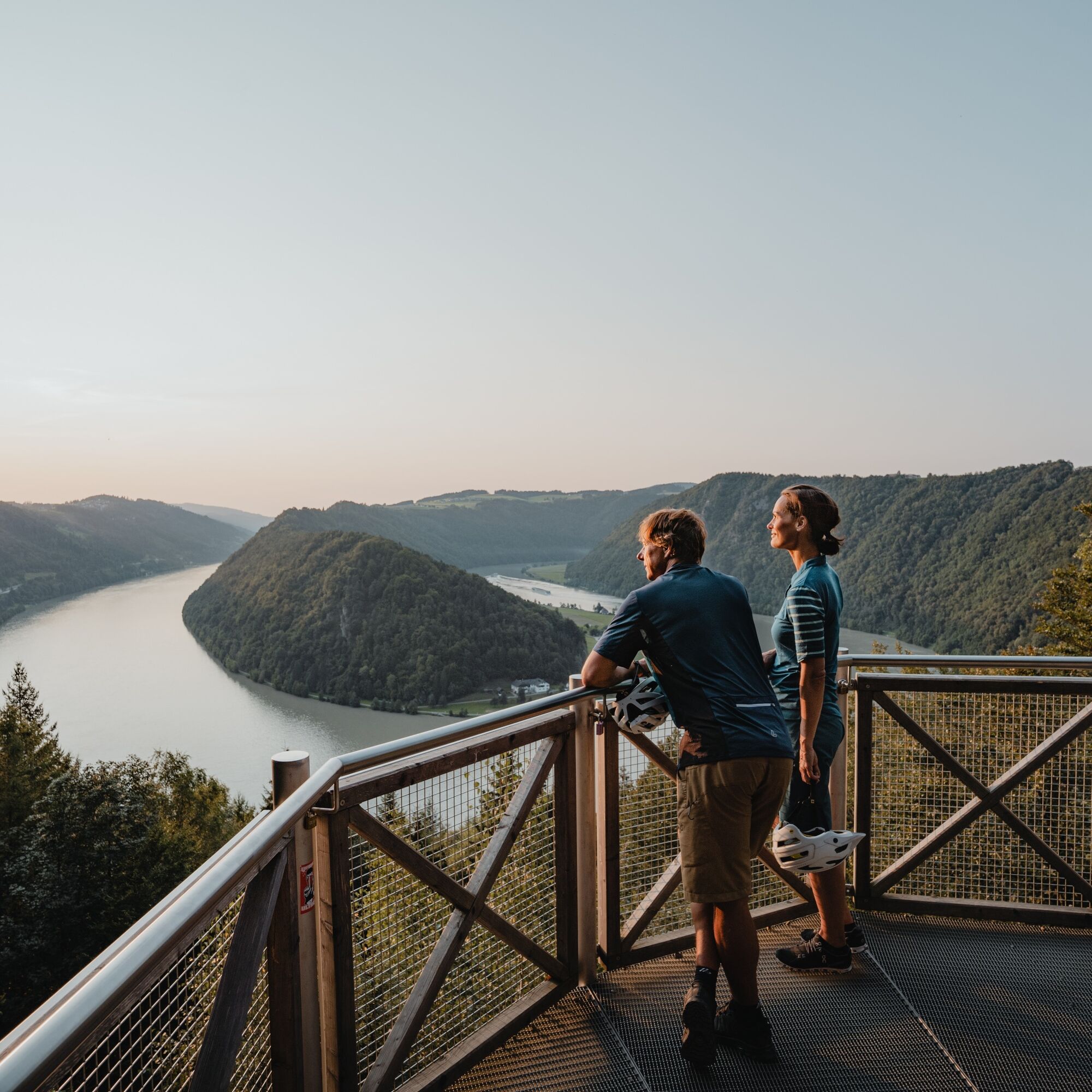
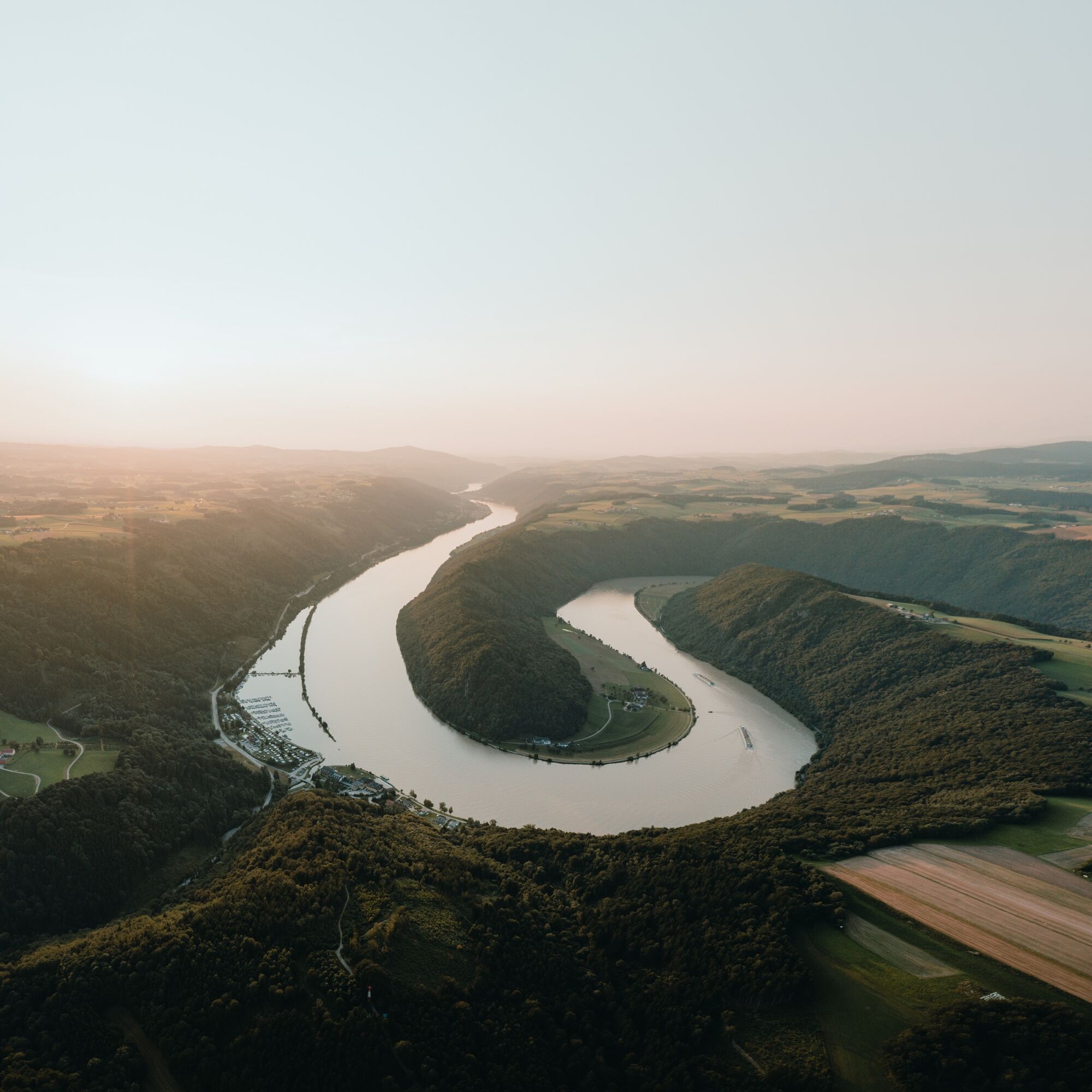
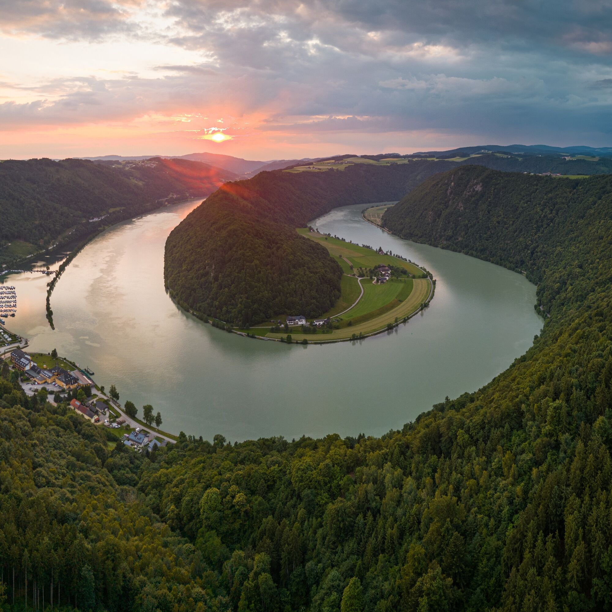
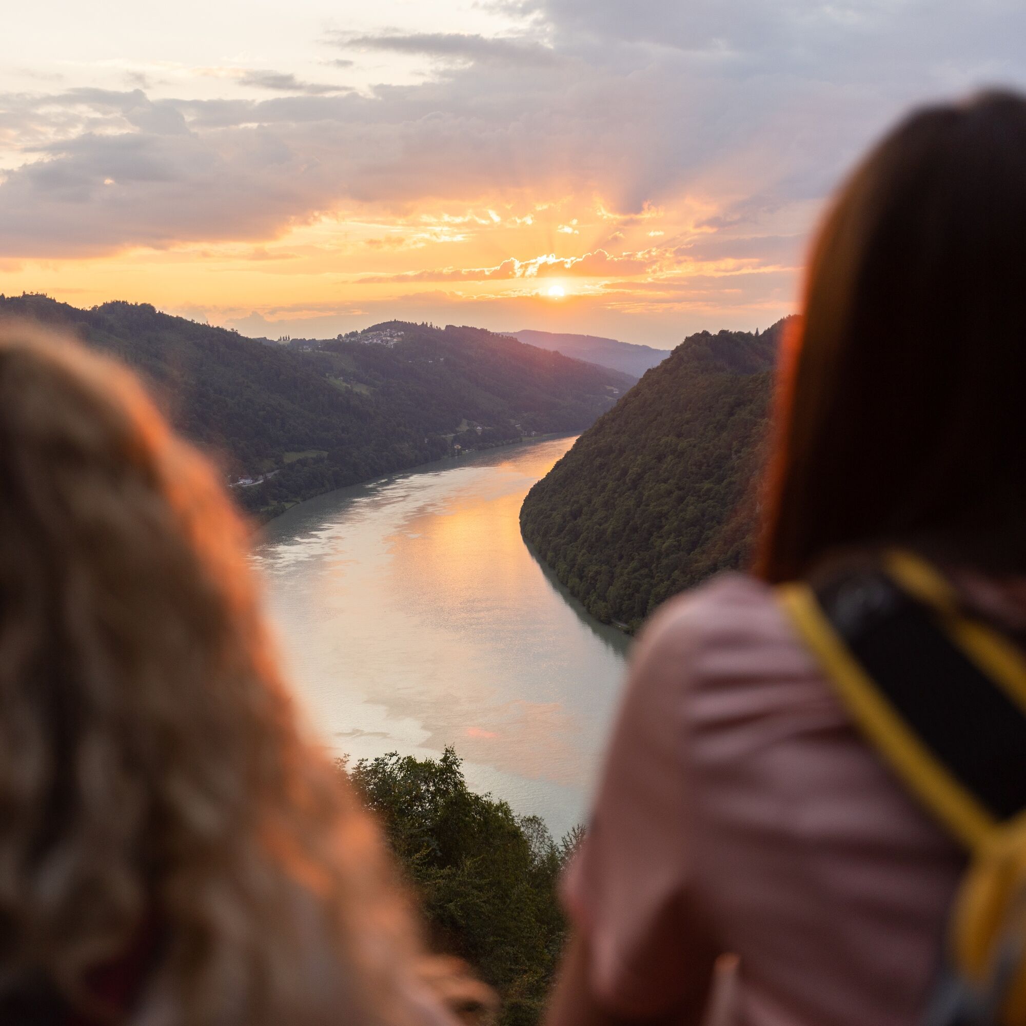
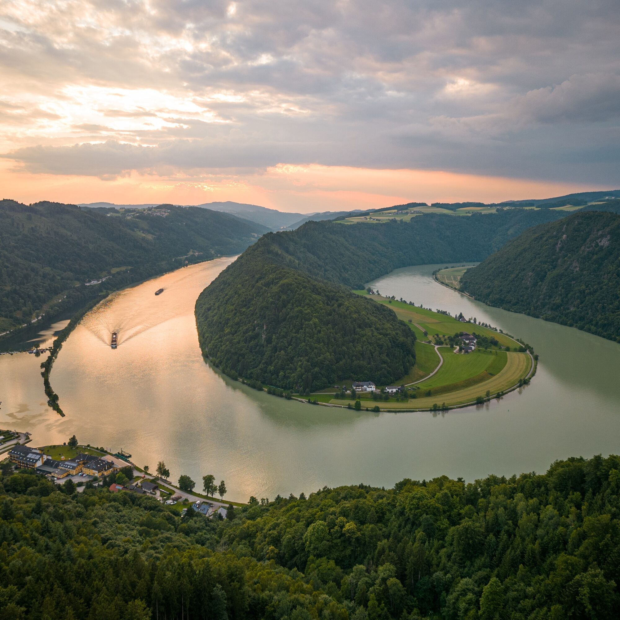
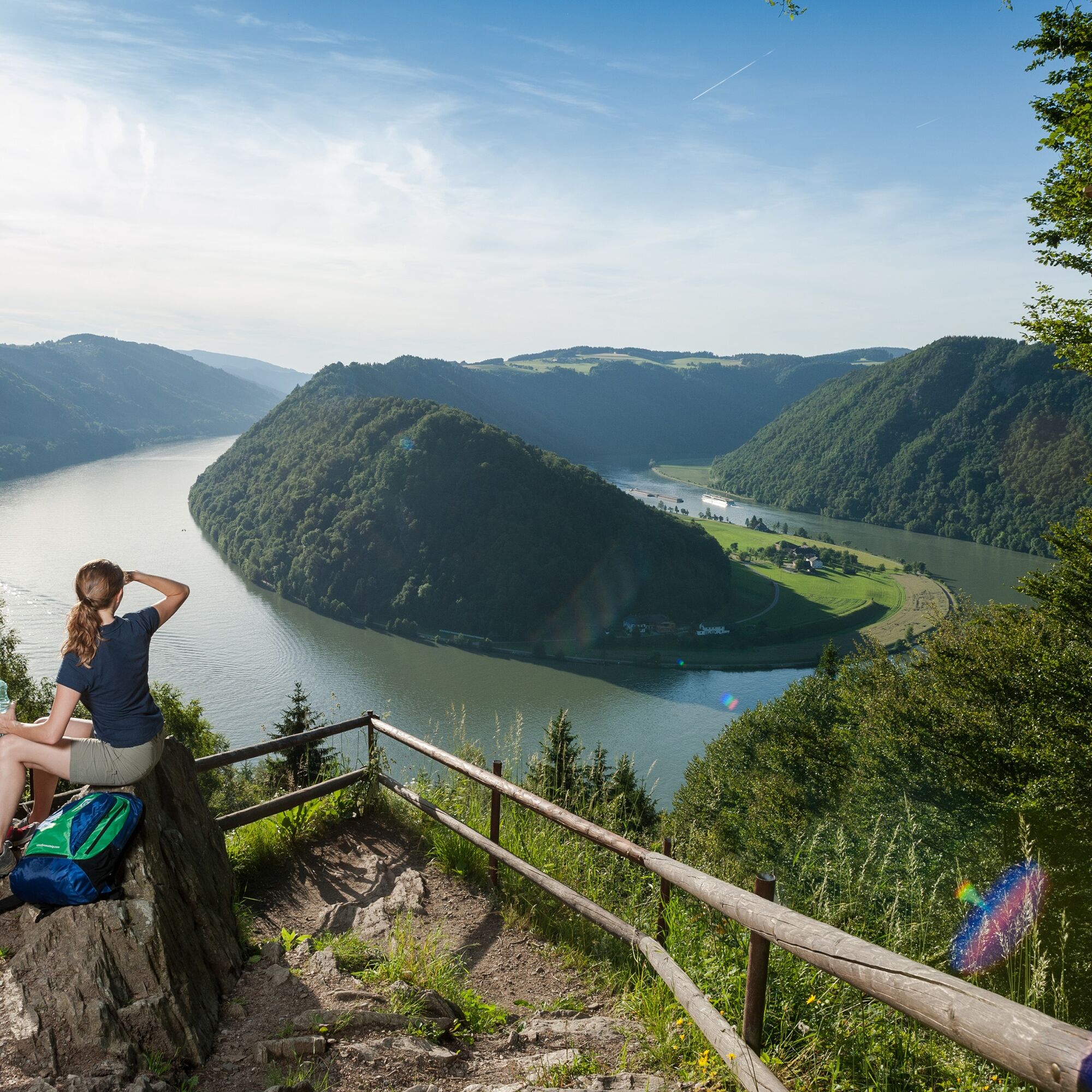
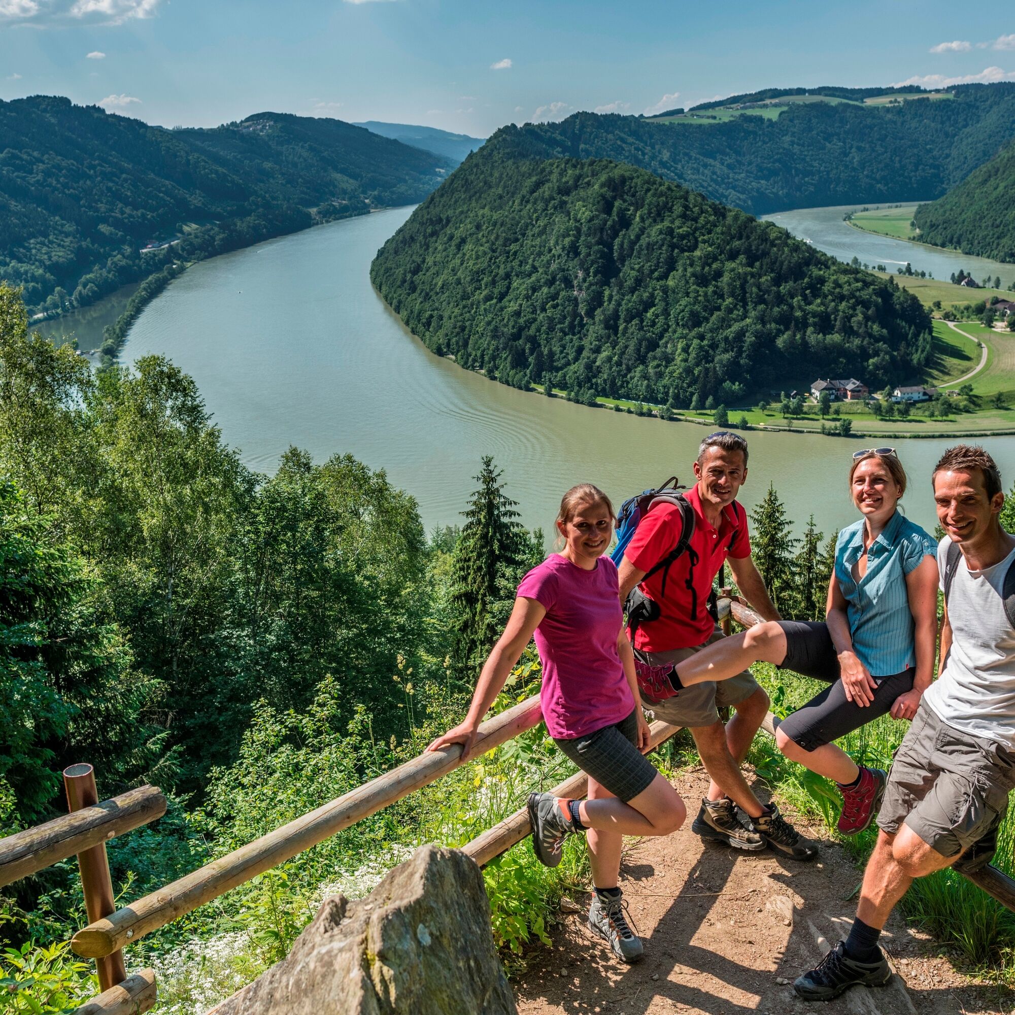
Donausteig Stage 1_S03 Engelhartszell - Schlögen: "Over the 4/4 View to the Schlögen Loop"


Kuvia käyttäjistämme
-
 © Kateřina KozováLuotu 13.08.2025
 -
 © Kateřina KozováLuotu 13.08.2025
 -
 © Kateřina KozováLuotu 13.08.2025
 -
 © Kateřina KozováLuotu 13.08.2025
 -
 © Christian Haik 1Luotu 04.05.2024
 -
 © Christian Haik 1Luotu 04.05.2024
 -
 © Christian Haik 1Luotu 04.05.2024
 -
 © Emanuel Kis PálLuotu 17.03.2024
 -
 © Emanuel Kis PálLuotu 17.03.2024
 -
 © Erwin KrumböckLuotu 27.09.2023
 -
 © Agnes KohlLuotu 13.05.2023
 -
 © webrchLuotu 30.10.2022
 -
 © webrchLuotu 30.10.2022
 -
 © Johann SpielLuotu 10.10.2022
 -
 © Johann SpielLuotu 10.10.2022
 -
 © Johann SpielLuotu 10.10.2022
 -
 © Johann SpielLuotu 10.10.2022
 -
 © Johann SpielLuotu 10.10.2022


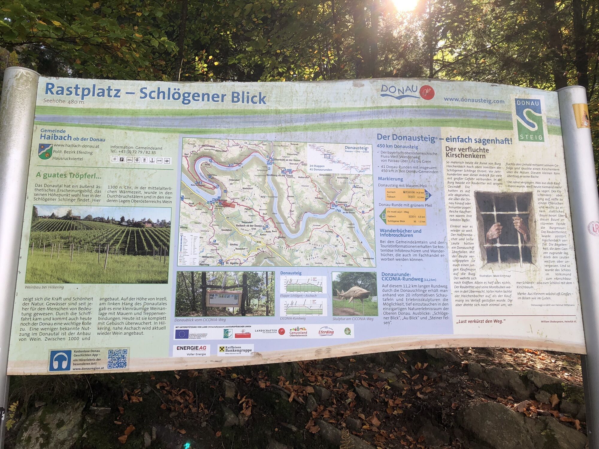
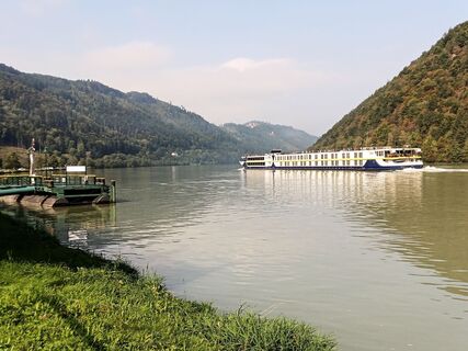
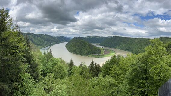
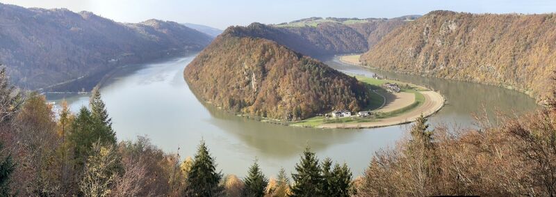
This Donausteig stage starts in Engelhartszell. The historic Danube market is nestled in the forest-rich breakthrough valley of the upper Danube close to the Bavarian border. The beautiful town center...
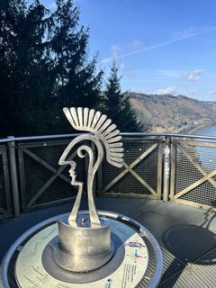
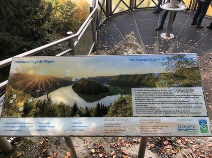
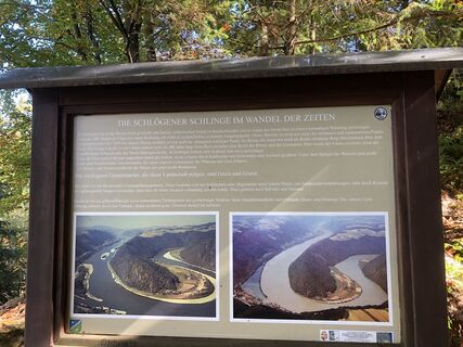
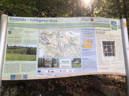
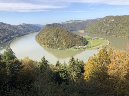
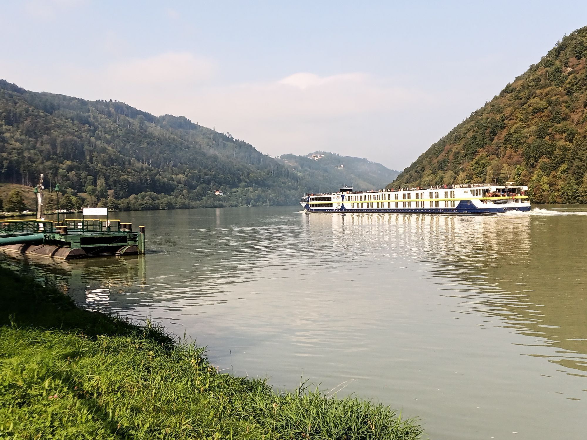
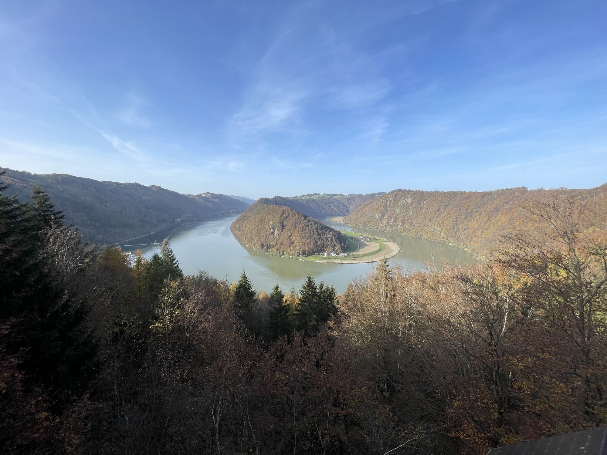
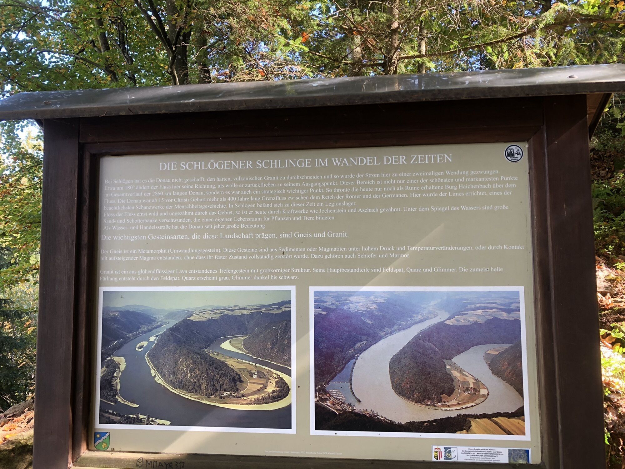
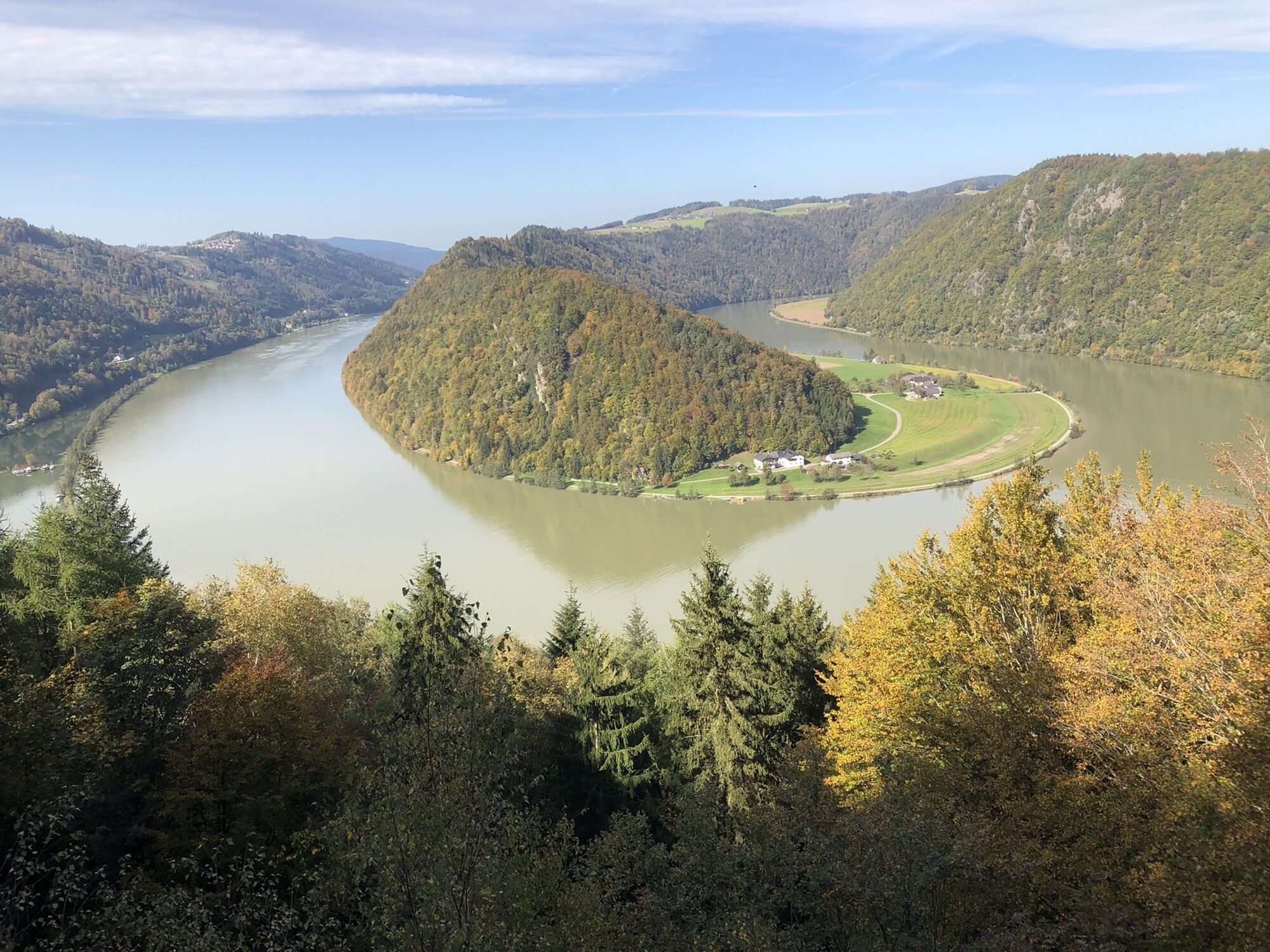
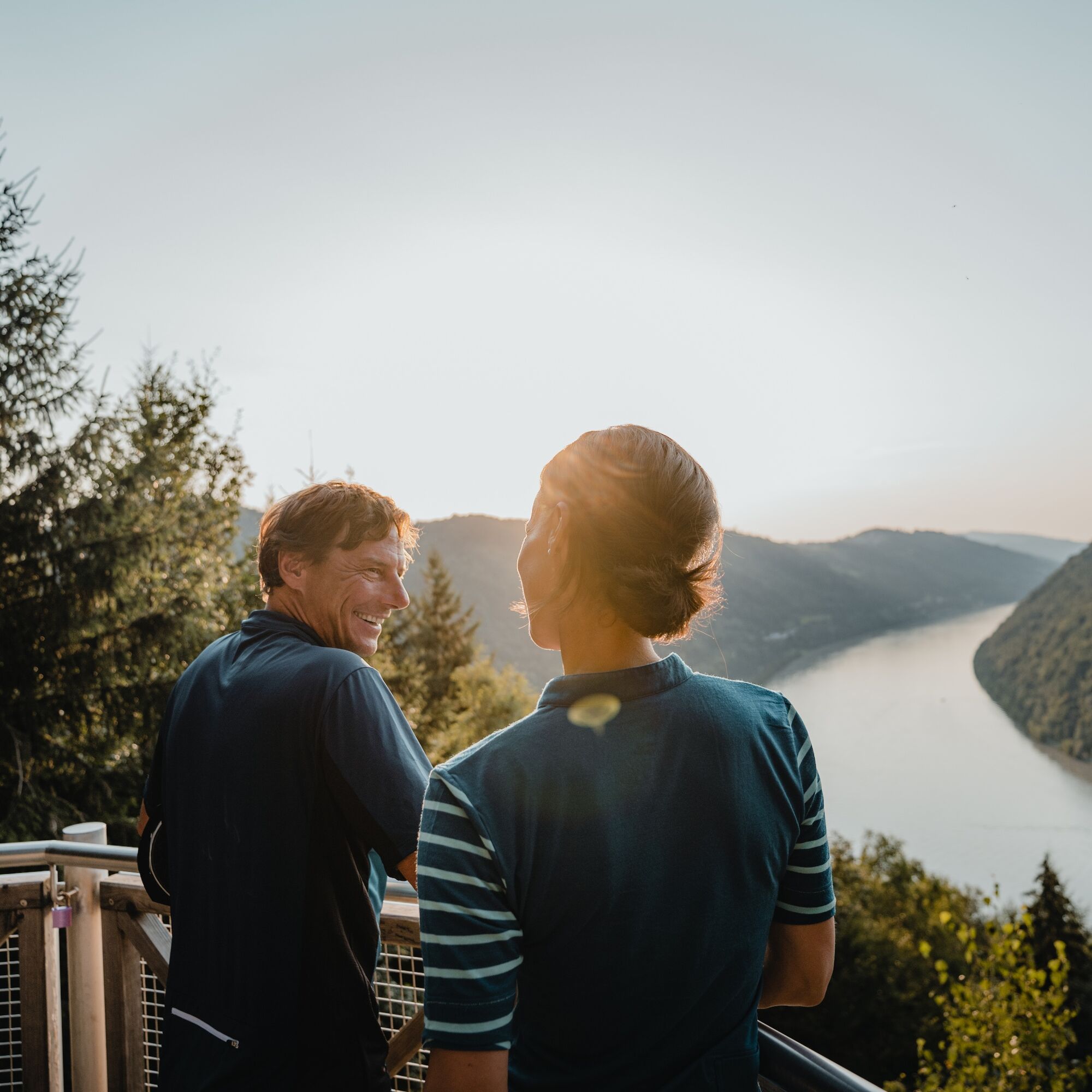
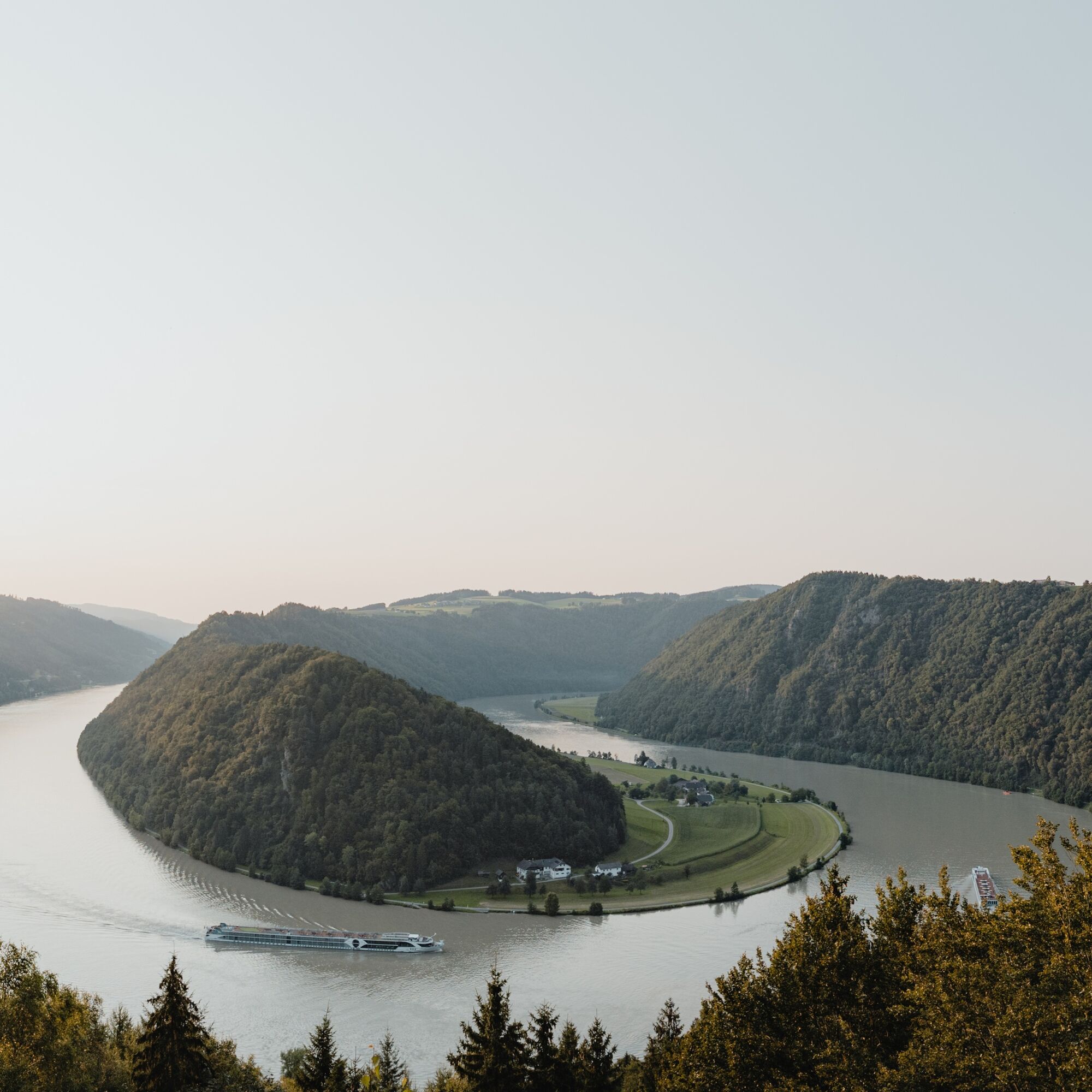
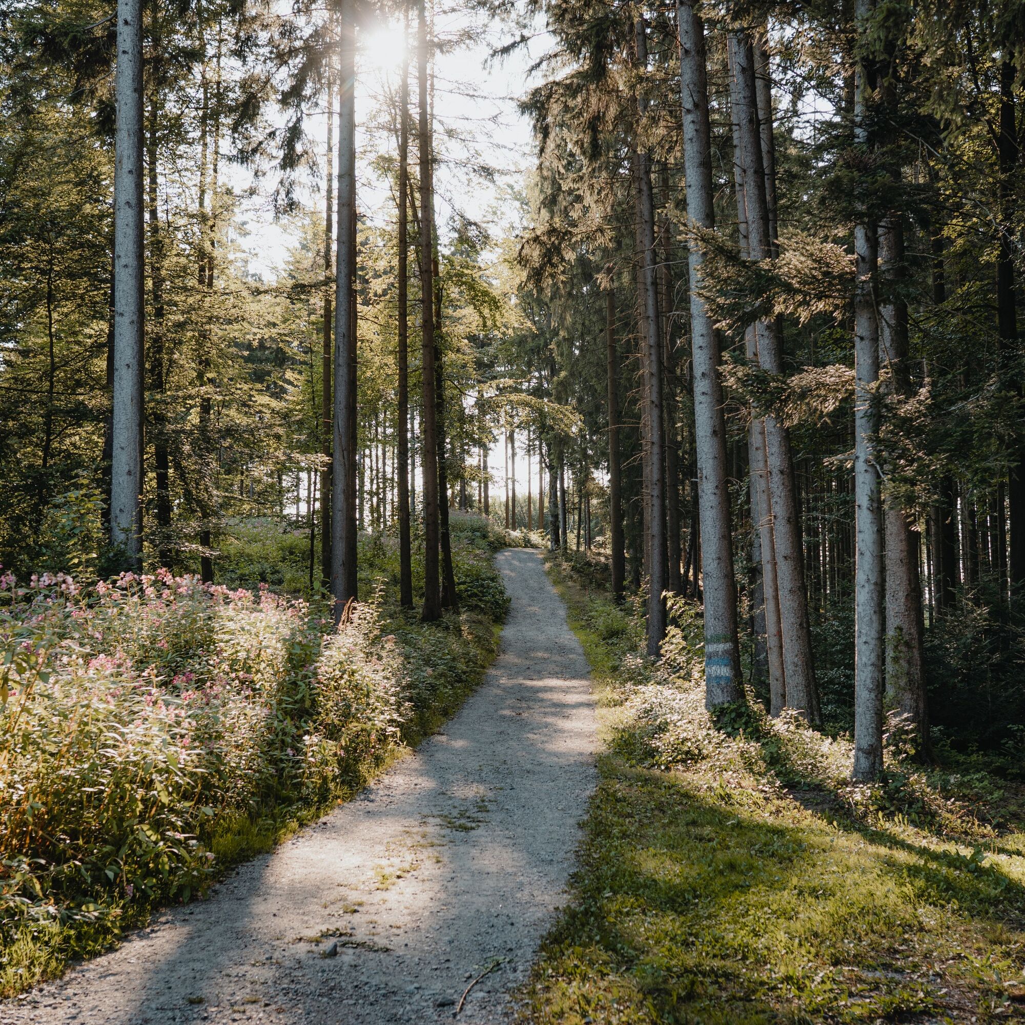
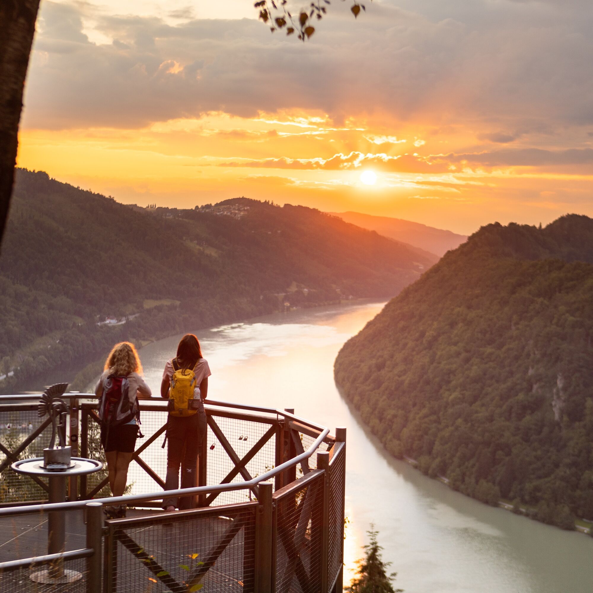
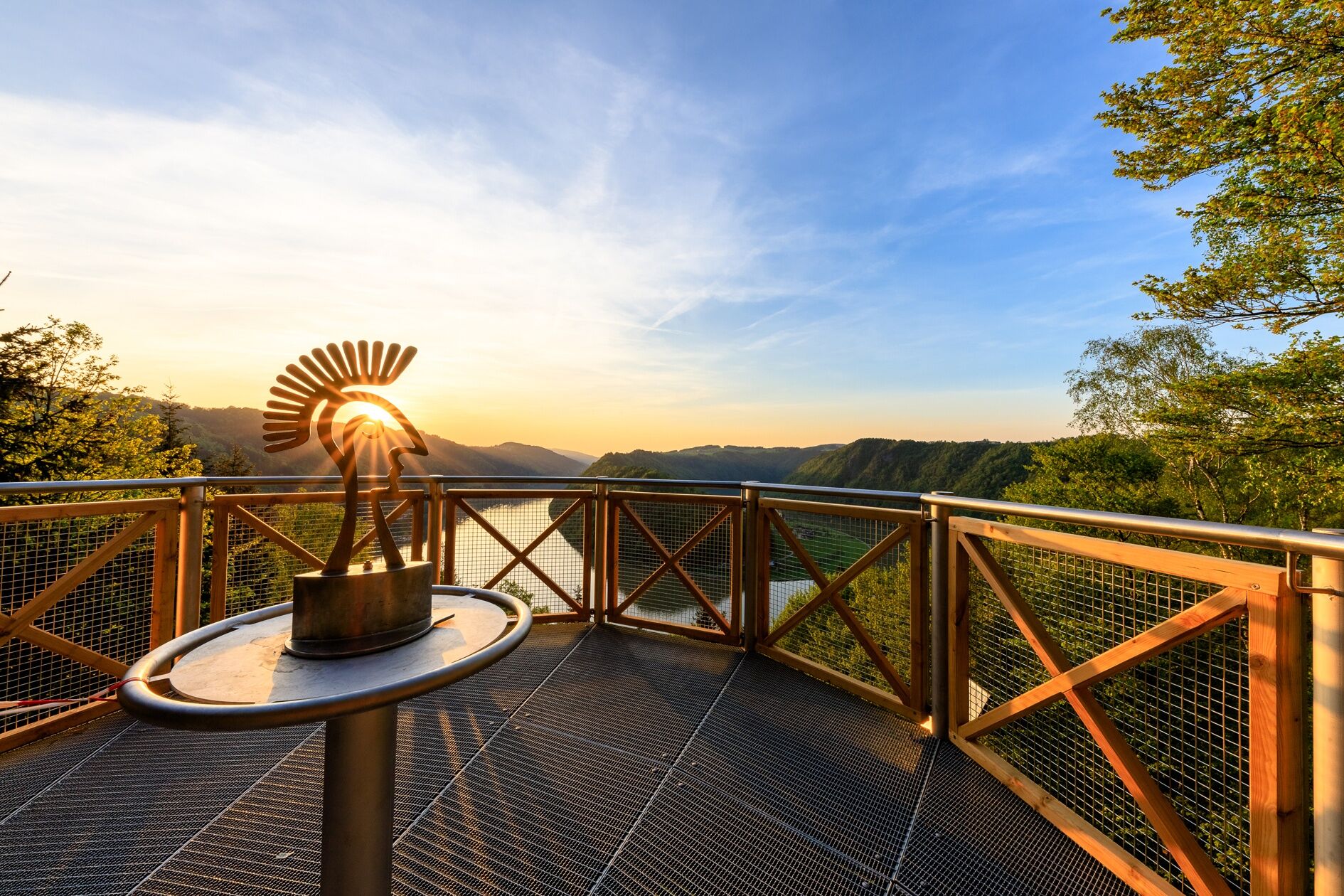
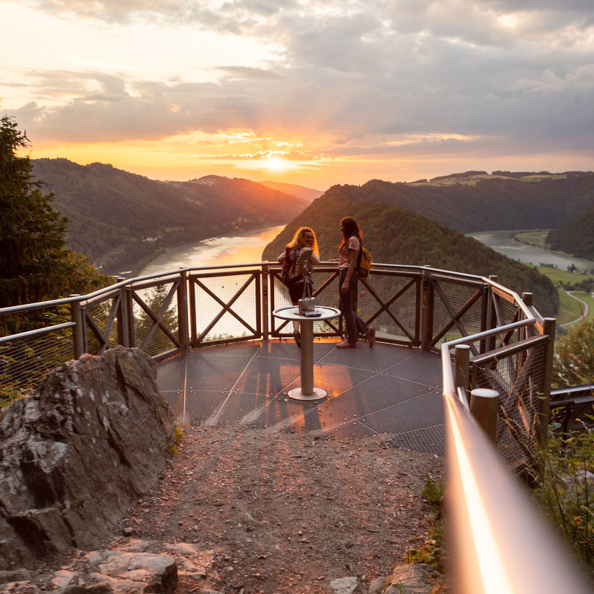
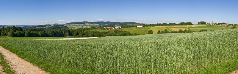
This Donausteig stage starts in Engelhartszell. The historic Danube market is nestled in the forest-rich breakthrough valley of the upper Danube close to the Bavarian border. The beautiful town center tells of a significant history as an imperial toll station and blends with the settings of the Engelhartszell Danube world into an experience world "Danube" – simply amazing! From the village center, we follow the mighty Danube River along the towpath about 4 km downstream. At the start, a short detour to the Trappist Abbey Engelszell and its wonderful Rococo church – a true jewel – is recommended! Later, the long Danube bank offers plenty of time for reflection. Suddenly, the conscious silence of the Trappist monks gains new quality and sharpens our senses for the special things along the way. In Oberranna, we make a short curve up into the mixed forests of the steep Danube slopes. The beautiful view back into the Danube valley rewards our effort. At the mouth of the Kleine Kösslbach into the Danube, we return to the large river. Now the ascent begins through the secluded Kleine Kösslbach valley – one of the top 10 natural highlights of the Donausteig! After a stretch of forest road, a magnificent hiking trail leads uphill through primeval gorge forests. Moss-covered block piles and mystical rock towers inspire our imagination. The highlight of this natural jewel is the rock balcony "Felsen-Blick" high above the valley – a secluded power spot! Shortly after, the rural Sauwald plateau begins. A atmospheric mosaic of extensive forests, flower-rich meadows, fertile fields, and traditional homesteads shapes this rolling cultural landscape. Over small country roads, we climb up to the Donausteig rest area "4/4-Blick". Congratulations – here we stand on the first summit of this stage! The unique 360° panoramic view allows seemingly endless vistas in all four quarters of Upper Austria. Then we continue on scenic country roads, through gentle ups and downs of the wonderful cultural landscape. In Aichberg, the Donausteig leads down into the dense forests of the steep Danube slopes and follows there, high above the Danube, the mighty river. The diversity of the forests here in the upper Danube valley becomes evident. In Waldkirchen, we return to the plateau. Here, a short detour to the village's picturesque parish church is recommended. The Donausteig now makes a deep loop down into the forest-rich Danube slopes, offering beautiful views of the nearby Danube castles from Vornwald. Once back on the plateau, we enjoy the extensive cultural landscape and hike along rural side roads to Paschinger Hill with its Donausteig rest area. Congratulations – here we stand on the second summit of this stage! The magnificent panoramic view over three sides reveals an incredible 20 church towers. Now the descent begins. Small village roads lead us to Straß, from where we descend via field and forest paths through the steep Danube slopes to the grand natural wonder of the Schlögen Danube loop. Donausteig – simply an experience!
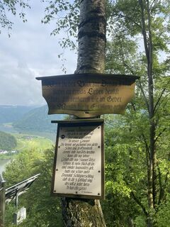
Discover the following special features with the Donausteig diary:
- Engelhartszell toll & Fliehsteiner
- Donausteig starting point "Engelhartszell"
- Danube world venue "Danube stories"
- Plague column – a land without people!
- Farrier's house – shoes for the ship horses
- Danube world venue "Danube square"
- Gauge life with the water level
- Granite is not just granite
- ...
Download: Donausteig diary stage 1_S03 Engelhartszell-Schlögen
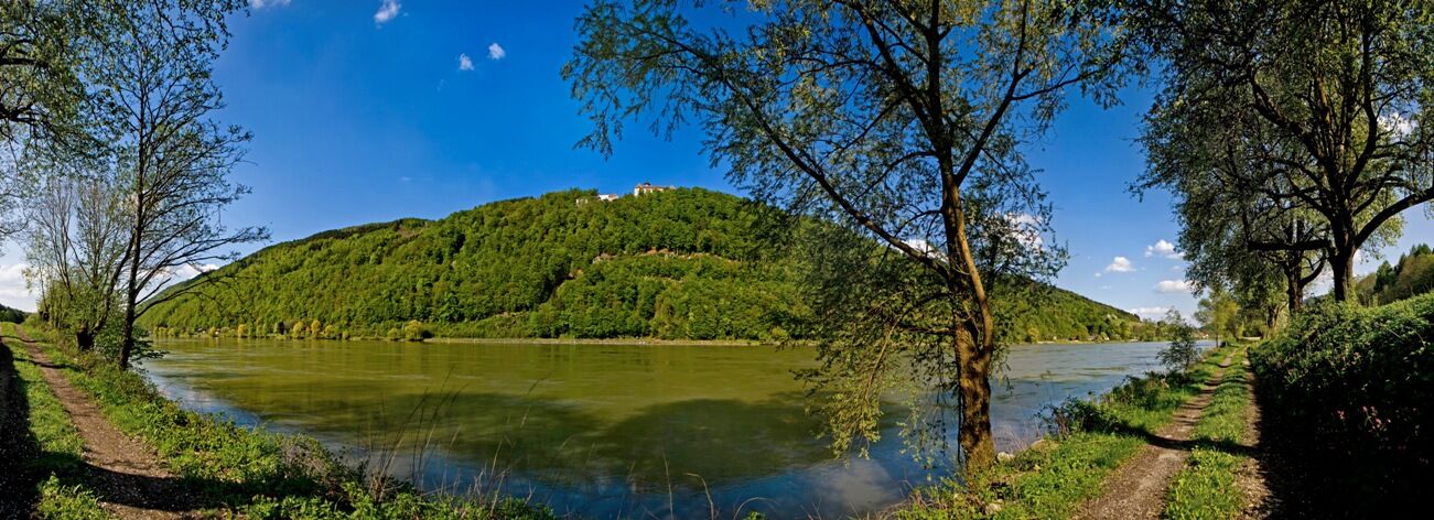
From the Donausteig starting point "Engelhartszell", we walk along Sauwaldstraße to the Danube and then follow the Danube bank path downstream to the right. After the building of the shipping authority, a right turn (through the underpass) allows a detour to Engelszell Abbey. However, the Donausteig continues straight ahead and briefly climbs to Nibelungenstraße. Afterwards, the route follows the Danube bank for about 4 km: first along the towpath, later through Saag on a narrow hiking trail, and finally on a driveable path. At the Donausteig rest area "Danube View Rannariedl", the path leaves the Danube and leads out to Nibelungenstraße. There, continue left to Oberranna, where a driveable road branches off to the right to the chapel "Magna Mater Austriae". This leads uphill through the forest-rich Danube slopes. Past a forest clearing with two houses, the path descends after a hillcrest and leads down again to Nibelungenstraße. On this road, we cross the bridge over the Kleine Kösslbach and turn right. Now a forest road takes us moderately uphill into the seclusion of the forest-rich Kleine Kösslbach valley. After a bend, a trail branches off to the right and partly alpine-like leads through the most rustic part of the valley up to the rock balcony "Felsen-Blick" high above the valley. Shortly after, we stand at the edge of the gorge forest at the Donausteig rest area "Felsen-Blick". Now the rolling cultural landscape of the Sauwald plateau begins. In an S-curve (please do not shorten!), we go over the meadow to a farm, from which we reach a T-junction by a paved road with a slight incline. The road to the left leads straight to the Donausteig rest area "4/4 View". This road then continues on to Atzersdorf. Here, we turn left at the Sigl guesthouse and, at the next T-junction, continue right into the village of Aichberg. The Donausteig turns left at the fire station and after 100 m turns right again (at the former castle tavern). A field path leads in an S-curve to the forest edge at the terrain edge. After a short descent, we hike comfortably on forest paths along the forest-rich Danube slopes to Waldkirchen am Wesen. Near the parish church, a paved road begins, on which the Donausteig turns left to lead down to the main road Wesenufer-Neukirchen. We cross this and immediately turn left. A paved service road now takes us through the forest-rich Danube slopes down to a remote farm on a forest clearing (Vornwald). Afterwards, forest paths lead in wide switchbacks back up to the Sauwald plateau. Reaching the paved road (fire station), we turn left there to the Donausteig rest area "Paschinger Hill". The road then continues directly to Straß. Here, the Donausteig turns left. Via a field path, we make a left curve to the forest edge. Then initially a forest path, later a forest road in several switchbacks, leads down to the forest clearing in Mitterberg. There, continue left further down on the paved road. Passing the farm on the left, we then hike through the last section of Danube slope forest and finally reach Nibelungenstraße in Schlögen. Short right, then a small street on the left takes us directly to the Donausteig starting point "Schlögen" in front of Hotel Donauschlinge.
To make orientation easier for you, Donausteig has been equipped with its own orientation system – the description can be found here.
Kyllä
In addition to your personal hiking equipment, there are no special requirements.
The starting point of this stage is located on Sauwaldstraße about 30 m southeast of the Engelhartszell municipal office (GPS: A‑4090 Engelhartszell, municipal office/market square 61).
Engelhartszell can be reached by bus. A return transfer from Schlögen is also possible by bus. Information about departure times can be found at http://www.ooevv.at .
Directly in front of the Donausteig starting point, there are some parking spaces along Sauwaldstraße. Additional parking options are available along Stiftsstraße (access to Engelszell Abbey; about a 10-minute walk away). Please pay attention to any short-term parking zones!
WGD Donau Upper Austria Tourism GmbH
Lindengasse 9
4040 Linz, Austria
Tel. +43(0)732/7277-800
Fax. +43(0)732/7277-804
info@donausteig.com
Engelhartszell Municipal Office
Marktplatz 61
4090 Engelhartszell
Tel.: +43(0)7717/8055-16
Fax: +43(0)7717/8055-22
tourismus@engelhartszell.ooe.gv.at
www.engelhartszell.at
Haibach ob der Donau Municipality
4083 Haibach 40
Tel.: +43(0)7279/8235*
Fax: +43(0)7279/8235-16
haibach@oberoesterreich.at
www.haibach-donau.at
The Engelhartszell Danube market is a little treasure chest – be sure to plan time for a visit!
Suosittuja retkiä naapurustossa
-
4,4
Haibach: CICONIA circular route
mediumVaellus 11,2 km -
3,7
Waldkirchen: 4/4 View Round | Large Danube Resonance Path Round
mediumVaellus 12,9 km -
4,7
Hofkirchen: Waterfall round
mediumVaellus 8,43 km -
4,7
Donauschlinge Schlögen
Vaellus 15,2 km -
5,0
Donauradweg - Aschachtal - Runde
mediumPyöräily 58,1 km -
4,7
Ciconia Weg Schlögen, Oberösterreich
mediumVaellus 11,2 km -
2,8
Alm-Mühlen-Runde
valoVaellus 5,12 km -
5,0
Ranna-Stausee
valoVaellus 12,2 km -
4,6
St. Agatha: It must be - Trail
mediumVaellus 20,7 km -
4,0
R1.05 Sauwald Panorama Circuit
mediumPyöräily 57,8 km
Vaellus & jäljitys


Älä jää paitsi tarjouksista ja inspiraatiosta seuraavaa lomaasi varten.
Sähköpostiosoitteesi on lisätty postituslistalle.