


Lourdes Vélosud (V81) and Pyrenean foothills
Vaikeustaso: 3


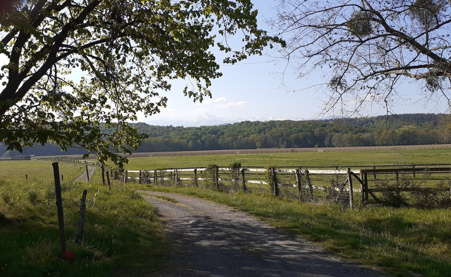
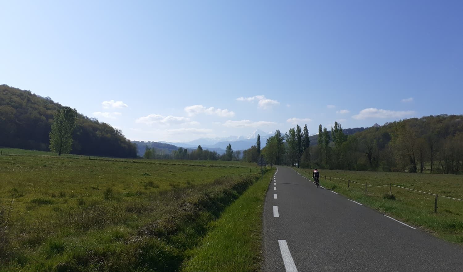
Panoramic views of the Pyrenean foothills accompany your journey, creating a striking contrast between lush valleys and mountain peaks. The route offers a balance between flat sections to enjoy the scenery...
Panoramic views of the Pyrenean foothills accompany your journey, creating a striking contrast between lush valleys and mountain peaks. The route offers a balance between flat sections to enjoy the scenery and more challenging climbs to take on the challenge.
You can customize the route based on your fitness level and preferences.
In summary, this cycling route combines exploring picturesque villages, relaxing along the V81, and enjoying views of the Pyrenees. It is a rewarding experience that combines physical activity, cultural discovery, and natural beauty.
On the way back, you can take a gastronomic break at the Brasserie des Aouits or the Terroirs Pyrénéens shop.

Before setting off:
Make sure the bike is in perfect mechanical condition, including tires and brakes Ensure the bike is properly adjusted to your body Wearing a helmet is strongly recommended Bring a repair kit Remember that the Highway Code applies to cyclists at all times Never ride more than two abreast and keep to a single file when traffic conditions require it Respect other users as you would want them to respect you Choose a route suitable for your physical abilities Inform those around you of your itinerary Check the weather conditions A first aid kit is not essential but can be very useful Know and keep emergency numbers Respect the environment by not throwing food packaging on the roadside If you must return at dusk, make sure you can see and be seen
In case of emergency, dial 112
Consider carpooling
Parking near the starting point
3
To learn more about our destination, visit our website
Easy-level route for e-biking.
Suosittuja retkiä naapurustossa
-
LA VOIE VERTE DES GAVES A VELO
valoPyöräily 18,8 km -
Orincles und Umland
mediumE-MTB 32,7 km -
Lourdes Hautacam
raskasMaantiepyörä 55,4 km -
CHEMIN DE BERNADETTE VERS BARTRÈS
valoVaellus 4,52 km -
Lourdes Vélosud (V81) along the Gave
valoPyöräily 33,0 km -
Lingous Pass Loop, Castelloubon valley
valoPyöräily 20,9 km -
SOUM DE CAUBI ET DE BASTA
valoVaellus 19,1 km -
Lourdes Argelès Gazost, small balcony
valoPyöräily 32 km -
Parcours n°5 - Le pays de Lourdes
mediumMaantiepyörä 54,4 km -
Lourdes Vallée des Gaves route
mediumPyöräily 39,3 km
Vaellus & jäljitys


Älä jää paitsi tarjouksista ja inspiraatiosta seuraavaa lomaasi varten.
Sähköpostiosoitteesi on lisätty postituslistalle.