


Seerenbach waterfalls


A natural wonder at Lake Walen!
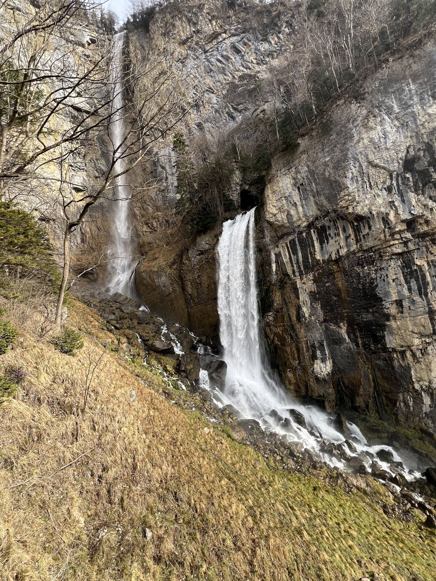
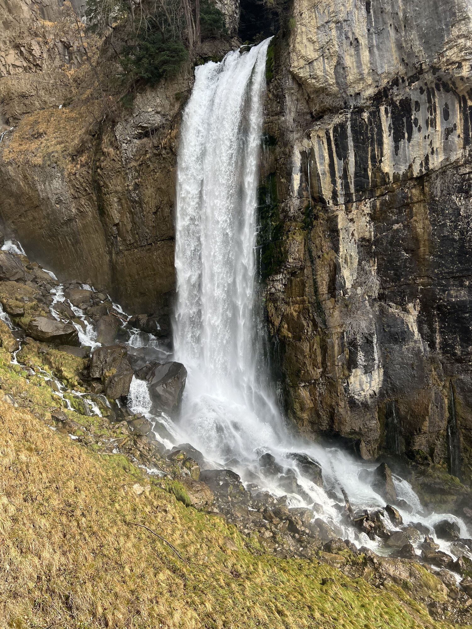
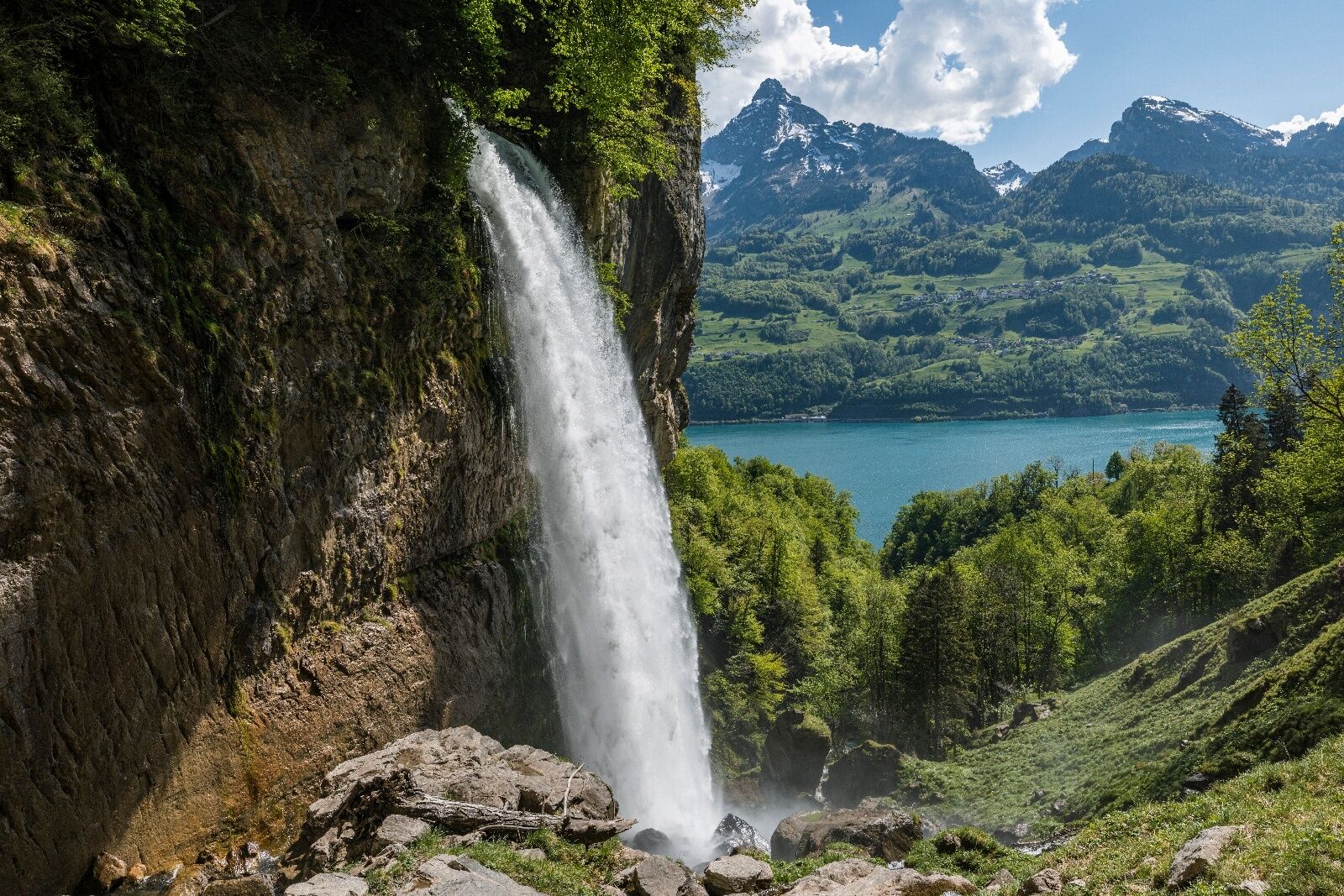
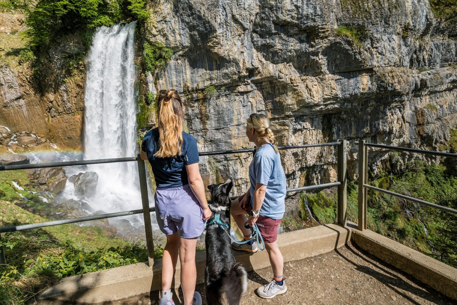
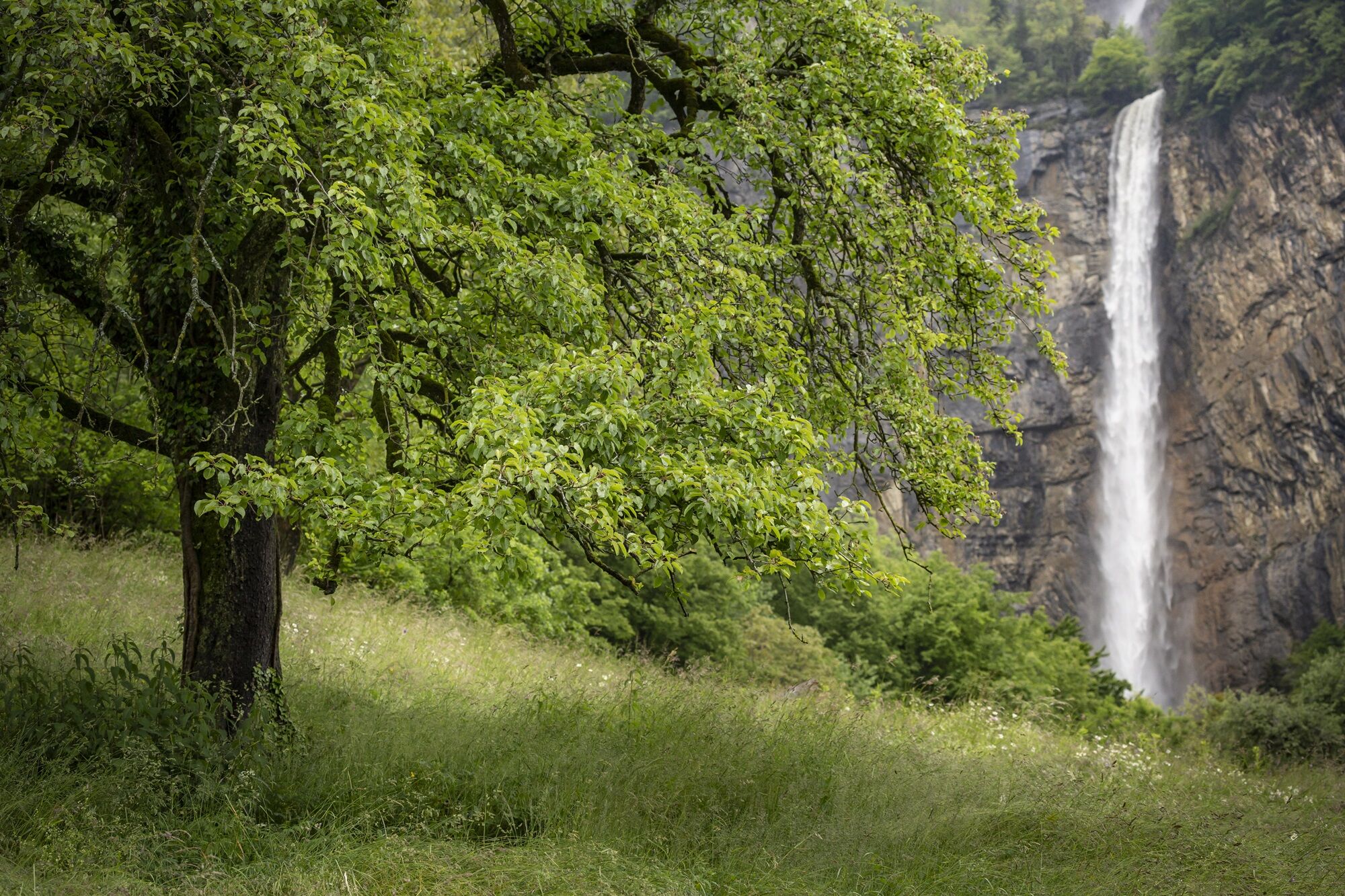
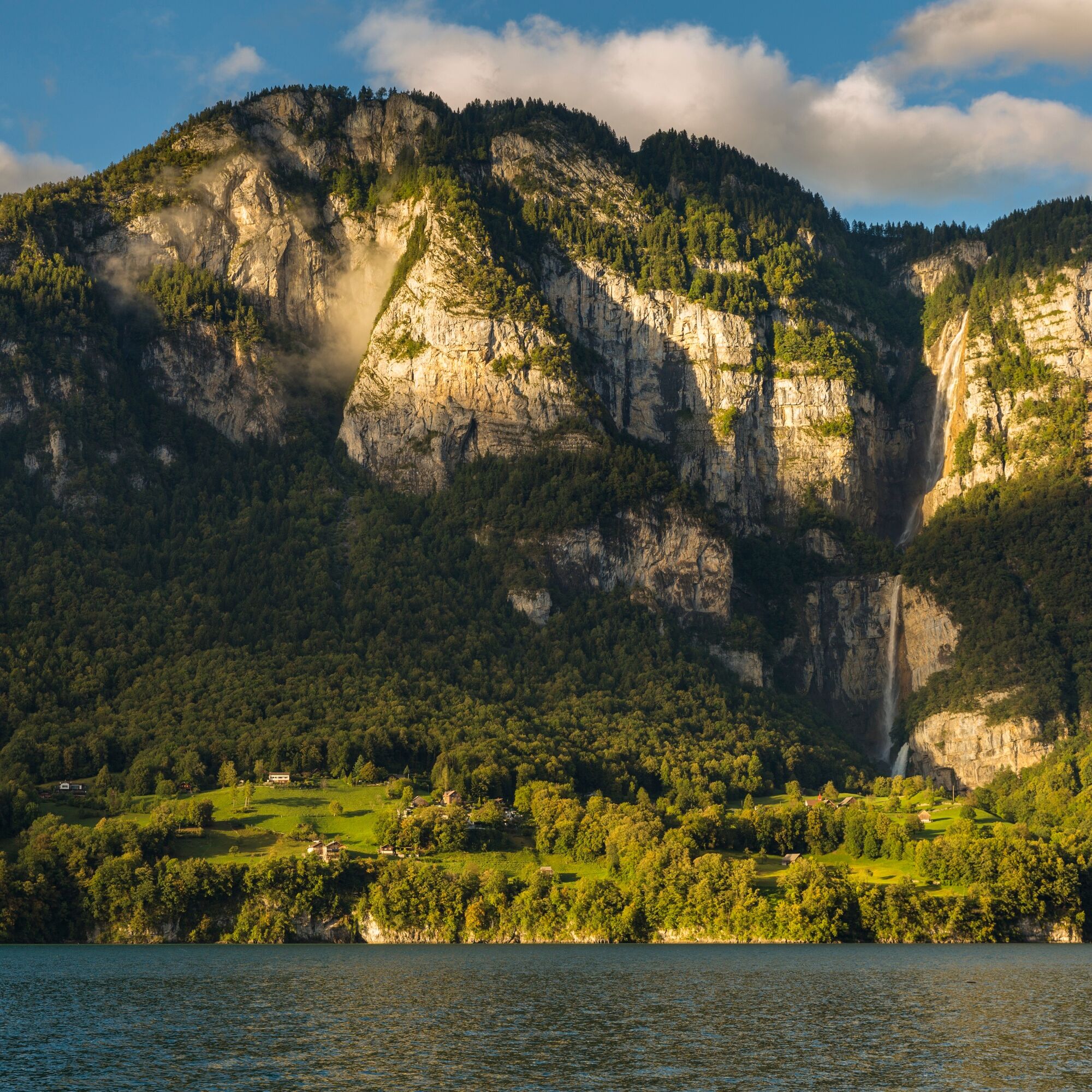
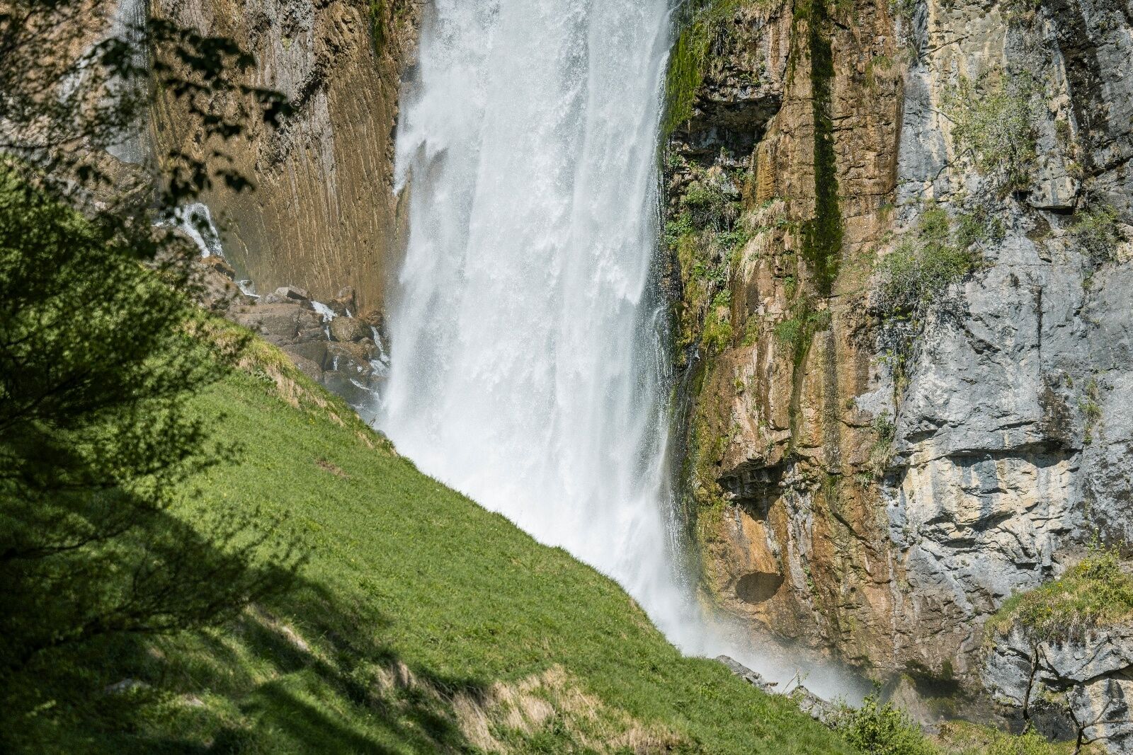
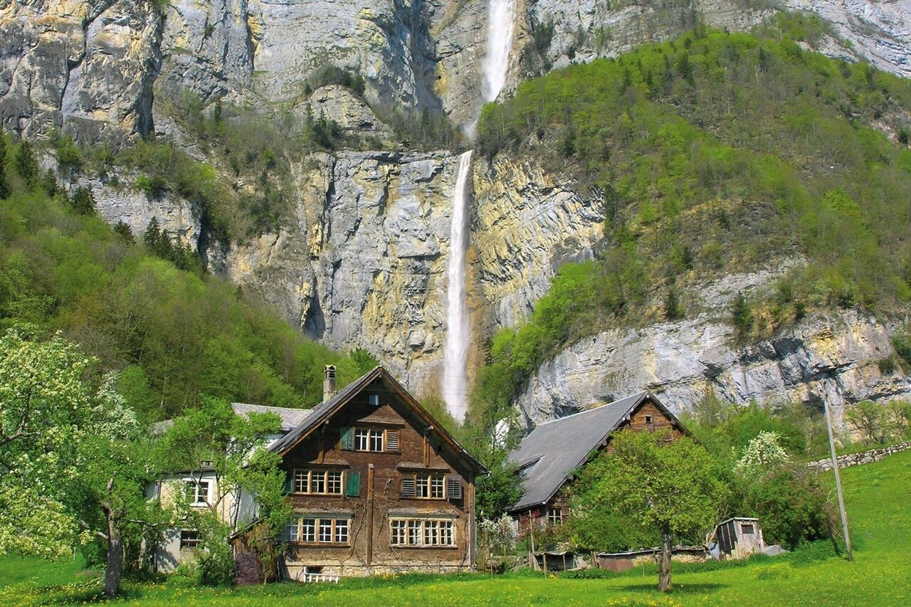
In the ravine in which the imposing Seerenbach Falls plunge to the depths, the source of the Rin also makes its appearance. From a subterranean cavern system substantial...
A natural wonder at Lake Walen!
In the ravine in which the imposing Seerenbach Falls plunge to the depths, the source of the Rin also makes its appearance. From a subterranean cavern system substantial masses of water pour down a chasm 22 metres to the bottom.
At the beginning of the 20th century scientists started to investigate the source and the multi-branched cave system. Various expeditions furnished with diving equipment explored the Rin cave and penetrated over 1000 metres into the core of the mountain. A gallery leading to the outside serves, after the rainy period and during the melting of the snow, as high water spillway of the underground river system. About 3000 metres distant from the cave entrance there is a branch where the water vanishes inside the mountain. Where to? - That will probably remain a mystery!
Note(s)
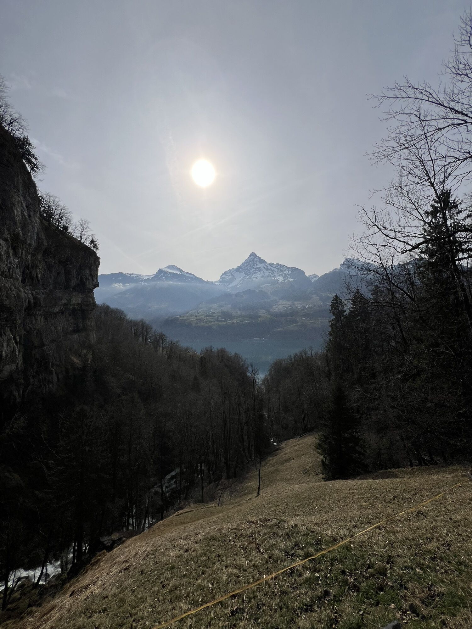
In summer the regular ship service of the Lake Walen Navigation plies from Betlis to Weesen and return.
See also
Amden & Weesen Tourismus
Dorfstrasse 22
CH-8873 Amden
Tel: +41 (0)58 228 28 30
E-Mail: tourismus@amden.ch
Internet: www.amden-weesen.ch
Heidiland Tourismus AG
Infostelle Walensee-Unterterzen
Walenseestrasse 18
CH-8882 Unterterzen
Tel: +41 (0)81 720 17 17
Fax: +41 (0)81 720 17 18
E-Mail: unterterzen@heidiland.com
Internet: www.heidiland.com
Hiking map HEIDILAND: www.heidiland.com/de/aktivitaeten-erlebnisse/sommer/wandern-klettern/wanderkarte-heidiland


Betlis - Strahlegg - Vorderbetlis - Seerenbachfälle
Kyllä
Light sneakers are sufficient in dry weather, otherwise water-repellent trekking shoes are recommended
The path does not require any special precautions. Only the last section before the platform can occasionally be slippery due to the weather.
Take the Weesen highway exit, then continue to the port of Weesen.
Travel by train to Ziegelbrücke and post bus to Weesen, See
Daily to Ziegelbrücke, continue by bus 650 in the direction of Amden, Vorderdorf to the Weesen, See stop. From there, take the Walensee boat to Betlis.
Paid parking lot at the port of Weesen.
Amden & Weesen Tourism
T +41 58 228 28 30
Heidiland Tourismus AG, Flumserberg information office
T +41 81 720 18 18
As the name suggests, it is worth making a detour to the "Paradiesli" restaurant in Betlis
Kiertueen webbikamerat
Suosittuja retkiä naapurustossa
-
4,7
Riviera Walensee Walenstadt - Quinten
mediumVaellus 10,4 km -
4,5
Weesen - Quinten - Walenstadt
raskasVaellus 20,6 km -
4,4
7-Peak-Tour Flumserberg
raskasVaellus 15,0 km -
5,0
Schrina Alp and Cultural Trail
mediumTeemareitti 11,5 km -
4,6
4 Summit Tour Flumserberg
mediumVaellus 8,65 km -
4,5
Amden - Speer (Rundkurs)
valoVaellus 17,6 km -
5,0
Fronalpstock GL
mediumVaellus 7,84 km -
Murgsee circular route
raskasVaellus 14,5 km -
Murgsee Runde
mediumVaellus 16,2 km -
2,5
Hike to the Murg lakes
mediumVaellus 9,83 km
Vaellus & jäljitys


Älä jää paitsi tarjouksista ja inspiraatiosta seuraavaa lomaasi varten.
Sähköpostiosoitteesi on lisätty postituslistalle.