


From Vättis to the Walser settlement St. Martin


The old Walser path from Vättis to the Gigerwald Dam crosses a small natural bridge in the Gwölb. Through mixed forest, we reach the Isig Brugg, where we cross the Tamina. In open forest meadows over the...
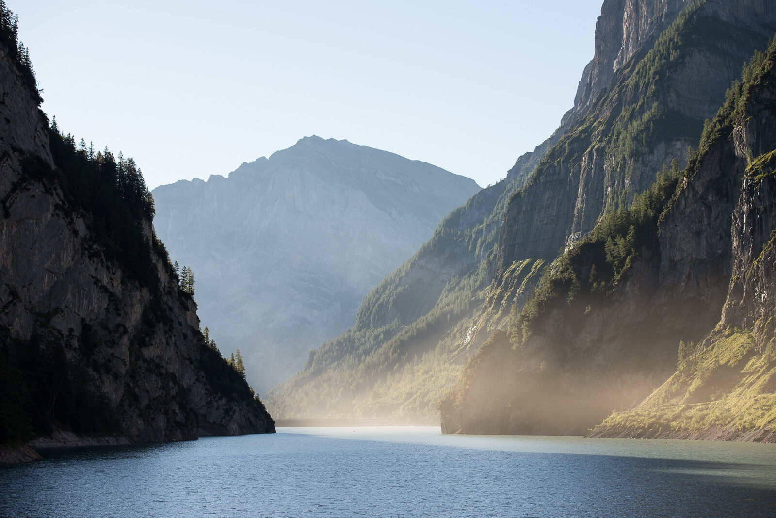
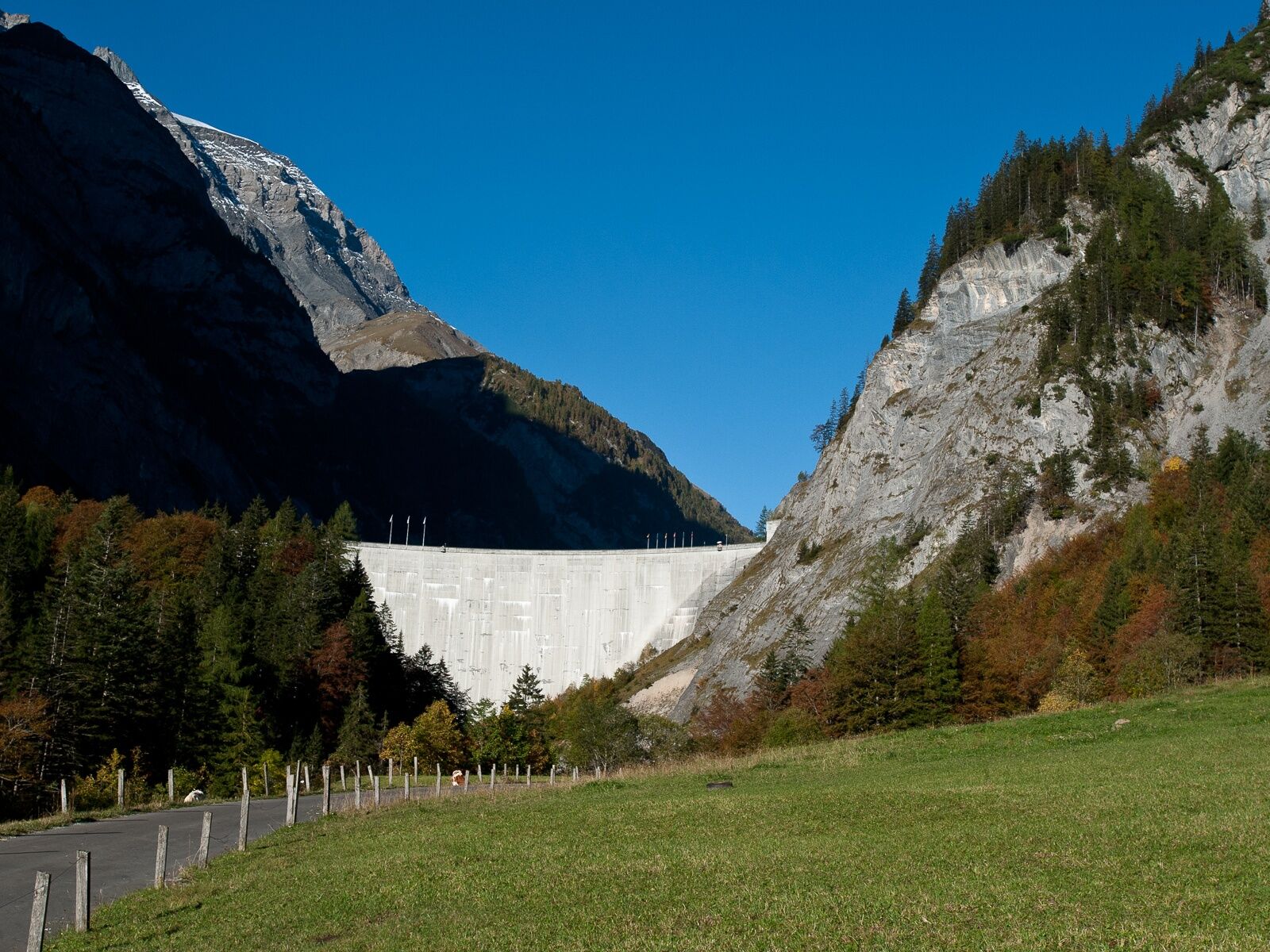
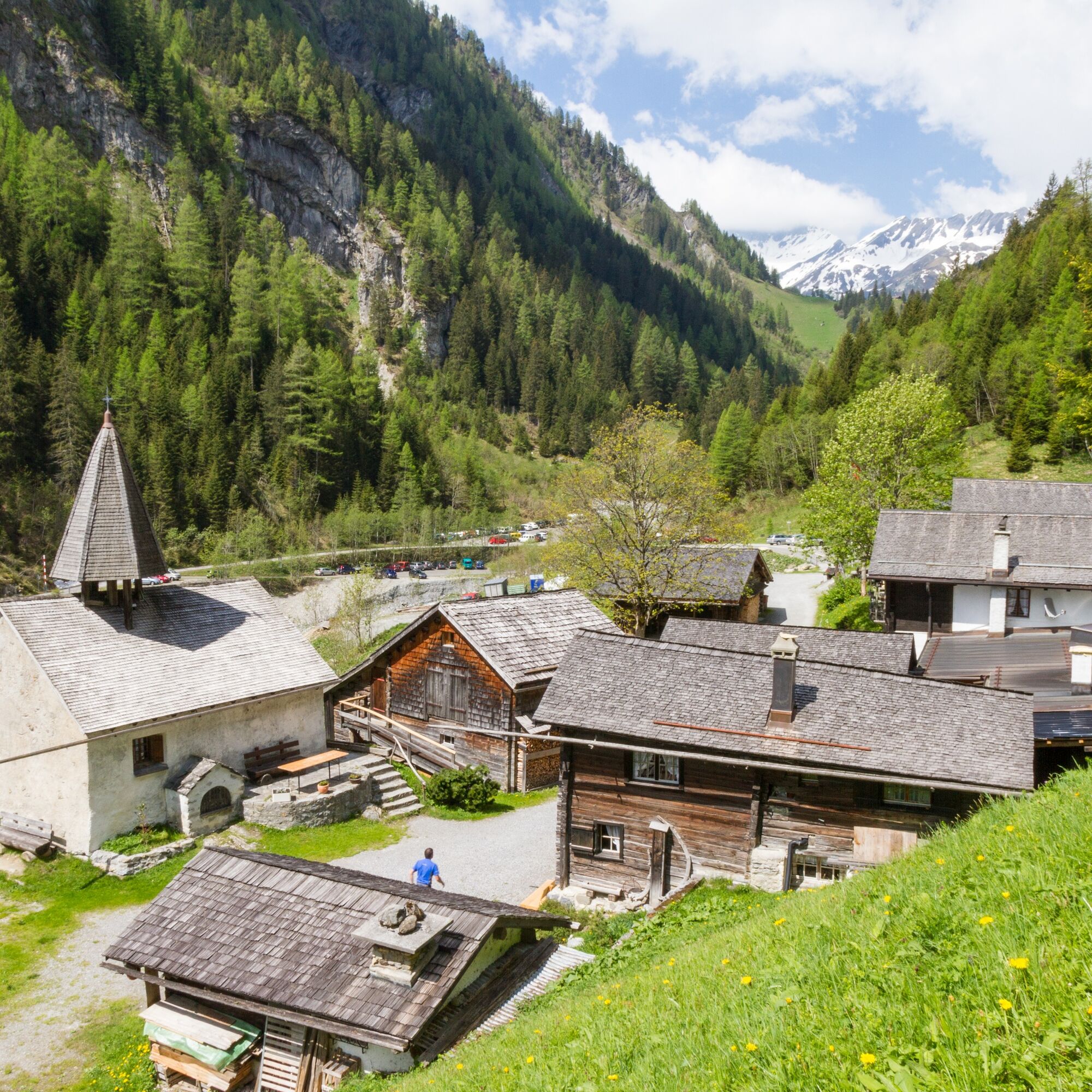
The old Walser path from Vättis to the Gigerwald Dam crosses a small natural bridge in the Gwölb. Through mixed forest, we reach the Isig Brugg, where we cross the Tamina. In open forest meadows over the Höhi to the Gigerwald Dam, wildlife can often be observed. The steep rock walls with waterfalls on both sides along the reservoir are spectacular. A visit to the charming Walser settlement of St. Martin with its small church from the year 1321 at the end of the lake is a must.

Vättis – Gwölb – Isig Brugg – Luterazug – Höhi – Gigerwald Dam – St. Martin
Kyllä
Normal hiking equipment. Depending on the weather, good footwear (hiking boots) is recommended, otherwise slightly lighter but still closed shoes are sufficient for the route.
From the Gigerwald dam to St. Martin, you walk on the main road. Please watch out for other path users.
Motorway exit Bad Ragaz. In the village center of Bad Ragaz, turn onto Bergstrasse towards Pfäfers/Valens and drive either via Pfäfers or via Taminabrücke and Valens to Vättis.
By train to Bad Ragaz station. Then by PostBus to Vättis.
Parking is available opposite the gas station in the village center (Calfeisenstrasse) or at the Vättis village bus stop.
Heidiland Tourism, Bad Ragaz information office
T +41 81 300 40 20
www.heidiland.com
The cozy lounge in the restaurant at St. Martin invites you to relax with a drink or a meal.
Suosittuja retkiä naapurustossa
-
4,5
4-lake hike
mediumVaellus 12,8 km -
4,8
Pizalun circular route
valoVaellus 7,18 km -
4,7
The riverside trail: Trutg dil Flem
mediumTeemareitti 13,5 km -
4,6
5-Seen Wanderung am Pizol
valoVaellus 10,1 km -
4,7
Pizol - Batöni - Weisstannen
raskasVaellus 11,7 km -
Lake Chapfen round trip
valoVaellus 4,27 km -
4,3
Via Ferrata Pinut
mediumVia ferrata 5,82 km -
4,7
Rhine Gorge Hike: Senda Ruinaulta (659)
valoVaellus 9,39 km -
5,0
Circular hike Bettlerweg & 2-Lakes Hike Pizol
mediumVaellus 11,4 km -
5,0
Staderas - Conn - Rhein Gorge Ruinaulta-Staderas
mediumVaellus 19,8 km

Vaellus & jäljitys


Älä jää paitsi tarjouksista ja inspiraatiosta seuraavaa lomaasi varten.
Sähköpostiosoitteesi on lisätty postituslistalle.