


CESANA T.SE Ring Tour San Sicario Alto - Autagne - Colombiere - Solomiac - Mollieres (No. 45)


The loop trail from San Sicario Alto connects rather different hamlets, whose characteristics range from modernity to a state of semi-abandonment and mountain-style renovations. Another reason for contrast...
The loop trail from San Sicario Alto connects rather different hamlets, whose characteristics range from modernity to a state of semi-abandonment and mountain-style renovations. Another reason for contrast is found by crossing, albeit briefly, a number of ski slopes with related facilities, as well as enveloping portions of dense and slender forest, alternating with pastures and panoramic stretches. Variety is also to be found in the forest itself, interspersed with conifers and deciduous trees. With the exception of a short stretch of path, the hike is entirely along dirt roads and forest tracks.
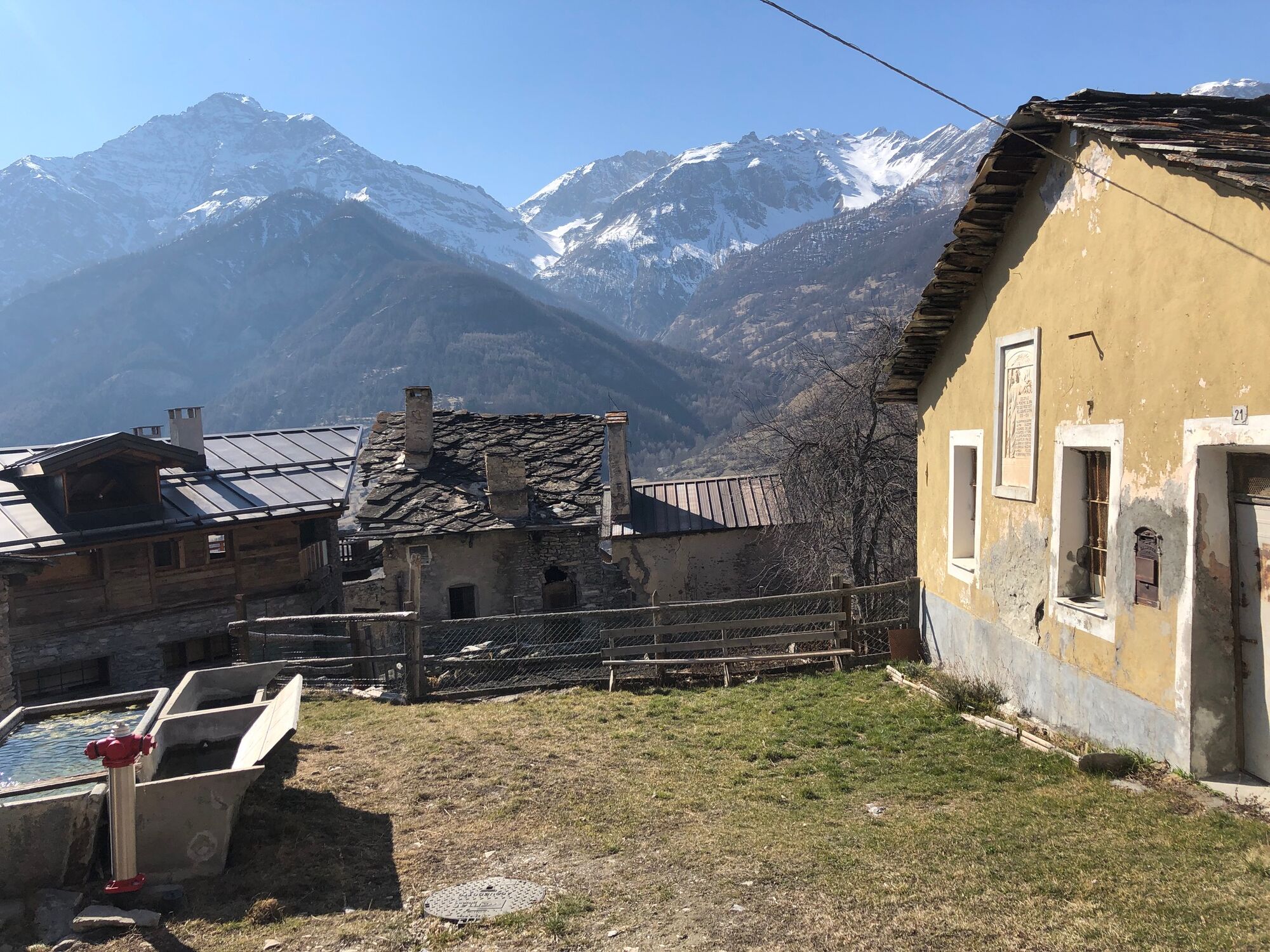
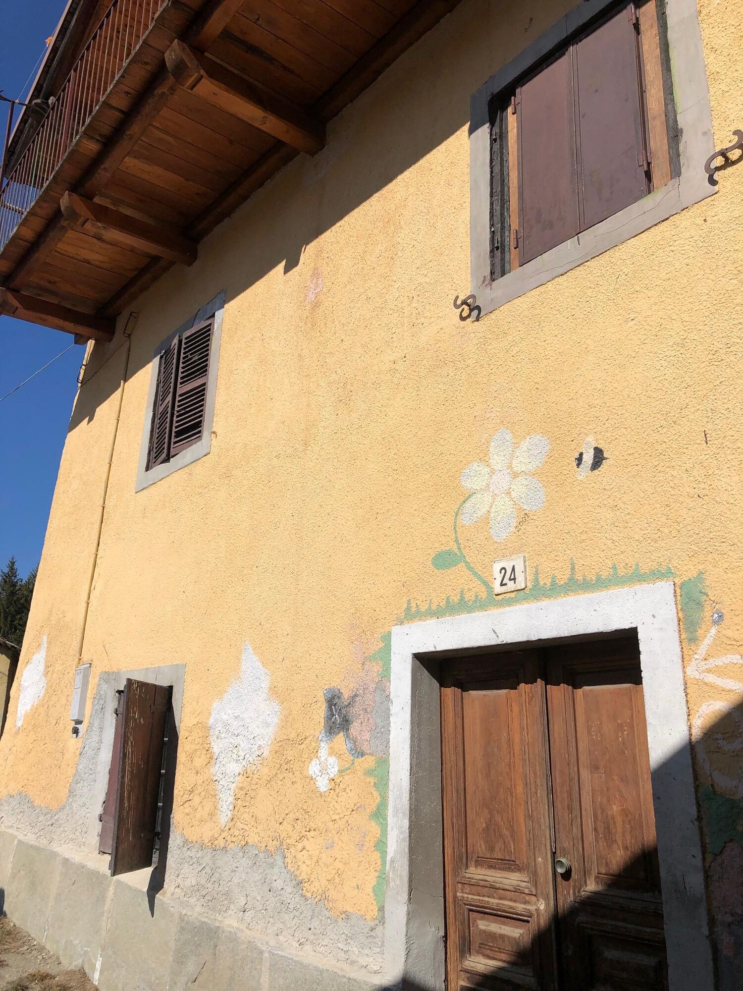
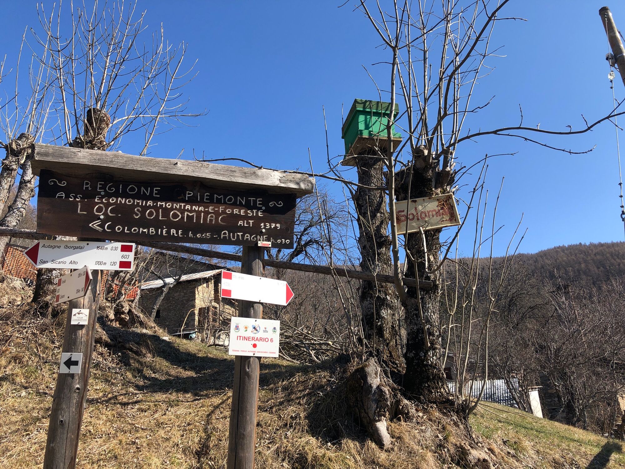
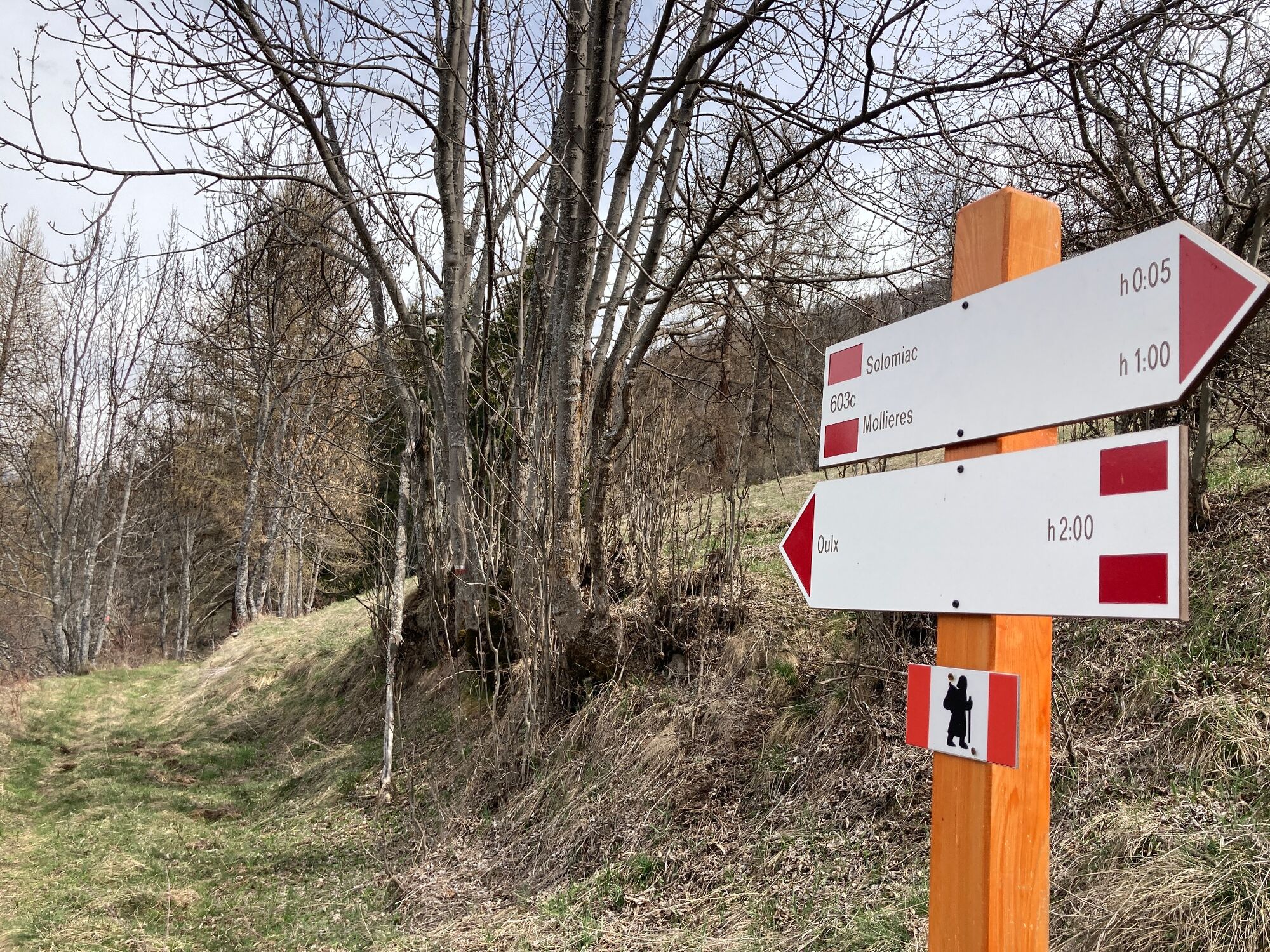
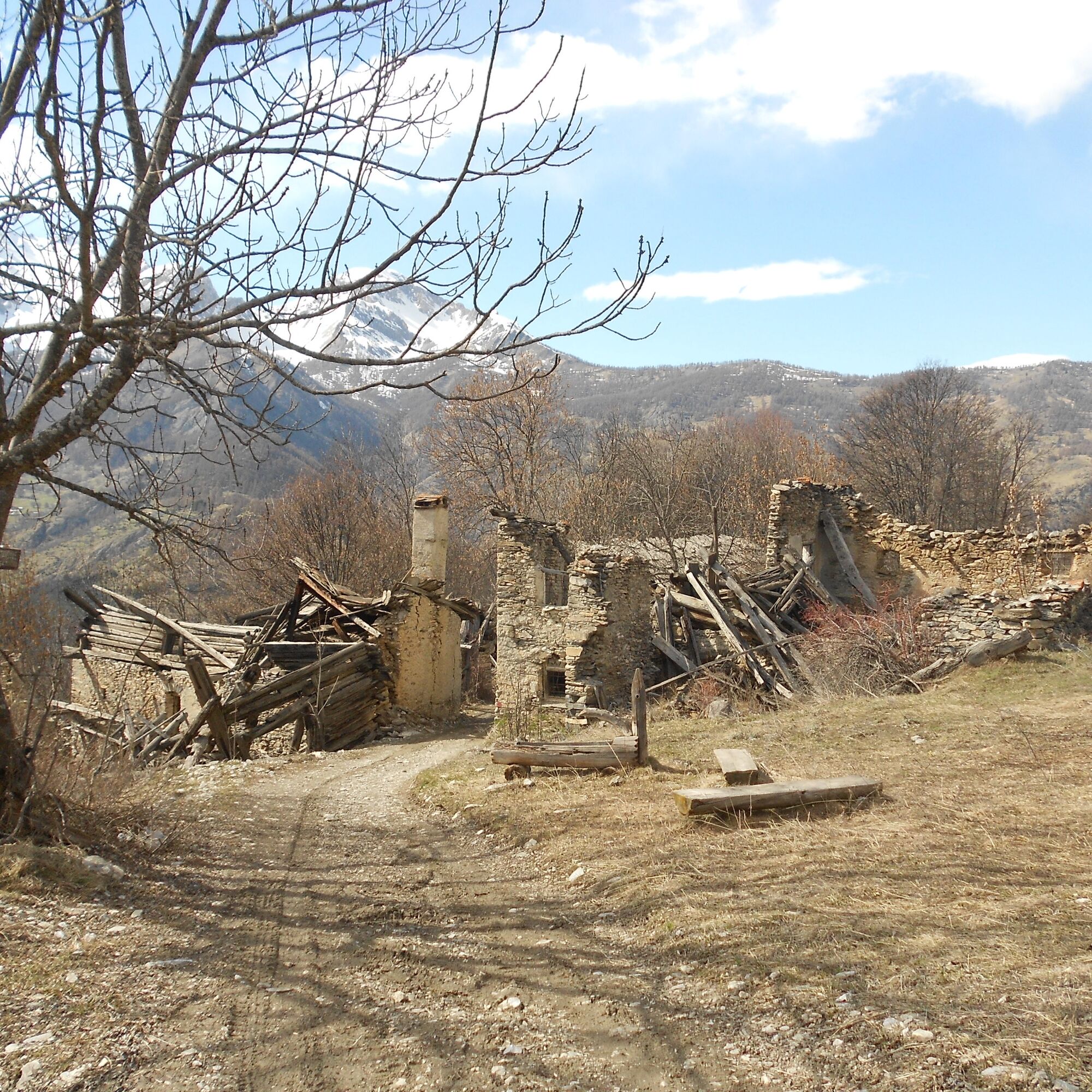
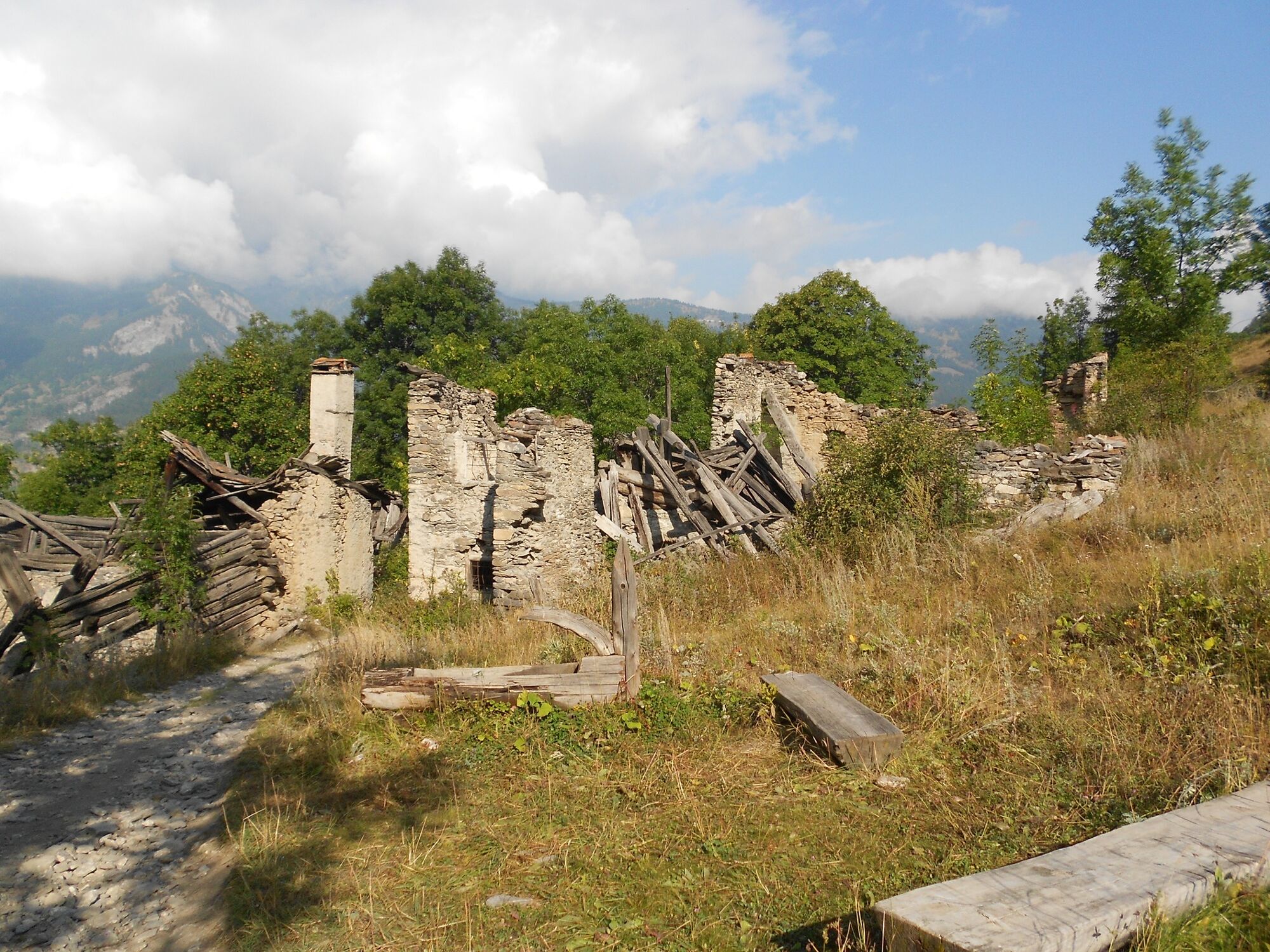
The trail begins in San Sicario Alto at the "Le Sellette" ski lift at an altitude of 1,720 m, where it is possible to park in the large square. Heading north, skirting the start of the lift, you descend slightly until you come to a fork in the road, still near the village, where you take the track that climbs to the right, signposted "La Madia". At an altitude of 1,780 m, after a distance of about 1.5 km, leave a path to the left that descends towards Molliere; a little further on, turn left and, ignoring the path that climbs to the right towards the "Rocce del Fraiteve", begin the descent, which is rather steep in places, towards Autagne, through pastures and sparse woods, reaching the hamlet at an altitude of 1,650 m after about 1 km, which appears mostly ruined and abandoned, but was certainly once populated and flourishing. Recently renovated, however, is the chapel of Sant'Anna, which stands near a large cross carved out of wood. Descending further for about 1 km, we cross the hamlet of Colombieres at an altitude of about 1,500 m, consisting of several renovated huts, and then reach the hamlet of Solomiac at 1,390 m. Here we leave the dirt road that descends to the right to state road 24 near Fenils, to cross the village downhill, which is very well maintained; the "Casa Cossul", a typical example of a house-fortress with basements and no less than four floors above ground, is worth seeing. Turning back, near the junction with the carriage road, take the path on the right with the Via Francigena symbol, which immediately crosses a wooden bridge over the Rio de la Grande Cote and leads to Molliere at an altitude of 1,350 metres, preceded by meadows and cleared fields. The hamlet, close to the state road, is inhabited all year round and has a fine old stone fountain. Just after the fountain, you turn abruptly to the left to climb a very steep stretch of asphalt followed by a stretch of dirt road until, after about 300 m. at a fountain, you leave the dirt road and take a track to the right that begins to climb steeply through the larch forest. At an altitude of 1,500 metres, instead of proceeding straight along a path that gets lost, you turn decisively to the left; after a short while you face a last long straight and steep stretch that at the end turns to the right, ending up at the edge of the village of San Sicario Alto. Turning left, the asphalt road climbs uphill among the houses, arriving at a hairpin bend; ride along it, and shortly after ignoring a fork to the left indicating the church, proceed straight ahead and then slightly to the left, passing in front of the shopping centre. The road bends slightly to the right, reaching the small bridge over the Envers stream, which you cross. Here you turn immediately to the left and climb for a few dozen metres, arriving again at the crossroads for the "La Madia" restaurant, which you met at the start; proceeding to the right you soon return to the car park.
.
Wear appropriate clothing and footwear for the environment and the season.
There are no refreshments along the route, so stock up on water and food
.
By car from Turin, follow signs for Tangenziale Nord in the direction of Trafori - Frejus. Take the A32 motorway towards Bardonecchia and exit at Oulx -Monginevro-Sestriere.
Continue on the S.S 24 towards Cesana Torinese and then on the S.P 23 towards Sestriere.
.
After 2 km turn left at the signpost for San Sicario.
.
Pass the first village of San Sicario Borgo and continue for about 3 km, arriving at San Sicario Alto
.
By using public transport, it is possible to walk the loop from Solomiac instead of San Sicario Alto (from the bus stop: 1 km walk - 20 minutes).
Turin P.N. train - Bardonecchia (Oulx-Cesana-Claviere-Sestriere stop) + Bus of Linea Arriva n.285 ("Fenils" stop)
.
Cross the SS24 and proceed on the dirt road towards Solomiac
.
Parking is available at the start of the 'Le Sellette' ski lift, in the car park.
- Before embarking on any excursion, it is advisable to consult weather bulletins or ask for information at the local tourist offices.
- It is good practice not to undertake a hike alone, always inform yourself of your destination.
- Do not throw rubbish into the environment but take it with you, picking up any left by others.
- The hiking times given are approximate and may vary depending on weather conditions and your own ability.
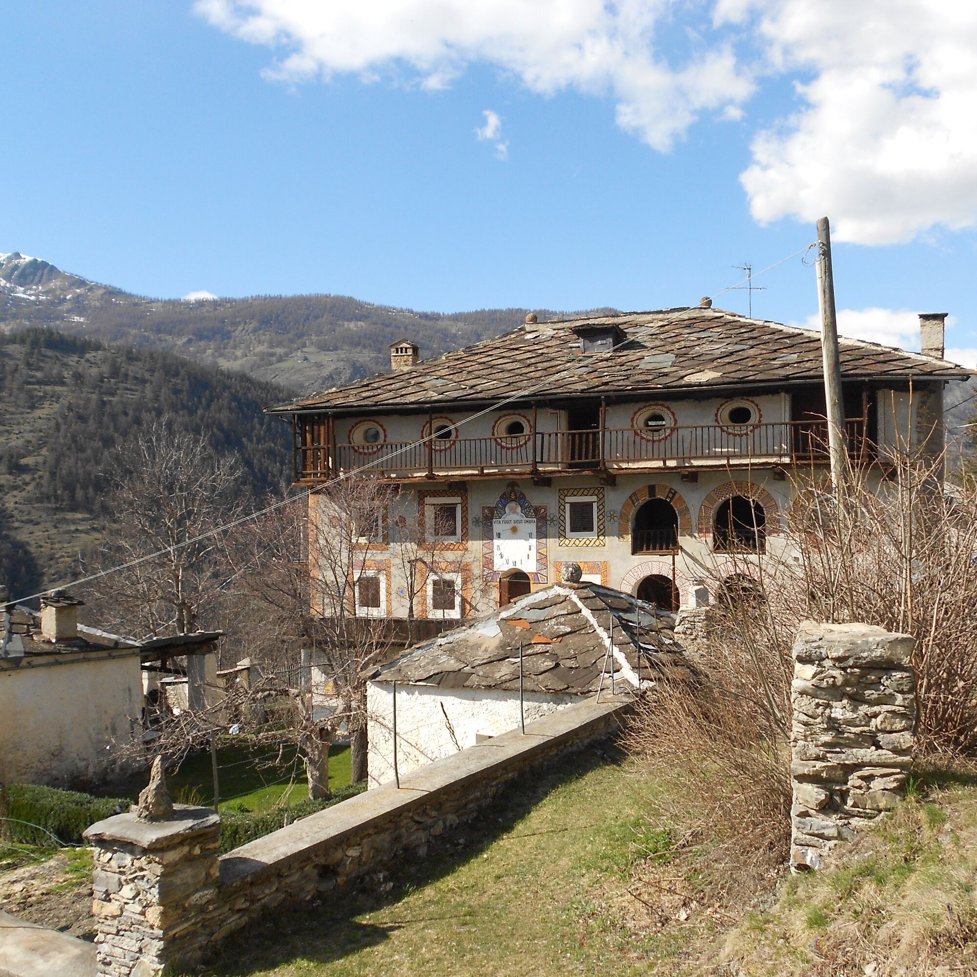
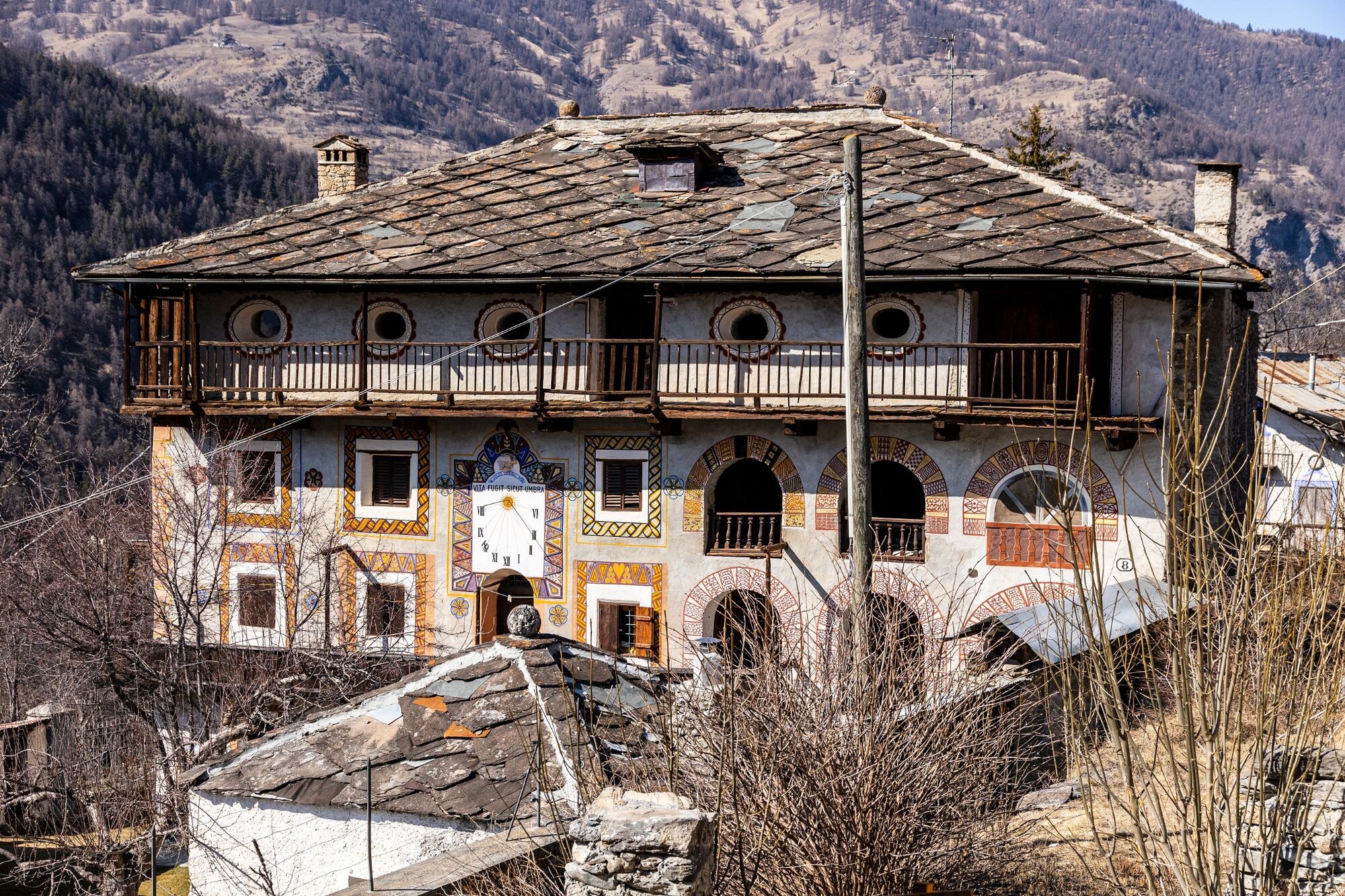
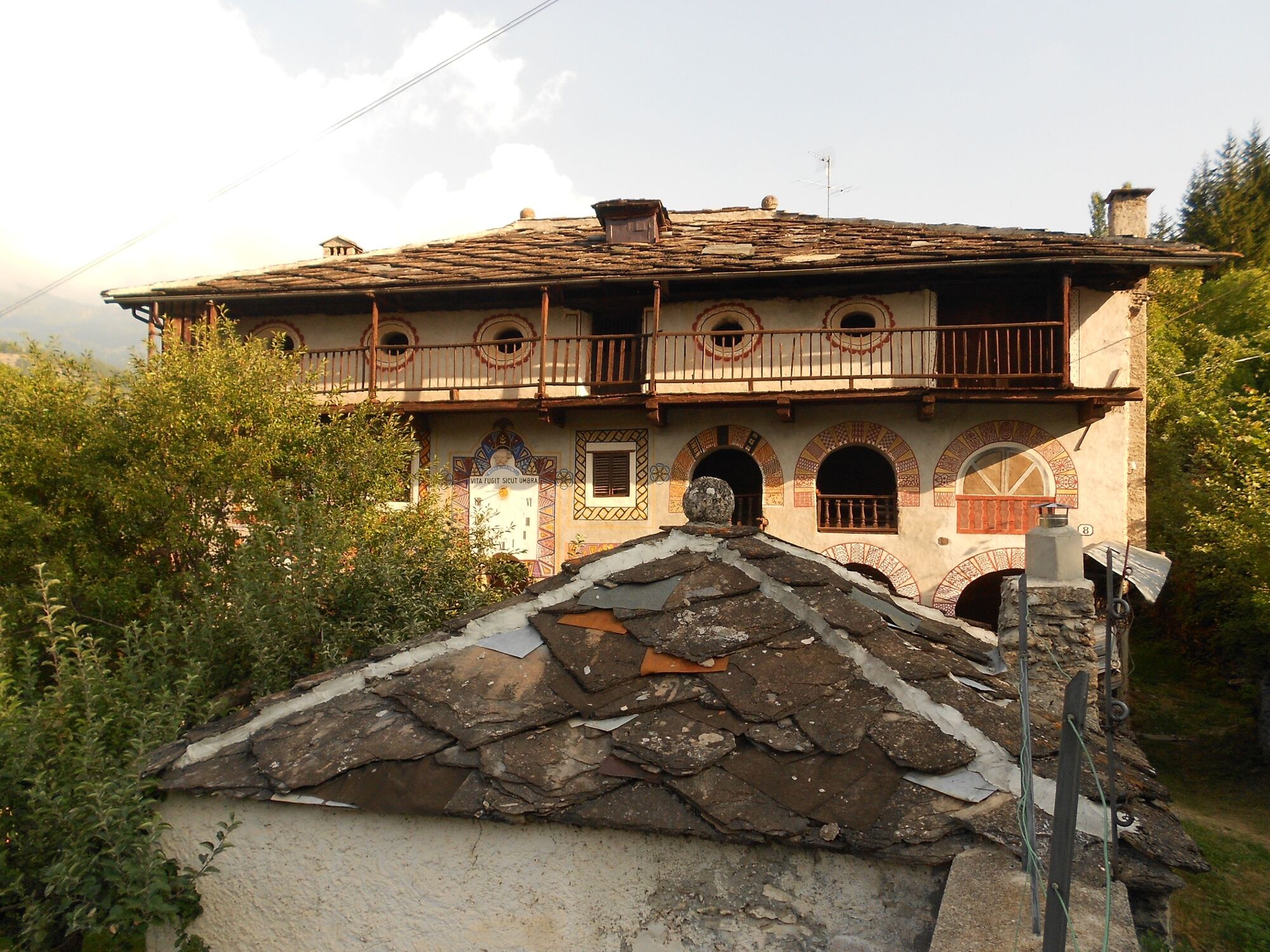
Each hamlet has its own history and tradition: points of interest are the Church of St. Anne in Autagne with its characteristic carved wooden cross, the chapel dedicated to St. Sebastian and St. Rocco, the old bakery and the Cossul family house in Solomiac.
Suosittuja retkiä naapurustossa
-
5,0
CESANA T.SE To Fenils (No. 48)
valoVaellus 4,29 km -
5,0
BARDONECCHIA Col des Acles - Passo della Mulattiera
raskasVaellus 6,57 km -
SESTRIERE Assietta Road
mediumMaastopyörä 43,3 km -
BARDONECCHIA Punta Colomion - Passo della Mulattiera - Pian del Colle Ring
raskasMaastopyörä 25,1 km -
BARDONECCHIA Rocce della Sueur - Tour jaune de Barabbas
mediumVaellus 4,12 km -
CESANA T.SE Val Thuras Valley
mediumVaellus 7,58 km -
La Via dei Saraceni (Sauze d'Oulx)
mediumMaastopyörä 33,6 km -
BARDONECCHIA Punta Colomion - Puys - Beaulard Ring
mediumMaastopyörä 24,7 km -
SAUZE DI CESANA Argentera Valley
mediumMaastopyörä 30,7 km -
Val Thuras and Tornior bivacco (Cesana T.se)
mediumMaastopyörä 37,5 km
Vaellus & jäljitys


Älä jää paitsi tarjouksista ja inspiraatiosta seuraavaa lomaasi varten.
Sähköpostiosoitteesi on lisätty postituslistalle.