


Monferrato degli Infernots: Stage 3


The departure of this stage from Cellamonte is in the wide crossing point between Via Barbano, the Ring Road and the provincial road SP 40. Take the SP40 for Rosignano, crossing part of the village and...
The departure of this stage from Cellamonte is in the wide crossing point between Via Barbano, the Ring Road and the provincial road SP 40. Take the SP40 for Rosignano, crossing part of the village and taking a short section of the provincial road SP38 before turning after about 1450 m from the departure to the right on the municipal road San Sebastiano and continue to Cascina Cavalla. After about 1000 m take provincial road SP42 towards Frassinello, travel it for 300 m and take a dirt trail on the right which runs parallel to provincial road SP42. We are now in Valle Ghenza white truffle area (it is possible to see truffle hunters at work here in autumn). Walking the trail parallel to provincial road SP42 for 3200 m, go past Cascina Bellero, to reach the SP (provincial road) for Moleto where you turn left at theValisenda equestrian centre, continue for 400 m and turn right in the direction of Frassinello on provincial road SP42. After 300 m, turn left onto a dirt road and then after another 300 m turn right onto a paved road and you meet the Church of S. Bernardo. 500 m further on, resume provincial road SP46 and continue towards the village of Frassinello.Having crossed Frassinello turn left on the road for the Castle of Lignano. Follow the road passing under the Castle of Lignano to reach the SP (provincial road), turn left and walk for 20 m then turn right onto the paved road for Camagna and cross the River Rotaldo. Turn onto the first dirt trail you meet on the left, and continue uphill for 800 m until the Church of S. Andrea, then turn right for Camagna on provincial road SP69 until the junction with provincial road SP68. Continue to the right, towards the centre of Camagna. Cross the town in the direction of Vignale. Arrived in Piazza Lenti looking upwards to the left you can admire the majestic 19th century cupola of the architect Crescentino Caselli that resumes the structure developed a few years earlier by his illustrious teacher Antonelli in the cupola of San Gaudenzio in Novara. Looking right, at the end of the square there is the birth home of the brothers Agostino and Pietro Lenti, respectively commander and member of the III Brigata Matteoti, Partisan band known as Banda Lenti.Having reached the cemetery, in correspondence of the park of the rimembranza, keep to the right and continue towards Vignale along provincial road SP68 for 800 mand turn at Cascina Patrucco, onto the dirt trail on the left downhill until you meet the trail at the valley bottom which you take to the right in the direction of Vignale. Follow the valley bottom trail parallel to provincial road SP68 for 1200 m then turn left onto the trail uphill that becomes paved in the last section. From here, to the left, you can admire the profile of the town of Camagna. Walk along the football pitch and you arrive in Vignale at the junction for Camagna. Take Via Rossi until you reach piazza Mezzadra that is the arrival point a few hundred metres on.

The departure of this stage from Cellamonte is at the wide crossing point between Via Barbano, the Circonvallazione and the SP40. Take the SP40 for Rosignano, crossing part of the town and taking a short stretch of the SP38 before turning right after about 1450 m onto the San Sebastiano municipal road and continuing up to the Cavalla farmhouse. After about 1000 m, take the SP42 towards Frassinello, follow it for 300 m and take a dirt path on the right that runs parallel to the SP42. Here we are in the Ghenza valley, a white truffle area (not infrequently in autumn you can observe the truffle hunters at work). Going along the path parallel to the SP42 for 3200 m you pass the Bellero farmhouse until you reach the SP for Moleto where you turn left at the Valisenda equestrian centre, continue for 400 m and turn right towards Frassinello on the SP42. After 300 m turn left onto a dirt road and then after another 300 m turn right onto an asphalt road, you come across the church of S. Bernardo, after 500 m you take the SP46 again and continue towards the town center of Frassinello. Once you have crossed Frassinello, turn left onto the road to the castle of Lignano. Follow the road passing under the castle of Lignano until you reach the SP, turn left and follow it for 20 m then turn right onto the asphalt road to Camagna and cross the Rotaldo stream. Turn onto the first dirt path you come across on the left, and continue uphill for 800 m until you reach the church of S. Andrea, then turn right towards Camagna on the SP69 until the junction with the SP68. Continue to the right towards the center of Camagna. You cross the town in the direction of Vignale. Once you arrive in Piazza Lenti, looking up to the left you can admire the majestic nineteenth-century dome by the architect Crescentino Caselli which takes up the structure developed a few years earlier by his illustrious master Antonelli in the dome of San Gaudenzio in Novara. Looking to the right at the end of the square is the birthplace of the brothers Agostino and Pietro Lenti, respectively commander and member of the III Matteotti Brigade, a partisan band known as the Lenti Band. Once you reach the cemetery, near the Parco della Rimembranza, keep right and continue towards Vignale along the SP68 for 800 m until you turn at the height of the Paltrucco c.na, on the dirt path on the left downhill until you cross the path at the bottom of the valley which you take on the right in the direction of Vignale. Follow the valley floor path parallel to the SP68 for 1200 m then turn left onto an uphill path which becomes asphalted in the last stretch. From here you can admire the profile of the town of Camagna on the left. You walk alongside the football field and arrive in Vignale at the crossroads for Camagna. Take via Rossi until you reach Piazza Mezzadra after about a hundred meters, the arrival point.
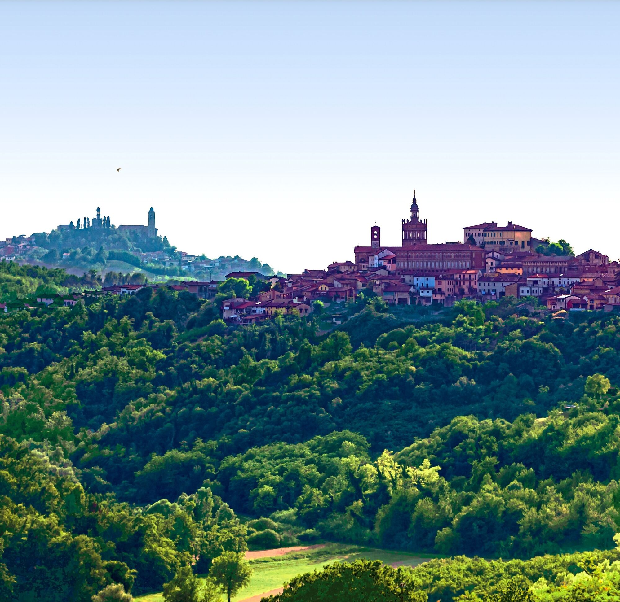
Along the stage: Valle Ghenza (white truffle area), majestic 19th century dome by the architect Crescentino Caselli, birthplace of the brothers Agostino and Pietro Lenti (Banda Lenti). In Frassinello: 17th century chapel of San Bernardo, church dedicated to San Giuseppe (1600), parish church of the Assumption, Lignano castle, 16th century church of Sant'Anna, Sanctuary Beata Vergine delle Grazie (1600), medieval castle.
Suosittuja retkiä naapurustossa
-
Sentiero "Vigneti e Infernot" - Sentiero 726 in mountain bike
Maastopyörä 14,1 km -
Sentiero "Vigneti e Infernot" - Sentiero 726 in camminata
Pyhiinvaellusreitti 14,1 km -
Sentiero panorami e ciminiere di Ozzano - Sentiero 738 in mountain bike
Maastopyörä 7,20 km -
Sentiero panorami e ciminiere di Ozzano - Sentiero 738 in camminata
Pyhiinvaellusreitti 7,20 km -
Sentiero le Vecchie Fonti - Sentiero 860 in mountain bike
Maastopyörä 14,4 km -
Sentiero le Vecchie Fonti - Sentiero 860 in camminata
Pyhiinvaellusreitti 14,4 km -
Sentiero Pieve di San Giovanni - Santuario di Crea - Sentiero 727 in mountain bike
Maastopyörä 27,3 km -
Sentiero 700 - SVC Tratto Crea - Casale in mountain bike
Maastopyörä 25,2 km -
Sentiero 700 - SVC Tratto Crea - Casale in camminata
Pyhiinvaellusreitti 25,2 km -
Sentiero i Colli di Conzano - Sentiero 735 in mountain bike
Maastopyörä 5,96 km
Vaellus & jäljitys


Älä jää paitsi tarjouksista ja inspiraatiosta seuraavaa lomaasi varten.
Sähköpostiosoitteesi on lisätty postituslistalle.