Via dei Briganti | Stage 3 Villafranca d'Asti - Roatto
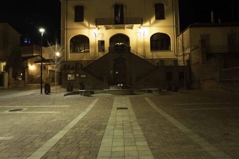
The route starts from the concentric of Villafranca, where you can visit the beautiful baroque church of Castellamonte. Cross the state road and the highway via an underpass. The route proceeds along a...
The route starts from the concentric of Villafranca, where you can visit the beautiful baroque church of Castellamonte. Cross the state road and the highway via an underpass. The route proceeds along a road parallel to the motorway, then heads north into the Valtriversa, so called for the Traversola stream that once fed many mills in the area. You can opt for the 3A variant that leads to the Via dell'acqua and San Paolo Solbrito. Continuing along stage 3, cross cultivated fields and groves until the junction with the provincial road 10, from which you can climb to Maretto through a country road. Maretto has Roman origins and is characterized by the parish church, built in the eighteenth century and dedicated to SS. Maria and Michele, and from the church of the S. Croce, built in the XVII century and already seat of the brotherhood of the "battuti". Crossing the center you reach Roatto, the final point of the stage, where you can choose variant 3A towards the Via dei Santi and Cortandone or variant 3B. Roatto has a war-free history and is characterized by its parish church of Saints Michael and Radegonda, built on the site of an older church.

A partire dal concentrico di Villafranca, si abbandona il nucleo principale attraversando prima la strada statale e poi, tramite un sottopasso, l'autostrada. Il primo tratto di cammino percorre una strada bianca parallela all'autostrada stessa, quindi si prosegue fino ad arrivare in prossimità della regione Crocetta per poi dirigersi verso nord, entrando nell'ambiente della Valtriversa. In corrispondenza del torrente Traversola possiamo intraprendere la variante 3A che si collega alla Via dell'acqua e quindi a San Paolo Solbrito. Continuiamo lungo la tappa 3 e percorriamo la vallata, attraversando campi coltivati e piccole aree boscate sino ad arrivare all'incrocio con SP 10, dalla quale possiamo risalire sino ad arrivare al concentrico di Maretto, attraverso una strada campestre che porta direttamente al centro. Attraversando il centro storico si prosegue sino ad arrivare al vicinissimo nucleo di Roatto, punto terminale della terza tappa. Da qui possiamo intraprendere la variante 3A di collegamento alla Via dei Santi e al comune di Cortandone oppure la variante 3B.
Suosittuja retkiä naapurustossa
Älä jää paitsi tarjouksista ja inspiraatiosta seuraavaa lomaasi varten.
Sähköpostiosoitteesi on lisätty postituslistalle.


