Darlingerode - Klosterkirche St. Peter und Paul / Schlosskirche - Ilsenburg (Harz) - Ilsestein
medium
Navigoi osoitteessa
Navigoi osoitteessa
Hanki tämä kiertue matkapuhelimeesi
Darlingerode - Klosterkirche St. Peter und Paul / Schlosskirche - Ilsenburg (Harz) - Ilsestein
medium
Vuoristovaellus
16,10
km
Skannaa QR-koodi ja aloita navigointi bergfex -sovelluksessa.

Vaellus & jäljitys


Darlingerode - Klosterkirche St. Peter und Paul / Schlosskirche - Ilsenburg (Harz) - Ilsestein
medium
Etäisyys
16,10
km
Kesto
04:54
h
Nousu
254
hm
Merenpinnan taso
275 -
549
m
Track download
Darlingerode - Klosterkirche St. Peter und Paul / Schlosskirche - Ilsenburg (Harz) - Ilsestein
medium
Vuoristovaellus
16,10
km


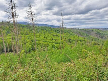
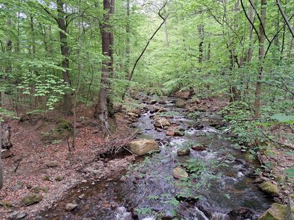
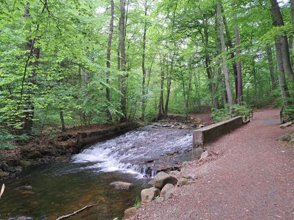
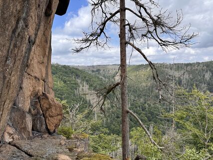
Kuvia käyttäjistämme
-
 © Sabine KrohnLuotu 05.05.2024
 -
 © Sabine KrohnLuotu 05.05.2024
 -
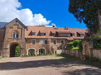
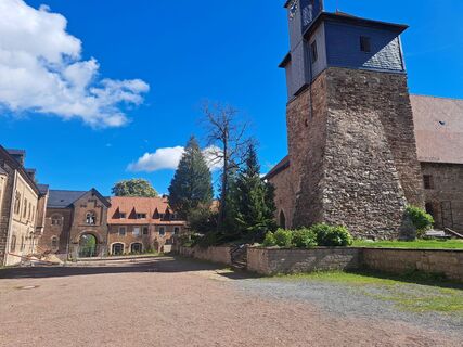
 © Sabine KrohnLuotu 04.05.2024
 -
 © Sabine KrohnLuotu 04.05.2024
 -
 © Sabine KrohnLuotu 04.05.2024
 -
 © Sabine KrohnLuotu 04.05.2024
 -
 © Sabine KrohnLuotu 04.05.2024
 -
 © Sabine KrohnLuotu 04.05.2024
 -
 © Sabine KrohnLuotu 04.05.2024
 -
 © Dr. Rike MaurerLuotu 26.07.2025
 -
 © Dr. Rike MaurerLuotu 26.07.2025
 -
 © Dr. Rike MaurerLuotu 26.07.2025
 -
 © Dr. Rike MaurerLuotu 26.07.2025


Reitti
Oehrenfeld
(290 m)
Kylä
1,1 km
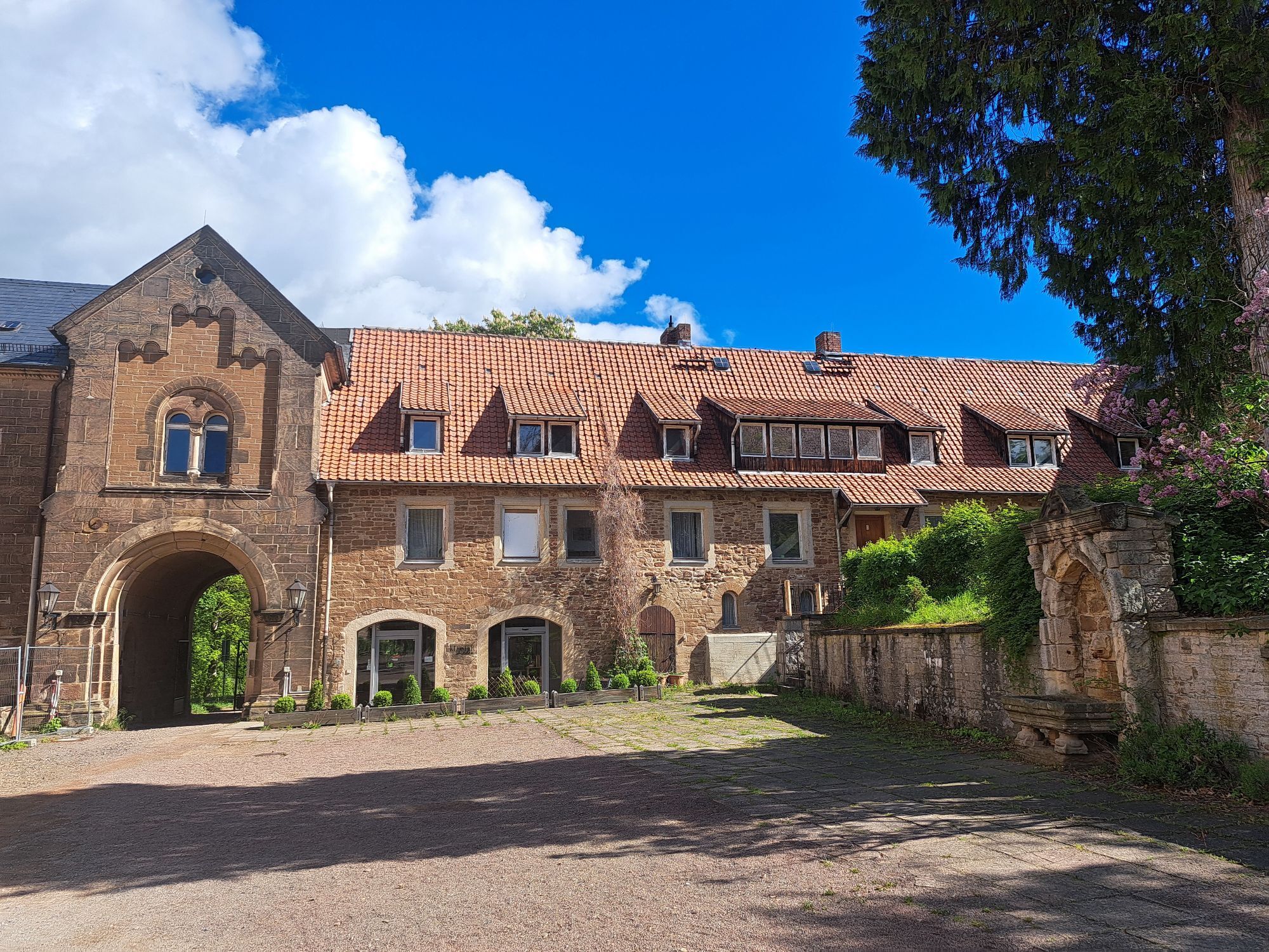
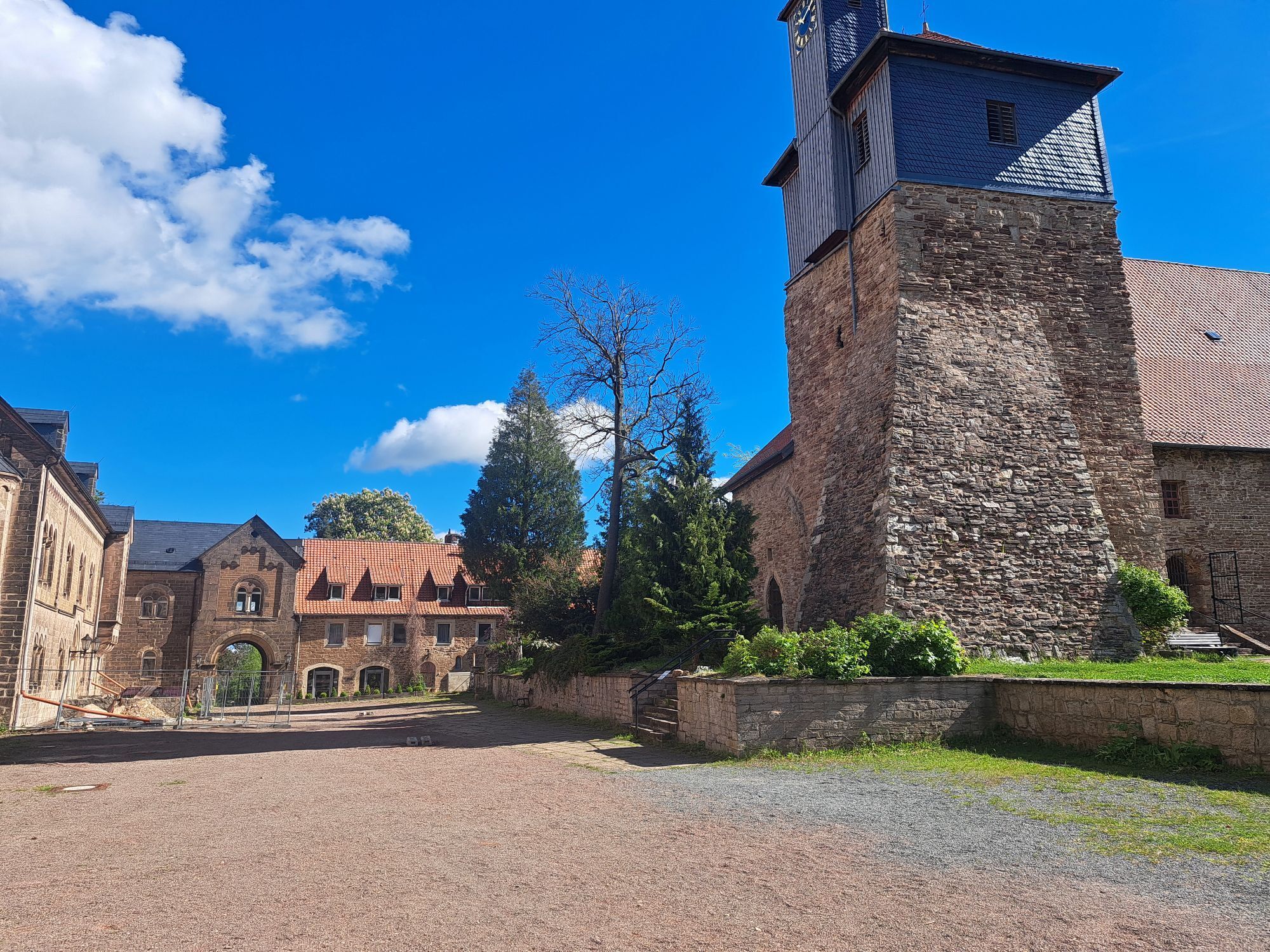
Klosterkirche St. Peter und Paul / Schlosskirche
(285 m)
Jumalanpalveluspaikka
4,7 km
Ilsenburg (Harz)
(250 m)
Kaupunki
4,7 km
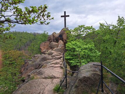
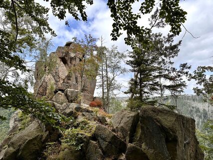
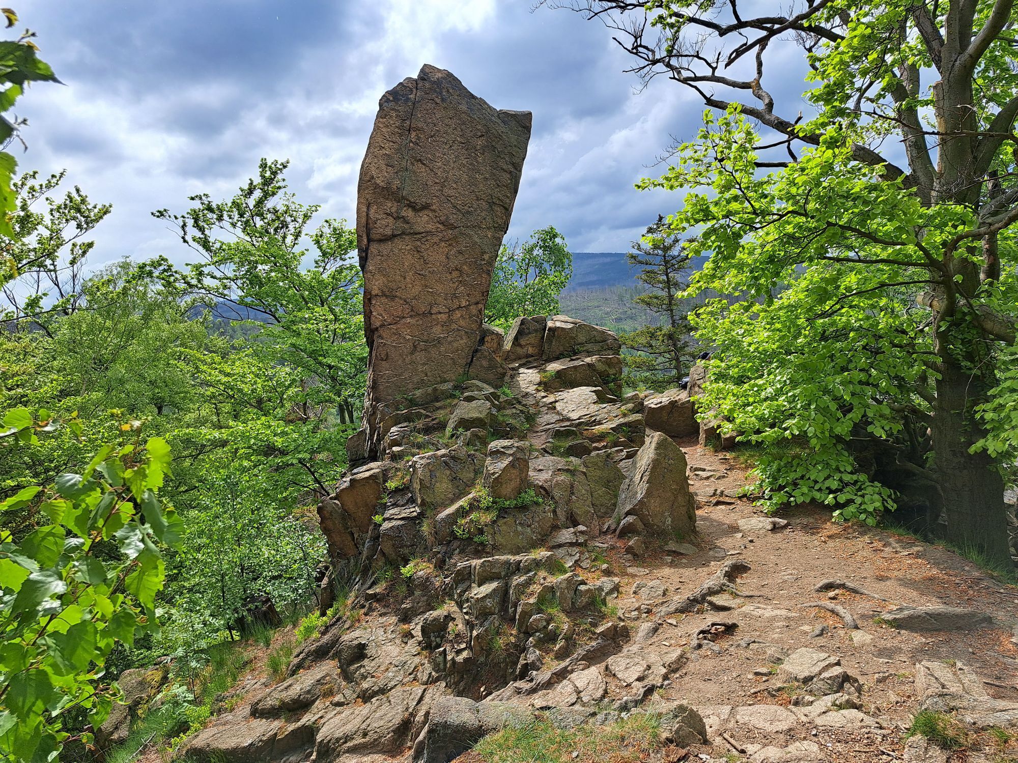
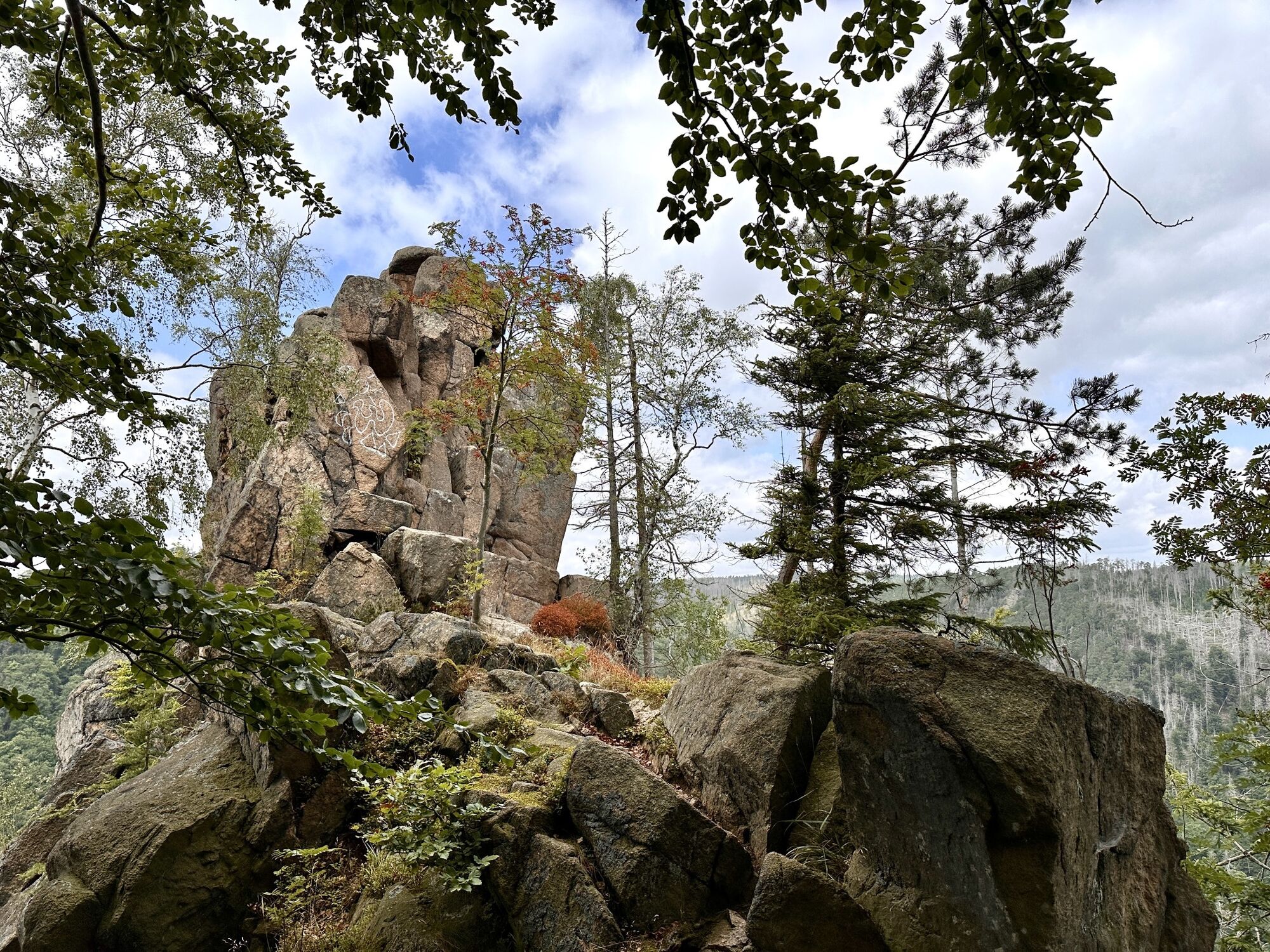
Ilsestein
(473 m)
Summit
8,8 km
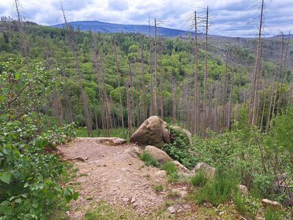
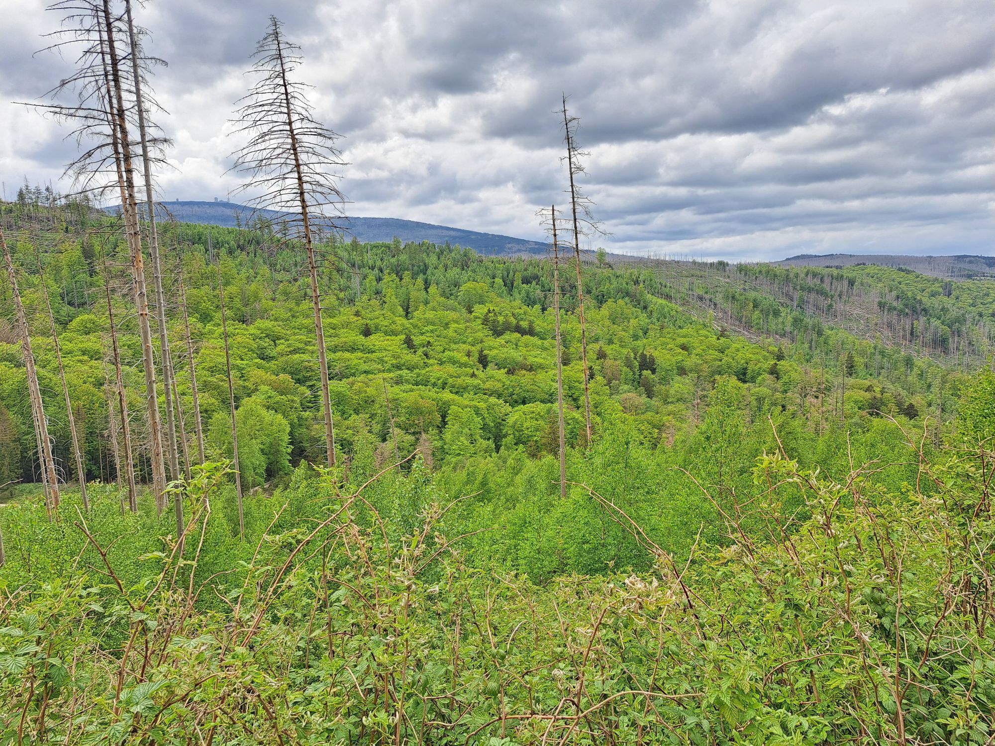
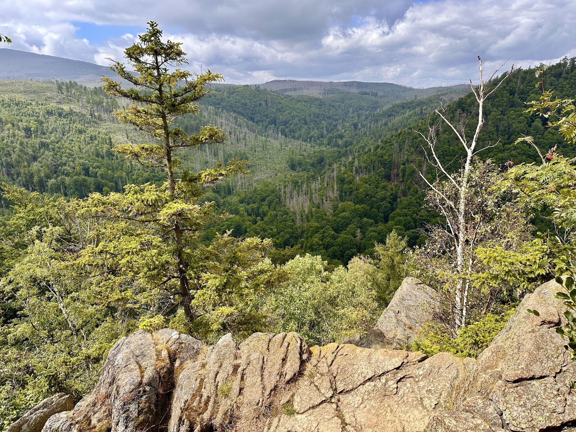
Ilsenburg-Blick
(536 m)
Näkökulma
9,8 km
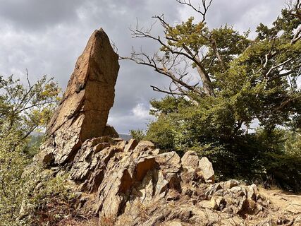
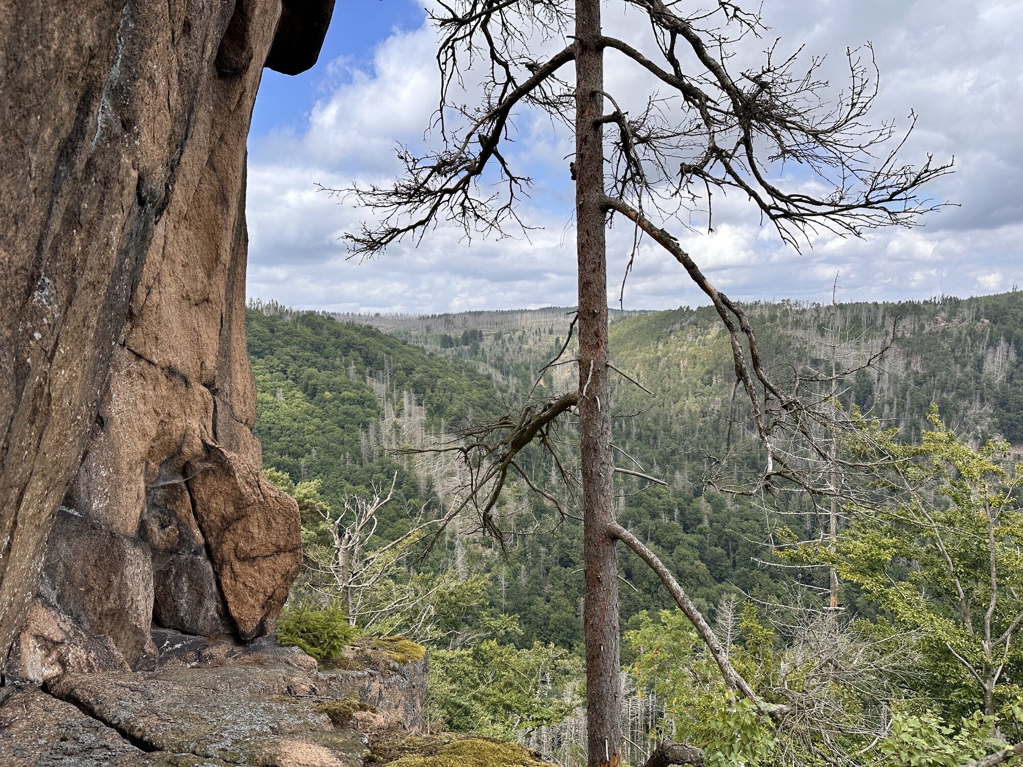
Aussichtspunkt Paternosterklippe
(521 m)
Näkökulma
9,9 km
Waldgasthaus Plessenburg
(549 m)
Ravintola
11,4 km
Reitti
Darlingerode - Klosterkirche St. Peter und Paul / Schlosskirche - Ilsenburg (Harz) - Ilsestein
medium
Vuoristovaellus
16,10
km
Oehrenfeld
(290 m)
Kylä
1,1 km
Klosterkirche St. Peter und Paul / Schlosskirche
(285 m)
Jumalanpalveluspaikka
4,7 km
Ilsenburg (Harz)
(250 m)
Kaupunki
4,7 km
Seilfahrt
(304 m)
Leikkipaikka
5,7 km
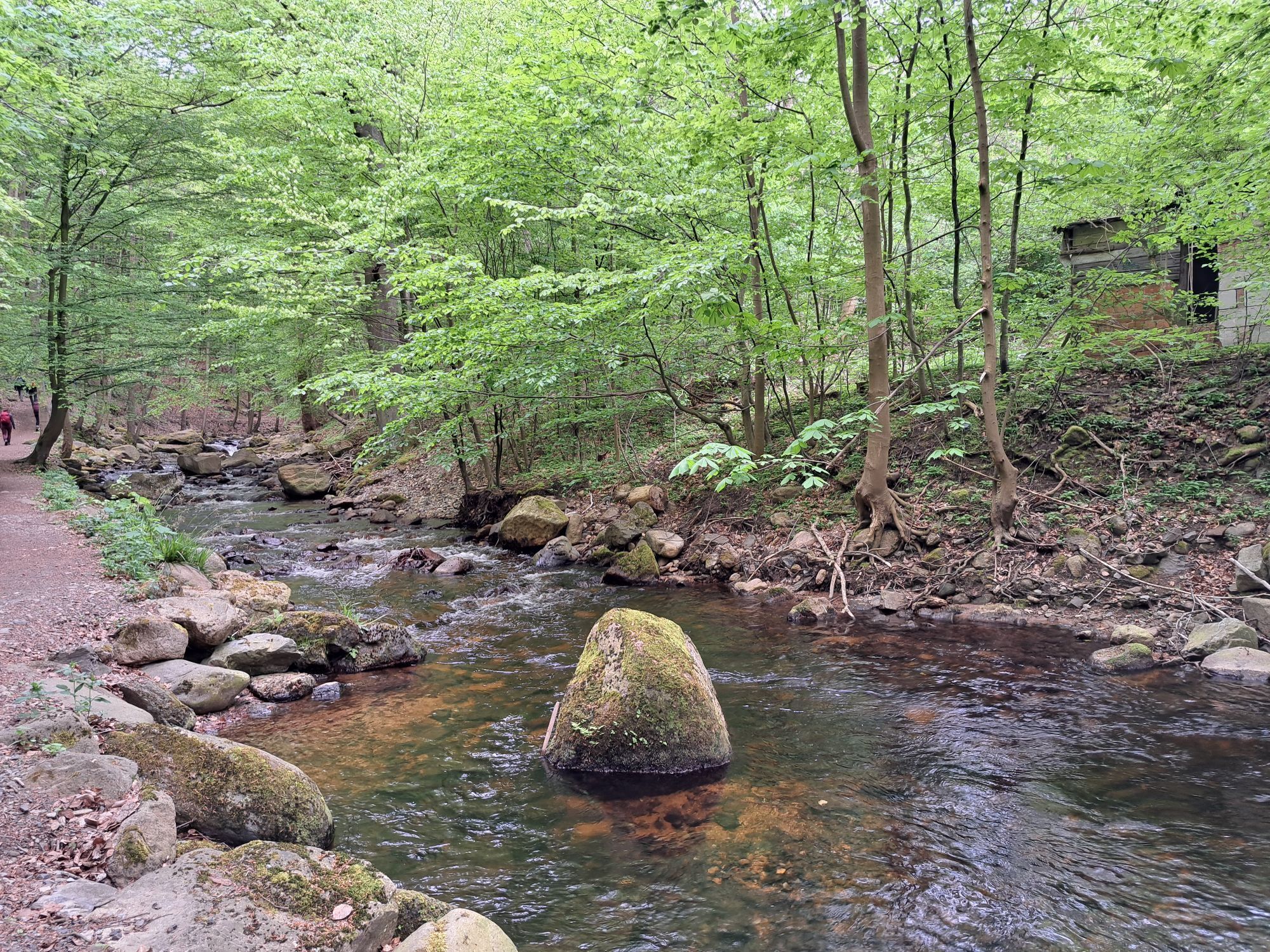
Prinzess-Ilse-Quelle
(328 m)
Lähde
6,5 km
Ilsestein
(473 m)
Summit
8,8 km
Ilsenburg-Blick
(536 m)
Näkökulma
9,8 km
Aussichtspunkt Paternosterklippe
(521 m)
Näkökulma
9,9 km
Waldgasthaus Plessenburg
(549 m)
Ravintola
11,4 km
Oehrenfeld
(290 m)
Kylä
15,8 km
Kirjoittaja
Toimittanut Bergfex Tour Generator
Jaa kiertue
Darlingerode - Klosterkirche St. Peter und Paul / Schlosskirche - Ilsenburg (Harz) - Ilsestein
medium
Vuoristovaellus
16,10
km
Virhe
On tapahtunut virhe. Yritä uudelleen.
Viimeksi jäljitetty
3 viikkoa sitten
Ei vielä arvosteluja
Suosittuja retkiä naapurustossa
-
4,8
Ilsenburg - Brocken - Ilsenburg
mediumVaellus 23,0 km -
4,6
Trail Brocken über Ecklochstieg Schierke
raskasVaellus 12,9 km -
5,0
Wernigerode, Deutschland
mediumVaellus 15,5 km -
4,5
durchs Ilsetal zur Plessenburg
mediumVaellus 13,7 km -
4,5
Schierke - Brocken und zurück
mediumVaellus 15,3 km -
3,8
vom Oderteich zur Achtermannshöhe
mediumVaellus 11,3 km -
4,5
Schierke / Brocken / Schierke
raskasVaellus 15,2 km -
4,0
Brockentour
valoVaellus 18,8 km -
von Romkerhall zum Kästehaus
mediumVaellus 8,93 km -
5,0
von Königskrug zum Wurmberg
mediumVaellus 13,6 km

Vaellus & jäljitys

Yli 550.000 retkiehdotusta, yksityiskohtaiset kartat ja intuitiivinen reittisuunnittelija tekevät sovelluksesta kaikkien luonnonystävien pakollisen työkalun.

Älä jää paitsi tarjouksista ja inspiraatiosta seuraavaa lomaasi varten.
Tilaa uutiskirje
Virhe
On tapahtunut virhe. Yritä uudelleen.
Kiitos rekisteröinnistä
Sähköpostiosoitteesi on lisätty postituslistalle.
Kiertueet kaikkialla Euroopassa
Itävalta
Sveitsi
Saksa
Italia
Slovenia
Ranska
Alankomaat
Belgium
Puola
Liechtenstein
Tšekki
Slovakia
Espanja
Kroatia
Bosnia ja Hertsegovina
Luxemburg
Andorra
Portugali
Islanti
Yhdistynyt kuningaskunta
Irlanti
Kreikka
Albania
North Macedonia
Malta
Norja
Montenegro
Moldova
Kosovo
Unkari
San Marino
Romania
Viro
Latvia
Valko-Venäjä
Kypros
Liettua
Serbia
Bulgaria
Monaco
Tanska
Ruotsi
Suomi