


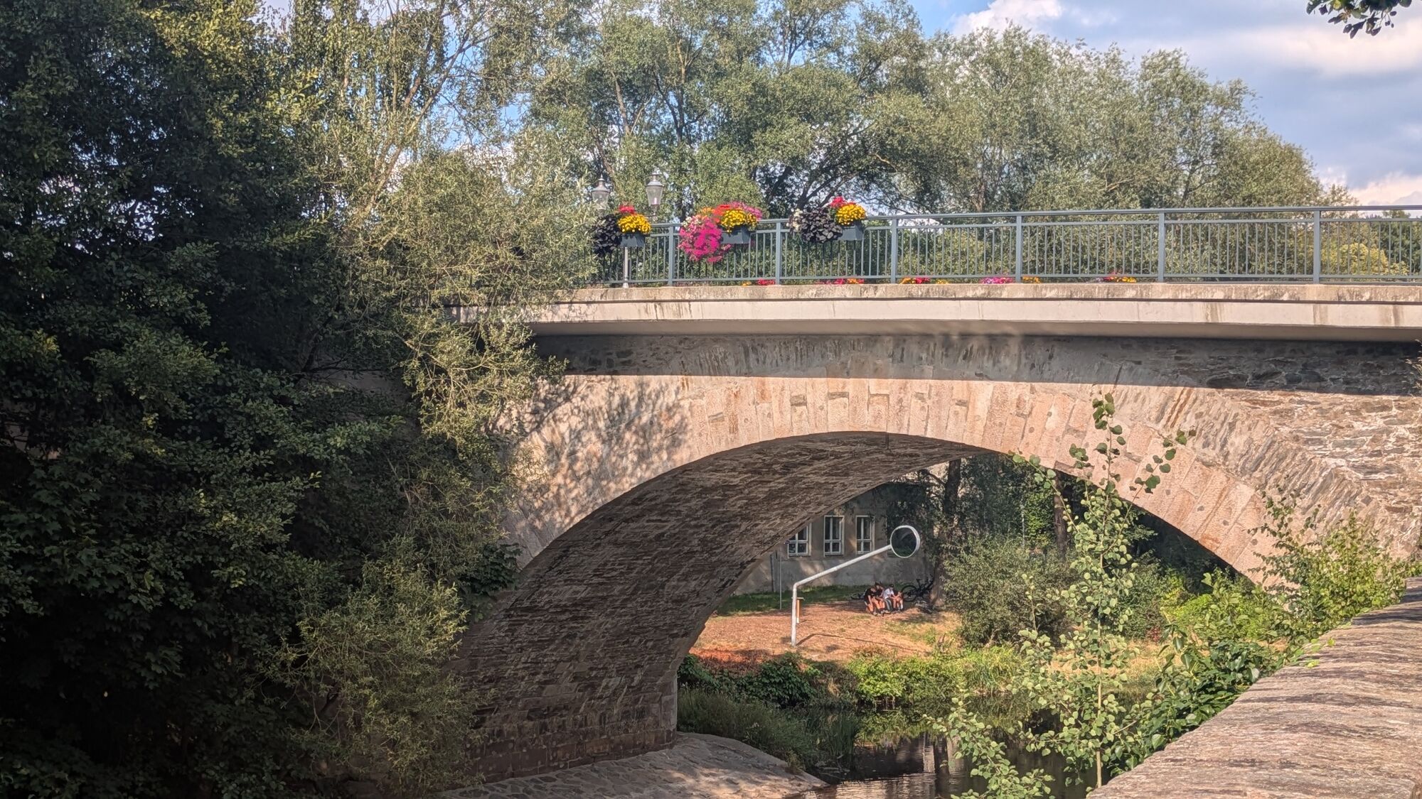
Via Mala


The circular walk is marked in yellow and starts at the Steinbogenbrücke bridge. From here, the signs lead towards Wildeck Castle, the historic old town and the Bodemerkanzel, which is a popular vantage...
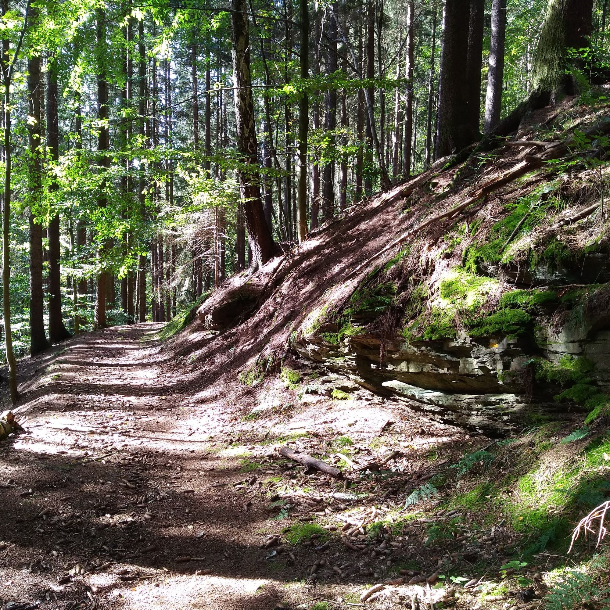
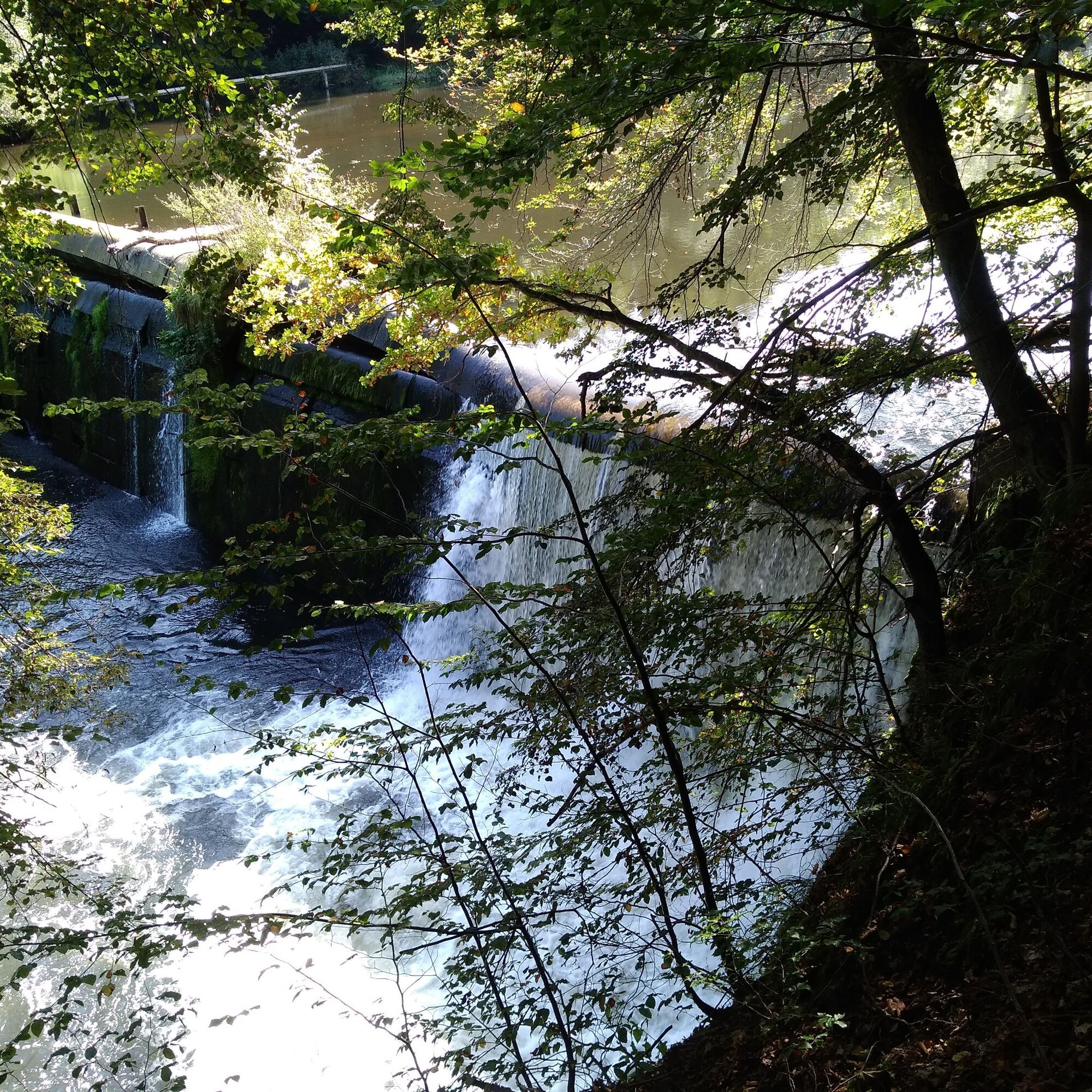
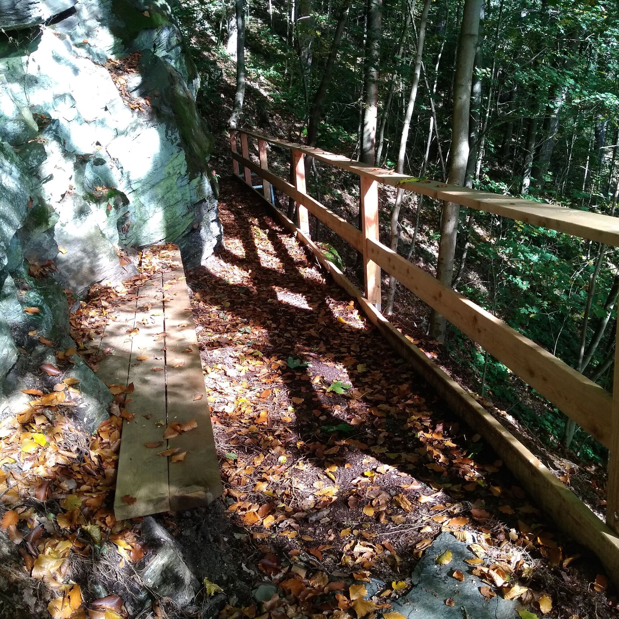
The circular walk is marked in yellow and starts at the Steinbogenbrücke bridge. From here, the signs lead towards Wildeck Castle, the historic old town and the Bodemerkanzel, which is a popular vantage point high above the Zschopau. A pleasant path along the edge of the forest leads to the turn-off to the "Via Mala". This initially wide path becomes increasingly narrow and rocky, sometimes exposed, and winds its way down into the wild and romantic Zschopau valley. Along the idyllic riverside path, the route follows the river back to the starting point, with the historic Stülpnerbrunnen fountain, the weir at the "Bodemerwehr" and the crossing of the imposing B174 viaduct as striking landmarks. After passing the former Bodemer spinning mill, the Bodemer manor house and the baroque coach house with its beautiful Renaissance portal are a feast for the eyes.
Open this route on komoot.

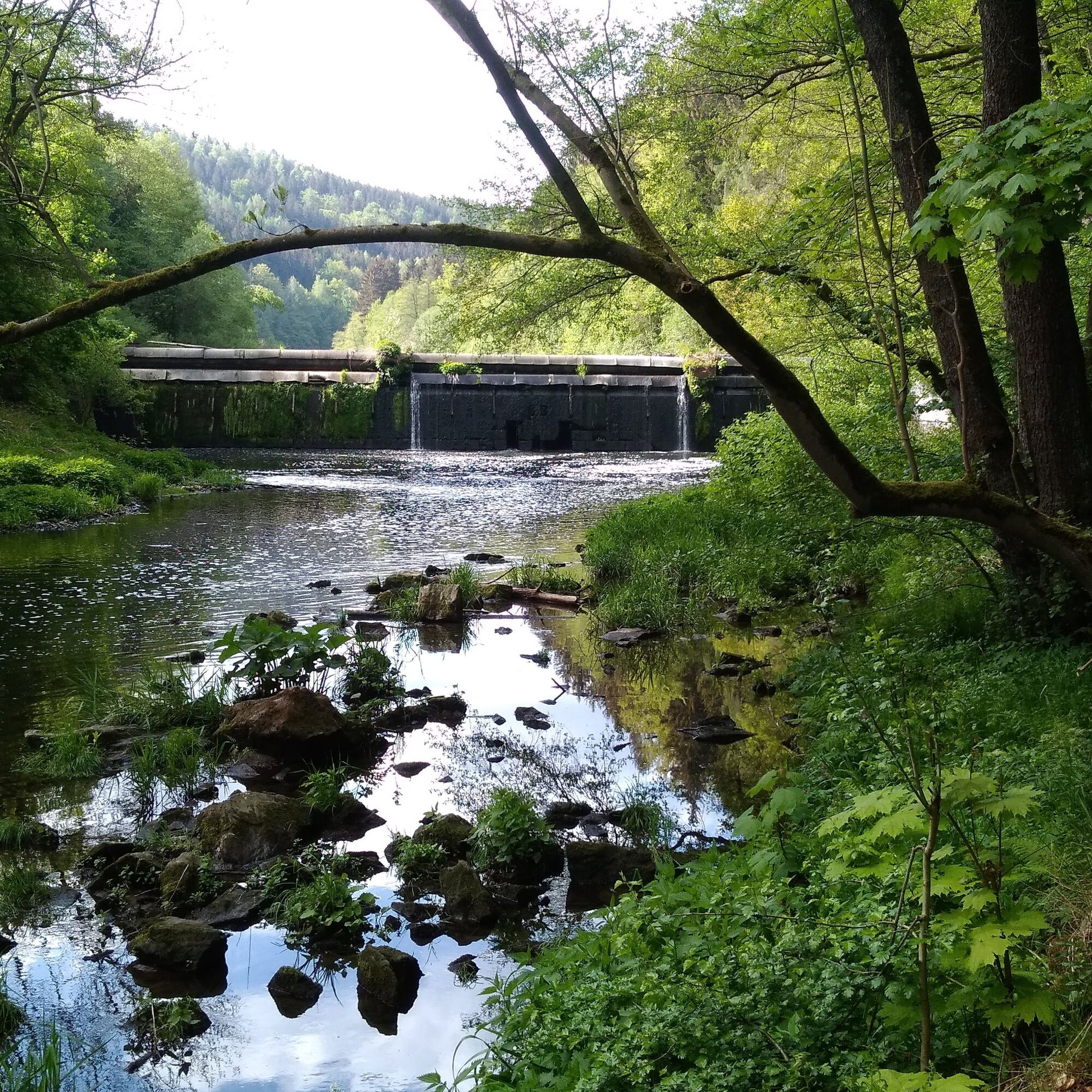
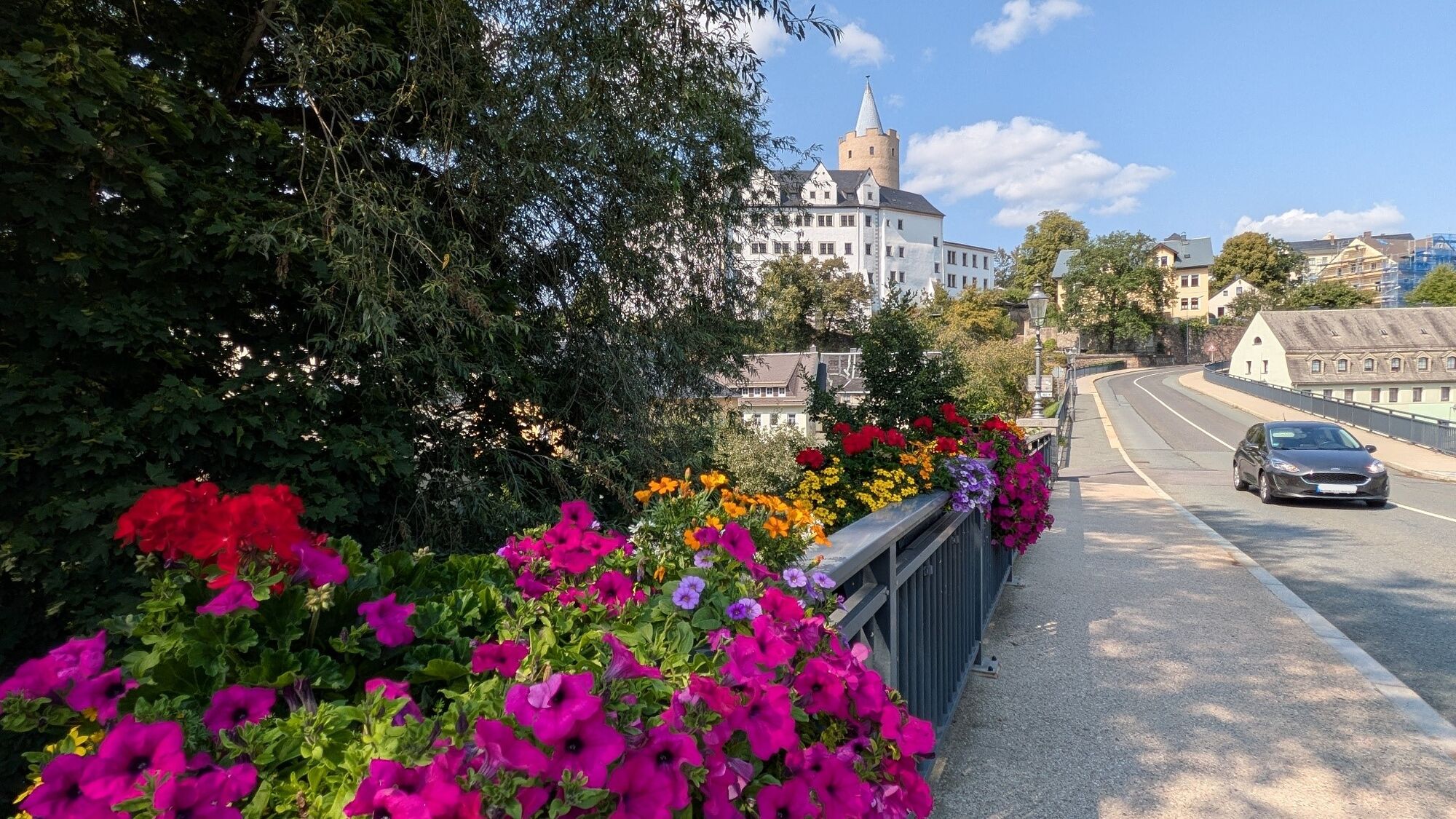
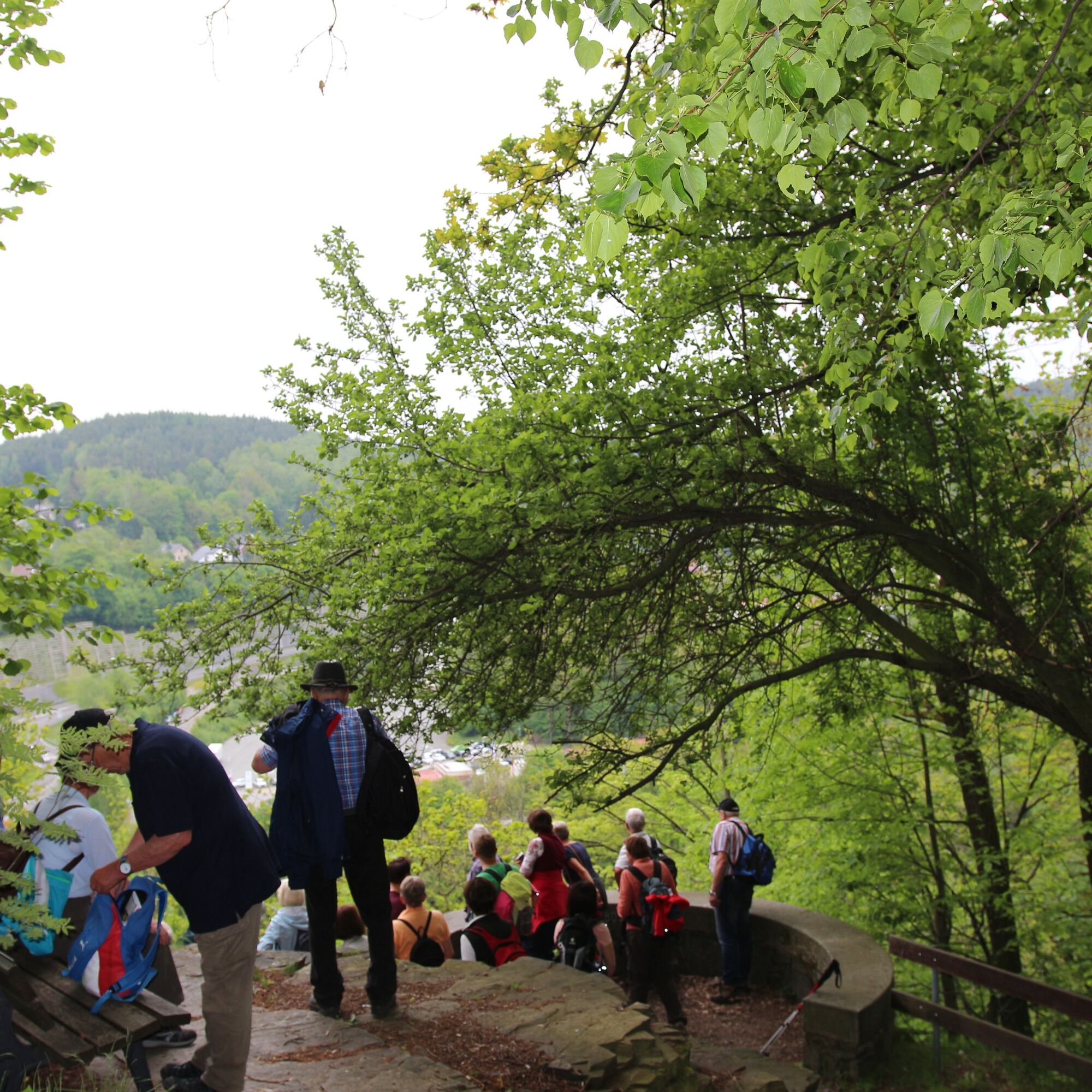
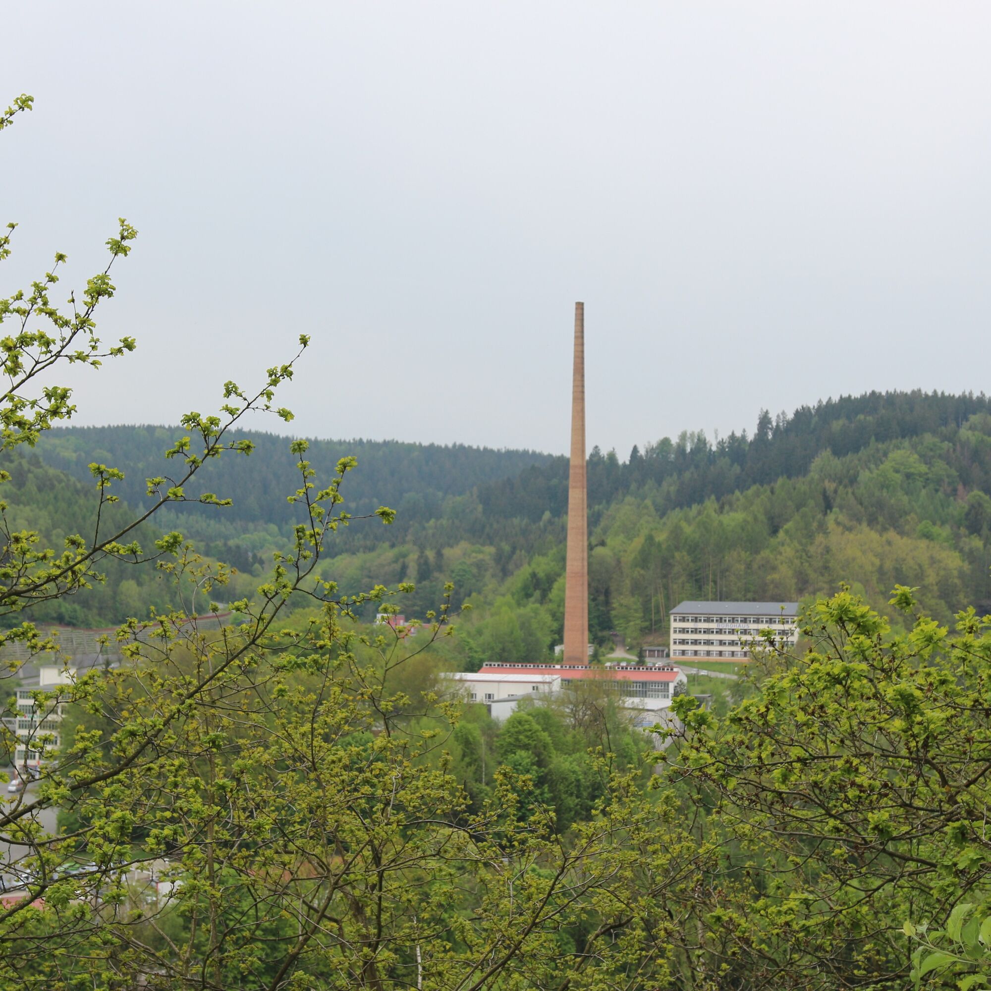
We start at the "Zschaap mei Geeß" bridge memorial on the corner of Lange Straße and Bahnhofstraße in the direction of Wildeck Castle. At the end of the Zschopau bridge, turn left towards the castle. Cross the castle parking lot via the narrow Pfarrgässchen to the church of St. Martin. Take the stairs next to the church to get to Johannisstraße. Follow Wiesenstraße straight ahead and keep left at the fork (Bergstraße). Follow the signs via Feldgasse to Bodemersiedlung. At the end of this road, take the steps, cross Thumer Straße and follow the forest path. Immediately after the wooden bridge, turn right and follow the path under the B174 bridge until you reach the Bodemerkanzel viewing point via the hiking trail. The view extends over the river and the town of Zschopau, over the former DKW-MZ factory and the former cotton mill. The B174 bridge you can see has a span of 407m. Follow the path at the edge of the forest along the field and turn left into the forest after a few minutes' walk. Follow the forest path to the end. Turn left, follow the waterway and pass the Stülpnerbrunnen fountain until you reach a wooden footbridge over the Zschopau. Cross the wooden bridge and follow the path across the industrial estate to Spinnereistraße. Follow Spinnereistraße back to the Zschopau bridge and the "Zschaap mei Geeß" bridge memorial.
Sturdy shoes and not suitable for bicycles due to stairs.
Walk the trail at your own risk. Sure-footedness is required around the Bodemerkanzel.
Train
RE 3 from Dresden to Flöha, RB 80 from Flöha to Zschopau
Erzgebirgsbahn RB 80 from Chemnitz to Zschopau
Bus (selected)
Line 206 from Chemnitz or Marienberg to Zschopau (Gartenstraße)
Line 231 from Lengefeld to Zschopau (Gartenstraße)
Line 240 from Thum to Zschopau (Gartenstraße)
Wildeck Castle parking lot (subject to charge)
Parking lot Gartenstraße
We also offer guided hikes. Please contact us.
A view of Wildeck Castle from the "Dicker Heinricht" observation tower.
Wildeck Castle is always worth a visit and is usually open daily. Please refer to the homepage at www.schloss-wildeck.de for opening times
Suosittuja retkiä naapurustossa
-
Ehrenfriedersdorf-Waldgeisterweg-Greifensteine
valoVaellus 7,33 km -
5,0
Greifensteine und Binge von Geyer
mediumVaellus 15,7 km -
Root path and old mining in Zschopau
valoVaellus 4,71 km -
Silberstrasse vacation route - Annaberg-Geyer-Falkenbach excursion tour
Moottoripyörä 27,6 km -
Greifensteine und Waldgeisterweg
mediumVaellus 6,86 km -
Silberstrasse vacation route
Moottoripyörä 147,6 km -
From Engeldorf to the hunting lodge - a tour with a view of the castle
mediumPyöräily 22,4 km -
Zschopautalweg
mediumPitkän matkan vaellusreitti 130,2 km -
Einsiedel/Erfenschlag Rundweg mit dem Hund
valoVaellus 12,0 km -
SMQR C-Edition Section 10 Niederlauterstein Greifensteine
Maantiepyörä 27,1 km
Vaellus & jäljitys


Älä jää paitsi tarjouksista ja inspiraatiosta seuraavaa lomaasi varten.
Sähköpostiosoitteesi on lisätty postituslistalle.