


Stage 2: Rifugio Alpe Masnee-Brione Verzasca


It is worth starting the day early because the sunrise here, like almost everywhere in the mountains, is a spectacular event. Once the first rays of sun are out, the descent can begin. To the Passo Deva,...
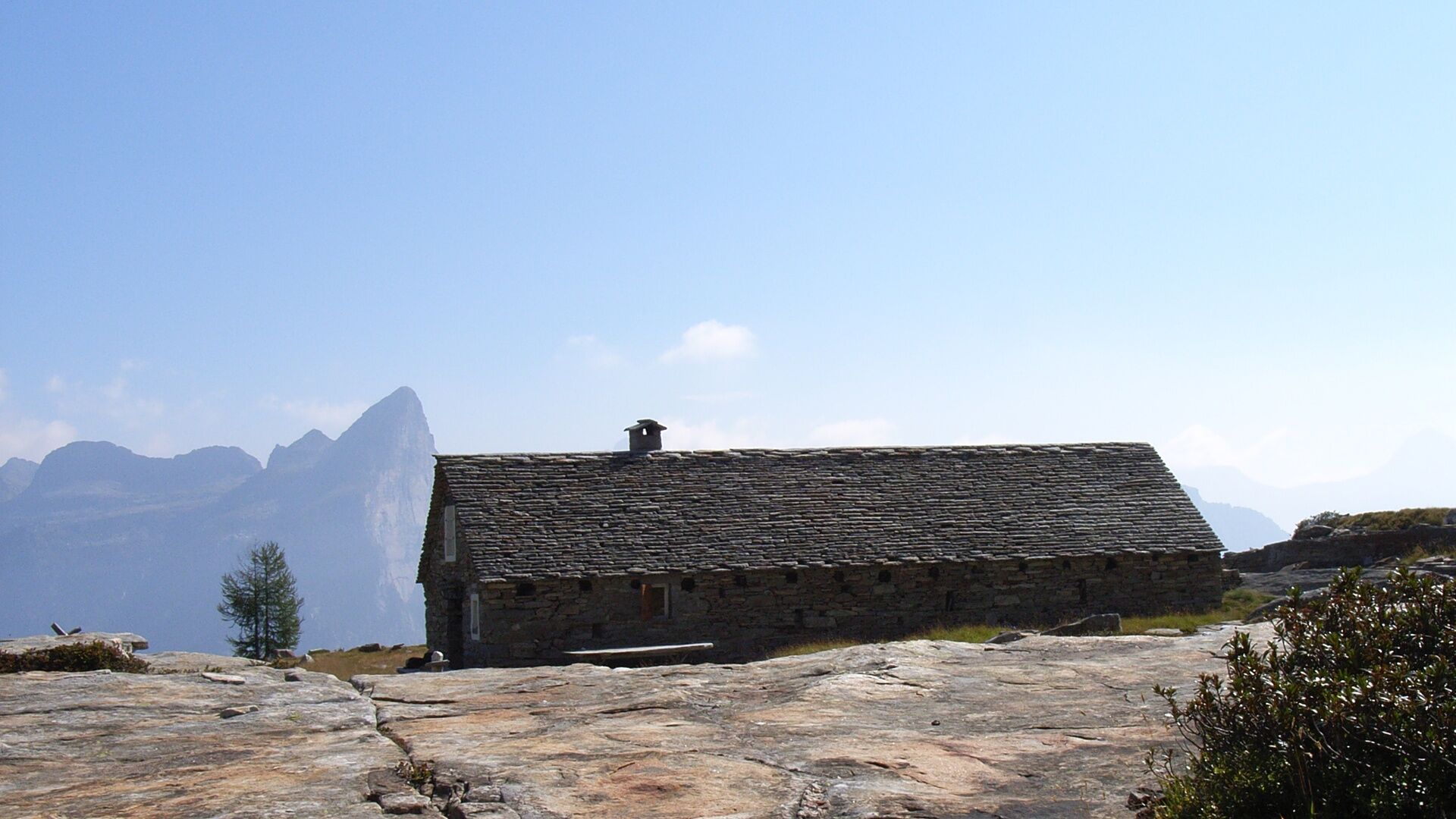
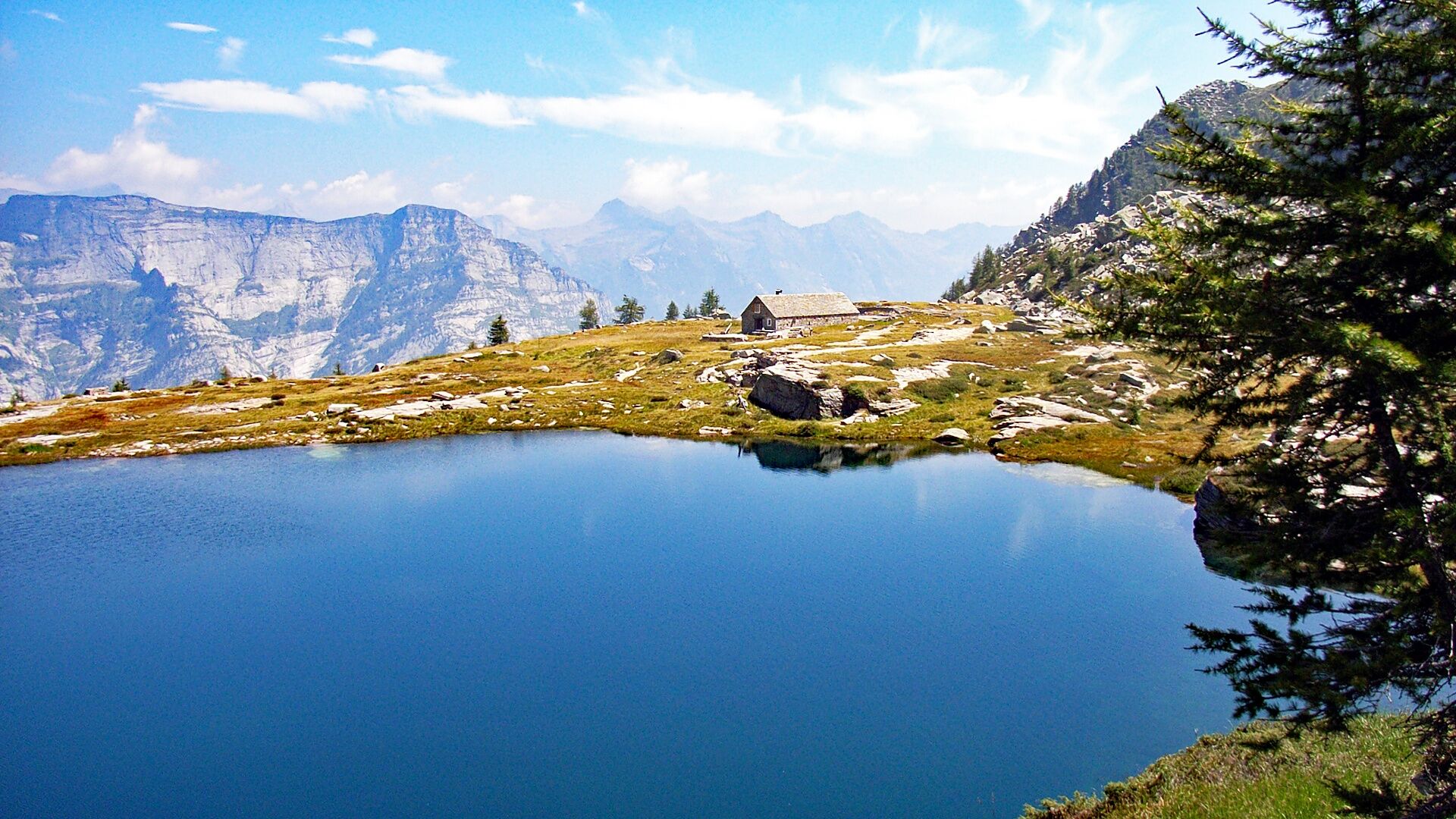
It is worth starting the day early because the sunrise here, like almost everywhere in the mountains, is a spectacular event. Once the first rays of sun are out, the descent can begin. To the Passo Deva, which forms the border between the Vallemaggia and the Verzasca Valley and from where you have a fantastic view over the valleys and far beyond Ticino. A short but steep descent leads to the beautiful mountain lake Lago Starlaresc, which is special not only because of its positioning, but also because of its rare alpine newts that inhabit it. Pass the Capanna Starlaresc and continue to the Alpe di Sgiòf. The further descent towards Piano del Vald now leads through less alpine terrain again and the vegetation is getting more and more lovely. On reaching the valley bottom, you cross the emerald-green Verzasca River at Ganne and follow the Sentierone the short distance to Brione Verzasca.


Rifugio Alpe Masnee-Passo Deva-Lago del Starlarèsc da Sgióf-Capanna Starlaresc-Motarüch-Piano del Vald-Ganne-Piee-Brione Verzasca
Trekking backpack (approx. 50 liters) with rain cover
Comfortable and sturdy footwear, second pair of shoes / sandals if necessary
Adequate and durable outdoor clothing in multiple layers
Change of clothes,
Telescope sticks
Sun and rain protection
Snacks and drinking water
First aid kit
Penknife
Mobile phone
Headlight
Maps
Travel documents
Toilet bag and travel towel, travel detergent and clothesline, camping equipment if necessary (tent, sleeping mat, sleeping bag, cooking equipment), hut equipment if necessary
Suosittuja retkiä naapurustossa
-
4,8
Avegno-Ponte Brolla-Avegno
mediumVaellus 8,56 km -
4,3
Sentiero etnografico Revöira (SvizzeraMobile 629)
mediumVaellus 7,97 km -
4,0
Cardada Bike (SwitzerlandMobility 397)
raskasMaastopyörä 30,4 km -
3,5
Entlang der Verzasca von Sonogno via Brione nach Lavertezzo
valoVaellus 14,5 km -
5,0
Giro della Valle del Salto (SvizzeraMobile 611)
mediumVaellus 8,84 km -
4,8
Diga Verzasca-Mergoscia-Corippo-Lavertezzo
mediumVaellus 13,0 km -
Sentiero Verzasca (SvizzeraMobile 74)
mediumPitkän matkan vaellusreitti 34,4 km -
4,3
Sentiero Verzasca (SvizzeraMobile 74) - Stage 1: Sonogno-Lavertezzo
mediumPitkän matkan vaellusreitti 13,4 km -
4,5
Sculpture path
valoTeemareitti 2,49 km -
4,0
Bolle di Magadino
valoTeemareitti 5,97 km
Vaellus & jäljitys


Älä jää paitsi tarjouksista ja inspiraatiosta seuraavaa lomaasi varten.
Sähköpostiosoitteesi on lisätty postituslistalle.