


Chemin du Lac de Taney


Lac de Taney is situated in an idyllic, lightly wooded location at an altitude of 1408 m above sea level. The lake and its surroundings have been protected as a nature reserve for over 50 years. Vehicles...
Lac de Taney is situated in an idyllic, lightly wooded location at an altitude of 1408 m above sea level. The lake and its surroundings have been protected as a nature reserve for over 50 years. Vehicles are only allowed here with a special permit. This allows hikers and those seeking peace a special natural experience.
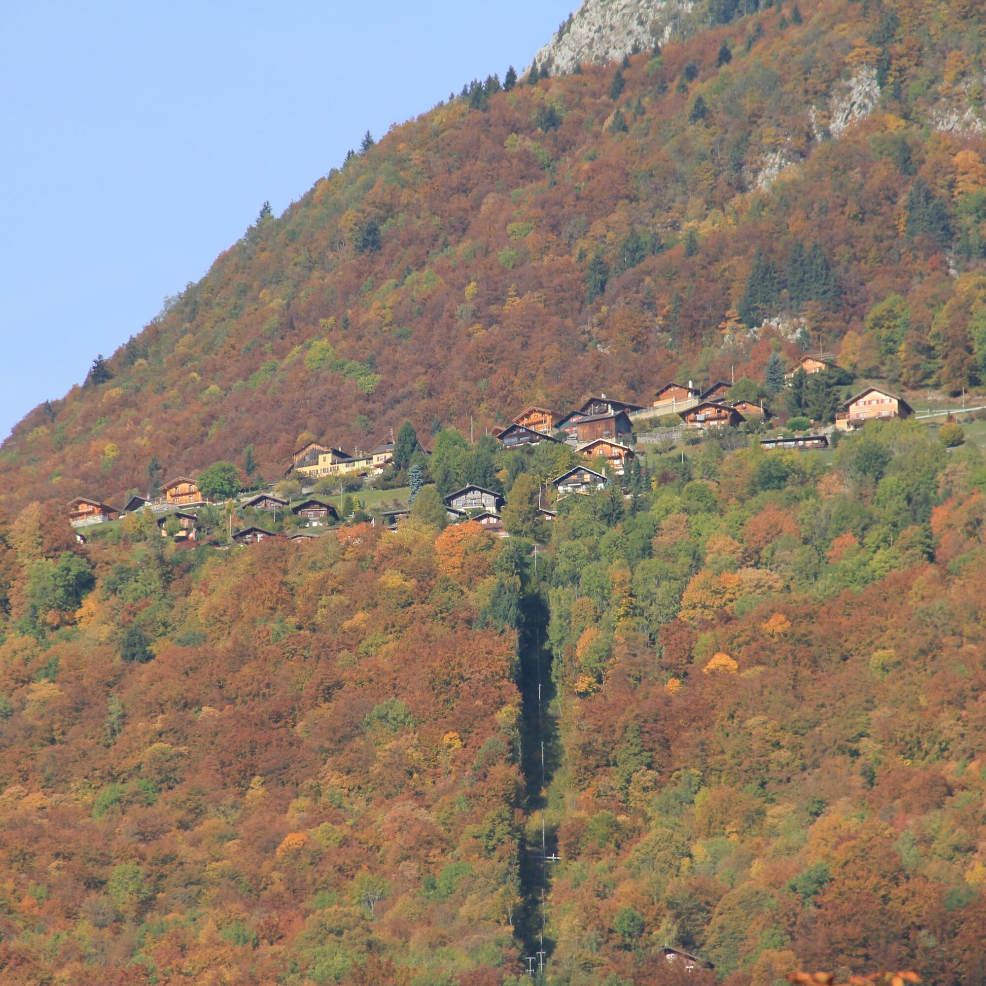
The route begins in the small village of Miex, which lies halfway up between the Rhone Valley and the mountain lake. The drive from the Rhone Valley to Miex is already an experience due to the winding road. With the PostBus, you can enjoy the view all the more.
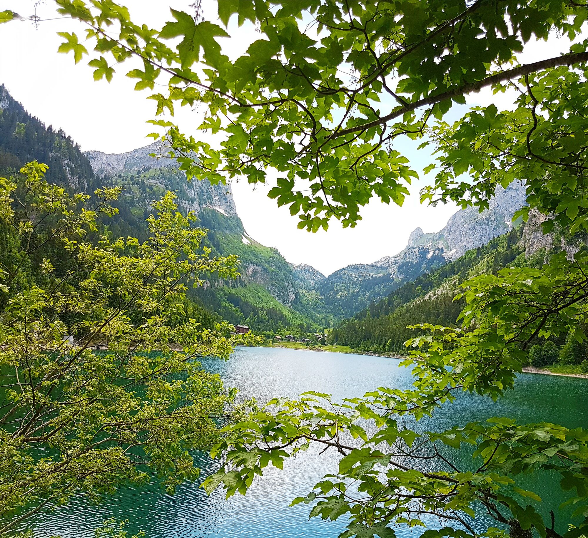
The path climbs through the forest until you reach the pastures of “Prélagine.” From here, the path leads more gently until the easternmost point of the mountain lake “Lac de Taney” is reached. The first view of the deep blue lake, surrounded by forests and mountain peaks, is enchanting. The route then follows the northern shore to Taney, the alpine pasture with its three alpine farms offering catering and overnight accommodation.
The lake is the heart of the nature reserve and is especially known for the amphibians that thrive here. With some luck, Alpine salamanders can be observed in the shade of the forest. On the lake shore in spring, a carpet of colorful flowers blooms, including alpine roses, willowherb, lilies, and monkshood.
This natural abundance owes its nature reserve to a microclimate influenced by Lake Geneva, which brings mild winters and fresh summers. This region was probably one of the first settled areas nearby – caves were found here that were likely inhabited around 30,000 years ago.
The path leaves the lake at its southern shore and leads to the slightly higher Col de Taney pass before returning through forests high above the Rhone Valley back to “Le Flon” above Miex.
Highlights of the hike:
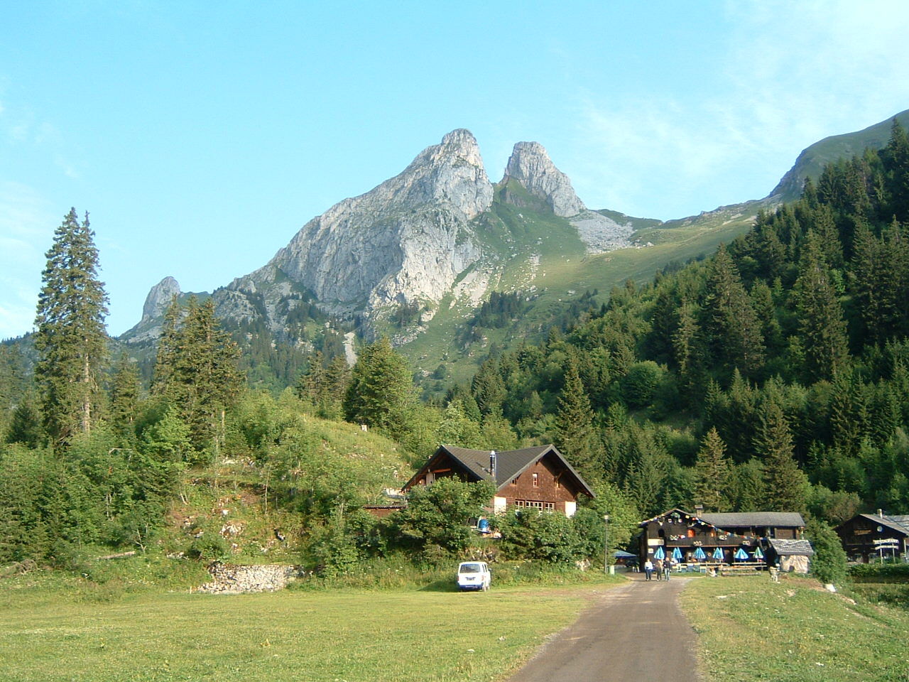
Enchanting section through forests high above the Rhone Valley. The idyllic mountain lake Lac de Taney with diverse flora and alpine farms inviting you to stop.


The hike begins in the eastern village part of Miex, in Le Vésenand. The first section leads steeply up to the alpine pastures of Prélagine. Then follow the path counterclockwise around Lac de Taney. After crossing the Col de Taney, an old goat path zigzags back to Le Flon at the western end of Miex.
We recommend:
Good footwear Weather-dependent clothing: always carry a waterproof vest Headwear Sunscreen Water bottle Picnic Camera Binoculars (optional) Hiking poles (optional) Printout of the hiking trail (click “Print” to download)
For certain hikes:
Swimsuit
The mountains, a place of joy to share and respect. The mountain world is a place to meet and experience unforgettable moments together – whether by bike or on foot. For all users to benefit, it is essential to share this space with respect for nature and agriculture. Respectful behavior allows everyone to enjoy their leisure activities under the best conditions. Inform yourself about recommendations and rules. Assess your own skills and fitness well. Using the various routes is always at your own risk.
For all hikes:
Carry a map with you. Download the complete description of the hiking trail with a large-scale map by clicking “Print” at the top right of the page. Use only marked hiking trails and observe all signs and instructions – for your own safety, to protect grazing animals, and out of respect for wildlife. Close gates again after passing through. Be considerate to other trail users, plants, and animals.
For mountain hikes:
Carry additional sun protection. UV rays at altitude can be very strong, even on cloudy days. Plan your hike carefully: Take into account the required fitness level of all participants, weather forecasts, and seasonal conditions. Weather conditions in the mountains can change very quickly and without warning. Appropriate clothing and sufficient provisions (food and drink) are very important. In unstable weather, it is better to turn back early.
For high alpine hikes:
Inform your family about your hiking route. Avoid hiking alone if possible. Do not go onto glaciers without a mountain guide. Observe warning signs indicating dangers at riverbanks, along waterways below dams and reservoirs: water levels can rise quickly and without warning.
Highway A9, exit 16 (Villeneuve) coming from the north or exit 17 (Aigle) coming from the south. Follow the signs to Vouvry. Ideally, park your car in Vouvry and take the bus to Miex, as the road to Miex is very narrow and winding and parking spaces in Miex are limited.
Regular train connections on the Simplon line to St-Maurice. From there, take the regional train to Vouvry, where a bus connection runs to Miex. Train and PostBus timetables can be found at sbb.ch.
Parking in Vouvry, follow the local parking guidance system. From Vouvry, take the bus to Miex, as parking spaces in Miex are limited.
View this route on SchweizMobil: No. 216 Chemin du Lac de Taney
More information about the destination:
VouvryStay overnight in one of the accommodations at Lac de Taney and experience impressive moods at dusk.
Suosittuja retkiä naapurustossa
-
3,0
Rundherumwanderung vom d‘Aï.
mediumVuoristovaellus 6 km -
4,7
Le Grammont
valoVaellus 13,8 km -
St. Gingolph - Villeneuve
valoVaellus 17,3 km -
4,0
Sentier de la Joux Verte
mediumVuoristovaellus 9,61 km -
LTdP 21
valoVaellus 4,46 km -
Pointe de Bellevue
raskasPolkujuoksu 16,5 km -
Les Cerniers – Valleys & must-sees
mediumPyöräily 11,5 km -
Through the Vallon de They to the sources of the Vièze
mediumVaellus 16,7 km -
Torgon – Valleys & must-sees
mediumPyöräily 12,8 km -
Tour du Haut Lac
mediumPyöräily 52,2 km

Vaellus & jäljitys


Älä jää paitsi tarjouksista ja inspiraatiosta seuraavaa lomaasi varten.
Sähköpostiosoitteesi on lisätty postituslistalle.