


Panoramic winter hiking route Moosalp
Vaikeustaso: 3


The approximately 18 km long panoramic winter hiking route leads from Törbel via Zeneggen, Bürchen, and Unterbäch to Eischoll. Fringed by the Valais and Bernese Alps, the panoramic view changes hourly....
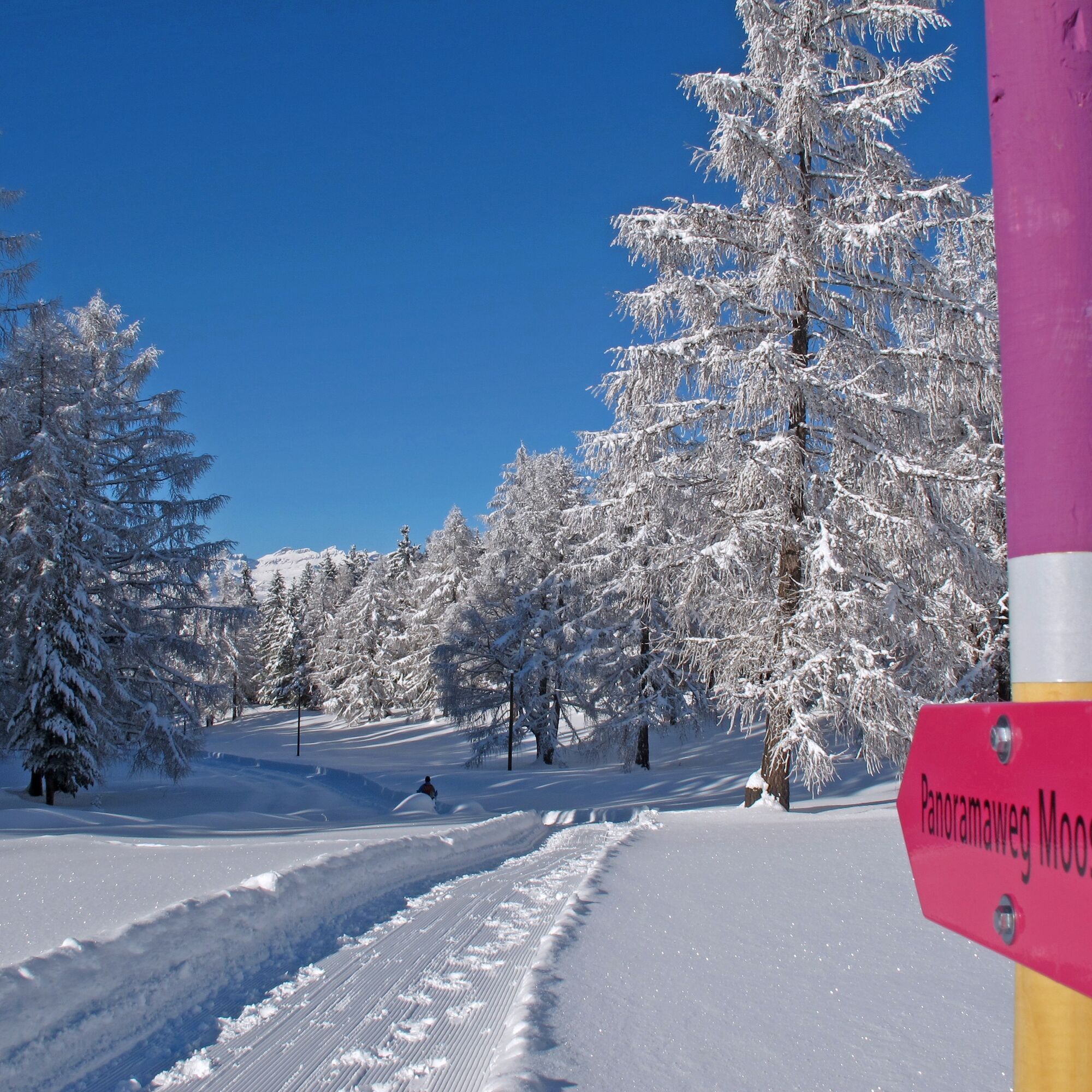
The approximately 18 km long panoramic winter hiking route leads from Törbel via Zeneggen, Bürchen, and Unterbäch to Eischoll. Fringed by the Valais and Bernese Alps, the panoramic view changes hourly. On crackling snow, you hike between 1480 and 1800 m above sea level, from mountain village to mountain village. The path is groomed with piste vehicles during the winter season. It is also designed so that only sections of it can be completed. The individual places are accessible by public transport.

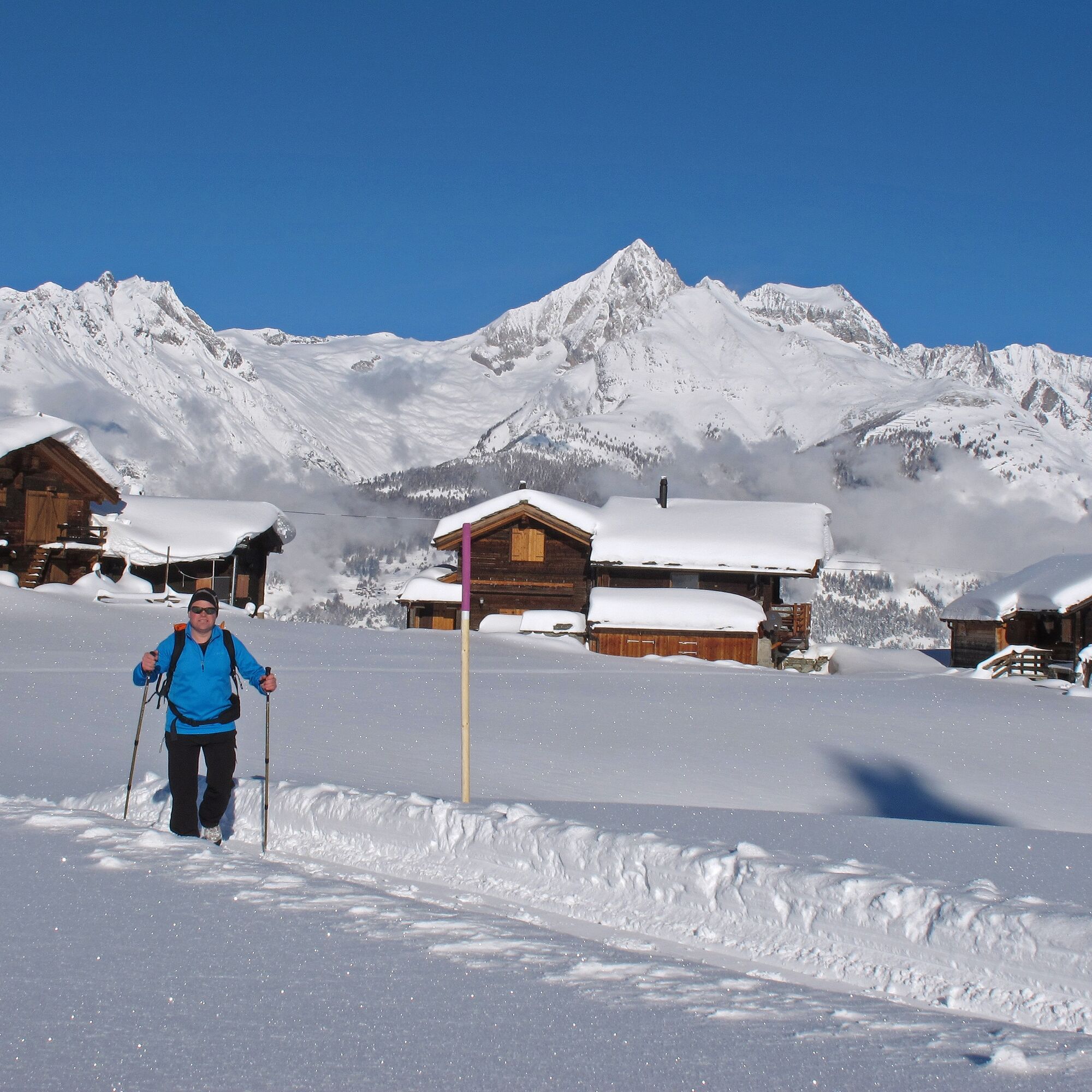
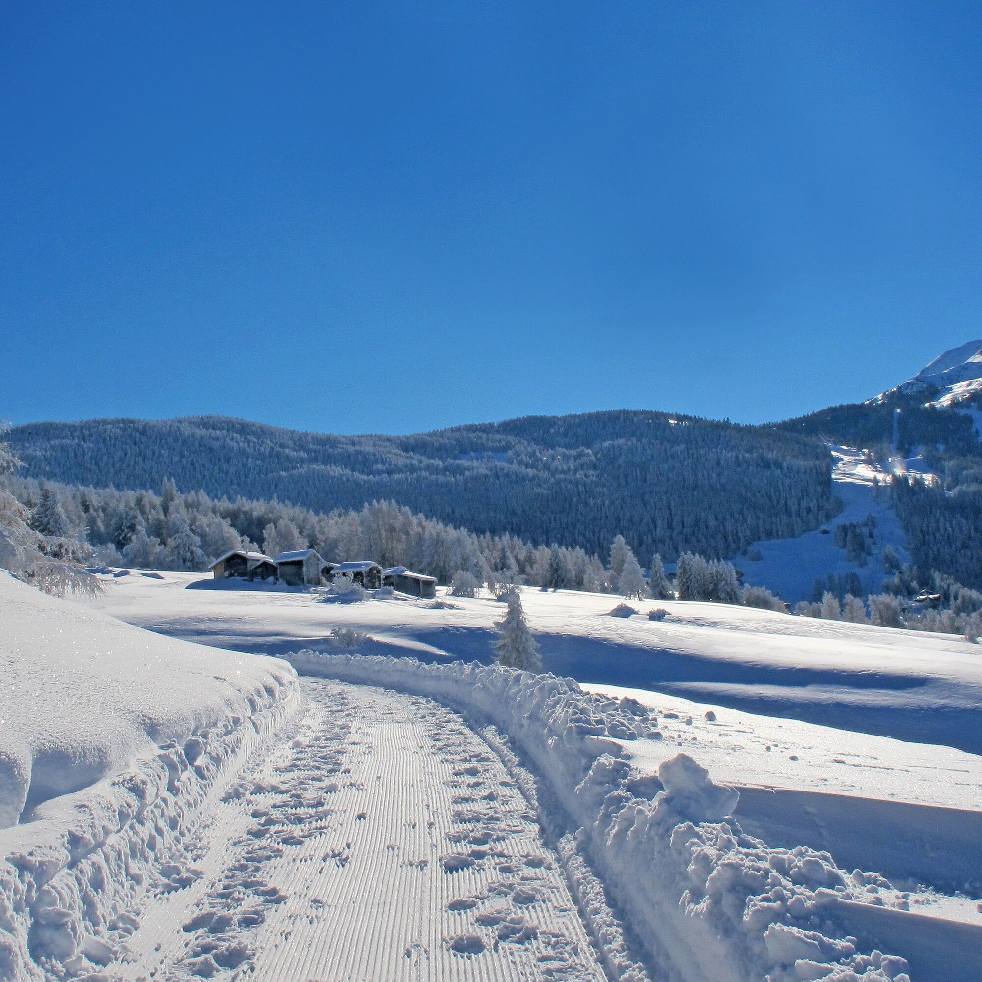
The tightly packed, blackened wooden facades of Törbel cling closely to the mountain. Behind, the imposing Weisshorn; at the side, the Mischabel group with the highest Swiss mountains. Through the hamlet of Furen, the narrow alley climbs up to the hairpin turn towards Moosalp. There you branch off to Hofstetten, the legendary hamlet, and immerse yourself in the fairytale forest above Diepjen. The dreamy terrace hollow Hellela gives you the first view of the Bietschhorn. From there, you traverse the open, sunny snow slopes to Bürchen (Bodmen), where the winter hiking trail, PostBus, and ski lifts intersect. Then you cross Bodmen parallel to the children's lift and reach Brandalp through the Gärwerwald and two small valley hollows. From there you finally reach Eischoll (Strygge) via Breite Stäg and the Seewustafel.
The path is walkable with good footwear and winter equipment. The path is groomed with a piste vehicle during the winter season.
Through the NEAT base tunnel you travel by train via the station in Visp to us.
From there you reach Törbel, Furen by PostBus via Stalden.
Exit in Bürchen: PostBus line from Visp to Bürchen, bus stop "Ronalp".
Exit in Unterbäch: Train Visp-Raron, cable car Raron - Unterbäch, chairlift Unterbäch - Brandalp
Eischoll: Train Visp-Raron, cable car Raron - Eischoll, chairlift Eischoll - Strygge
3
The hike repeatedly passes by various restaurants where you can indulge yourself culinarly.
Kiertueen webbikamerat
-
Seetal - Grächen
-
Brandalp - Skilift Seefeld
-
Moosalp - Restaurant Moosalp - Törbel
-
Hannigalp
-
Grächen - Dorf
-
Eischoll - Stryggen
-
Moosalp - Bergrestaurant Dorbia
-
Air Zermatt - Station Raron
-
Air Zermatt - Station Raron
-
Brandalp - Skilift Seefeld
-
Brandalp - Skilift Seefeld
-
Brandalp - Skilift Seefeld
-
Brandalp - Skilift Seefeld
-
Rothorli
-
Rothorli
-
Grächen
-
Air Zermatt - Station Raron
-
Gspon
-
Heidabahn Talstation
-
Eischoll Dorf
-
Furggen Berg
-
Brandalp - Skilift Seefeld
-
Brandalp - Skilift Seefeld
-
Brandalp - Skilift Seefeld
-
Brandalp - Skilift Seefeld
-
Törbel - Chalet Dolores
-
Yakfarm - Embd
Suosittuja retkiä naapurustossa
-
3,8
Höhenweg Saas-Fee - Grächen
Vaellus 12,0 km -
5,0
Bella-Tola
mediumKorkea kiertue 6,72 km -
5,0
Restipass
Vaellus 14,5 km -
Panoramaweg Visperterminen
valoVaellus 9,72 km -
4,0
NATICHERBERG CIRCULAR TRAIL
mediumVaellus 12,1 km -
5,0
Moosalp Panoramaweg
valoVaellus 6,36 km -
5,0
Jolischlucht
mediumVaellus 8,06 km -
Gibidumpass
valoVaellus 11,6 km -
Hannigalp-Seetal-Hannigalp
mediumVaellus 10,4 km -
BELALP - NESSELALP - BIRGIST
mediumVaellus 9,68 km

Vaellus & jäljitys


Älä jää paitsi tarjouksista ja inspiraatiosta seuraavaa lomaasi varten.
Sähköpostiosoitteesi on lisätty postituslistalle.