Talvi
Kesä
Sää
Webbikamerat
Majoitukset
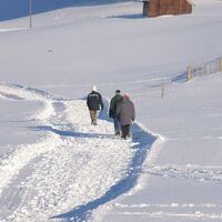
Retket
Hakuhistoria
Hakuehdotukset
Tuloksia ei löytynyt
Etsi
Winter
Etusivu
Kesä Schweiz
Itä-Sveitsi
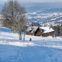
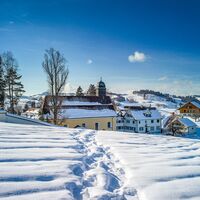
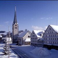
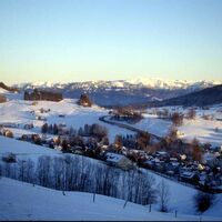
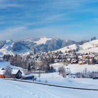
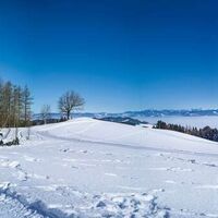
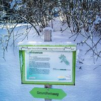
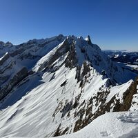
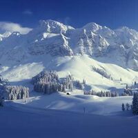
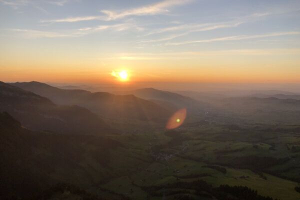
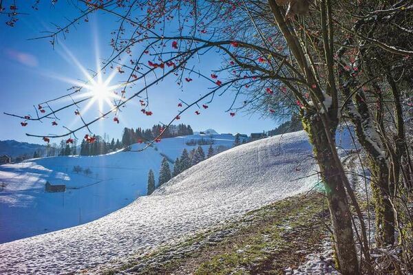
Appenzell Ausserrhoden
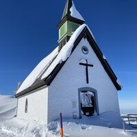
Bühler
Retket
Winter
Alue
Sää
Webbikamerat
Retket
Urheilu
Foorumi
Winter
Bühler
Kartta
näytä
piilota
Suodata matkat
Retkityyppi
(Kaikki)
Winter hiking (13)
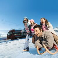
Sledge (7)
Snowshoe (7)
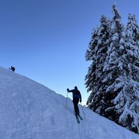
Ski tour (2)
Koko tekstin haku
Kunto
min.
1 helppo
2 kohtuullinen
3 keskivaikea
4 vaikea
5 erittäin vaikea
6 äärimmäinen
maks.
1 helppo
2 kohtuullinen
3 keskivaikea
4 vaikea
5 erittäin vaikea
6 äärimmäinen
Tekniikka
min.
1 helppo
2 kohtuullinen
3 keskivaikea
4 vaikea
5 erittäin vaikea
6 äärimmäinen
maks.
1 helppo
2 kohtuullinen
3 keskivaikea
4 vaikea
5 erittäin vaikea
6 äärimmäinen
Pituus (km)
Korkeusmittari
muut suodattimet
Hae
Palauta
29 Retket.
lajiteltu
Relevanz
Relevanz
längste Distanz
kürzeste Distanz
pisin kesto
lyhin kesto
eniten pystymetrejä
vähiten pystymetrejä
korkea kunto
heikko kunto
huipputeknologia
alhainen teknologia
Nimi A-Z
Nimi Z-A
Route with a view
tapa
8,79
km
03:10
h
340
hm
823 - 1.124
m
Tekniikka
Kunto
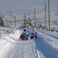
Sleighing Eugst-Chellen Bühler
0,82
km
00:25
h
-
875 - 974
m
Up to the Wissegg Pass
tapa
7,62
km
03:00
h
290
hm
832 - 1.092
m
Tekniikka
Kunto
Trough untouched deep snow
vaikea
8,29
km
03:50
h
223
hm
647 - 841
m
Tekniikka
Kunto
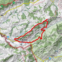
Over the Gäbris and Sommersberg
vaikea
9,19
km
04:10
h
315
hm
916 - 1.173
m
Tekniikka
Kunto
Food for thought and a feast for the eyes
tapa
8,51
km
02:40
h
90
hm
913 - 992
m
Tekniikka
Kunto
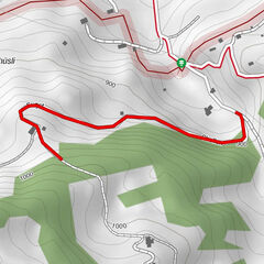
Traces in the snow
tapa
8,34
km
02:20
h
222
hm
942 - 1.070
m
Tekniikka
Kunto
Sleighing Stoss - Altstätten
4,44
km
00:50
h
-
463 - 943
m
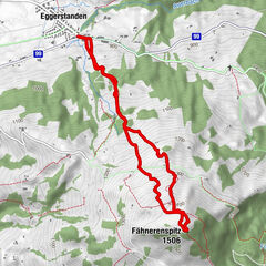
Fähnerenspitz Rüte, Appenzell Innerrhoden
helppo
5,42
km
01:29
h
564
hm
946 - 1.510
m
Tekniikka
Kunto
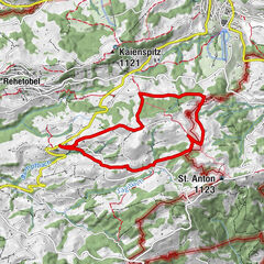
Panoramic view St. Anton
tapa
7,22
km
02:30
h
197
hm
971 - 1.106
m
Tekniikka
Kunto
Sleighing Rehetobel - Hörnlirank
1,9
km
00:07
h
-
752 - 901
m
Schlittelweg Kronberg-Jakobsbad
6,99
km
00:30
h
3
hm
873 - 1.655
m
Ravines, hills and views into the distance
helppo
7,52
km
02:30
h
392
hm
625 - 994
m
Tekniikka
Kunto
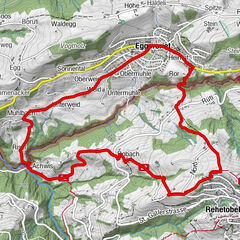
Views of the Appenzell hinterland
tapa
6,75
km
02:30
h
330
hm
825 - 1.206
m
Tekniikka
Kunto
With a view of the Rhine Valley
helppo
3,5
km
01:40
h
145
hm
958 - 1.108
m
Tekniikka
Kunto
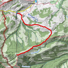
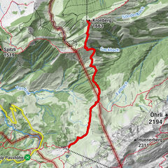
Winterwanderung Jakobsbad - Kronberg
tapa
7,69
km
03:12
h
786
hm
877 - 1.663
m
Tekniikka
Kunto
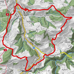
Across lovely hills with distant views
tapa
8,93
km
03:10
h
267
hm
747 - 934
m
Tekniikka
Kunto
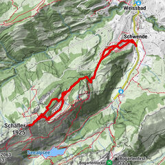
Schäfler, Skitour, Appenzell Innerrhoden/Schweiz
tapa
11,58
km
03:21
h
1.090
hm
829 - 1.920
m
Tekniikka
Kunto
Uphill
vaikea
5,22
km
02:50
h
397
hm
1.306 - 1.645
m
Tekniikka
Kunto
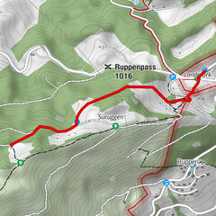
Schlittelpiste Landmark - Suruggen
1,51
km
00:30
h
143
hm
1.004 - 1.159
m
Sivut:
1
2
seuraava
Matkat tyypeittäin
Hiking
Bike
Winter
Running
Motorsport
Winter hiking
Sledge
Snowshoe
Ski tour
Touren nach Regionen
Appenzellerland
234
Appenzell Ausserrhoden
122
Gipfeltouren in der Region
St. Anton (1.123 m)
14
Kaienspitz (1.121 m)
23
Gäbris (1.250 m)
6
Hundwiler Höhi (1.305 m)
12
Hohe Buche (1.145 m)
6
Golterberg (1.174 m)
7
Fähnerenspitz (1.506 m)
5
Gupf (1.089 m)
14
Hoher Kasten (1.795 m)
25
Hoher Hirschberg (1.169 m)
10
Suosittuja retkiä alueella
Seealpsee, Schweiz
tapa
7,02
km |
364
hm |
02:31
h
Hoher Kasten Abstieg Montlinger Schwamm
helppo
4,53
km |
18
hm |
00:54
h
Across lovely hills with distant views
tapa
8,93
km |
267
hm |
03:10
h
Food for thought and a feast for the eyes
tapa
8,51
km |
90
hm |
02:40
h
Naapurit
Gais
Speicher
Teufen
Appenzell
Trogen
Suosituimmat alueet
Säntis / Schwägalp
Glarus Süd
Appenzell
St. Gallen - Bodensee
St. Gallen
Schaffhausen
Glarus Nord
Romanshorn
Kreuzlingen
Rapperswil-Jona
Rorschach
Bottighofen
Wildhaus - Alt St. Johann
Glarnerland
Jakobsbad - Kronberg
Thal / Staad / Altenrhein
Walenstadt
Amden - Weesen
Teufen
Ebenalp
Arpajaiset
Produkt-Paket für die ganze Familie
Primavera XXL-Gewinnspiel
Merkintöjä ei löytynyt.
Haku ei ole tällä hetkellä käytettävissä.
Tarkenna hakua.
Paikalliset hakutulokset
(<= 25km)
Lisää hakutuloksia
(> 25km)
%count% Hakutulokset
%name%
%type%
%elevation%
%population%
%lpButton%