


Carinthia - Water-rich Route | NOCKBIKE Route 11


Starting point: Feld am See, Kirchenplatz
Route course: Feld am See – Feldpannalm – Maibrunn hut – Bad Kleinkirchheim creek – Obertweng – Feld am See
Route connections: No. 20, T20, 8, 9, T9
Special features:...
Starting point: Feld am See, Kirchenplatz
Route course: Feld am See – Feldpannalm – Maibrunn hut – Bad Kleinkirchheim creek – Obertweng – Feld am See
Route connections: No. 20, T20, 8, 9, T9
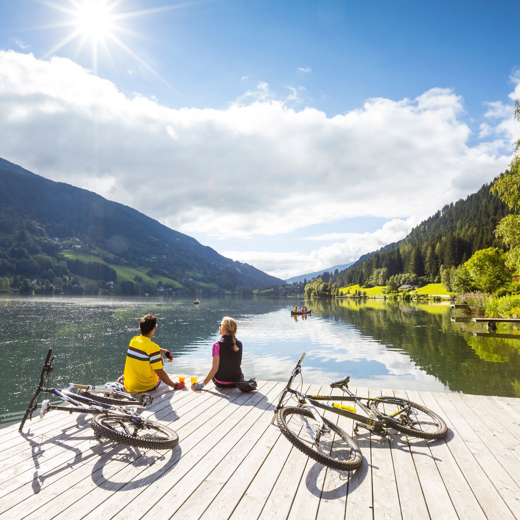
Special features: Panorama, the element water accompanies us on this route in various ways, such as the lake, water activities, waterfall, springs, streams, Maibrunn, thermal baths, biker fountain, fish culinary.
e-MTB – this route can also be ridden with an e-mountain bike.
Huts: Rieser hut, Unterwirth hut, Groar Alm, Trattler's inn.
Note: The route can optionally be started in Feld am See or Bad Kleinkirchheim. The description refers to Feld am See as the starting point.
The starting point is Feld am See. First, it goes relatively steeply uphill on asphalt roads over the Klamberg. After a short very steep section before the toll booth, it then proceeds moderately on a gravel path towards Feldpannalm. A short break is recommended at one of the numerous refreshment options.
In Feldpannalm then keep left towards Rieser hut and follow the signs. At a subsequent fork, go left towards Rieser hut, here turn right and follow the gravel path to the Maibrunn hut (short pushing section and crossing before the Maibrunn hut).
Follow the gravel path down to the valley to Bad Kleinkirchheim (tip: definitely stop at the beautiful Unterwirth hut).
In Bad Kleinkirchheim, shortly before the junction to the main road, turn left (to the restaurant "zur Einkehr"). Follow the signs and turn left before the creek. Continue on this path to Obertweng (attention: pushing section) (attention: shortly after Bad Kleinkirchheim, technically difficult section - possibly push).
Refresh yourself at Obertweng at the "Biker fountain", then return on the road to Feld am See.
Kyllä
Basic skills
Appropriate riding skills and basic fitness are essential for a pleasant and safe ride. When braking, it is particularly important to use only one finger, distribute the braking force correctly, and adjust the basic position.
The bike used
Must be adapted to the trail conditions and well maintained. A freeride or downhill bike is best suited. Tip: Protective gear and bikes can be rented or purchased at rental stations.
Mountain bike Fair Play rules for orderly coexistence
1. Stay only on marked and signposted nock/bike trails
2. The use of nock/bike trails is only allowed at the contractually fixed periods from May 1 to August 31 between 09:00 and 19:00 and from September 1 to October 31 between 09:00 and 17:00 at your own risk
3. No riding at dusk to protect wildlife
4. Observe nock/bike maps and route descriptions
5. Priority to hikers over mountain bikers, "shared trail"
6. Forest roads are operational areas and workplaces. Therefore, expect work machines, wood or potholes on the road, grazing livestock and motor vehicle traffic
7. Pay special attention to motor vehicles and traffic regulations
8. Ride with half visibility and controlled speed; in case of suddenly and unexpectedly appearing obstacles, dismount and push the bike past the obstacle
9. Camping, staying overnight in the forest at dark, making fires, disturbing wildlife or entering forest crops under 3 m tree height are legally prohibited in the forest
10. Always close pasture gates and doors and be careful when forest work and grazing livestock are around
11. Consideration for a clean environment and noise avoidance
12. Providing first aid in case of accidents is mandatory, first aid kit, emergency numbers
13. Ongoing sports equipment checks by professionals, riding with helmet and gloves etc.
14. Get riding technique tips for increased safety and fun from professionals – nock/bike competence center
15. Also communicate fair play rules to raise awareness
Parking available
nock/bike Competence Center
Krainer family
Sonnenstraße 5
A-9544 Feld am SEE
Tel.: +43 4246 3188
www.nockbike.com
Further information about the Bad Kleinkirchheim region at: www.badkleinkirchheim.at
Suosittuja retkiä naapurustossa
-
4,4
Rundweg über den Falkert
mediumVaellus 6,26 km -
4,8
Lammersdorfer Hütte, Granattor Runde
valoVaellus 9,85 km -
4,3
Sonnwiesenrundweg
mediumVaellus 4,67 km -
4,7
Brunnachalm Biosphärenrunde
valoVaellus 8,39 km -
4,9
Nockbergrundwanderweg
mediumVaellus 6,62 km -
4,4
Panorama trail Schwarzsee - Palnock
mediumVaellus 11,9 km -
4,6
Falkertsee - Sonntagstal - Falkert
mediumVaellus 4,84 km -
4,7
Millstätter See cycle track
mediumPyöräily 27,7 km -
4,4
Falkertsee - Murmelsteig mit Abstieg über Falkertscharte
mediumVia ferrata 4,04 km -
4,5
Drei Hütten Tour - Tour to three huts | nock/bike Tour 48
raskasMaastopyörä 26,5 km
Vaellus & jäljitys


Älä jää paitsi tarjouksista ja inspiraatiosta seuraavaa lomaasi varten.
Sähköpostiosoitteesi on lisätty postituslistalle.