


Ilbesheim - Hirtenbrunnenweg
Vaikeustaso: T1


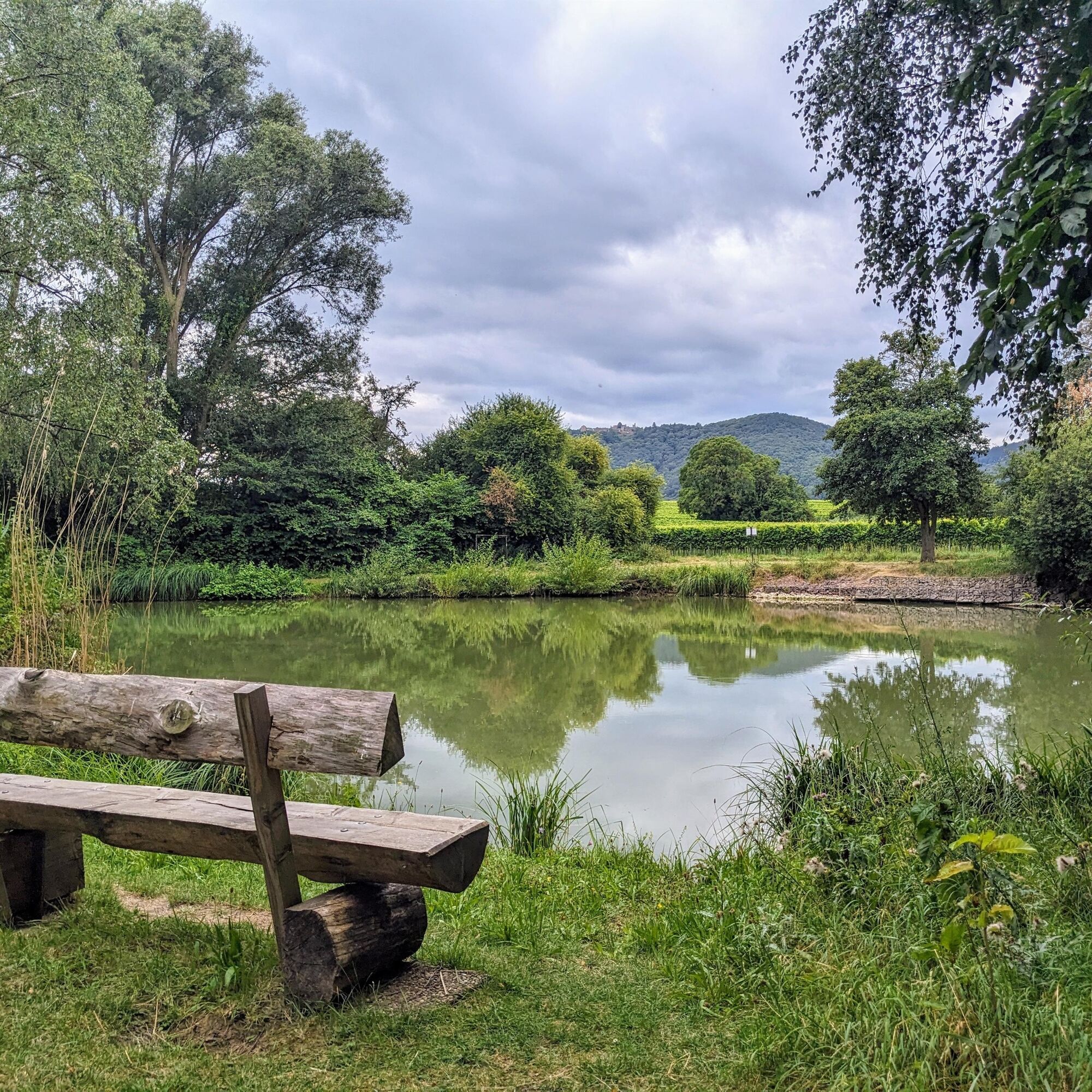
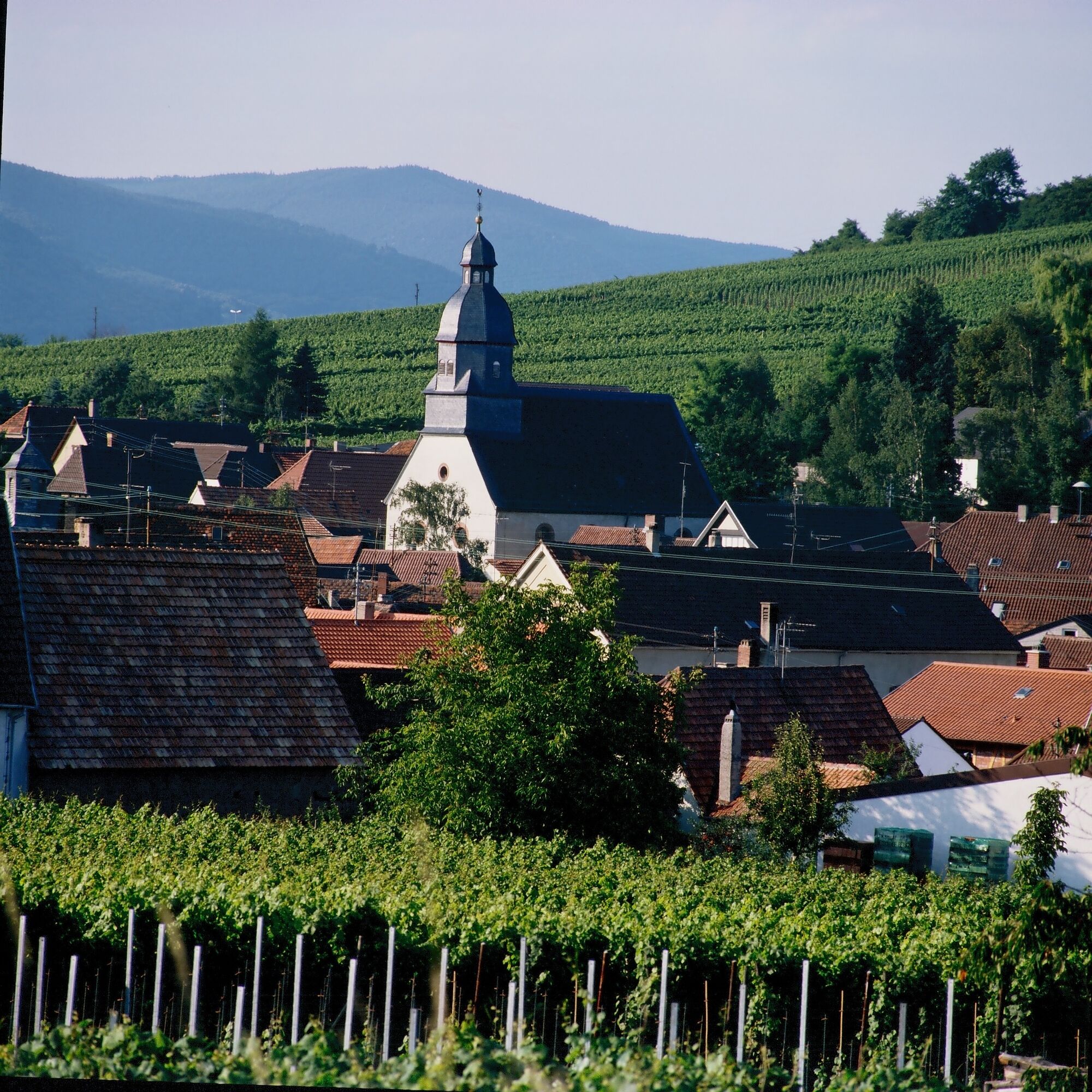
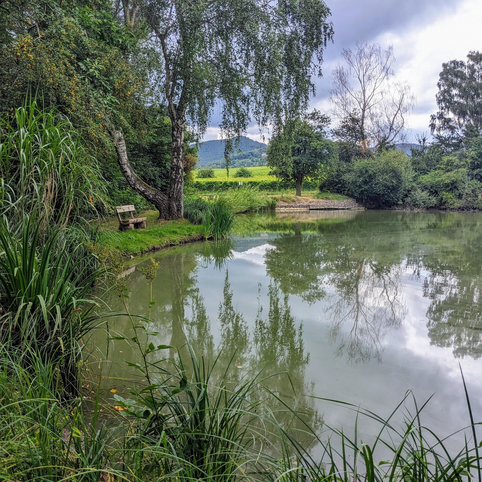
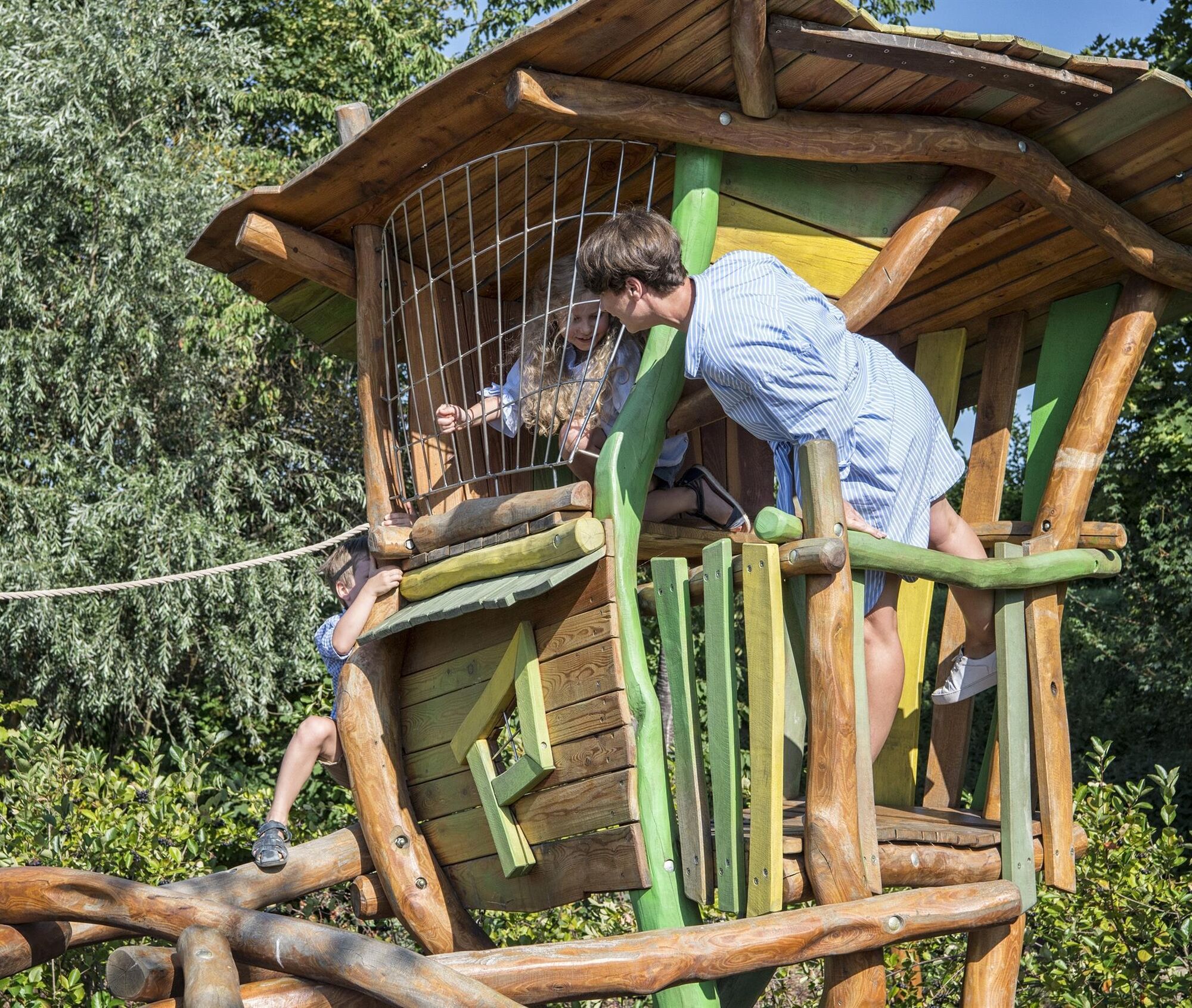
The route takes you through the winegrower village Ilbesheim into the vineyards of the "Rittersberg" wine region. You pass the Ahlmühlweiher, where a break is advisable. Very soon, you return to the village...
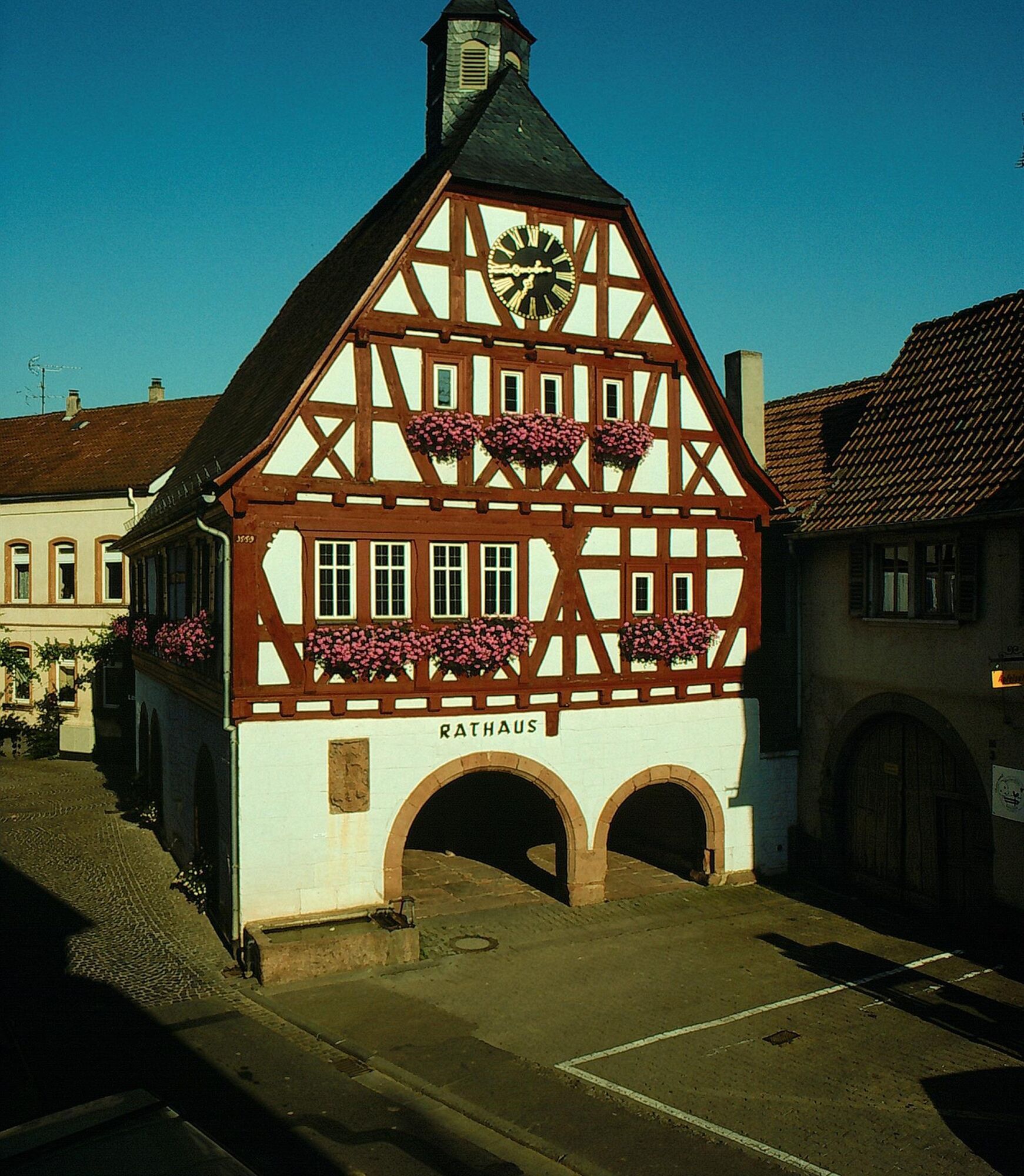
The route takes you through the winegrower village Ilbesheim into the vineyards of the "Rittersberg" wine region. You pass the Ahlmühlweiher, where a break is advisable. Very soon, you return to the village and pass the historic town hall before returning to the alla Hopp! facility.
UFFBASSE! - Campaign for considerate coexistence in nature
Be considerate on your way - Always behave proactively, kindly, and considerately towards everyone you meet along the way. This applies especially to farm roads, where winegrowers, farmers, and foresters also work on weekends.
Picnic & rubbish - Remember a rubbish bag for the way and take your waste back home. Use only furnished rest areas for breaks and picnics.
Leash dogs - Please always keep your dog on a leash. Other visitors and animals will thank you.
www.pfalz.de/uffbasse
We, your fellow humans, and nature thank you!


You start your route at the alla Hopp! facility and follow the brown trail marker number 4 "Hirtenbrunnenweg." It takes you a bit through Ilbesheim and then to the western edge of the village. Be careful of traffic when crossing the main road!
You immerse yourself in the sea of vines with a view of the Palatinate Forest and the village of Leinsweiler. Then you continue past the Ahlmühlweiher. Here you should take a short break, look at the water of the small pond, and simply enjoy the peace!
Through the vineyards and past the Hirtenbrunner Hof, it goes back to Ilbesheim. You pass the historic town hall and stroll along the Birnbach back to your starting point at the alla Hopp! facility.
Kyllä
Kyllä
Sturdy footwear, weather-appropriate clothing, sun and rain protection, as well as sufficient supplies of food and especially drinks, since there are not always places to eat or shop available or open, should be in your backpack for every route. Although the path is continuously marked, it is always advisable to carry a suitable map or a hiking app for safety reasons.
Use of farm roads - Our routes often run in the vineyards along paths that we share with others. We therefore ask for considerate and friendly behavior at all times. Winegrowers, farmers, and foresters use these paths through fields, forests, and vineyards for their daily work – also on weekends. Due to work operations and/or weather conditions, the paths can sometimes be more heavily soiled. Special caution is also advised when crossing streets in and around Palatinate villages. Route closures and detours must be strictly observed.
Danger situations - If an emergency situation arises, quick help is needed. And although cell phones can send GPS signals, classic rescue points often allow for the fastest aid. These are located at places easily accessible by rescue vehicles. Remember the points with green signs and a white cross. In case of emergency, return there and give the number on the sign during your emergency call. This way, rescuers know where to find you.
On the A65 motorway take the Landau-Nord exit towards B10 to Annweiler. Leave the B10 at the LD-Godramstein/LD-Arzheim exit and follow the signs towards Arzheim. Drive through Arzheim and continue to follow the signs to Ilbesheim.
By train to Landau/Pfalz and from there by bus (line 530 towards Ranschbach) to Ilbesheim. The bus stop Ilbesheim Schule is located directly at the starting point of the route.
Timetable info: via the websites of the railway (www.bahn.de) and the transport associations (www.vrn.de) or the apps "DB Navigator" or "myVRN"
At the Ilbesheim elementary school, the start of the route, free parking spaces are available.
Please only park in designated parking spaces and always keep access routes for emergency vehicles as well as work paths in the forest and vineyards clear. There are explicitly designated motorhome parking spaces for overnight stays in campers & caravans.
T1
Tourism office landauland
Hauptstraße 4
76829 Leinsweiler
06345 3531
urlaub@landauland.de
www.landauland.de
March to October:
Monday to Friday 09:00 - 12:00
additionally Monday, Wednesday and Friday: 14:00 - 16:00
November to February:
Monday to Friday 09:00 - 12:00
Take a break at the Ahlmühlweiher, look at the water, enjoy the peace, and relax!
Suosittuja retkiä naapurustossa
-
5,0
Annweiler Richard-Löwenherz-Weg
raskasVaellus 13,1 km -
5,0
Palatinate Hut Route
raskasVaellus 18,5 km -
4,0
Annweiler Castle Trail
mediumVaellus 7,72 km -
4,8
Annweiler - Kaiser-Friedrich-Weg
mediumVaellus 9,53 km -
Ramberg - Drei Burgen Weg
mediumVaellus 17,2 km -
Gossersweiler-Stein rock path
mediumVaellus 9,01 km -
Wasgau Rock Path
raskasVaellus 20,8 km -
4,5
Schusterpfad
mediumVaellus 16,4 km -
5,0
Pfälzer Weinsteig Stage 8: Dernbach - Annweiler am Trifels
raskasPitkän matkan vaellusreitti 14,4 km -
4,0
Palatinate Hut Route - Short southern route with 3 huts
mediumVaellus 10,5 km
Vaellus & jäljitys


Älä jää paitsi tarjouksista ja inspiraatiosta seuraavaa lomaasi varten.
Sähköpostiosoitteesi on lisätty postituslistalle.