


To the Urach Waterfall - No. 1
Vaikeustaso: 1


Kuvia käyttäjistämme
-
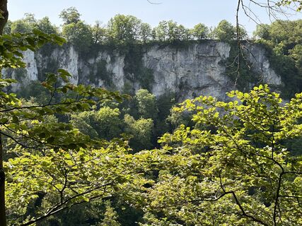
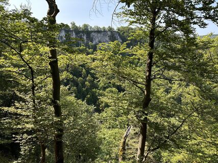
 © Tim eckhardtLuotu 12.05.2024
 -
 © Tim eckhardtLuotu 12.05.2024
 -
 © Tim eckhardtLuotu 12.05.2024
 -
 © Tim eckhardtLuotu 12.05.2024
 -
 © Tim eckhardtLuotu 12.05.2024
 -
 © Tim eckhardtLuotu 12.05.2024
 -
 © Tim eckhardtLuotu 12.05.2024
 -
 © Gunnar LuebckeLuotu 28.05.2023
 -
 © Gunnar LuebckeLuotu 28.05.2023
 -
 © Gunnar LuebckeLuotu 28.05.2023
 -
 © Gunnar LuebckeLuotu 28.05.2023
 -
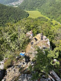 © Gunnar LuebckeLuotu 28.05.2023
 -
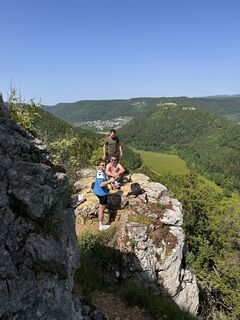 © Gunnar LuebckeLuotu 28.05.2023
 -
 © Gunnar LuebckeLuotu 28.05.2023
 -
 © Gunnar LuebckeLuotu 28.05.2023


Nordic Walking is very popular in Bad Urach. Experience and learn this new kind of healthy movement in our wonderful natural landscape. Nordic Walking is not a passing trend for us but an ideal way to...
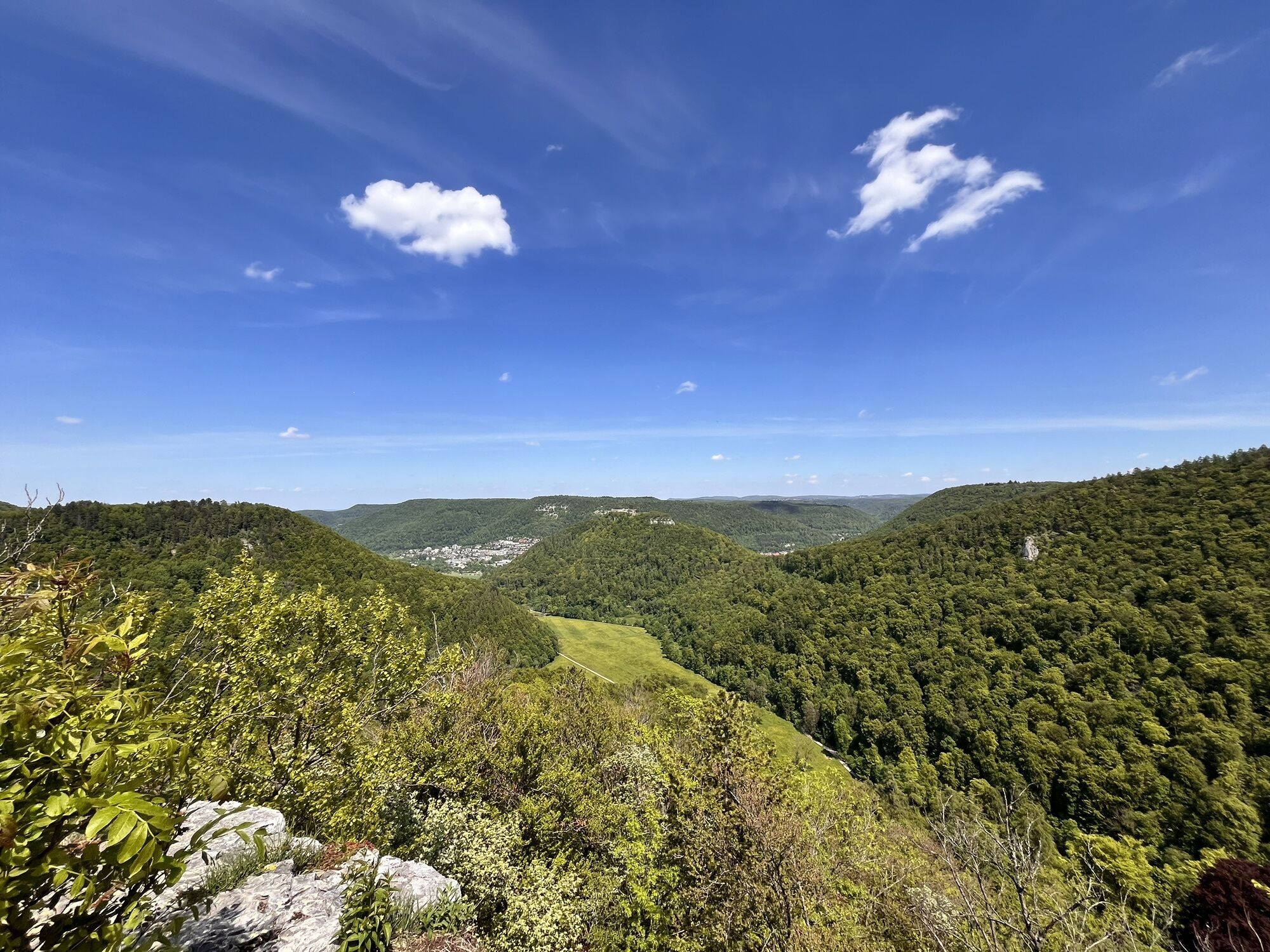
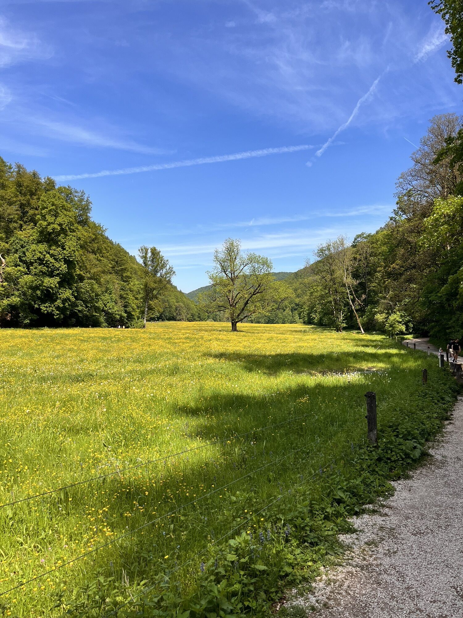
Nordic Walking is very popular in Bad Urach. Experience and learn this new kind of healthy movement in our wonderful natural landscape. Nordic Walking is not a passing trend for us but an ideal way to promote your own health with a lot of fun while moving through the most beautiful Alb landscape. The large Nordic Walking Park of Bad Urach with a specially marked network of paths offers you optimal conditions for a varied exercise and training program. This route leads to the Urach Waterfall.

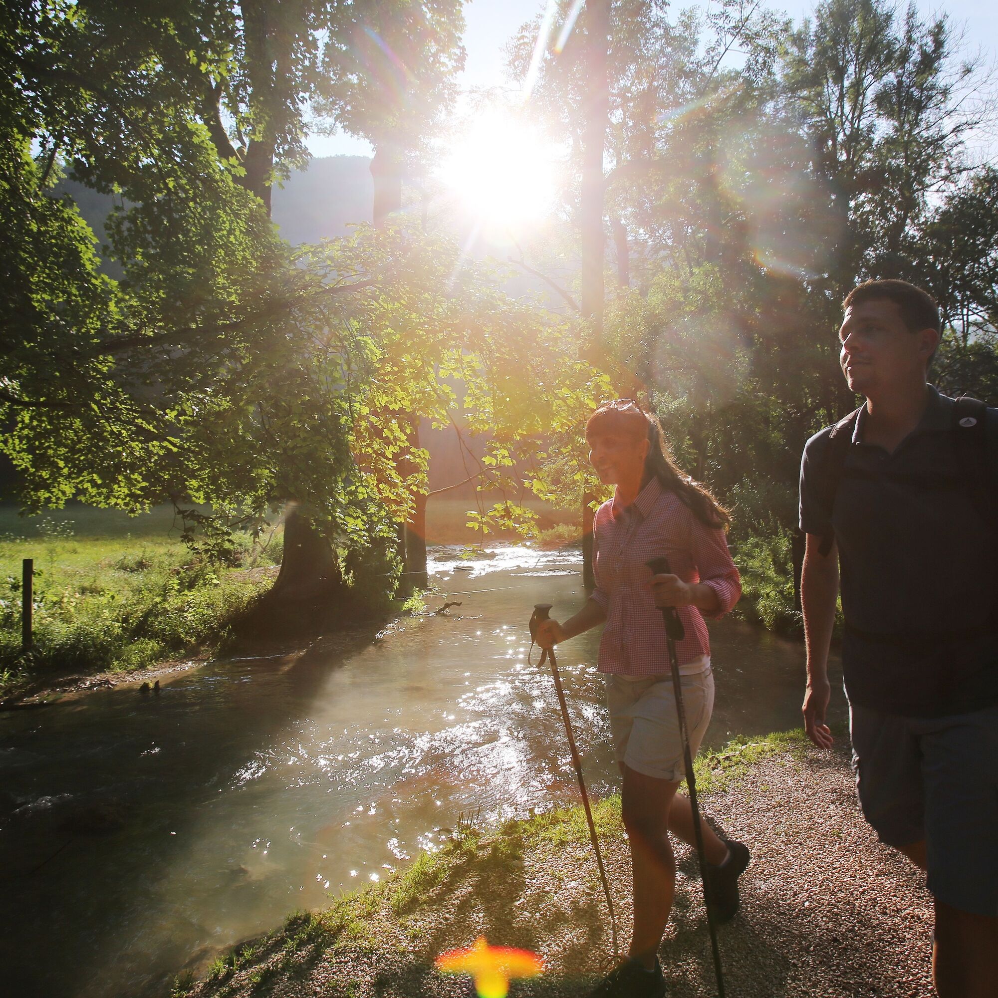
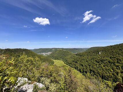
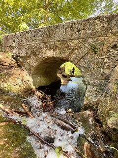
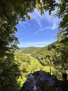
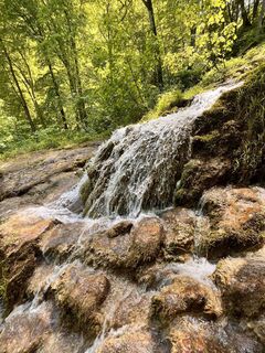
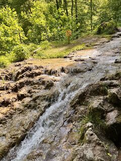
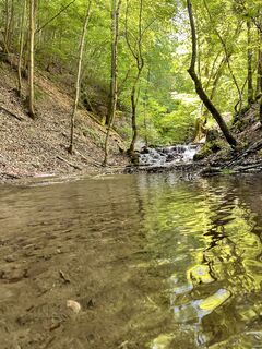
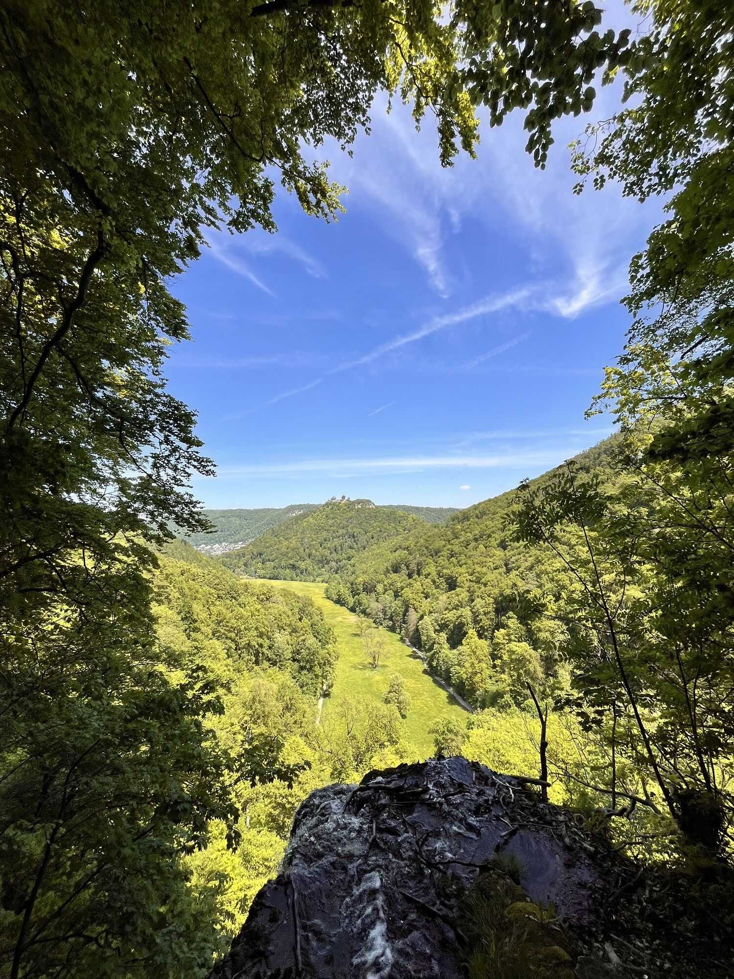
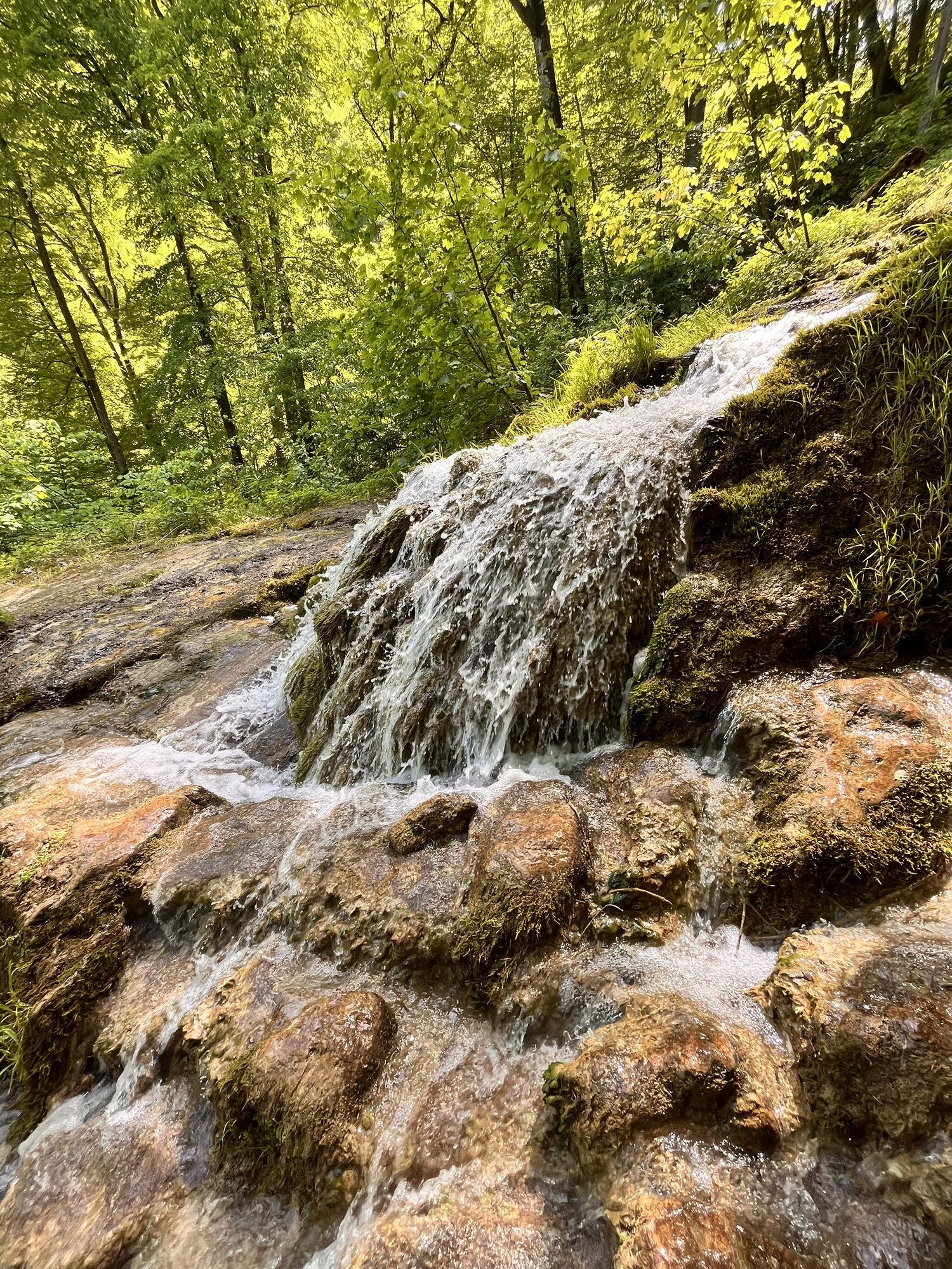
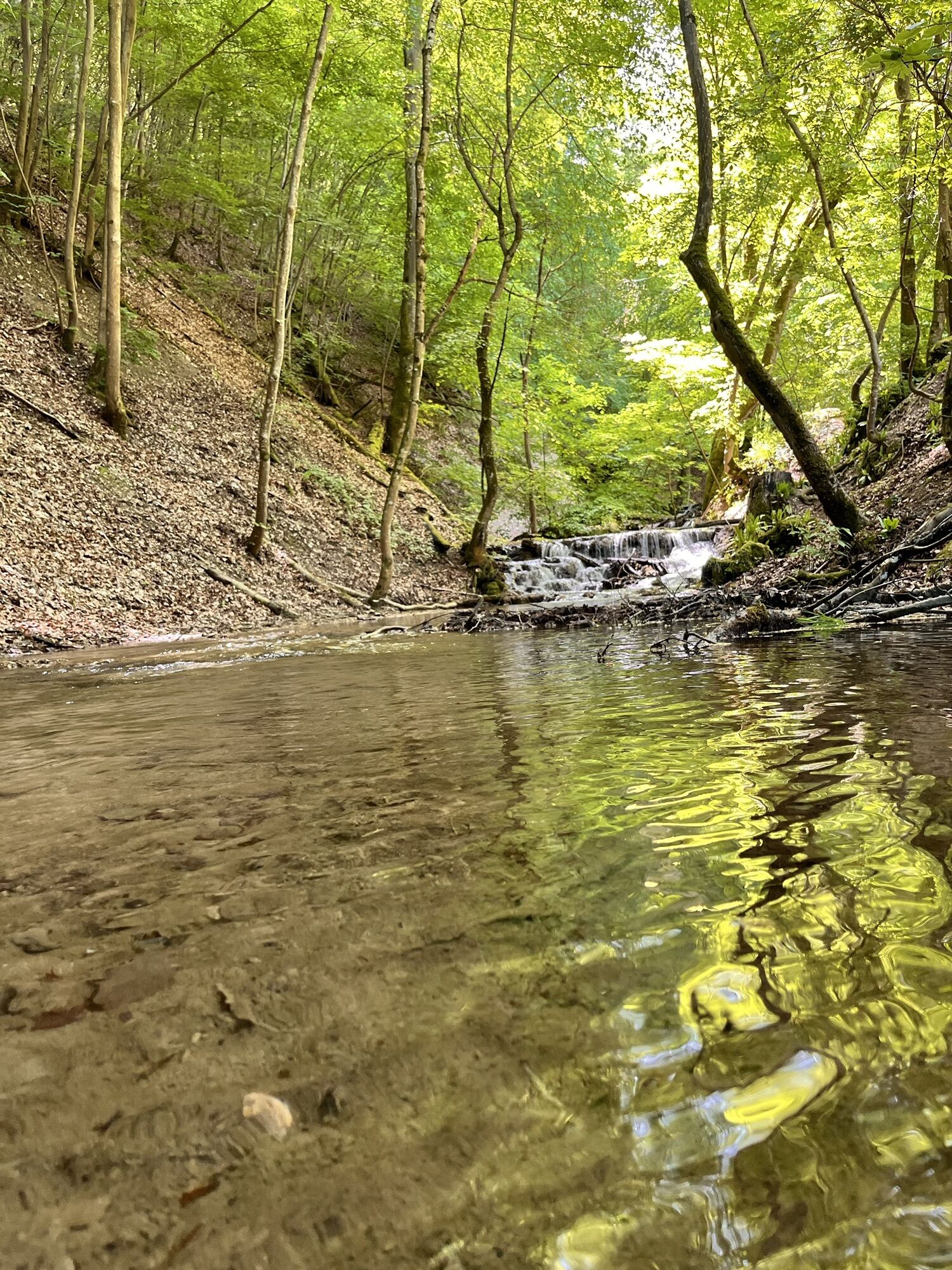
We walk the level path along the romantic Brühlbach stream to the foot of the well-known Urach Waterfall, which plunges 37 m downwards, enjoying the view upwards. A small narrow footpath bends right at the forest edge before we enter the shady Schießtal. We continue gently downhill on a gravel road at the foot of the Round Mountain. We now pass the grounds of the Bad Urach Fanfare Band (club house open on weekends) and then turn onto the small asphalt road, which quickly takes us back to our starting point. The route is ideal for children and Nordic Walking beginners.
Kyllä
Kyllä
Sturdy footwear and Nordic Walking poles are required.
Our Nordic Walking paths are not walking paths. Sturdy footwear and Nordic Walking poles are recommended for all routes. Especially after and during rainfall as well as in winter months, the calcareous rock and soil—especially on slopes—can be very slippery. Please exercise appropriate caution.
In case of emergency, always dial 112. Please mention if the injured persons are in inaccessible terrain so that the Bad Urach mountain rescue service is also informed, avoiding unnecessary delays in rescue.
On the signposts of the arrow directional signs, you will find a plaque with the exact location number. This number is known to the control center. This ensures quick help in an emergency.
A8 from the Karlsruhe direction: Exit Stuttgart-Degerloch, then B27/312 to Metzingen and B28 to Bad Urach.
Take the ICE to Stuttgart or Plochingen, from there use the Stuttgart - Reutlingen - Tübingen rail line, change trains in Metzingen to the regional train to Bad Urach, stop at Wasserfall.
Car park P 23 Waterfall
1
The leisure routes map „Nordic Walking“ is available free of charge at the Bad Urach spa administration. Information about guided routes and rental poles is available at the Schwäbische Alb Health and Rehabilitation Center, Bei den Thermen 10-12, Tel. 07125/1570.
Suosittuja retkiä naapurustossa
-
4,8
Wasserfallsteig Bad Urach
mediumVaellus 10,2 km -
4,0
Bad Urach Wasserfälle Rundwanderung
mediumVaellus 11,4 km -
4,8
Hohenwittlingensteig Bad Urach
mediumVaellus 6,48 km -
4,8
Hohenurachsteig Bad Urach
mediumVaellus 7,65 km -
4,0
Bad Urach Wasserfall, Runde von Buchhalde
mediumVaellus 12,1 km -
Trauf, Höllenlöcher, Wasserfälle und Tal
mediumVaellus 15,8 km -
5,0
Lenningen: Weiße Lauter, Wasserfels, Guttenberger-,Gußmannshöhle, Schopflocher Moor, Hohgreutfels, Ruine Wielandstein
mediumVaellus 15,7 km -
4,0
Seeburgsteig Bad Urach
mediumVaellus 8,19 km -
5,0
Breitensteinrunde
valoVaellus 10,3 km -
Rundweg Uracher Wasserfall Bad Urach, Deutschland
valoVaellus 5,26 km
Vaellus & jäljitys


Älä jää paitsi tarjouksista ja inspiraatiosta seuraavaa lomaasi varten.
Sähköpostiosoitteesi on lisätty postituslistalle.